This entry is a forum to post some of my pictures that I really like. It’s a collection of everything since about 2003.
There’s really no order here (other than I grouped like pictures roughly together). So, I’ll give a quick synopsis of the story for each picture, but I assume that most people just look at the pictures anyway. 🙂
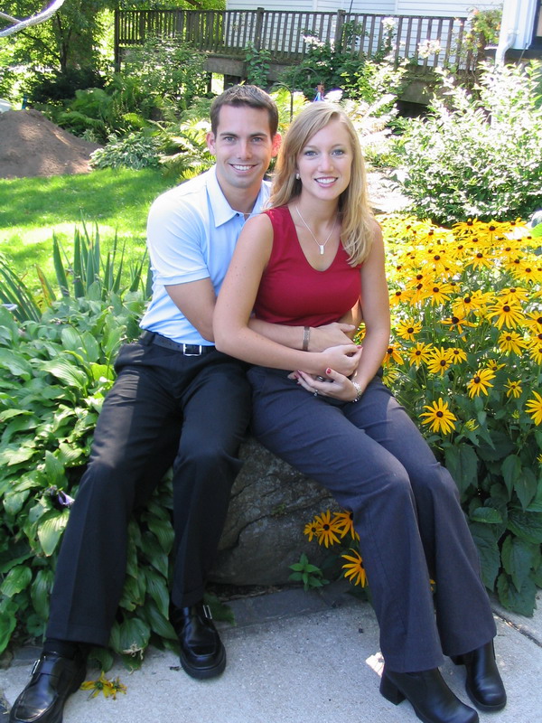
This first picture is one that I didn’t take. It’s a shot of Anna and I in front of her family’s house in Wisconsin, back in 2003 (taken by her Mom … thanks Mom).
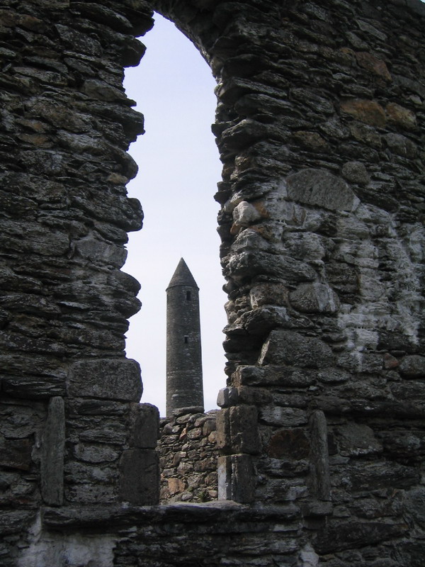
In the summer of 2004, my mom and sister took a trip to Ireland. Anna and her mom also joined the trip. I, however, had to stay back. I was in a 2-month long school in Ohio. Here’s a shot that we liked from her trip.
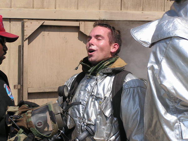
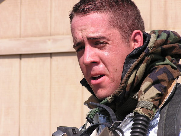
While the family was touring around Irish Isle, I was learning things like just how hot a firefighter’s suit can be. The first picture is me and the second, my friend Lucky (another Air Force officer currently stationed down in Florida).
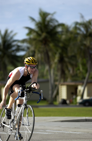
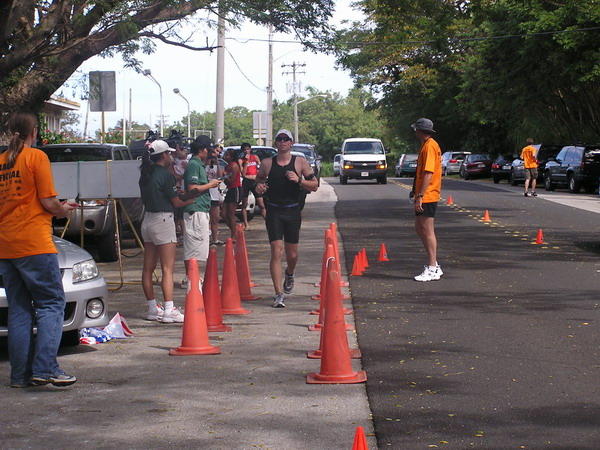
Here’s yet another picture that I didn’t take (this one was by one of the very talented base photographers). It was from one of the Andersen AFB’s triathlons last year (2005). I’m coming into transition 2 (as you can tell by the fact that I am taking my shoes off…)
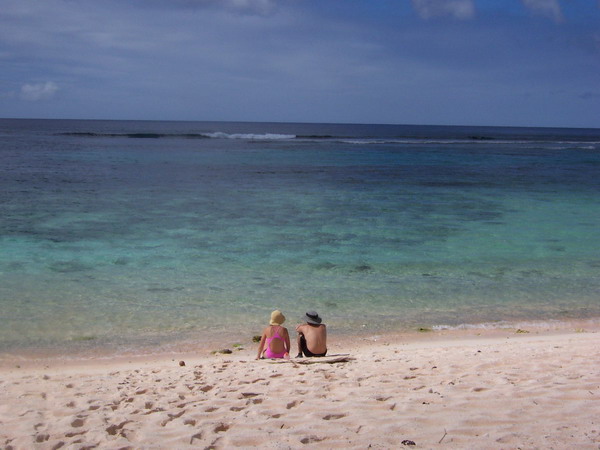
These next two shots are from the beaches of Guam. The first is Anna and I at a beach commonly referred to as Lost Pond. This one was taken by another friend of ours, Kevin (who’s now stationed in Italy).
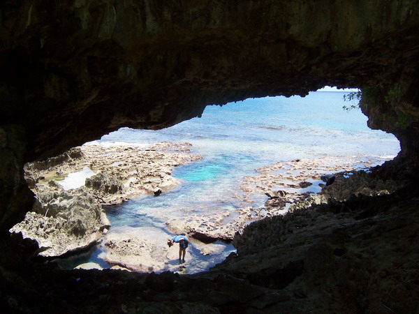
This is Anna inspecting the small creatures at the land bridge just north of Double Reef Beach.
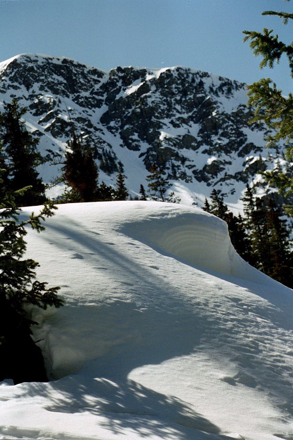
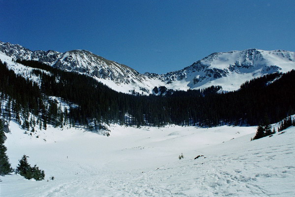
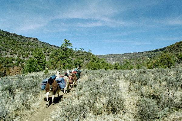
The next seven pictures are from our trip to New Mexico in 2004. We spent almost 2 weeks there visiting family in Albuquerque, hiking in Santa Fe, alpine skiing at Taos, snowshoeing in the mountains above Taos, and llama trekking in the Rio Grande river valley. Here are the representative shots.
In Taos, we stayed at a very cute bed and breakfast. This is a view from the outside. As an interesting side note, Julia Roberts owned the house right behind (we didn’t see Julia though).
This is my beautiful wife as we are snowshoeing our way up the mountain.
The mountains:
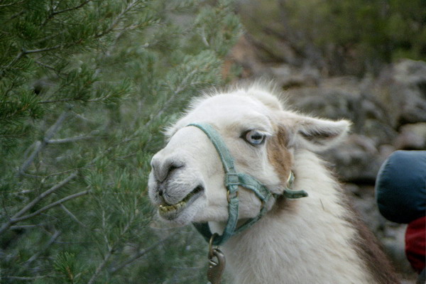
The highlight of the trip was probably the llama trek we took. It was only a couple days long, but a great experience. We highly recommend trekking with these affable animals. While they are in the camel family, they are not large enough to carry people, so they helped out and carried our gear. 🙂 Stuart (our guide) filled us in on all kinds of details on the surrounding flora and fauna.
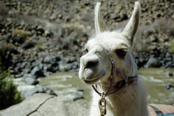
Llamas have a definite leader when they are in a group and this was our group’s leader, Azul.
Ok, I will end this entry here. I have picked out almost 100 pictures, so it will take a few parts to finish this one. 🙂
–Jim
Month: March 2006
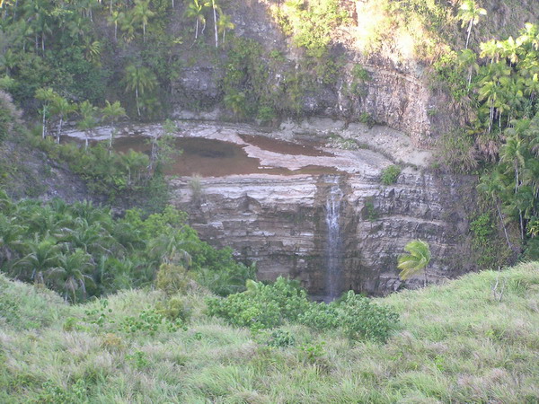
Lower Sigua Falls
Hi, well this weekend, we braved the jungle of Guam again. We went again with a group of CGOs. This time there were 12 in our party.
I offered to take the group on another hike, this time in search of one of the pretty waterfalls around the interior of Guam. However, my caveat was that it would be a hard hike. Even so, I had a surprising number of people join us.
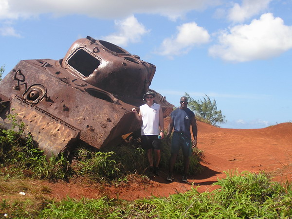
The trail began over very familiar territory on top of Mount Alutom. We took the same route as we did for several other hikes. However, this time we continued down the trail further. The landmark for our turn wasn’t a tree (as it was for Upper Sigua Falls), but a WWII Sherman tank.
You can see how happy we were to find it (there was only one small marsh to cross to get there…)
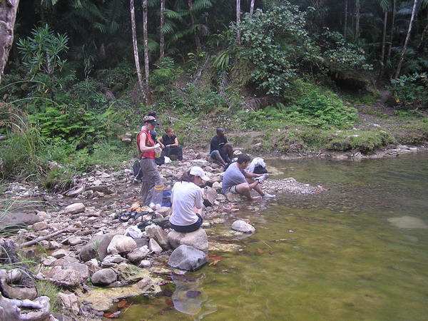
Here we all are posing in front of this tank that was brought here sometime after the war for target practice (no there wasn’t a battle fought there … although that would make for a better story).
Lance and Mario:
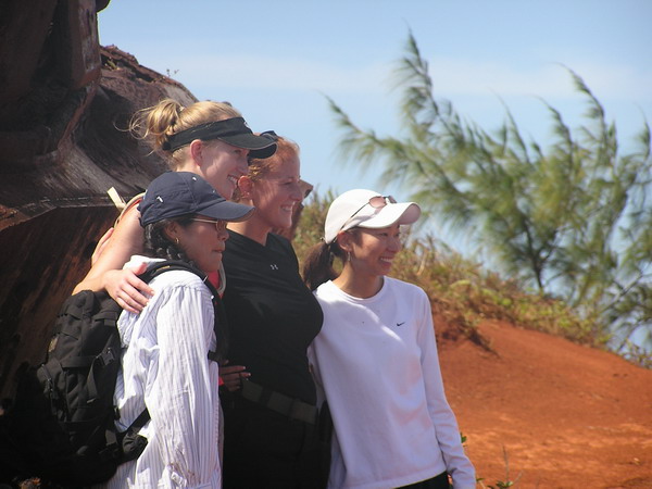
All the pretty girls in the group:
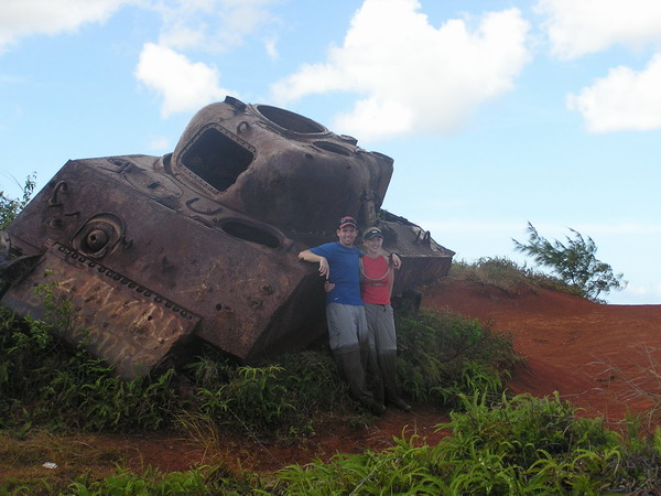
Here’s Anna and I:
From the tank, we descended into the jungle. In fact, we dropped down to the river valley floor and followed the very narrow, very murky, very deep river to the first water falls, Sinisa Falls. When we arrived at the top of the falls, it was pretty, but there was no easy way to reach the bottom. So, we hiked up the other side of the river bank, bushwhacked through some tough savanna grass and back down into the jungle. I wish I had some pictures of the stuff we went through, but I was more concerned with getting us safely back down to the river to take pictures. Sorry.
However, we all made it safely down, although not without our fair share of falls along the way.
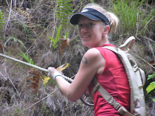
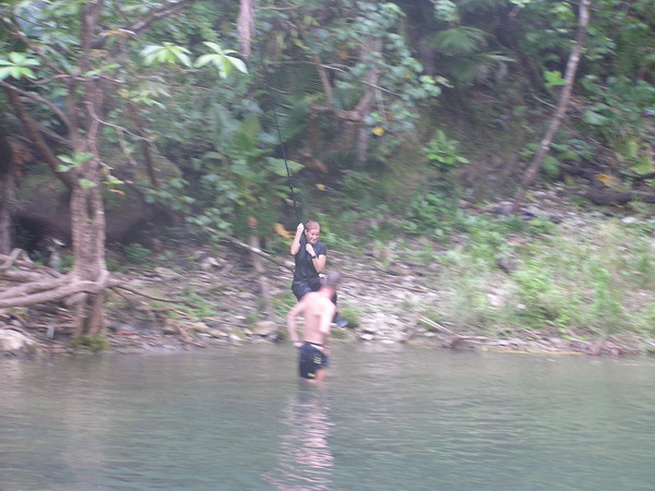
Here we are making our way down the last little section of the ravine to get to the falls.
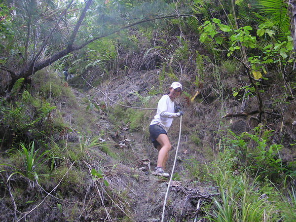
Anna coming down the rope, looking graceful as always:
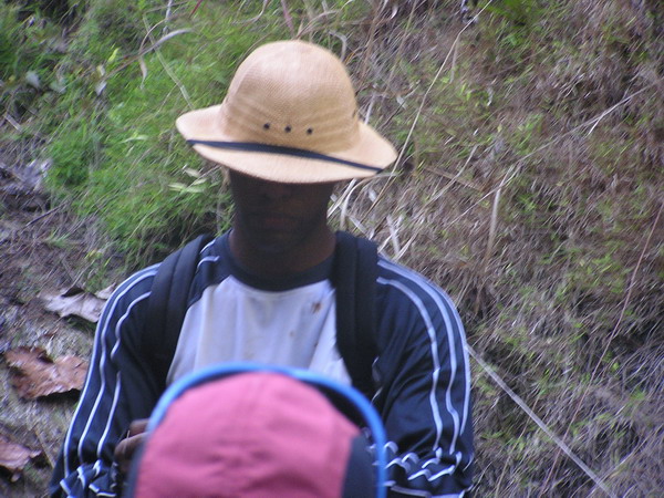
This is me spotting “Mudslide” as he came down. 🙂
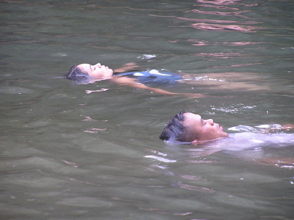
Once everyone got back down to the river, we decided it was time for a little relaxing in the water. Unfortunately, the pool wasn’t too large, nor was it very deep. It was refreshing nonetheless.
After we were cooled off, we continued down the river (which was the prettiest of all the rivers we’ve hiked though on Guam, thus far at least). Again, my camera was packed away in the dry bag because everything that wasn’t sealed or waterproof got utterly drenched on this trip.
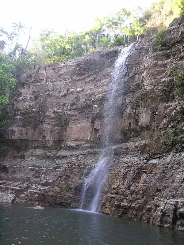
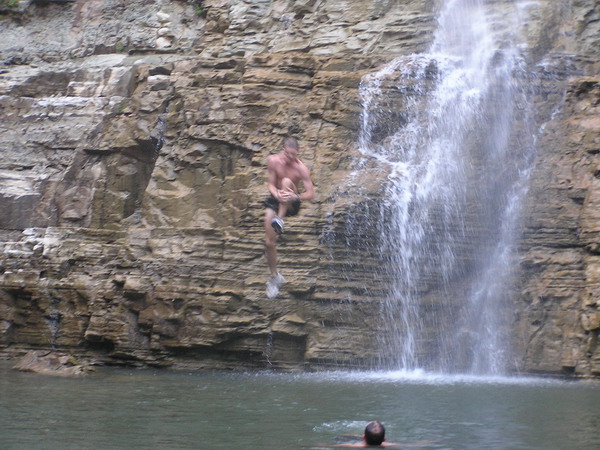
So, after our second leg of the trip. This is the waterfall we were rewarded with (Lower Sigua Falls).
This was a much larger and prettier falls (you can get an idea of scale from the person in the left side foreground).
Here are some more pictures of us playing the water.
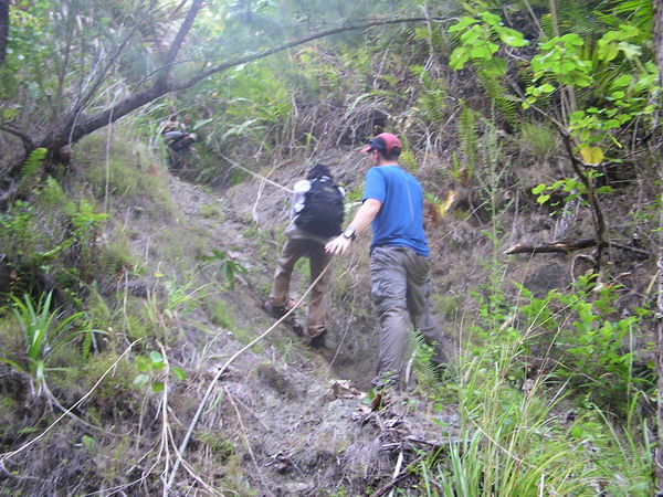
So, with nightfall fast approaching, we hustled up the bank. It was another steep trail, but this time it was well worn with a number of ropes along the way to assist us.
When we got back up to the top of the ridge, we were rewarded with this pretty aerial view of Lower Sigua Falls, where we had just been.
So, with that, we went back up the hill to our vehicles. We got back to complete a 7 mile round trip hike that went 1,200 feet down and back up again, and took just over 5 hours. It was not bad for an afternoon hike. I had a great time and hope that some of our friends from this hike will join us again soon!
Until the next adventure.
–Jim
Guam Isla Triathlon
I know it’s been a couple weeks since my last post. Sorry, just we’ve not done anything website worthy. 🙂
Last weekend, however, I decided to continue my masochistic habit of triathlons. If you’ve been following the site, you’ll notice that last year, I was very active, racing something like 12 times last year. This year, however, is a different story. Perhaps it’s that I’ve been working too much, but I haven’t been out training hardly at all, let alone racing.
This is our last year on the island, and I have heard stories of how great the X-Terra Offroad Triathlon in Saipan is. So, to determine if I would be able to survive it, I decided that I should try another one first. That’s where the Guam Isla comes in. My goal in this race was survival, not placement. 🙂
The Guam Isla was an Olympic distance race, which means we did a 1.5K (about 1 mile) swim, a 40K (about 26 miles) bike, and a 10K (about 6.5 miles) run. The site was down in Merizo on the far southern end of the island.
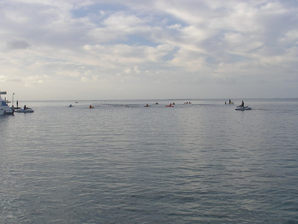
It was a floating start, so we all swam out to the starting buoy and did an out and back course. The water is very clear on Guam and this swim was quite pretty. I have to admit though … last year when I did the Cocos Crossing (a 2.5 mile swim from the small island back to the bigger island) a girl on the boat going to the start told me she saw a hammerhead shark in the channel from the helicopter she was flying just a few days before. I didn’t pay much attention then because we were only crossing the channel, not swimming in it. However, the swim course for this tri was entirely in the channel. Most of the time, I couldn’t see the sea floor (it was a pretty blue though) but the thought of the hammerheads in the water kept popping in my head and (here’s the admission) was a bit unnerving.
Anyway, here we are with the kayaker/jet ski support crews out in full force.
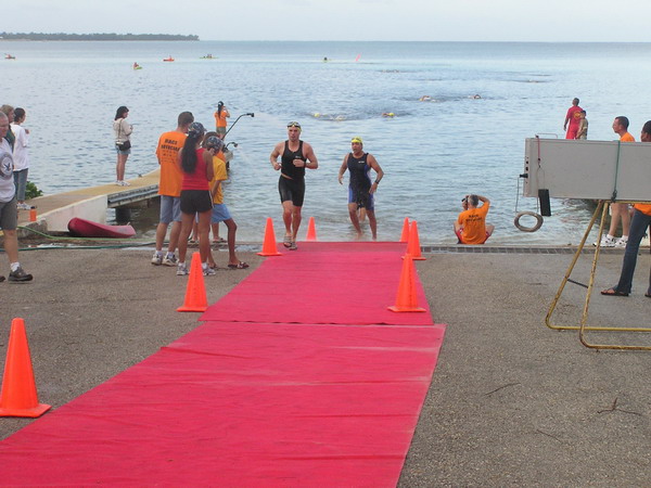
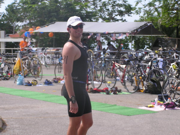
This is me on the left getting out of the water about a half an hour later.
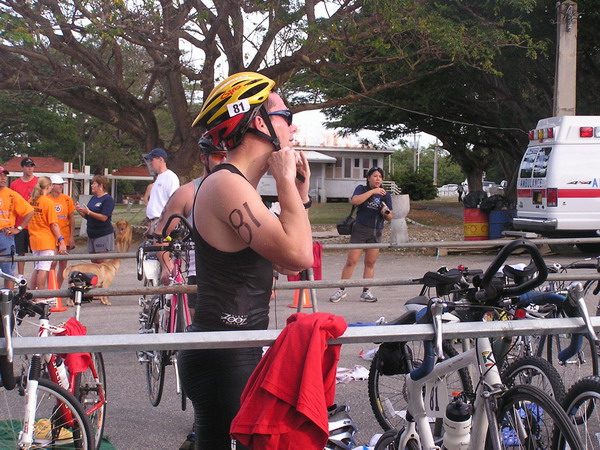
It was a little harder to get through the transitions this time, since I was a rather out of practice. (yes, I did fix my helmet before I started biking 🙂 ).
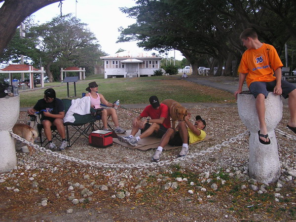
Once we left on our bikes, it was over an hour before we’d be back, so this is what everyone did to amuse themselves. As you can see, they had a good time.
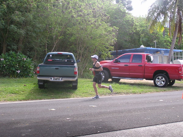
After a couple large hills, rough roads, and almost an hour and a half later, I came back in to transition to the run.
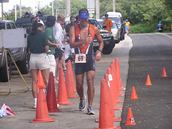
It was a long, hot, but fortunately flat run course. The only bad part was pyschcological … I got to the run turn around point and thought that the course was marked short (according to my GPS). So, I cruised in and pushed hard for what I thought was the last half mile or so. Unfortunately, when I got to the end (or so I thought), to my surprise they said, “keep going!”
Here I am right after I heard that … I don’t know if you can tell by my expression, but I was not pleased at the thought of running more. 🙂
So, in reality it was another half mile out and back. That was a minor point they forgot to point out on the course map. Oh well, it was only a mile right?
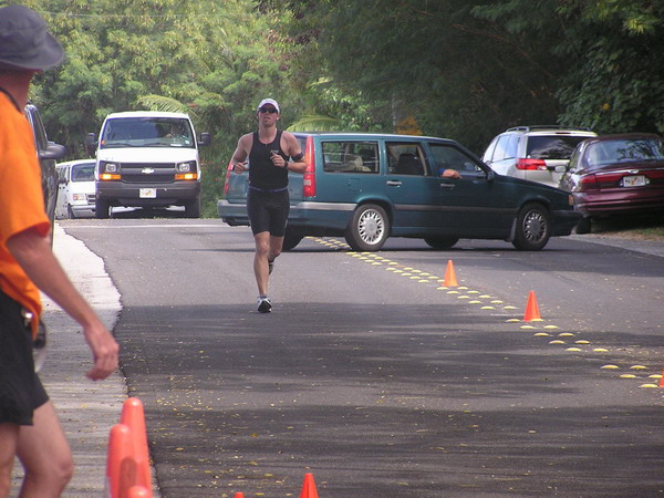
Here’s our friend finishing up. Way to go Mark!
FINALLY, here I am finishing up after just about 3 hours.
Can you see the relief in my face I am done?? I know I have done these races before, but this was by far the most difficult because I did it with no training and the run was a bit tough mentally.
So, looks like I am all set for X-Terra. We’re scheduled to be there for the race on April 1st.
Sometime after, I will post how it goes. 🙂
–Jim
Da Bomb
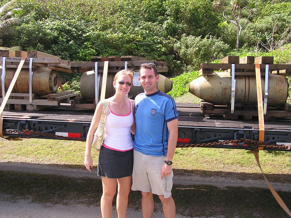
Anna and I were witness to history in the making (or rather destruction) this weekend. For those who don’t already know, there are a number of Vietnam era munitions (read: bombs) stored here at Andersen AFB. When these weapons reach the end of their service life, they are removed from our inventory and destroyed. This typically means putting them on a ship and sending them back to the mainland. However, since they are so old, there are some that are not stable enough to safely make the long voyage. So, that’s where we come in. Our expolsive ordinance disposal (EOD) flight was called in to destroy these munitions locally.
Anna and I were able to tag along and watch the process.
Here we are with da bomb.
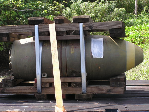
A close up of the 750 pound bomb.
Our EOD range is perhaps one of the prettiest anywhere. Not to worry though, there are PLENTY of environmental protections in place to make sure we don’t harm the environment. Having spent a year working as an environmental program manager, I can safely say that the Air Force is doing well in protecting our natural environment on Guam.
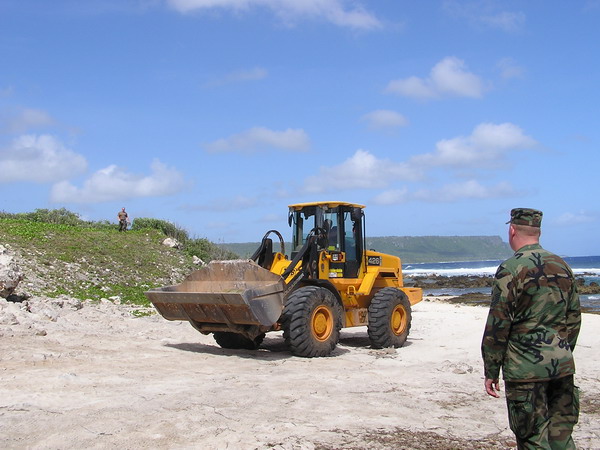
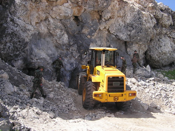
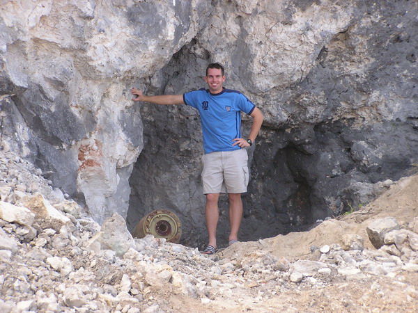
Here’s where the bombs are placed.
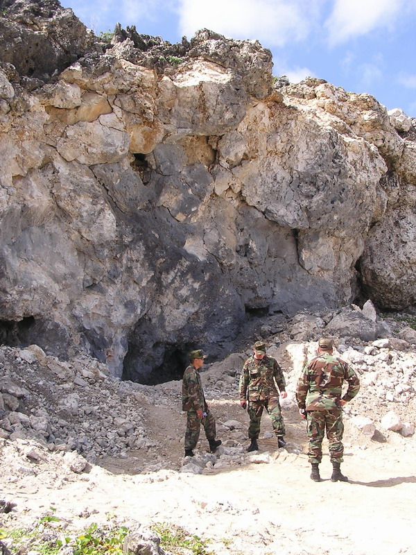
A front-end loader is used to carry the bomb from the trailer to deposit as close to the limestone cliff as possible.
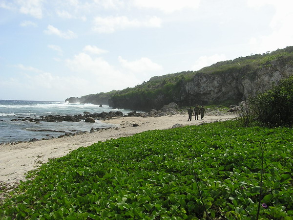
Here’s the view out from the beach to Pati Point.
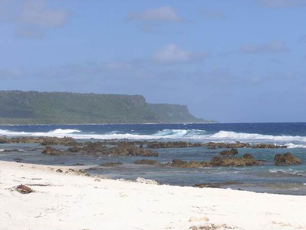
It looks so small and benign, doesn’t it??

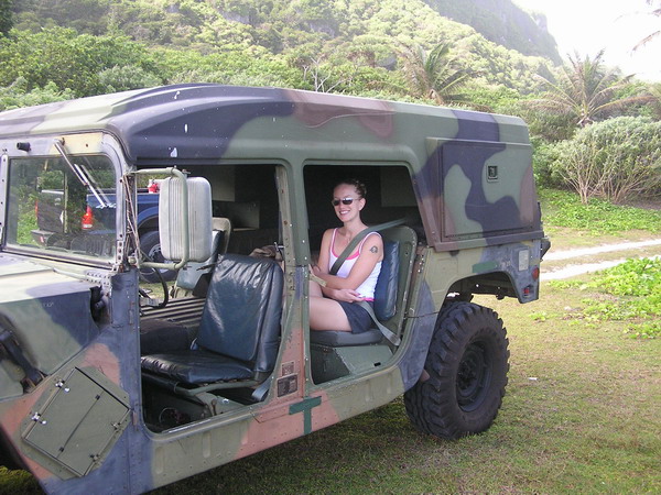
Anna even got to sit in the HMMWV (AKA Humvee) for a while. 🙂
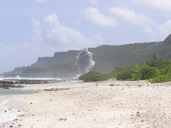
Once we got 6,500 feet away, we found a good vantage point to watch the explosion from.
Finally, after two and a half hours of waiting, we got to see…
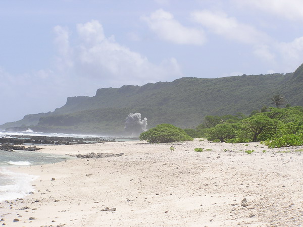
BOOM.
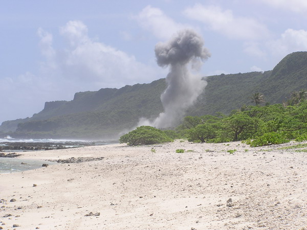
After the explosion, the plan was to repeat this process three more times that day. Unfortunately, when they got back to the site, so much of the cliff had come down, they had to wait until Monday to clear it out and repeat the process. It’s a long process to get everything set and make sure it’s completely safe. It’s the right thing to do, but makes for a rather anti-climactic finish.
It was a blast nonetheless. 🙂
–Jim