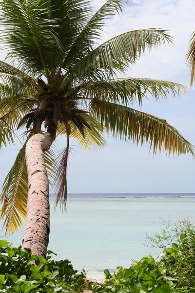
This afternoon, was again spent playing in the water. We left on a boat out of the small harbor just a few hundred yards down from our house.
We headed north to again visit Double Reef. It’s about a half an hour to get there, so we had a little time to enjoy the scenery and sun on the way.
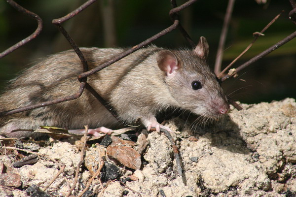
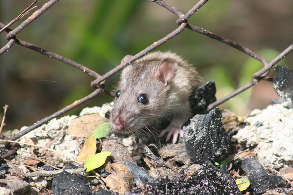
Double Reef is so named because there is a second, circular reef just offshore. Here is what it looks like.

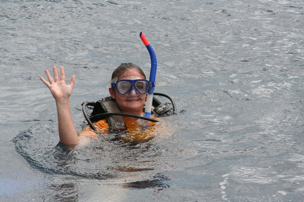
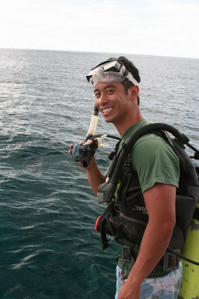
Once we were anchored, everyone geared up and dropped into the water.
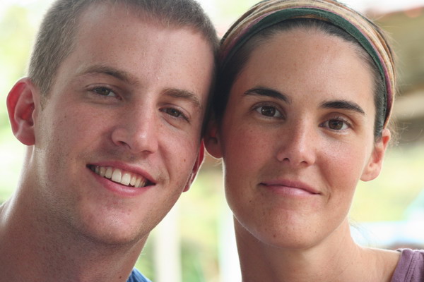
This is Jessica (one of the USAFA cadets, who were also on the boat with us). Isn’t she cute in all the gear?? 🙂
Then we have Sergeant SCUBA … “Hi kids, one day you can grow up and SCUBA dive … it’s lots of fun!”

Even though we only snorkeled today, it was great to be in the water. Plus, we got to lie out in the sun, enjoy the day, the boat and the people with us.
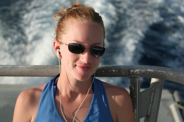
On the ride back home, I made this picture of someone who needs no introduction…
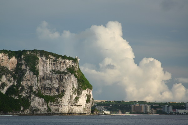
This is the venerable Two Lover’s Point where legend says two Chamorro lovers intertwined their hair when cornered by Spanish authorities to press them into a different arranged marriage. So, instead of face a fate without each other, they leapt off the several hundred foot cliff to their mutual (but joined together) demise.
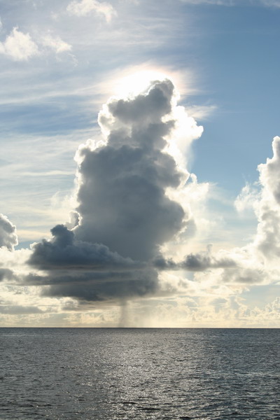
The clouds can be so hypnotic.
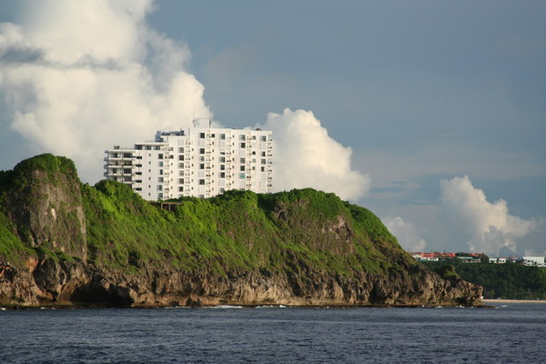
This picture is of Oka Tower (AKA where Sgt Hall lives). We’ve included it by special request. 🙂
These fisher people are at the mouth of the Agana Boat Basin (our starting and finishing point today).

It was a most enjoyable and relaxing day. This is such a beautiful island and the waters around it are immaculate (at least in most places).
Until the next adventure…
–Jim
Month: July 2006
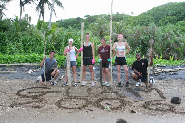
Waterfall Valley and Black Sand Beach … jump right in!
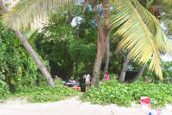
Today, Anna and I hiked out to two different destinations. The first, we had visited earlier this year with my parents and the second was a brand new hike (for us at least).
The impetus for the hikes today is that there is another group of six cadets from the Air Force Academy. They’re again visiting Guam to get an idea of what the “real” Air Force is all about. My part in that was to show them what the “real” Guam is all about.
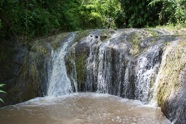
We started down south with a very pretty valley that contains 5 waterfalls very close to each other. However, we spent most of our time at the last two.
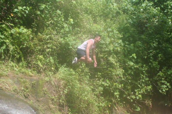
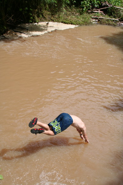
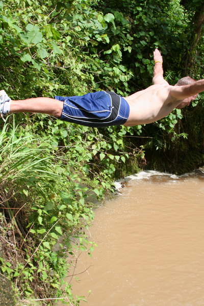
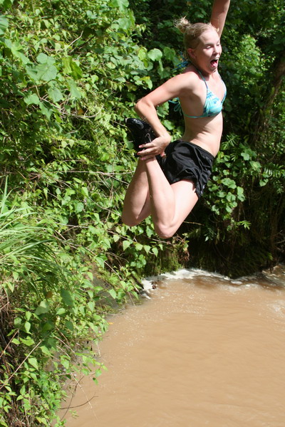
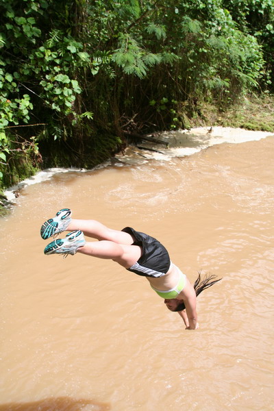
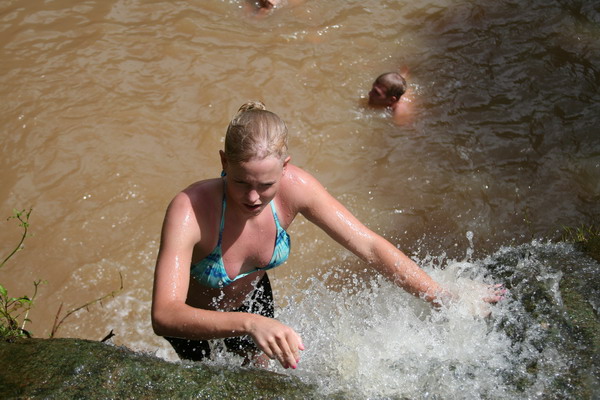
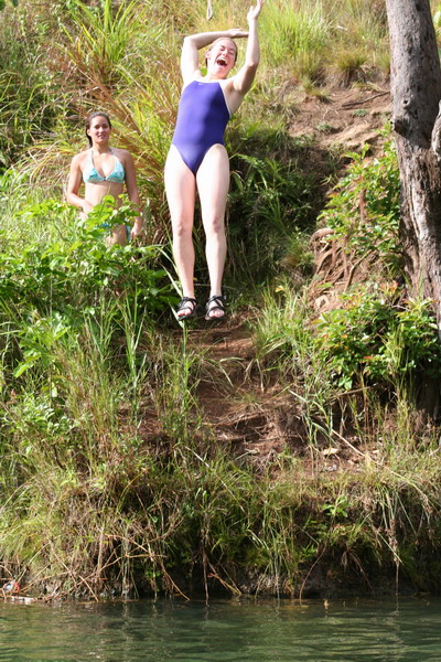
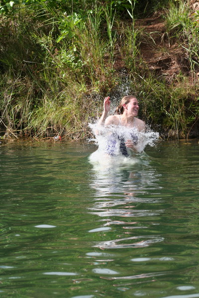
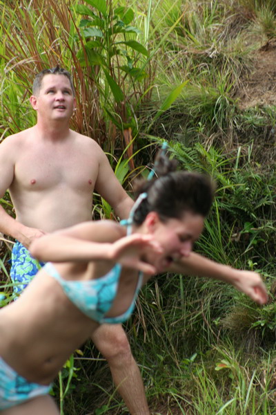
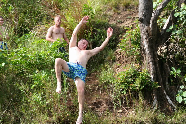
As you can see in these next few pictures, we decided to jump right in! Don’t worry, the water was plenty deep. Also, it’s brown because there has been so much rain lately.
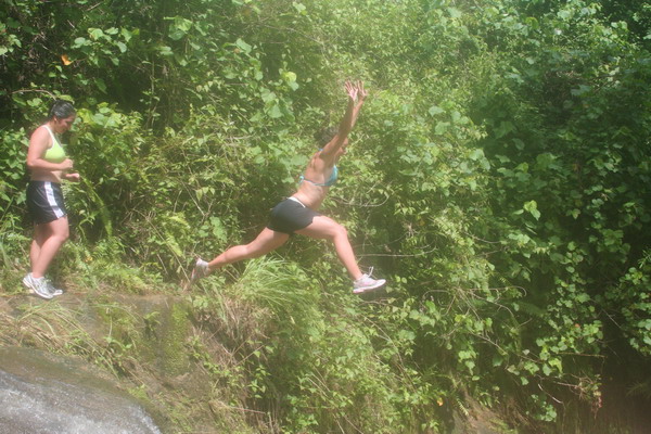
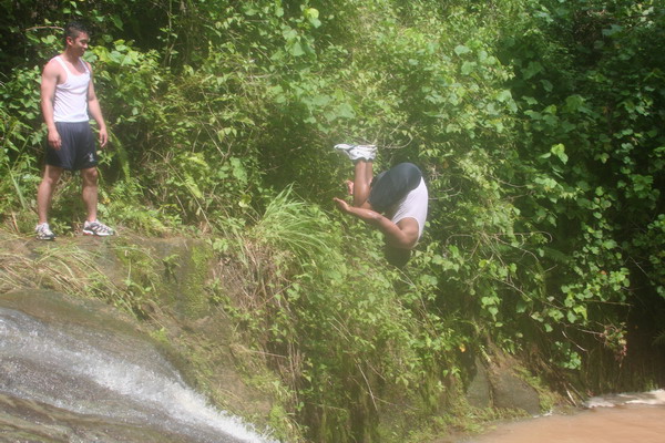
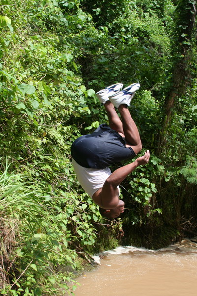
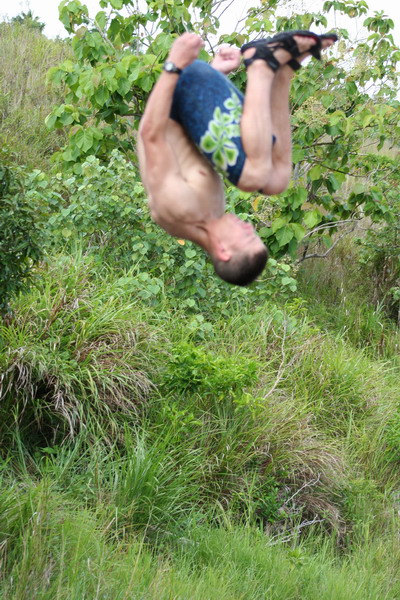
I know you can’t really tell from this picture, but here Jamie is just about to complete a one and a half flip. He almost made it all the way around. I give him a 7.0.
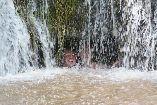
The only hard part about jumping in (although it was sorta fun), was that you had to climb back up the waterfall to get out.
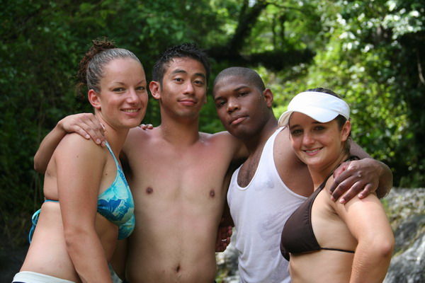
Here are four of the six cadets.
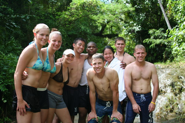
This is everyone who hiked with us (except Anna and me who were taking the pictures).
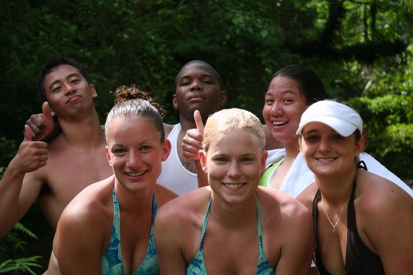
Just the cadets again.
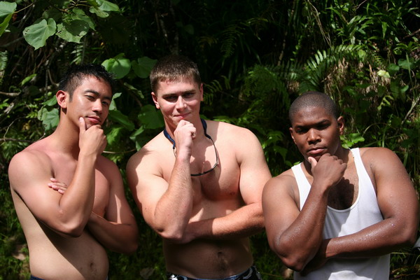
Here are some of the guys trying to look tough (or perhaps thoughtful … I’m not really sure which).
Here is the other waterfall we played in. It was a lot smaller, but fun to get behind the falls.
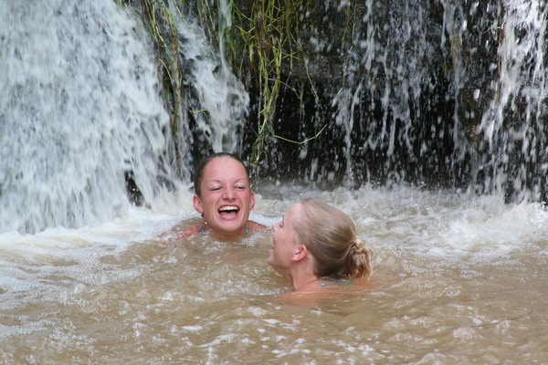
The girls were having lots of fun playing in the falls.
You can see in this picture of Lindsay of just how muddy the trail was.
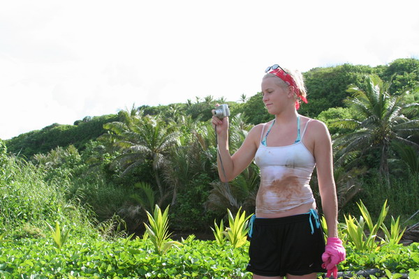
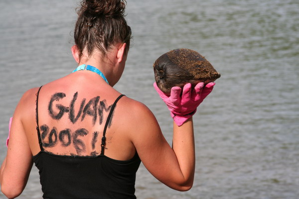
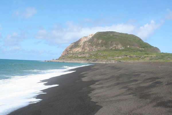
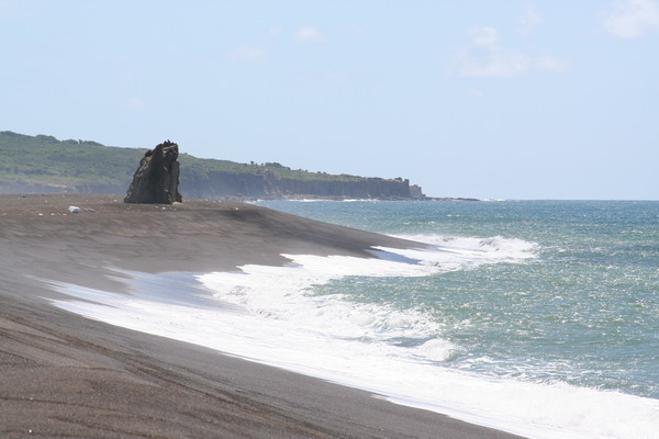
That concluded our hike to waterfall valley. After we (sort of) cleaned up, we jumped back in our car, drove 5 minutes north and parked at the Talafofo Bay trailhead. Although we didn’t really follow a trail, we went coast steering to reach the black sand beach of Guam. The beach is black due to the presence of the mineral magnetite (a form of iron oxide). A large quantity was carried to the beach by a nearby river, and kept there by wave and current action. Although, it was most likely deposited originally by the volcanic activity that formed the island. It’s interesting to note that magnetite is the most magnetic of all the minerals on Earth. If you hold a magnetic to the sand, it will pick up a number of the grains. Another random fact about this fascinating material is that crystals of it are found in numerous animals (including humans).
In fact, the black sand is also useful to write messages on your back.
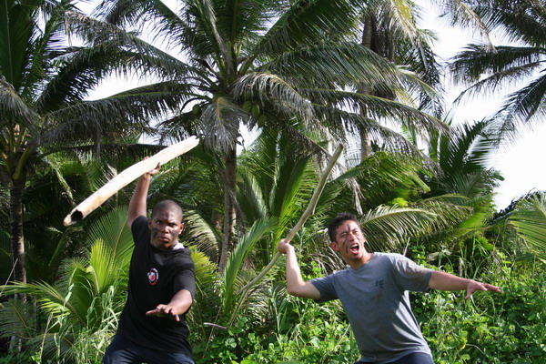
Another interesting use of magnetite sand is as war paint on your face. These guys were imagining what the ancient Chamorro warriors were like.
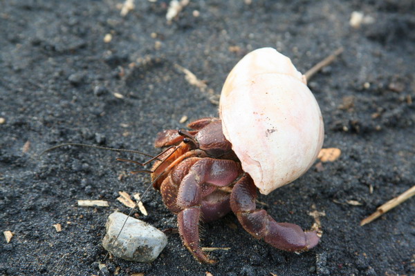
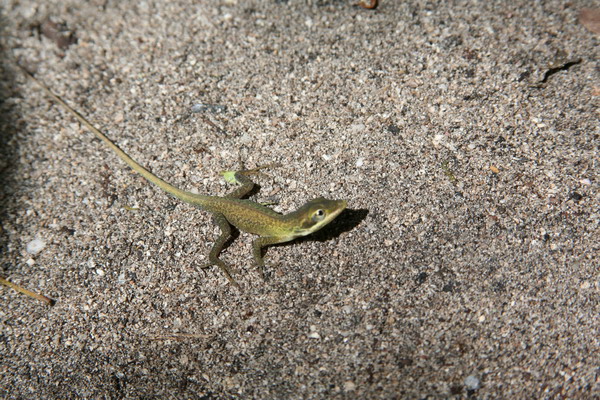
OK, so this little guy’s shell didn’t blend in too well with the black.
Here are the cadets again.
While the black sand was very pretty (and certainly unique), the beach itself had a LOT of trash on it. Perhaps it was just washed up from local fiestas, but it basically ruined an otherwise beautiful location on Guam. Unfortunately, it’s an all too common occurrence here to find a spot that could be simply stunning that is marred by an abundance of trash. So, if you ever visit or live here, please help clean some of it up, even if it’s one piece of trash at a time!
Overall though, it was a great day of hiking. We enjoyed hiking with the cadets and other CGOs from the base.
We can’t wait to go again. Our time here on Guam is drawing to a close (we have about a month left), so we’re trying to get everything in that we haven’t done yet. So much to do, so little time…
Until the next adventure.
–Jim
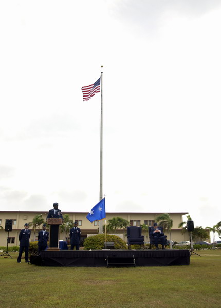
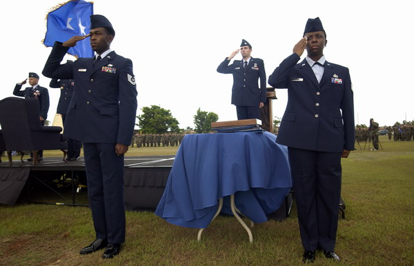
Military Retirement Ceremony
This post is for all those who have never had the opportunity to attend a military retreat or retirement ceremony.
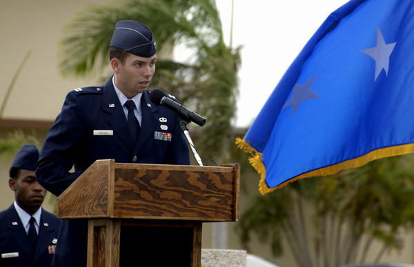
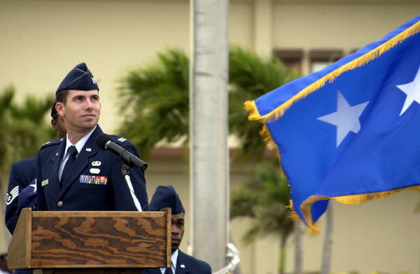
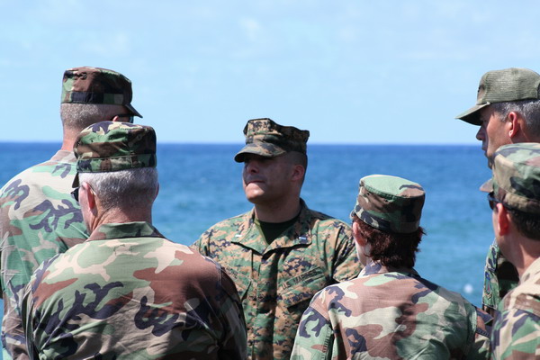
A few weeks ago, I had the opportunity to help with the planning and execution of a retirement ceremony for our vice wing commander, Col Stephen Wolborsky. He had served is country honorably in the United States Air Force for 26 years and the intent was to give him a fitting tribute.
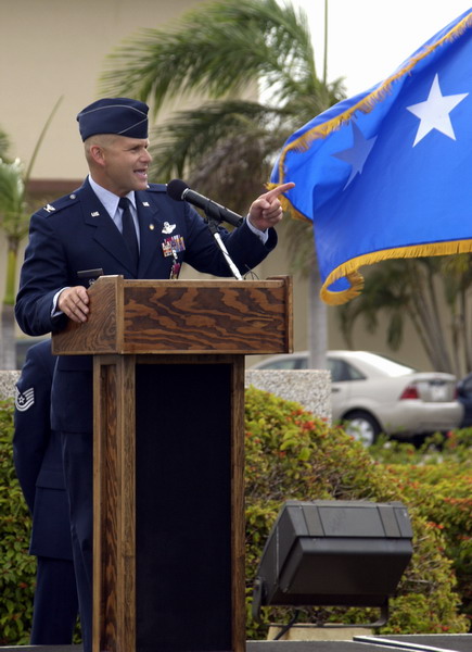
I had the honor of being the narrator for the event.
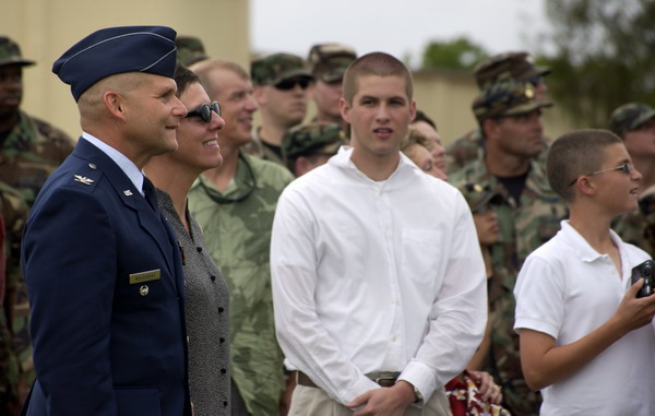
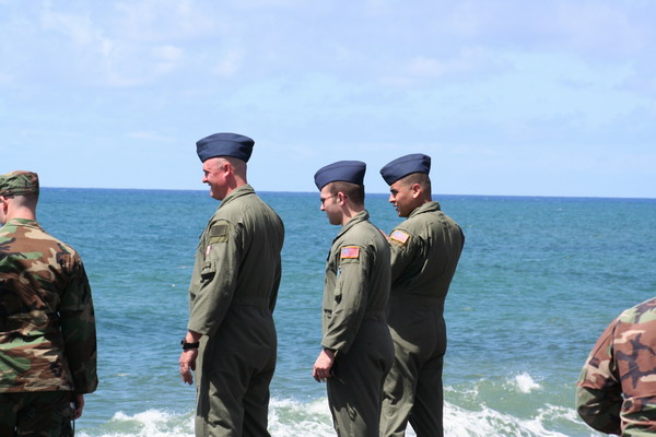
Here are some of those in attendance for the event.
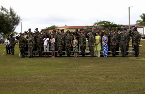
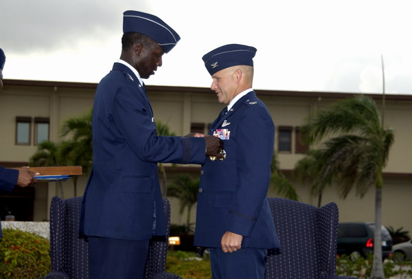
During the retirement ceremony, Col Wolborsky was presented with the Legion of Merit decoration, as well as a retirement certificate, a letter from the president and since the Air Force does think families are important, a letter to his wife, for her support of his career.
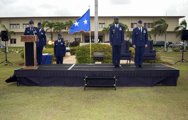
The ceremony was officiated by Major General Rice, who flew in from Hawaii and also presented Col Wolborsky with the medal and all of those certificates.
He also had a chance to tell some anecdotes from his long (and very distinguished) Air Force career. You can tell that he’s a very animated story teller.
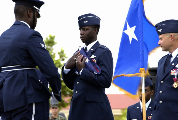
At the conclusion of the retirement ceremony, we had a retreat ceremony. The honor guard took the colors down, while the wing rendered the appropriate military custom.
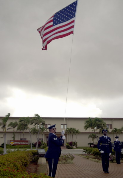
The honor guard also did a flag folding ceremony for him. The wing staff also gave Col Wolborsky the flag as a token of their appreciation.
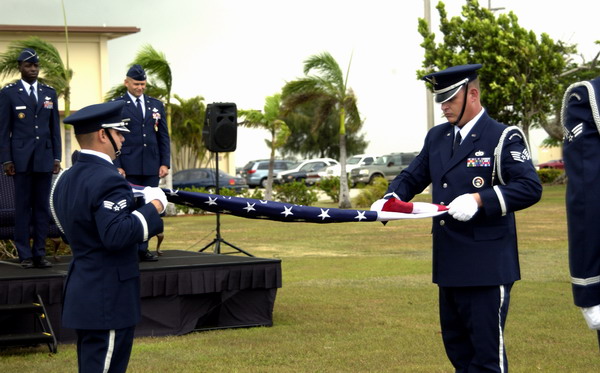
The flag was retired and presented to Maj Gen Rice, who in turn, presented it to Col Wolborsky.
A the end of the ceremony, a jet flying in the local exercise that had just ended coincidentally flew over and gave a fitting impromptu aerial display.
It was a very fitting tribute to the man who had done so much for the base. It was an honor to have worked with and for him.
–Jim
Note: many thanks to the base photographers who made these pictures.
Guam Liberation Day 2006
Yesterday was Guam’s 62nd Liberation Day. It commemorates July 21st as the day American military returned and defeated the occupying Japanese force during WWII. Each year, there is a huge celebration and parade to commemorate the event. While we didn’t go to the parade, we did celebrate with a BBQ with some friends.
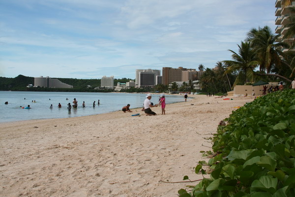
We went to the main tourist village and BBQ’d on the beach. It was a beautiful day for it because it was cloudy (but not rainy) in the morning and sunny in the afternoon, but a breeze kept the temperature cool. This is the view from our location.
You can see all the hotels along the beach in Tumon. This is where most of the 1.5 million Japanese tourists who come to Guam each year stay.
These are some of the people who work with Anna and were with us at the BBQ.
Tricia:
Liezl:
Ray:
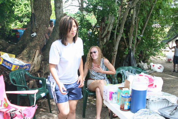
These are a few other friends who joined us for lunch.
We had a good time sharing food and laughter with our friends. So, until the next adventure…
–Jim
Southern Guam Fiesta
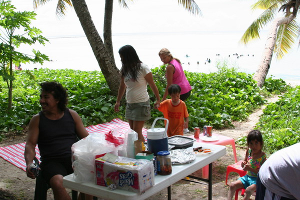
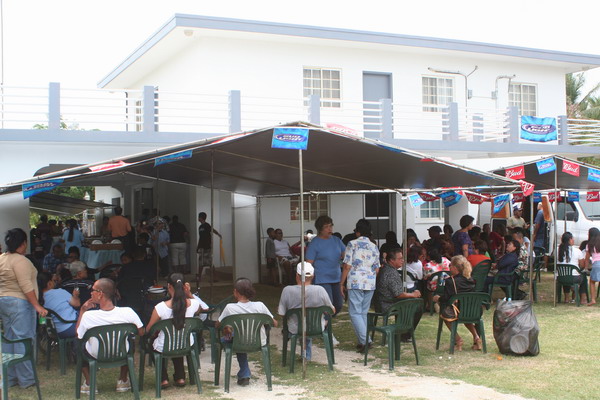
A couple weeks ago we went to the southern end of Guam for a fiesta. For those of you who aren’t familiar with that tradition here on Guam, here’s my understanding of how it works.
Fiestas are the national pastime of the island. This is the only place (that I know of) that people take out a loan for up to $25,000 to pay for a party for hundreds of people (most of whom they are related to). Oh, there’s no wedding involved. It’s typically to celebrate a patron saint (98% of the island is Catholic), or celebrate some other event. Basically, any excuse will do, and on any weekend, you can find a fiesta that ranges from a large family gathering, to an entire village joining in a celebration.
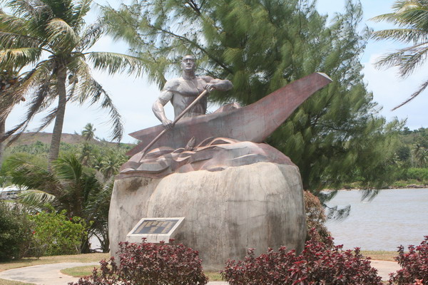
Our experience was down in the southern village of Malojloj. Here’s one of the monuments to an event by 2 ancient chiefs of Guam, Chiefs Gadao and Malaguana. Here’s the basic story:
Chief Malaguana from Tumon (in west central Guam), heard of the feats of Chief Gadao from Inarajan (in south central Guam). He decided to paddle down by canoe to challenge the great southern chief. As he got close, he met a stranger along the way who invited him to dinner. Chief Malaguana then shook a coconut off a nearby tree. The host (who was actually Chief Gadao) then crushed the coconut with his fingers. Chief Malaguana thought, “if an ordinary man can do this, how strong is the chief??” So, Chief Malaguana decided not to challenge Chief Gadao, but as the both got in the canoe, they were facing opposite directions. As they began to paddle, the canoe actually broke in half and Malaguana paddled so fast, he made it all the way back to Tumon without realizing that the canoe had broken.
Here’s a monument to those chiefs.
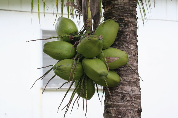
Here are some of those coconuts…
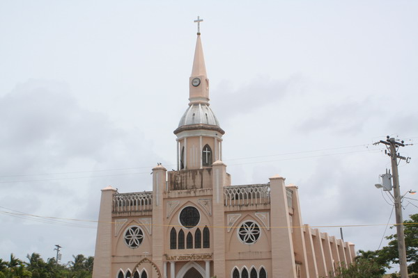
This church is one of the major landmarks on southern Guam.
Here is Anna and our friend and neighbor, Rachael.
Here’s the fiesta we went to (there were many going on at the same time).
Here are our friends Jon and Libby.
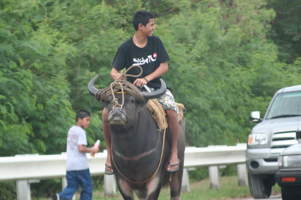
There are many carabao around the island. They are still used as a beast of burden, but can also be ridden for sport (as they are here). It’s interesting to note these are actually water buffalo.
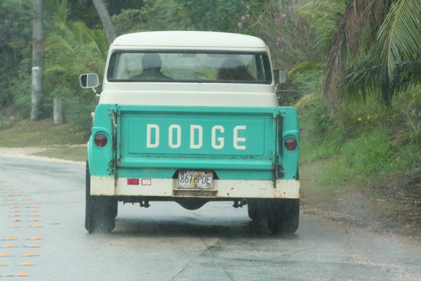
While there aren’t many cars like this on Guam anymore, it’s still fun to see a throw back to a time gone by.
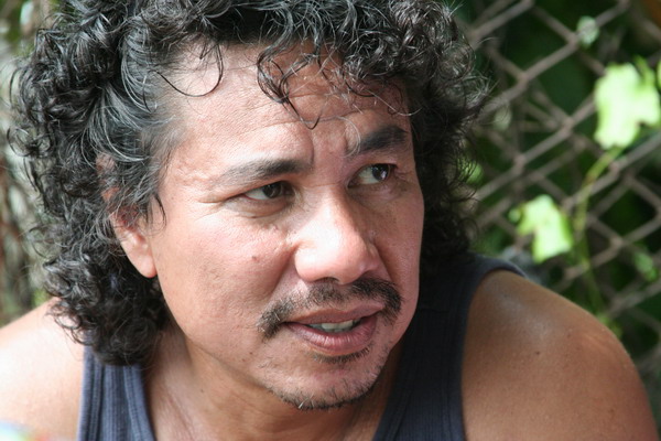
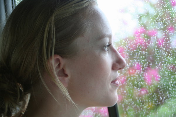
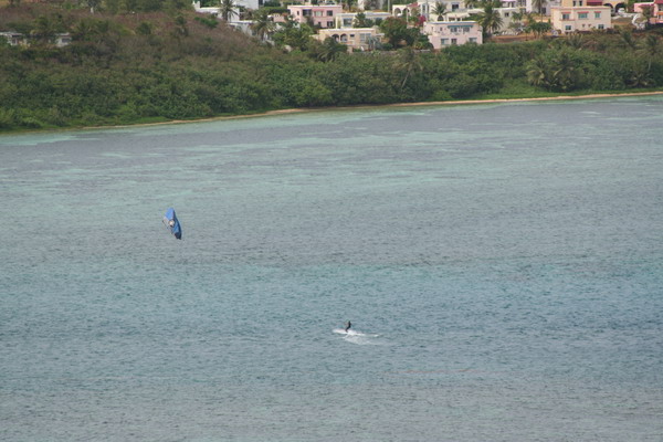
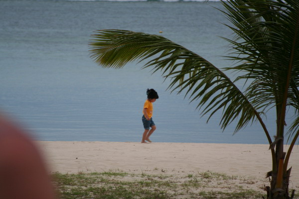
Here is my favorite photo subject.
Another popular sport on Guam is kite boarding. Here’s one in Pago Bay.
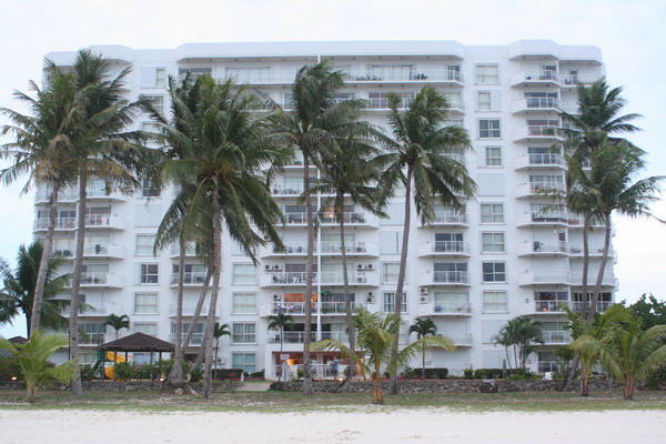
This is back on our beach, looking back up at our condo.
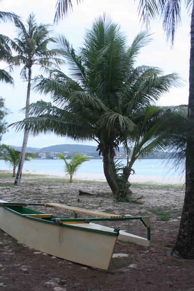
This is the outrigger canoe that Dan and I bought last year from our old neighbor who built it himself. Unfortunately, it’s no longer sea worthy, but it was fun to take it out snorkeling in search of manta rays (we’ve seen three thus far).
So, until the next adventure…
–Jim
Tarzan Swim Hole
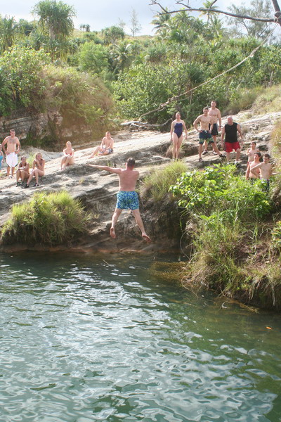
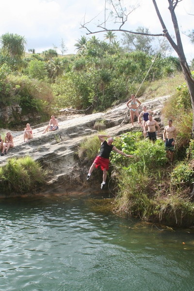
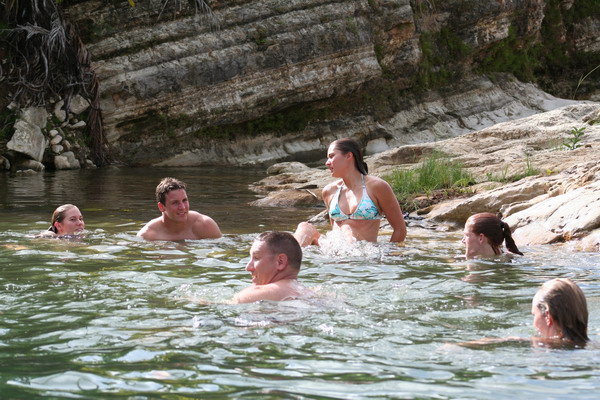
Today, we took our largest group on the hiking trails of Guam. There were 23 people who came with us to Tarzan Swim Hole. We wanted to go somewhere easy to get to and had water to cool off in.
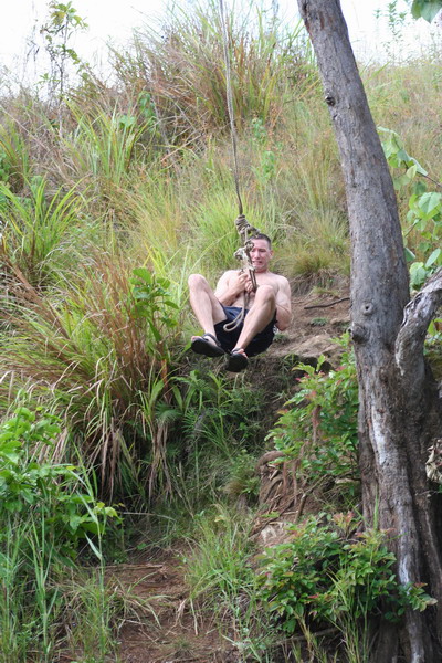
Here’s the group by the water. As you can see, the main attraction was the rope swing.
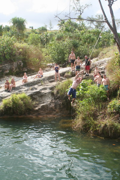
Unfortunately, this year’s wet season has been fairly dry (thus far at least) and the water level was about 3 feet lower than last time we were there.
This is our friend Gordon going into the water. As you can see, he made sure to point his fingers and toes before he hit the water…
This is Andy’s father (his mother and sister were also hiking with us) who had no fear going off the rope swing.
There are six Air Force Academy cadets who are on Andersen for a few weeks to learn about the Air Force. Here is a picture of most of them (all except Rodney in the middle are cadets).
Here’s Lindsey enjoying the ride on the swing.
Still smiling as she hits the water.
Gordon is apparently more interested in watching the rope than the girl about to face plant in the water. 🙂
Here’s Gordon, still pointing those fingers and toes…
Jen makes sure she can see where she’s going, while Andy watches attentively from the shore.
Rodney concentrates soo hard holding on to the rope, he grimaces…
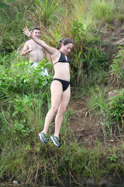
Jamie had without a doubt the most athletic water entry. He did a flip off the rocks into the water.
Once everyone enjoyed the water enough, we packed up and headed back up the hill and off to dinner for Guam’s best cheeseburgers at Jeff’s Pirates Cove.
Until the next adventure.
–Jim
Iwo Jima: 61 years later (2006)–Part 2
***Please read the entry Iwo Jima: 1945 and Part 1 first***
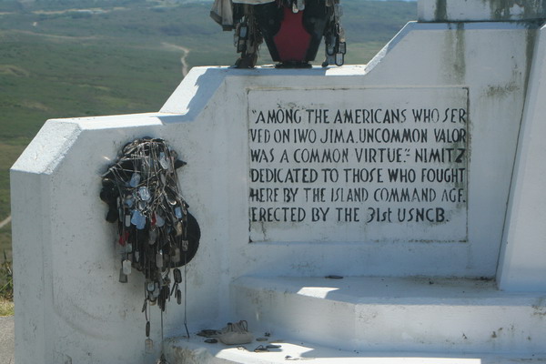
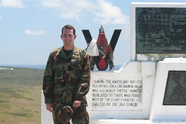
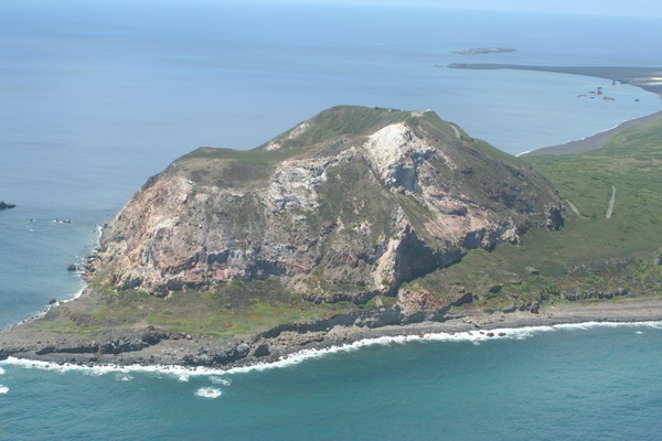
Perhaps the most poignant part of the whole trip was our time on Mt Suribachi. There is a memorial to both the American and Japanese forces on top.

Here is the American Memorial on the top of Mt Suribachi. From wverything I have seen and read about the battle. The inscription is VERY apropos.
Here is the other side.
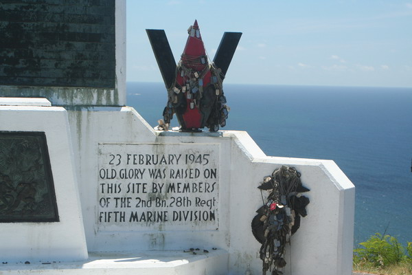
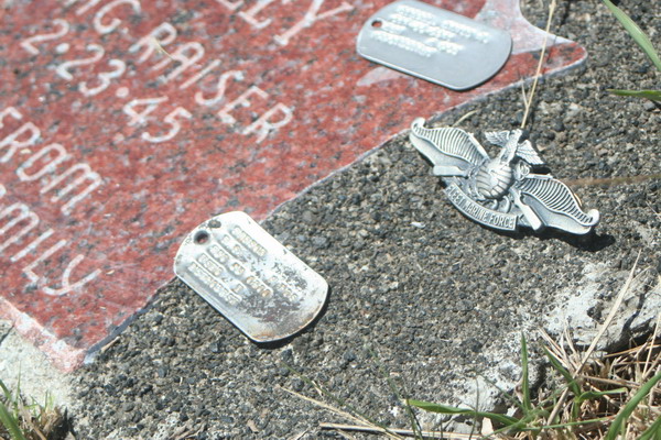
Many Marines (and other service members) have left tributes to those who have gone before. These dog tags are a very fitting tribute.
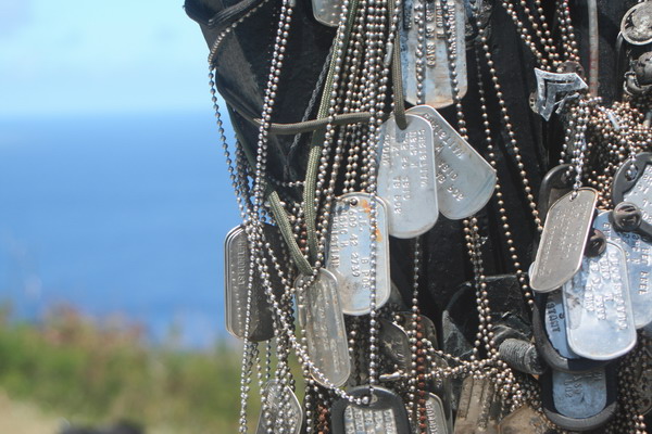
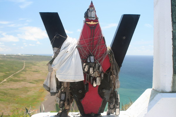
As you can see from this picture, everyone from a private to four
star general thought it appropriate to leave a bit of themselves behind on this small edifice.

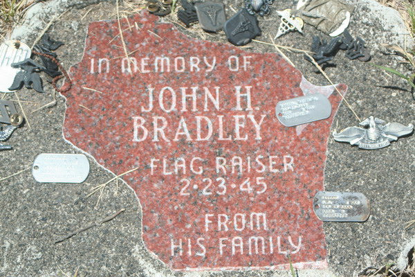
An interesting story about the flag raising. Of course you know that there were two flag raisings on the summit of Mt Suribachi. The second (and famous) flag was raised by six people. Of that, three were killed soon after in action on Iwo Jima. Of the remaining three there is one person who actually raised both flags. In fact, he wasn’t even a Marine. He was a Navy Corpsmen. He was assigned as a hospitable corpsman to a Marine rifle company. His name is John Bradley and he’s from a little town in North-Central Wisconsin called Antigo. For his actions on Iwo Jima, he was awarded the Navy Cross (the second highest medal, after the Medal of Honor). Here is what the citation to accompany award reads:
“For extraordinary heroism in action against the enemy at Iwo Jima on Feb. 21, 1945 as a hospital corpsman attached to a Marine Rifle platoon. During a furious assault by his company upon a strongly defended enemy zone at the base of Mt. Suribachi, Bradley observed a Marine infantryman fall wounded in an open area under a pounding barrage by mortars, interlaced with a merciless crossfire from Machine guns.
“With complete disregard for his own safety, he ran through the intense fire to the side of the fallen Marine, examined his wounds and ascertained that an immediate administration of plasma was necessary to save the man’s life. Unwilling to subject any of his comrades to the danger to which he had so valiantly exposed himself, he signaled would-be assistants to remain where they were. Placing himself in a position to shield the wounded man, he tied a plasma unit to a rifle planted upright in the sand and continued his life saving mission.
The Marine’s wounds bandaged and the condition of shock relieved by plasma, Bradley pulled the man thirty yards through intense enemy fire to a position of safety. His indomitable spirit, dauntless initiative, and heroic devotion to duty were an inspiration to those with who he served and were in keeping with the highest tradition of the United States Naval Service.”
He survived the war (although injured in both legs a month after the invasion of Iwo Jima) and returned to put his life back together in Wisconsin. When he passed away in 1994, the following was written about him in an editorial in his hometown paper, “The Antigo Daily Journal”:
“John Bradley will be forever memorialized for a few moments action at the top of a remote Pacific mountain. We prefer to remember him for his life. If the famous flag-raising at Iwo Jima symbolized American patriotism and valor, Bradley’s quiet, modest nature and philanthropic efforts shine as an example of the best of small town American values.”
From the vantage point on the top of Mt Suribachi, it’s very plain to see how easy it was to wreak so much havoc on the American invaders. Here is what the invasion beach looks like:
Here is the Japanese memorial to the island’s defenders.
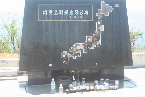
Yes, there are even some flowers there.
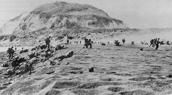
The group learning more about the history of the battle.
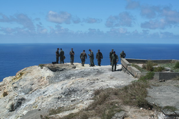
The volcano’s caldera.
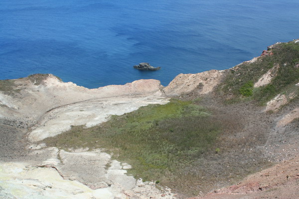
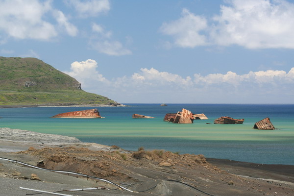
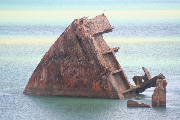
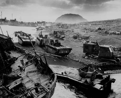
There are places where the wreckage from the invasion is still very visible. This is the alternate landing site for the invasion.

Before we left, I felt complelled to take this picture.
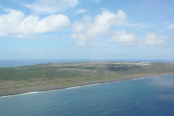
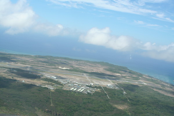
On our way back to Guam, we flew around the island twice and gave us a great perspective on the island we had just learned so much about.
Mt Suribachi:
It’s one thing to read about Iwo Jima and its battle/implications. It is completely different to go and experience it for yourself. I can say this is one of the best pieces of my professional military education. I’m truly grateful for the opportunity to pay my respects to so many on both sides that gave the final measure of devotion.
–Jim
Iwo Jima: 61 years later (2006)–Part 1
***Please read the entry Iwo Jima: 1945 first***
Last week, I had the rare opportunity to visit a sleepy little island about halfway between Guam and Japan, called Iwo Jima. It was the site of a ferocious battle in World War II.
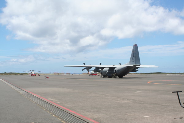
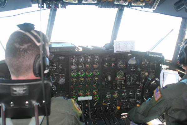
Here is how we got there and back, the venerable C-130 transport aircraft:

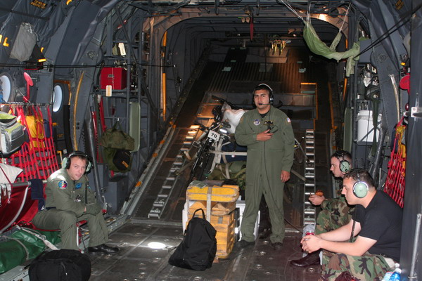
Here’s the inside. As you can see, it’s not quite as comfortable as a civilian airliner, and a whole lot louder. It sure can get into some remote places though!
While we were only on the ground for a few hours, we were able to see much of the island by using a minibus to drive us around. About the only people on the island these days are the 200 or so Japanese Maritime Self-Defense Force. So, it is an interesting turn of fate that we had a Japanese and an American Marine (who flew out with us from Guam) to guide us through the historical significance of the island where so many people had died on just 6 decades before.
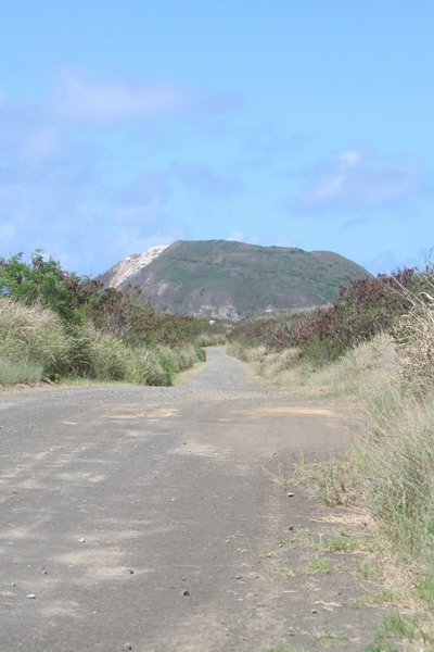
This is the dirt road that leads to the infamous Mt Suribachi.
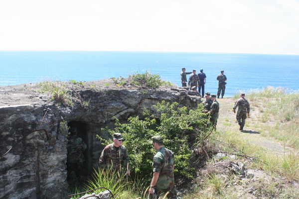
Here you can see on of the well entrenched bunkers that lined the shore where the Marines landed in February 1945.
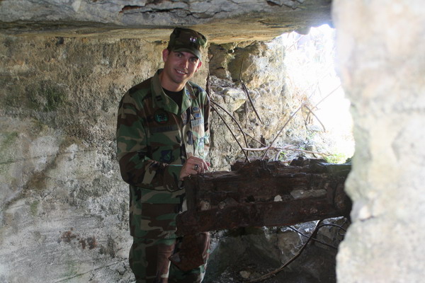
Here I am on the inside of that bunker (or pillbox).
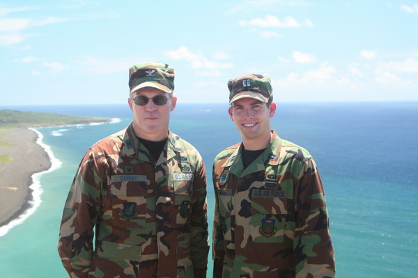
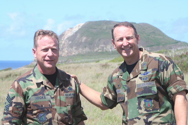
The Commander and Command Chief Master Sergeant.
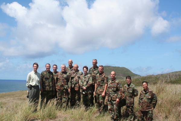
This is our group of Air Force people who attended.
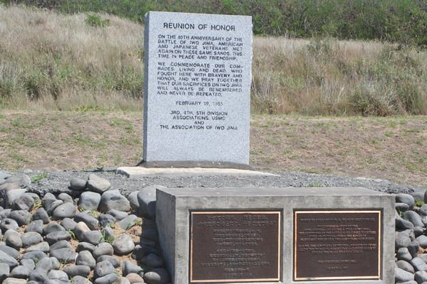
This monument is was dedicated when both Japanese and American soldiers met at this spot. This time it was under the banner of peace and friendship.
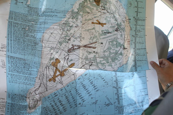
This map shows how the island looked during WWII and where the Marine units involved went. To orient you, Mt Suribachi is in the lower left hand corner (on the southernmost end of the island).
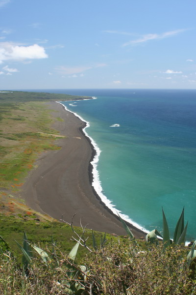
This is the invasion beach. You can see it’s a black volcanic beach. The sand is coarse and it’s very easy to imagine how hard it was to land all those men and equipment.
This rock marks the midway point on the beach and divided where the regiments came ashore.
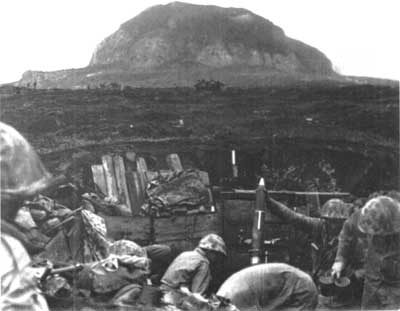
This is our Marine guide, Matt, recounting what happened 61 years ago.
During the war, everything the Japanese defenders did was underground. This included their hospital. Almost a month after the island was declared captured, American forces discovered an underground field hospital. It contained 72 Japanese soldiers and medical personnel. 71 of them surrendered (one committeed suicide).
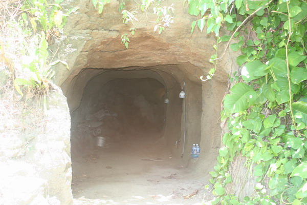
Here is the entrance to that hospital cave:
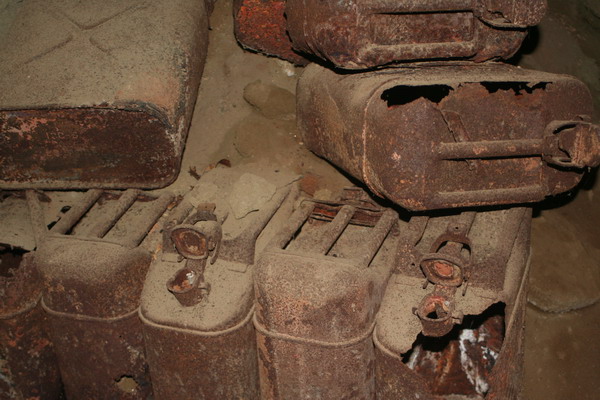
There were a number of artifacts that remained in the cave.
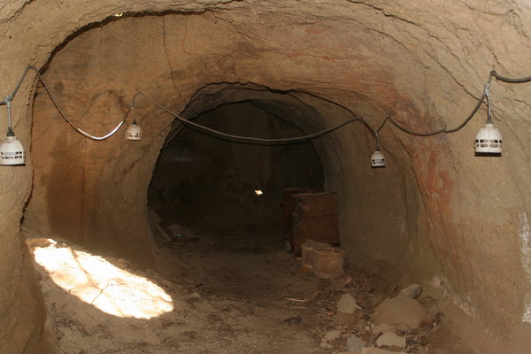
Inside the cave, there were a number of air vents that provided fresh air. That was especially important if one of the entrances were destroyed or blocked.
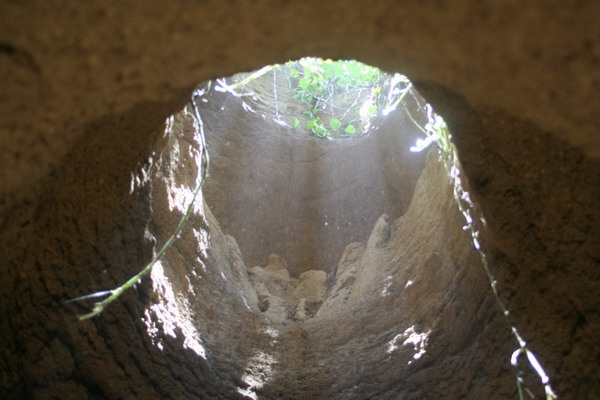
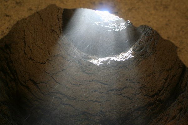
One aspect of the cave that the pictures don’t convey is just how hot it was inside. One would expect that it would be much cooler underground. However, since the island is an active volcano, going underground only brings you closer to the steam and magma. So, in places it was easily over 100 degrees. This picture shows the mass of hot air rising from the cave into the cooler air above and outside.
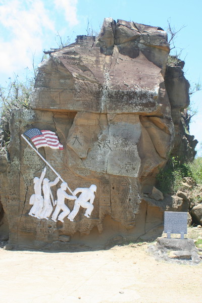
Nearby the hospital cave, there is a sandstone monument carved into the cliff. This carving of the famous flag raising on Mt Suribachi was done by Waldon Rich in July 1945 (only 5 months after the actual raising).
In the next part, I will include the pictures from the top of Mt Suribachi.
–Jim
Iwo Jima: 1945
Iwo Jima.
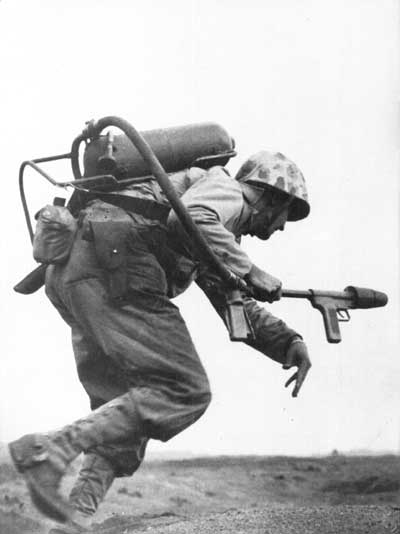
This is probably the image that comes to your mind when you think of that small island in the middle of the Pacific Ocean:
Now, imagine this (the rest of the story):
The date was 18 February 1945, D-Day to capture the critical island of Iwo Jima. This was the next island in line for the “island hopping” campaign for the United States in the Pacific Theater of Operations during World War II. There had already been three days of constant naval and aerial bombardment to “soften” the defenses of the island of Iwo Jima.
These assaults barely scratched the surface.
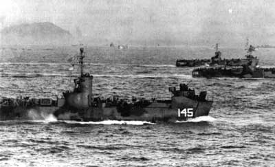
The invasion force was 70,647 US Marines. They faced 21,000 Japanese forces well entrenched in an intricate network of underground tunnels. The invasion force included a total of 250,000 US forces. They were carried on one of the largest armadas ever assembled, which included more than 800 vessels (12 aircraft carriers, 8 battleships and a host of other support vessels).
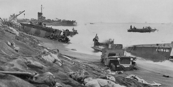
There was a 2 mile stretch of beach that was the only viable landing location. The American planners knew that and the Japanese defenders knew that. So, those 70,000 Marines came in to an area that was incredibly well defended and further complicated by soft, black volcanic beaches. So, the first wave got bogged down as they came ashore, then 5 minutes later another group was right on their heels, and another after that, and another, and so on. However, for the first hour, the Marines only encountered relatively light resistance. This is not what they were expecting. Once the beach had become congested though, the Japanese defenders opened up and decimated the men and equipment on the beach while remaining seemingly invisible from their underground or concealed emplacements. A book (Iwo Jima: Legacy of Valor) by Bill Ross described it as, “mortars fell cascades from hundreds of concealed pits. Heavy artillery and rapid-firing antiaircraft guns, barrels lowered to rake the beaches, slammed shells into oncoming landing craft and support vessels. Land mines sown like wheat in a field, exploded in sickening blasts as Marines stumbled across them. Fifteen inch guns and large mortars rained down from Suribachi’s base, slopes and crater … 6,200 men were down on the 3,000-yard strip of land.”
Eventually, the Marines broke free and began to advance inland in force.
Although the island is less than 8 square miles, it has a formidable natural fortress in the form of Mount Suribachi (A suribachi is a kind of rough grinding bowl. Apparently the mountain’s shape was reminiscent of a suribachi to the Japanese who named it) on the extreme southern end of the island.
On the third day of fighting on Iwo Jima (D+2), the Marines launched their coordinated attack on Mt Suribachi. However, in some places they only advanced 50 yards that day.
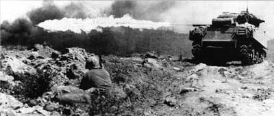
D+3 brought much of the same. There was no room for the supporting tanks and artillery to maneuver and the battle lines were so close that air support was ineffective. The battle raged with the marines fighting above ground and the Japanese fighting below. Many times, the US forces would never see their adversary as they were so well hidden. The most effective tactic was to use flame throwers and hand grenades.

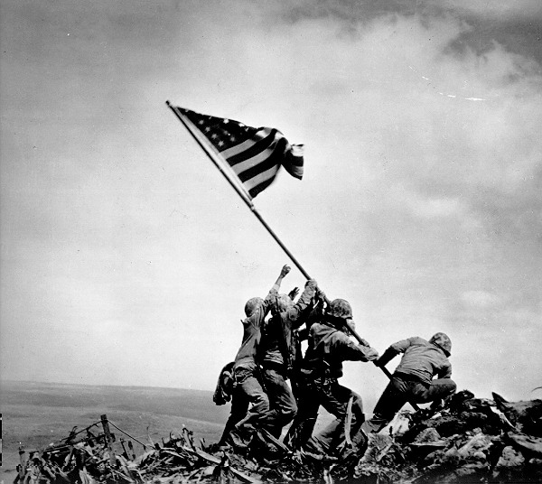
Finally on D+4 (24 February 1945), a forty man patrol was sent out and moved up the northern slopes toward the summit. They engaged a number of Japanese soldiers who attacked with hand grenades, but at 10:30 AM, the stars and stripes were raised on a length of pipe.
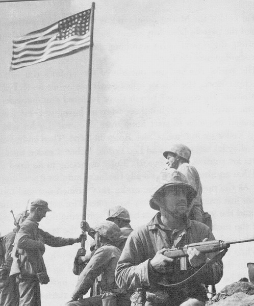
Photographer Lou Lowery captured this first flag raising on Iwo Jima on film. The shout went out throughout the southern part of the island “the flag is up!” and the troops cheered while the naval vessels sounded their siren. Around noon, the small flag first raised was replaced by a much larger one. These flag raisers are the ones that photographer Joe Rosenthal forever immortalized in his famous picture. This has become one of the most recognized pictures of the whole war. When asked 10 years later about the picture, he commented. “what difference does it make who took the picture, I took it, but the Marines took Iwo Jima.”
Here is a picture shortly after Old Glory was raised:

While the Marines were justifiably happy, the battle was far from over. The final “organized” attack occurred on 26 March 1945 (36 days after fighting began). 262 Japanese and 53 Americans were killed and at 0800, the island was declared captured.
This, over an island that is 5 miles long and averages only a mile and a half wide. The casualties were almost unbelievable. There were almost 7,000 American killed in the capture of Iwo Jima (of that 6,000 were Marines). Of the 21,000 Japanese defenders, 20,000 were killed and 1,083 were taken prisoner. There were 22 Medals of Honor awarded to Marines and 27 total were awarded, although 13 were posthumous (this is more than 25% of Marine Medals of Honor in all of WWII). The strategic value of the island is significant. Since the island is about halfway between the Marianas Islands and mainland Japan, it was an effective divert base for the many heavy bombers attacking Japan and a base for the shorter range fighters to escort the bombers. By the end of the war, more than 2,400 emergency landings were made at Iwo Jima. That meant that 27,000 men in those B-29s didn’t have to ditch their planes at sea (or worse) and prompted US Navy Admiral Ernest King to state that the lives saved “exceeded lives lost in the capture of the island itself.”
An interesting side note:
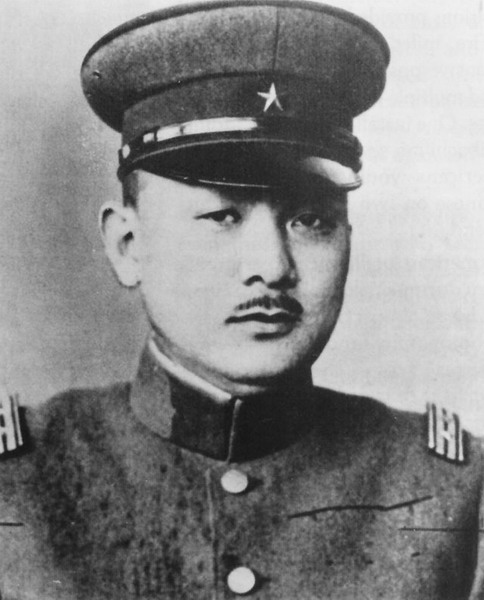
The man who led the Japanese defense of Iwo Jima was Lieutenant General Kuribayashi. He had lived and studied in the US during the 1920s and was later an assistant Defense Attaché before WWII. He wrote to his son and said, ” The United States is he last country in the world that Japan should fight. Its industrial potentiality is huge and fabulous, and the people are energetic and versatile. One must never underestimate the American’s fighting ability.” However, he led his forces in an effective, bitter fight to the end. His orders to his men were: don’t expect to survive the battle and to take out 10 Americans before they themselves were killed.
Here is the general:
My thanks to the base historian and our Marine guide who educated me on the history which I just shared with you all (and provided the reference material from which to draw upon).
The next entry will discuss our trip to this historic island.
–Jim