
We had mixed emotions about our last day in Beijing. Our main stop on the itinerary was to a place called World Park. It’s a park filled with replicas of the world’s monunments at one tenth size. While it was somewhat interesting, we mostly got the feeling that it was a very touristy with not the best construction.
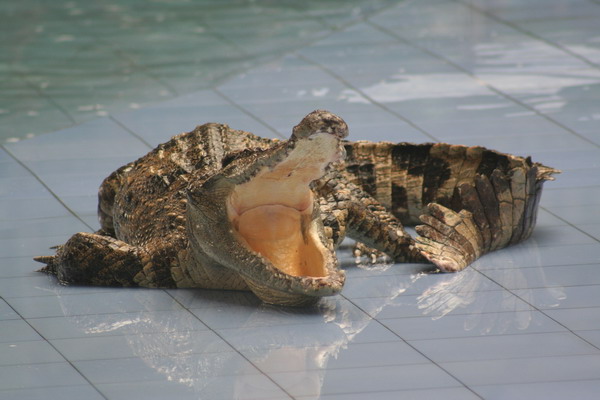
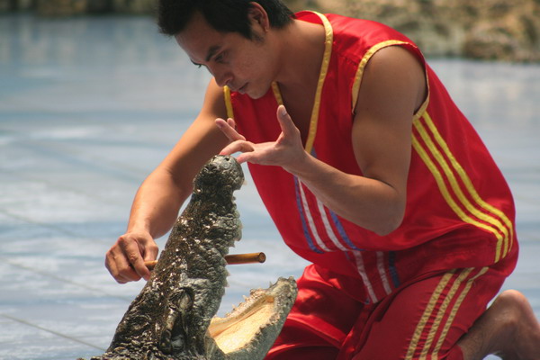
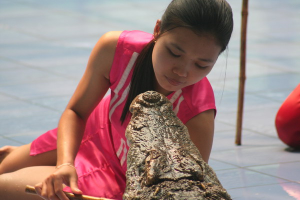
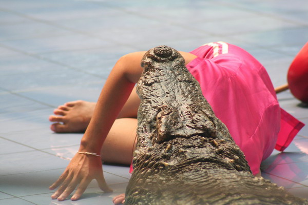
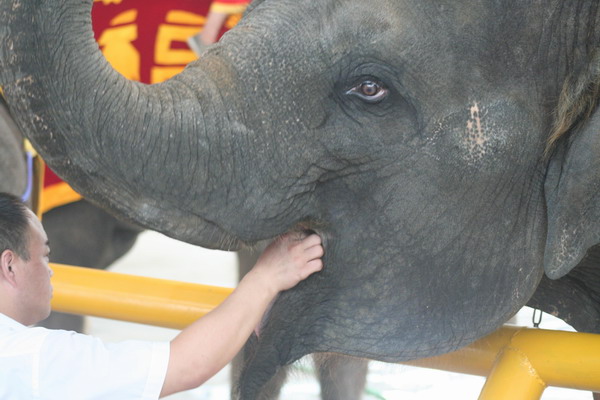
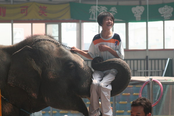
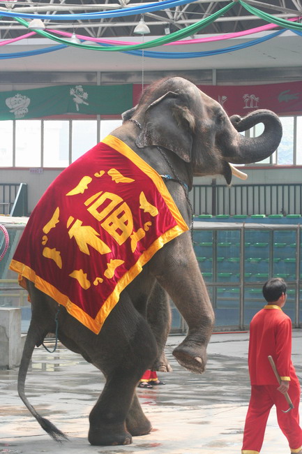
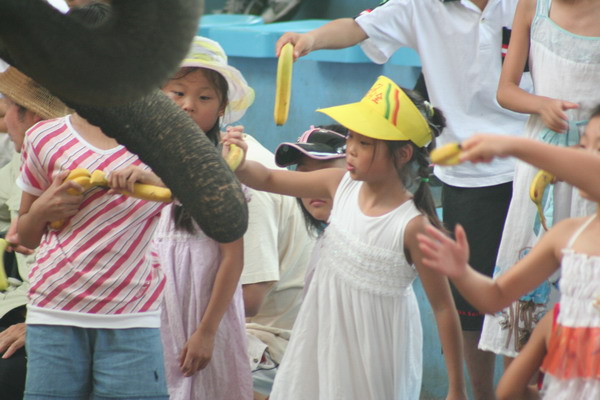
However, there was a crocodile and elephant show done by some Thai nationals. The show was entertaining, but we heard that if zoos are like prisons for animals, then the zoos in Beijing were like death row. So, suffice it to say, that as fun as the show was, we came away feeling sorry for these poor creatures.
That said, here are the images from the show.


Then, back to downtown Beijing to visit on last temple.
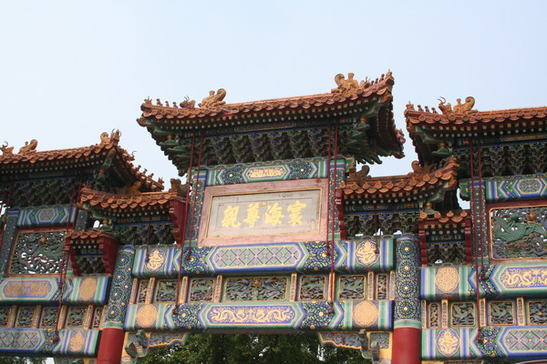
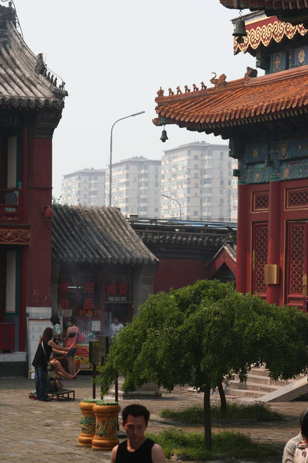
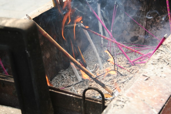
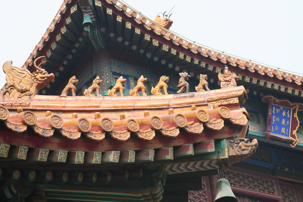
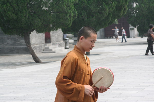
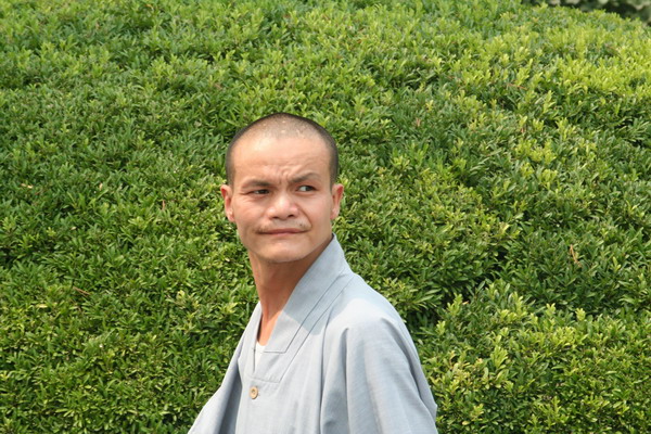
This time we went to Lama Temple. Lama, as you may be aware, is the term for a Tibetan religous (Buddhist) teacher (similar to a Guru). So, there were many young monks around and this temple was probably the most vibrant of all the ones we visited (even if the pictures don’t really show it…).
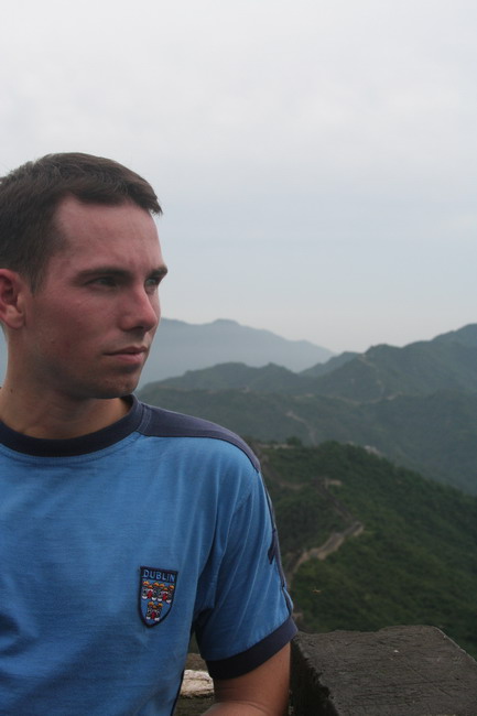
Here is our guide, Woo, again.

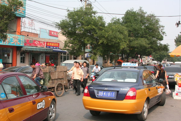
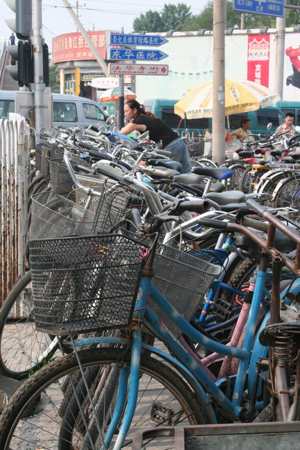
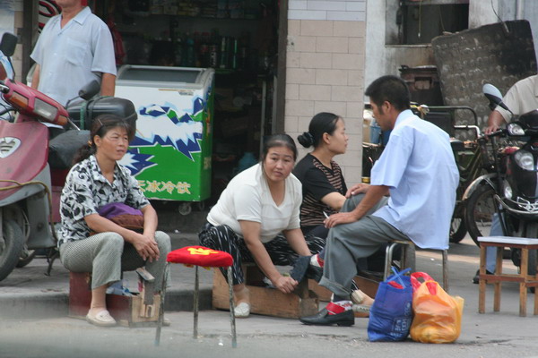
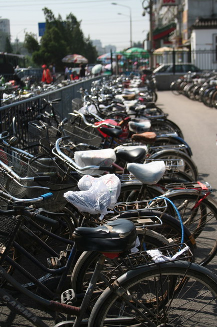
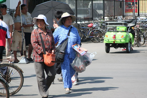
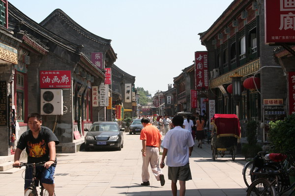
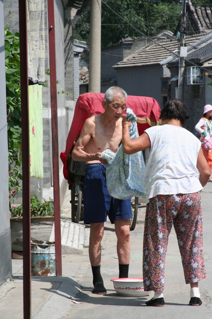
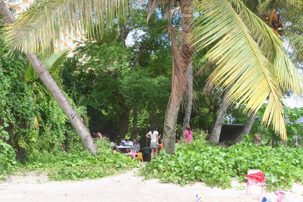
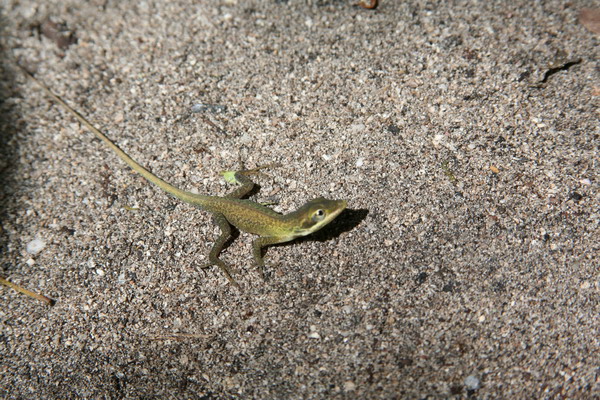
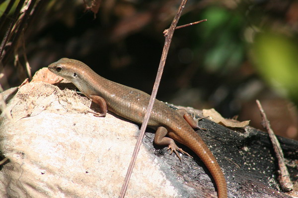
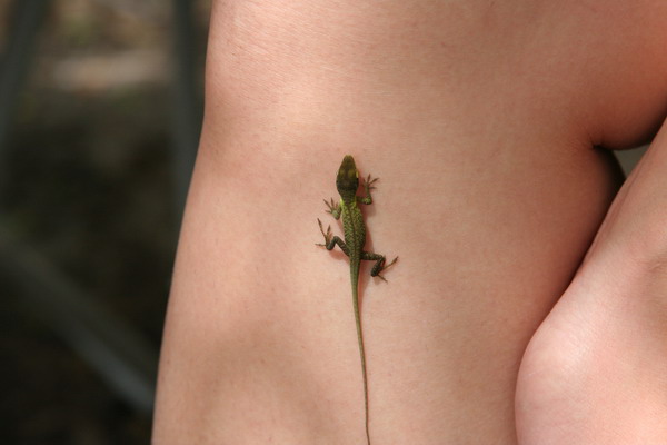
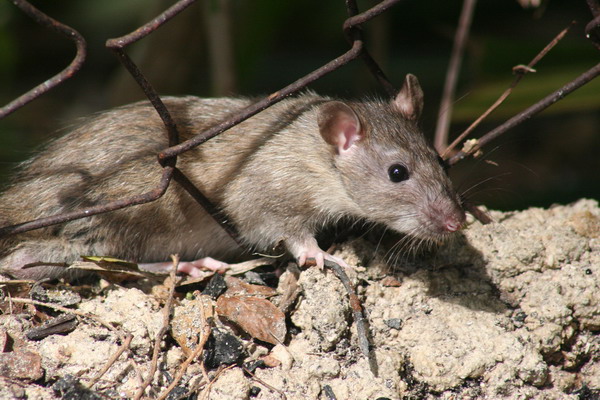
A couple more images of city life in Beijing.
After our time in Beijing, we boarded a flight down to Xi’an. While Beijing is a massive megapolis at 16 million people and feels like an enormous city, Xi’an, is also a large city by all rights with over 6 million inhabitants. In fact, in all our travels in China, we felt that there were lots of people everywhere. Perhaps even more so than Japan. Of course with 1.3 billion people spread out over a vast country, it brings the People’s Republic of China down to the 71st most densely populated countries (Monaco is the #1, if you’re curious, while Macau and Hong Kong are #2 and #3 on the list, and the USA is #172 and Greenland brings up the rear at #230).
Xi’an, was the ancient capital of China, and was the first city in the world to reach 1 million inhabitants (although there is some dispute to that claim). Also, and more notably, it was the eastern end of the Silk Road, when the city was known as Chang’an.
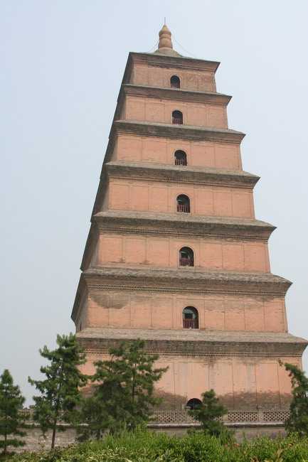
The first stop when we got to Xi’an was to visit the Big Goose Pagoda and the Tang Dynasty Arts Museum.
There were many interesting people also visiting the Pagoda.
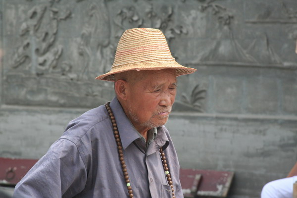
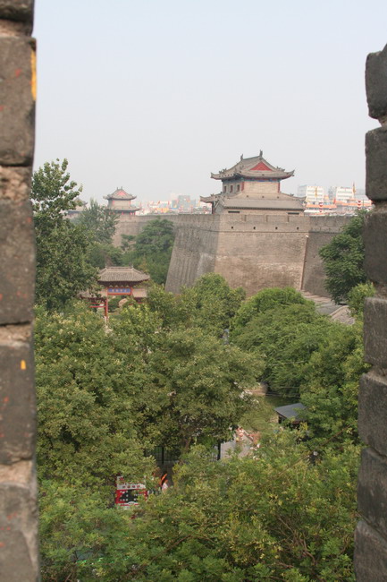
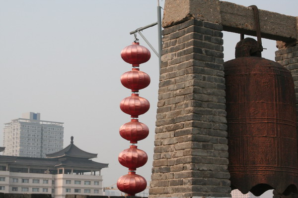
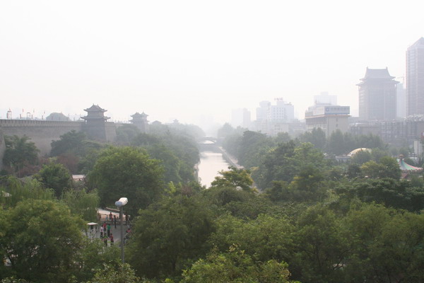
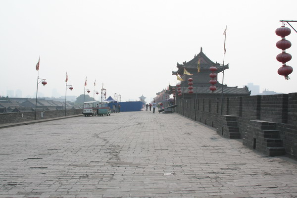
The next morning, we got up early and visited the city wall of Xi’an, which although much shorter than the Great Wall, was larger and impressive none the less.

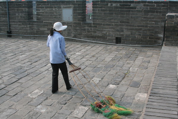
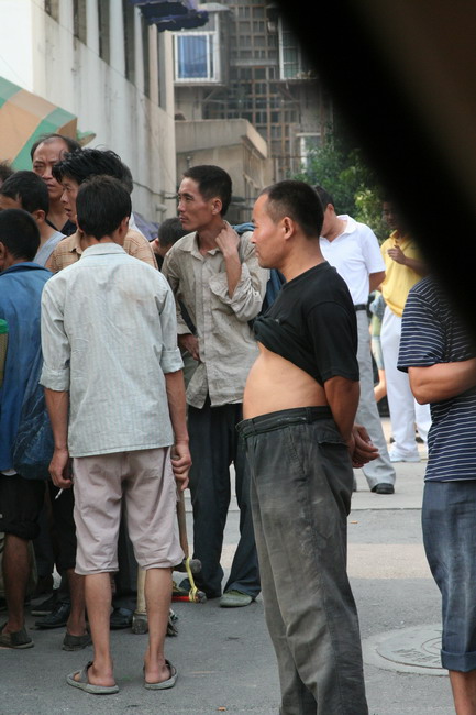
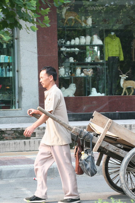
Back in the city, we found many more interesting people.
The man is demonstrating the fashion in China for men to keep cool (yes, it’s just the guys who do this … except one teenage Eurpean girl)
We also went to the regional history museum. It had very helpful displays that depicted the Chinese empires rise and fall through time.
This image was a taste for us of what was to come the next day. This is an actual Terra Cotta warrior from the archeological site outside the city.
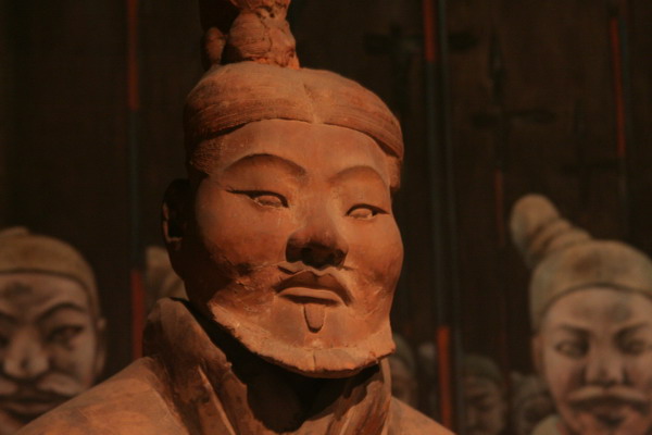
The next entry will of course will cover our tour of the magnificent Terra Cotta warrior site.
–Jim
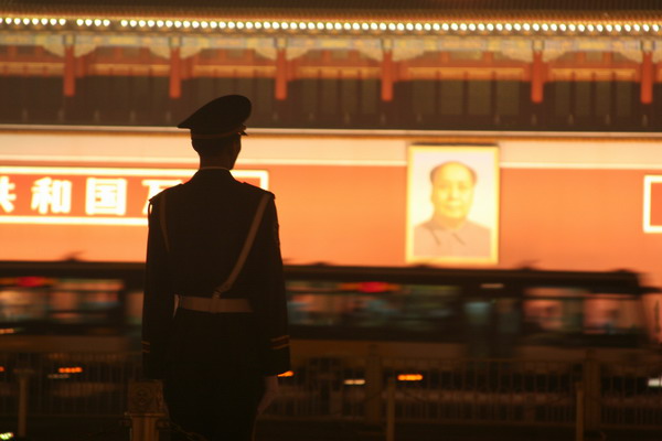
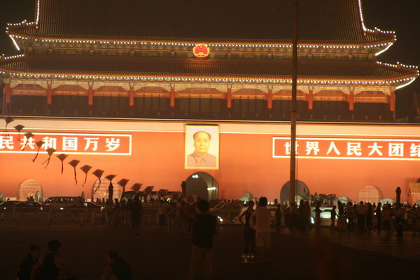
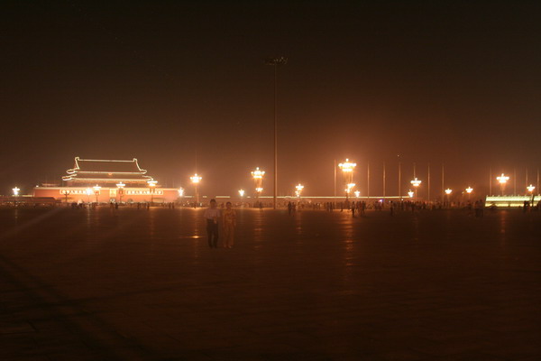
China Part 3–Tiananmen Square (night) & Temple of Heaven
We decided to make a return trip to Tiananmen Square to see the difference the night made.
Here are some of the images.

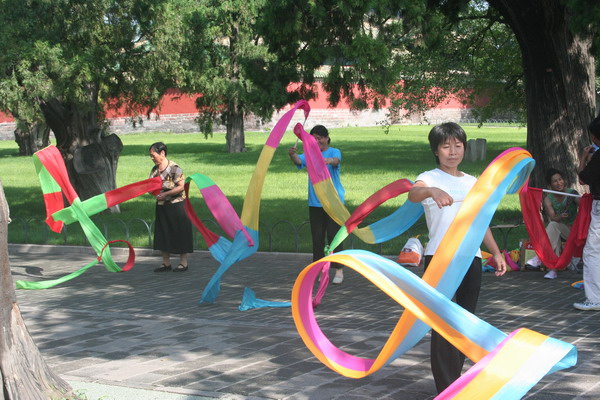
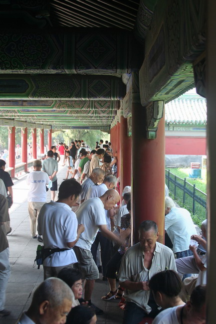
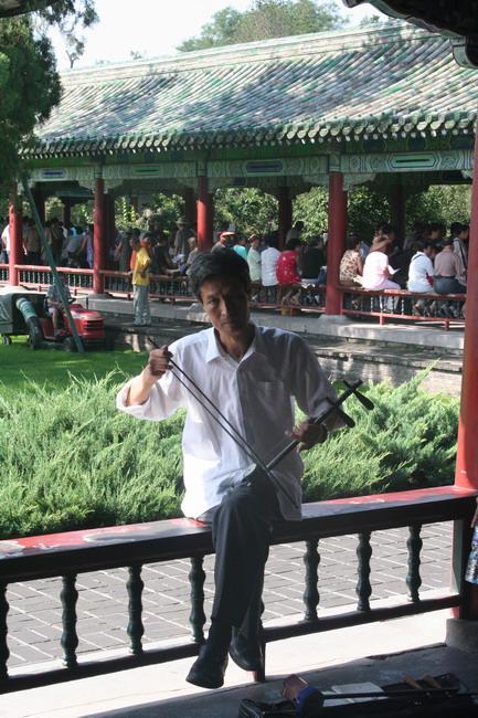
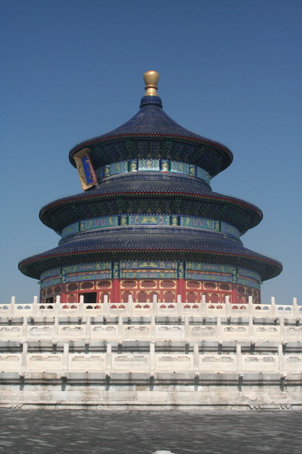
We also visited the Temple of Heaven. This very peaceful location, that is yet another example of Ming architecture, was where a large number of Chinese retirees came to relax. There were people doing all kinds of recreational activities (board games, dancing, singing, and rythmic gymnastics below).
The main feature is Hall of Prayer for Good Harvests. It’s 38 meters high and the round structure symbolizes heaven, which is contrasted by the rectangular base (and walls) which are the earth.

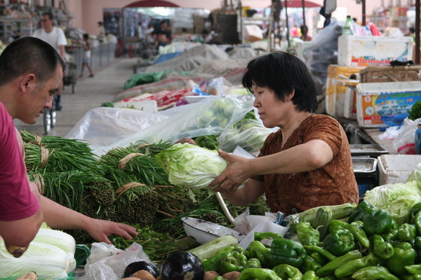
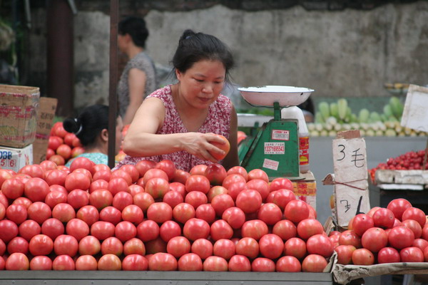
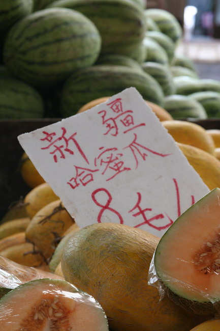
Next stop was a little cultural exploration in the form of shopping.
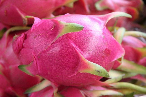
These are Dragon Fruit (Anna really liked the way they looked and their real name is Pitaya).
Then, there are the lychee fruits.

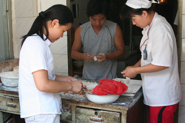
Another Chinese delicacy that we came to love were dumplings. Here is a group of cooks preparing them.
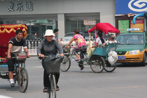
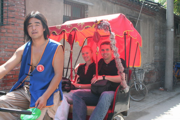
Not only did we explore on foot, we also went by pedicab. The areas we were exploring are called Hutongs (narrow alleyways). The roots of this type of urban development trace back to when Genghis Khan
laid waste to Beijing (known as Peking then). These narrow alley ways dominated zoning for the city for many centuries. However, they are rapidly being replaced by high rise apartment complexes (with much less character). Unfortunately, with the Olympic games coming to the city in 2008, the buildings there are being ruthlessly demolished by the government (with very little, if any, compensation to the owners). In fact, the atmosphere all around the country is of a headlong rush to modernize everything (oftentimes with extensive use of manual labor).
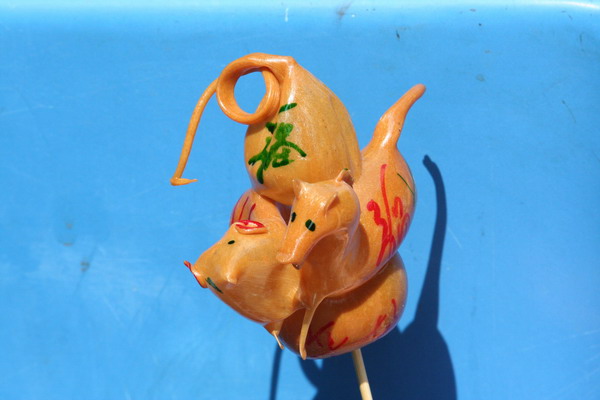
We also got a blown melted sugar sculpture of each of our birth years.
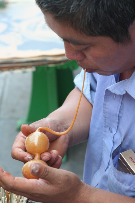
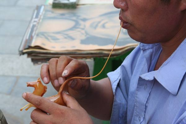
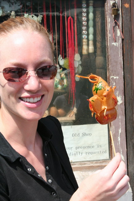
While it didn’t last long in the heat, it was fun to watch him make it.
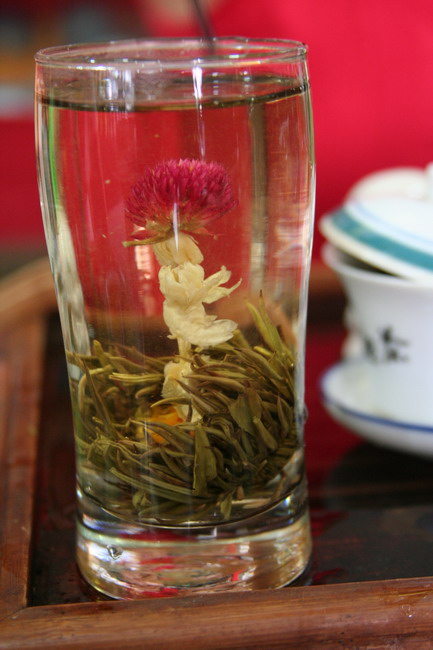
We also went to a tea shop that allowed us to sample different types of tea. Plus, they also had dried tea leaves with a chrysanthemum inside that blossomed with hot water.

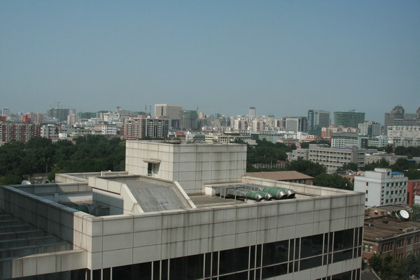
As a random picture, this is the view from our hotel.
The next post will have our last pictures from Beijing and the first from Xi’an.
–Jim
China Part 2 — The Great Wall
OK, so I wasn’t able to keep up with the real time posts in China again. However, again, we have a huge number of pictures, so there will be a number of posts.
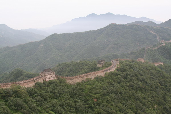
Next stop on the itinerary was one of the main reasons we went to China, to visit the Great Wall of China, truly one of the wonders of the world.
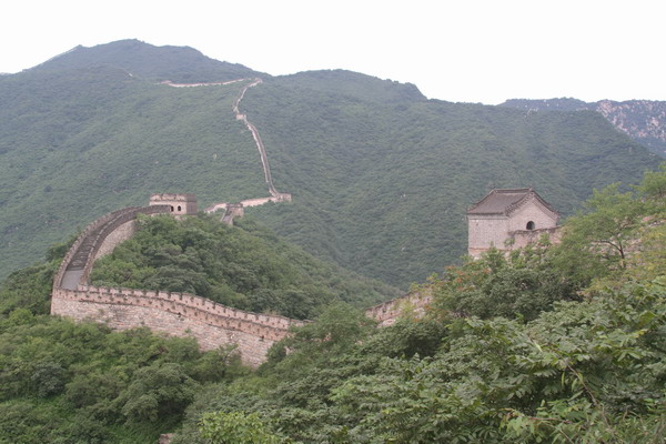
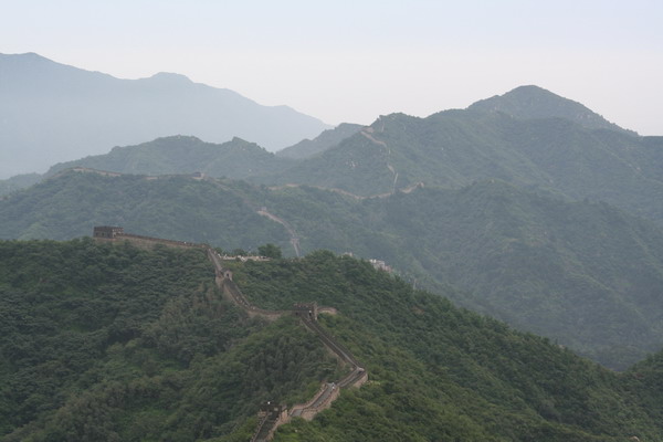
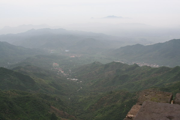
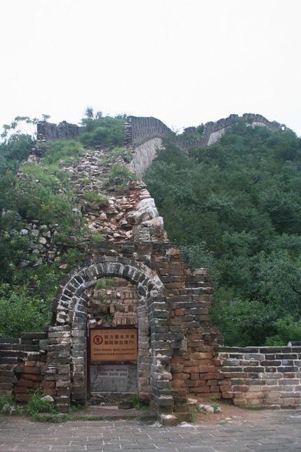
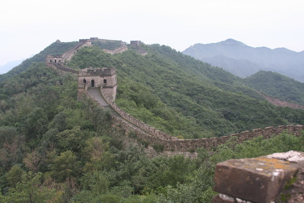
For those who don’t know much about the Great Wall (other than it’s really long wall in China). It was built and rebuilt at various times throughout history. However, it was started back in the Qin Dynasty (221-207 B.C.) when China was first unified by Emperor Qin Shi Huang, which makes the wall over 2,000 years old. They spent 10 years of forced labor and a massive human toll to build the original wall. This of course was very unpopular with the common people, since they were the ones sacrificing much and was one of the reasons that the Qin Dynasty was so short lived. However, during the Ming Dynasty (1368-1644) was when the wall took its modern form. During that time, over 100 years of effort went into making an impenetrable barrier, although it never really served as one. The idea was that at each guard house, sentries would light a fire to signal back to the capital Peking that an enemy was near (1 fire for 100 troops, 2 for 200 and 3 for 300 or more). As Gehghis Khan supposedly said, “The strength of a wall depends on the courage of those who defend it.” So, while it was never really impenetrable, it did serve a useful purpose of a convenient path to cross rough mountian terrain. Unfortunately, after the Ming Dynasty, the wall was largely forgotten and sections turned back into dust. Had not the tourism market resurrected it in the 20th century, the whole thing may have disappeared entirely. Now, there are several sections that have been restored to their original condition, as well as some that are in their more natural state. The place we chose to visit was called Mutianyu. It is a section 90 km northwest of Beijing and is about 2.5 km long. It was first built during the Northern Dynasties (386-581), but rebuilt during the Ming Dynasty. This section is between 7 and 8 meters high and 4-5 meters wide at the top.
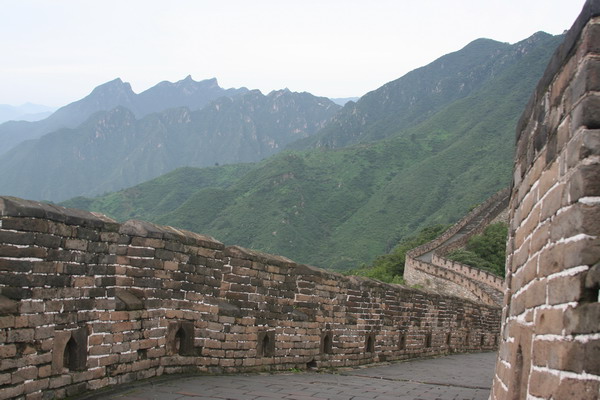
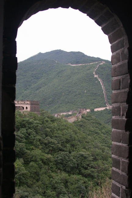
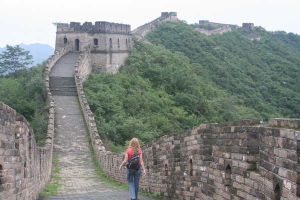
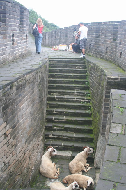
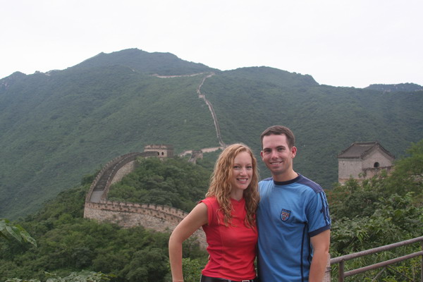
Ok, enough description, here are our pictures of the Great Wall of China.
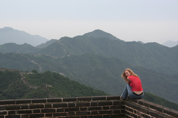
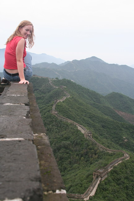
At the end of the wall, there was a rampart at the top of 400 stairs that offered a commanding and serene view of the surrounding area. Anna found this perch a very agreeable spot to watch the few other tourists climb the wall.


As you can see, after centuries of neglect, the wall has deteriorated quite significantly.
You can see one of the guard towers here.

There was even one hardy vendor who was willing to bring snacks and drinks up the mountain to hungry and thirsty tourists (with a little help from his friends here). Amazingly, the price was about the same as other places much further down.

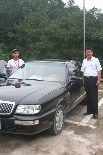
After we finished exploring the wall (although we could have easily stayed and explored a couple more sections), our guide and driver were ready to take us to our next location. Let me take a couple sentences to say just how nice it was to have a personal escort throughout our time in China. Normally, as you probably figured out by now, we like to blaze our own trail and explore on our own. However, in China we decided to use a personal guide and driver. It made things so much easier. Between our everpresent Lonely Planet guidebook (which is our favorite travel companion) and our guide, every question we had was answered. 🙂 Plus, a driver was there to drop us off as close as possible and wisk us away when we finished.
Here they are, ready to head back to Beijing.
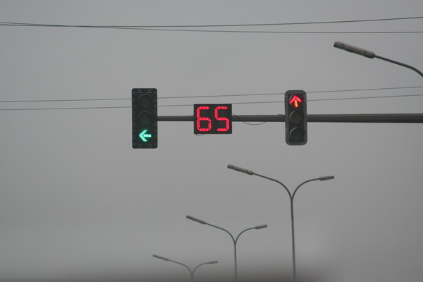
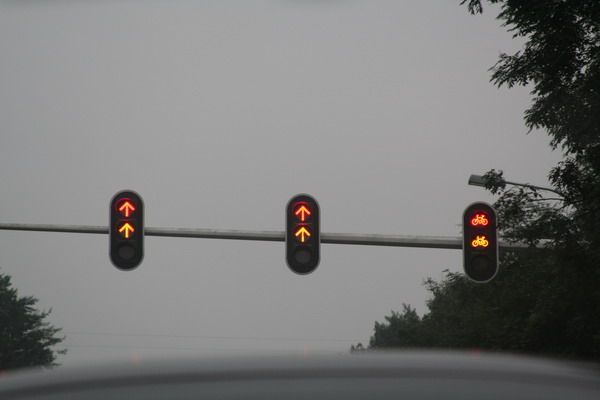
While China is certainly still a third world country, it has a couple unique traffic features. While not unique to China, they are certainly interesting to note (and not a bad idea for the US as well).

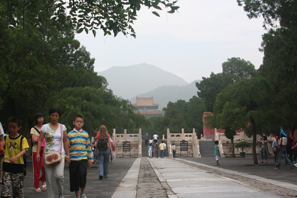
We also stopped by the Ming Tombs. This is the final resting place for 13 of the 16 Ming Dynasty Emperors. It had a very serene Sacred Road that led to the tomb.
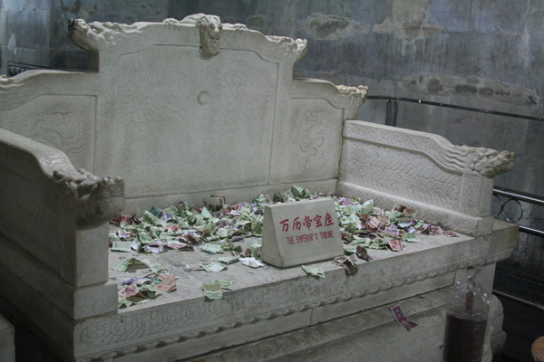
However, perhaps one of the most interesting parts of the tour was a trip into Dingling. It’s the underground tomb of Emperor Wanli. You can see from this picture that people liked to throw money on his throne.
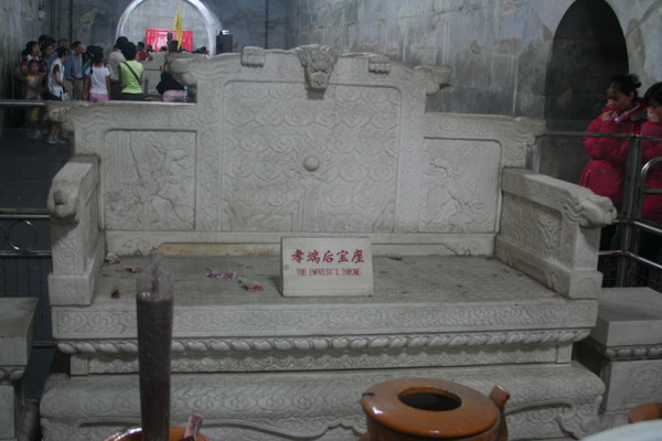
However, apparently, people didn’t feel the same way about his wife…
This is an interesting perspective looking back into the burial chambers.

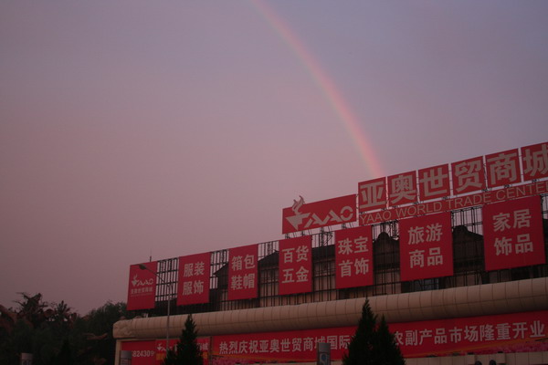
After dinner, we came outside to this beautiful full rainbow.
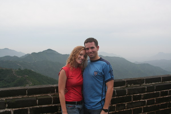
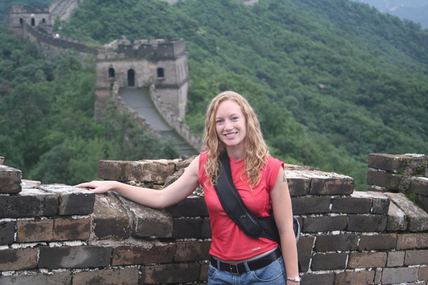
The Great Wall was without question our favorite site to see in China. So, this was an outstanding day. 🙂
Not to worry, there will be several other posts of our China adventures.
–Jim
China Part 1 — Tiananmen Square, Forbidden City and Summer Palace
Yesterday we began our voyage into mainland China. However, it wasn’t until today until we began our exploration in earnest.
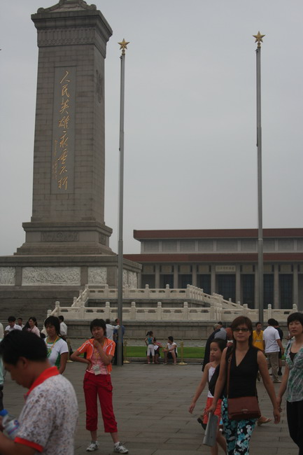
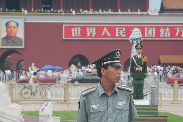
The first stop on our itinerary was the infamous Tiananmen Square. This of course was the site of the massive 1989 pro-democracy demonstration, where tanks were seen rolling in against student protestors. It is fitting that because the revolutionary Chinese leader, Chairman Mao Zedong, conceived the idea of the square, was also where one million Chinese paid their final respects to him in 1976.
Tiananmen Square is perhaps the symbolic center of China. This is evidenced by the mausoleum on one side that contains the remains of Chairman Mao. In fact, it has both a wax likeness and his actual body entombed in formaldahyde. As we passed the entrance in the morning, our guide informed us that Chinese people make it a ritual to visit and pay their respects every (or at lease many) mornings. Also, there is a “meridian” that runs directly through the middle of the square.
In addition, there’s a large monument in the middle of the square, called the Monument to the People’s Heros. This was completed in 1958, it’s about 40m high, and bears the inscription “Eternal Glory to the People’s Heros.”
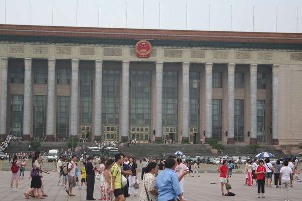
On the other side, there is the Great Hall of the People. Here’s an image of it.
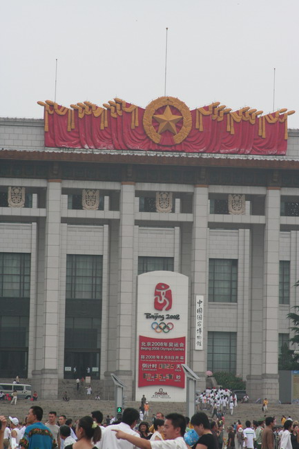
Here is the National Grand Theater, which advertises that the Olympic Games are coming to the capital city. In fact, there are several large clocks in the city that count down how much time is remaining (as of today, it was 725 days…).
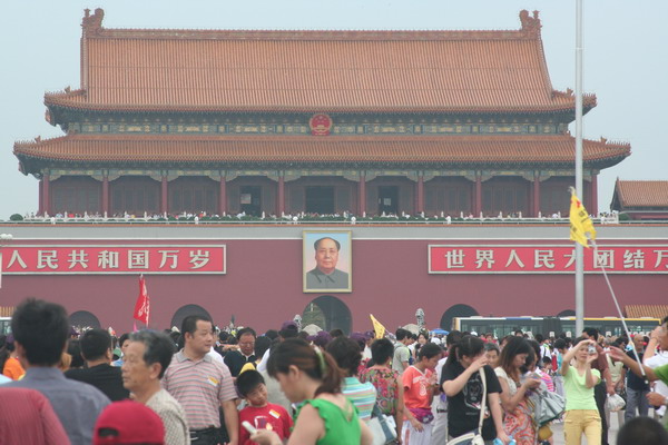
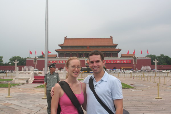
Looking over the throngs of people, you can see the Gate of Heavenly Peace. This was built in the 15th century (and restored in the 17th), and serves as the main gate for the Imperial Wall that encases the Forbidden City within. Also, it was from here that Chairman Mao proclaimed the People’s Republic of China on 1 October 1949. You can see his portrait is the main feature of the gate. The inscription on either side reads, “Long Live the People’s Republic” on the left and “Long Live the Unity of the People’s of the World” on the right. An interesting side note is that the painting was pelted with paint filled eggs during the 1989 demonstration.
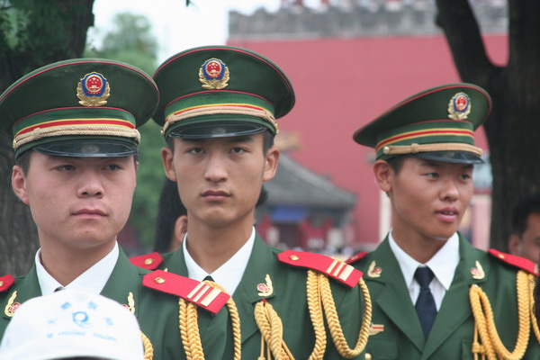
Government service is compulsory in China for 4 years. You can determine what branch these officials are in by the color of their uniform. Green is the military, blue for police, and gray for security.
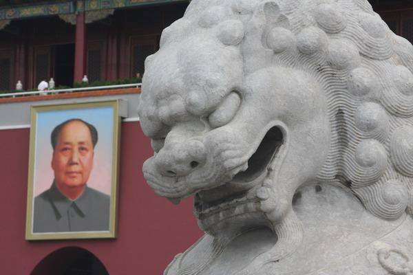
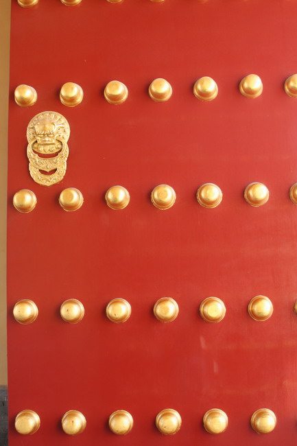
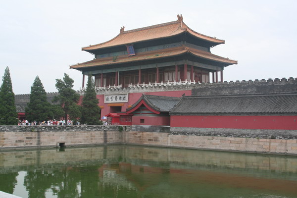
Inside the front gate of the Forbidden City (there are actually nine gates separating the inner city, with the outer). In fact, the number nine has special significance. It is viewed as the perfect number. It’s the largest single decimal number, and has spiritual importance.
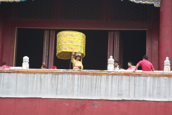
The Forbidden City is so called because it was off limits to the common people for 500 years. It is the largest cluster of ancient buildings in China. It was home to the Ming and Qing dynasties. Some of the imperial family may have never left the compund. If they did venture out, it was only when absolutely neccessary, and proceeded by a large entourage and accompanied by a loud bell to signify that they were about to depart the inner city. You can see people re-enacting royalty with the yellow robes.
More soldiers…
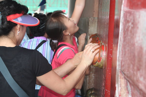
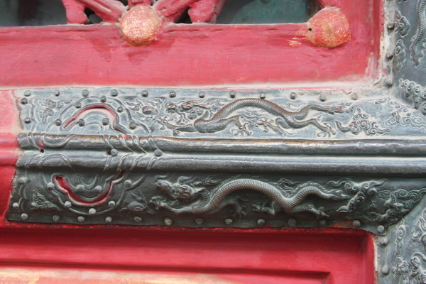
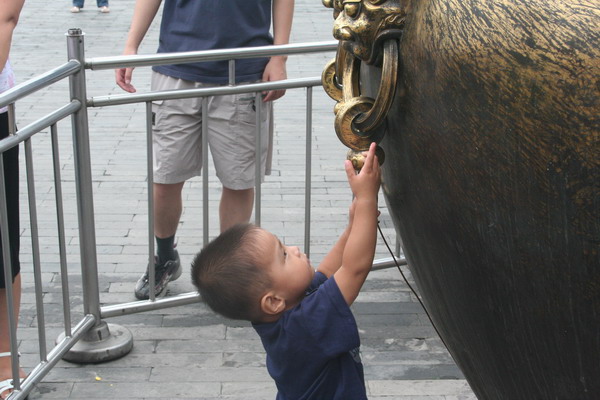
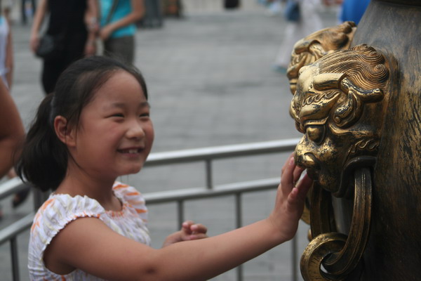
Another gate as we passed further into the Forbidden City. People seemed to have an affinity to touch certain items (like these brass knobs on the gate).
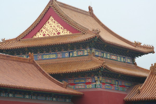
Here you can see the intricate painting on the steeples of the palace.

Here is one of the many thrones for the emperor. This one was for last minute preparations before he went out to the outer city.
These kids are holding the side of a large container that held water to extinguish any fires that flared up in the city.
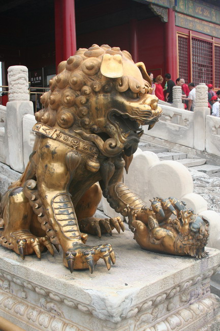
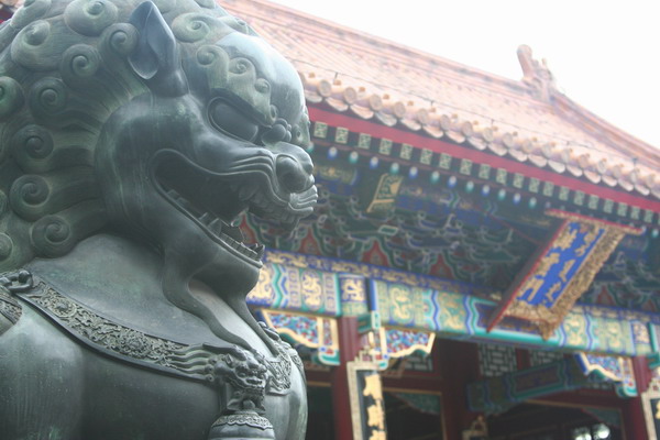
There are many real and symbolic guards to the city…
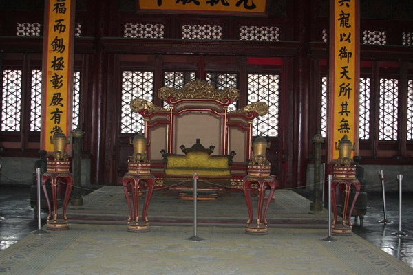
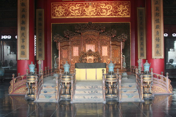
Here is the main throne for the emperor. As you can see it is quite imposing, although rather austere.
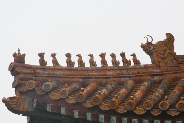
Animals on the roof … you’ll note there are 9 of them…
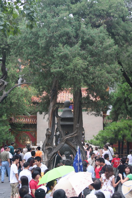
The Love Tree. It begins as 2 individual trees, but grows together as one.
Here is a view of the wall that surrounds the city. Anna liked that the mortar was made with egg whites and rice water.
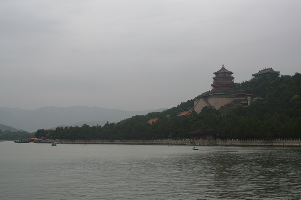
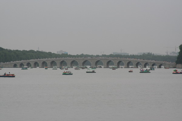
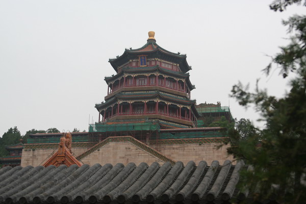
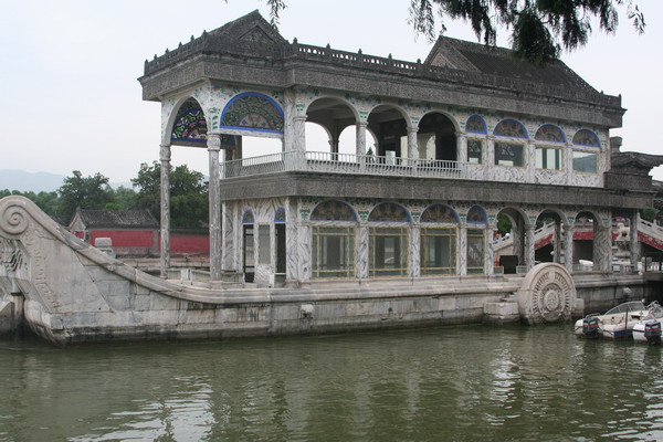
From the Forbidden City, we traveled to the Summer Palace. It was the place where royalty came to escape the furnace like heat of Beijing in the summer.
Here you can see Kunming Lake, which was deepend to about 7 meters and expanded with the help of about 100,000 labourers in the 18th century.
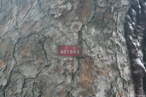
The trees are even labeled according to their age. This one idicates that it’s over 300 years old. I suppose that’s the benefit of having someone living in the same place for thousands of years, keeping records of everything that happens. 🙂
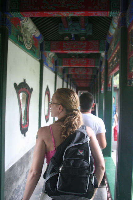
Anna exploring the halls…
Note how many archways lead to the middle of this bridge.
More guards…
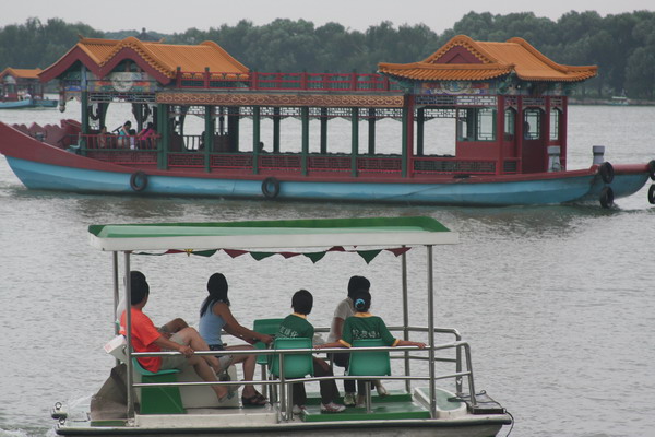
In 1888 the Empress Dowager Cixi used money earmarked for a modern Navy and used it refit buildings damaged in the Second Opium War of 1860. This is the only nautical device she had built. Although quite beautiful, the marble construction doesn’t make it the most sea worthy vessel around.
We ended our first day with a Kung Fu show. It was a spectacular display of form, precision, athleticism, and drama (as it was told in the form of a story). The experience was quite enjoyable.
That brought day one to a close. Day 2 holds the Great Wall, the Sacred Road, and the underground palace of Dingling. Dinner tonight will be the signature dish of Beijing, Peking Duck. Yum. I promise, you will hear all about it soon.
Until then…
–Jim
Pagat Cave and Cliff
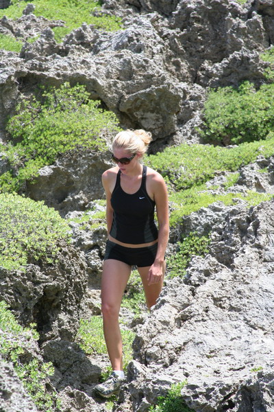
This afternoon, we had the pleasure of joining Dennis and Amanda for her first “real” hike on Guam. Amanda said she wanted to go on a hard hike. So … we decided on Pagat Cave and Cliff (which you may recall from a post last year).
In fact here she is now (she did really well, considering this was her first true foray into the jungles of Guam).
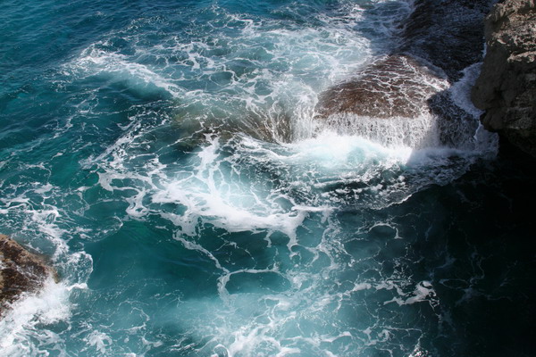
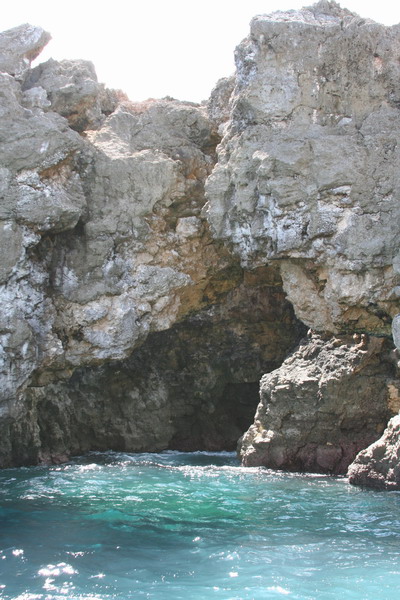
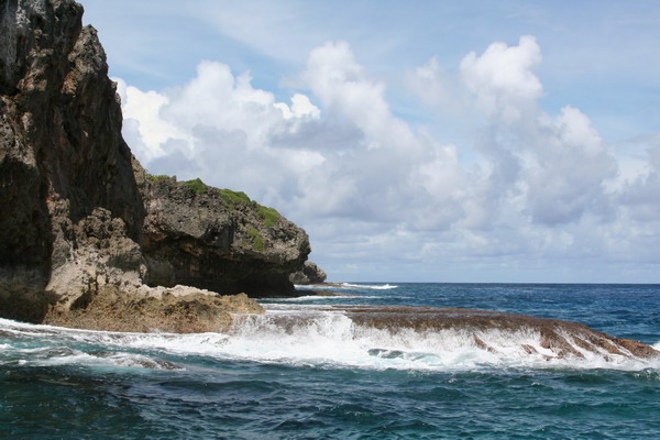
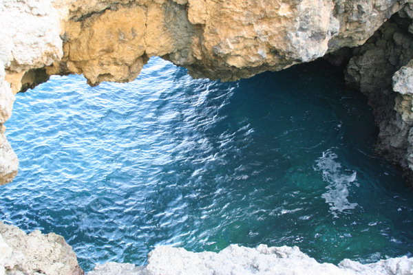
The hike meanders through the jungle for a while, past the cave and out to the ocean. We then headed north and made our way to the natural bridge. Once we arrived, the water had a little surge, but nothing too dangerous. Here’s what the area looks like.
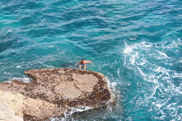
So, we decided to get in the water … off the cliff. 🙂 Don’t worry; there was a pretty easy (and safe) way to get out of the water. Just swim over to one of the ledges and wait for the water to raise you up, and then just step out. In fact, here’s Dennis doing just that.
Last time, I took all my pictures from above looking down. This time, I decided to get down on that ledge and take some pictures. This is what the perspective is from down there.
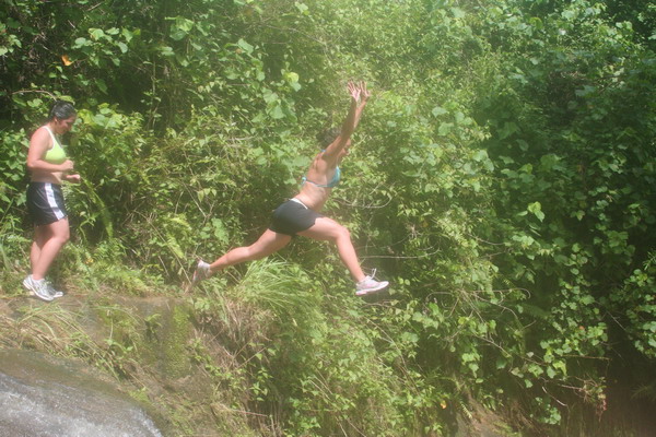
I caught Dennis in mid-leap, literally flying down toward the water.
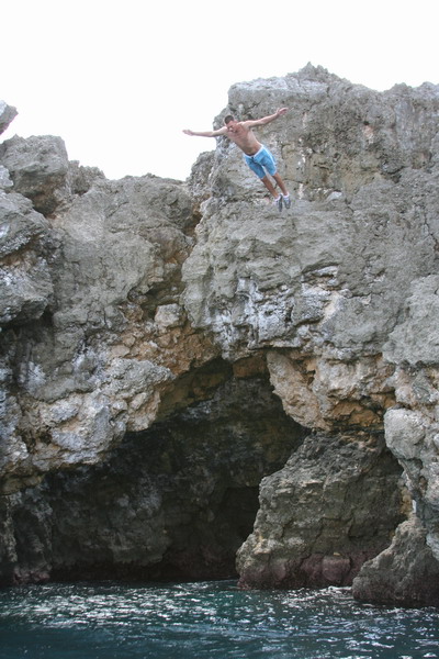
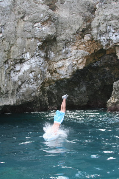
All four of us (including Anna, who hadn’t jumped off a cliff since a bad landing in Palau last year) felt the thrill of freefall. I always love the feeling of flying through the air. It’s just the landing that sometimes hurts. Fortunately, the water is very forgiving (to a point).
Here’s the other side of the bridge.
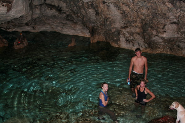
After the ocean, we needed some fresh water to rinse off in, so we went back up to the cave. When we got there, we found a couple candles burning, so we thought someone was already in the cave (and our entrance would be disturbing them), but the cave was empty. So, we light a bunch of candles ourselves so we could see without flashlights and cooled off the in very refreshing water of Pagat Cave. As you may recall, it was used as a water source for the ancient Chamorro village that is nearby. The water is a bit brackish (salty), but not too bad (don’t worry, I didn’t drink a lot).
This picture was the third one I had taken (after our eyes had adjusted to the light), so you can imagine how much the other three appreciated the flash (but the first two pictures didn’t turn out…). Sorry guys.
Although the flash ruins the lighting, you can still see how pretty the water is there.
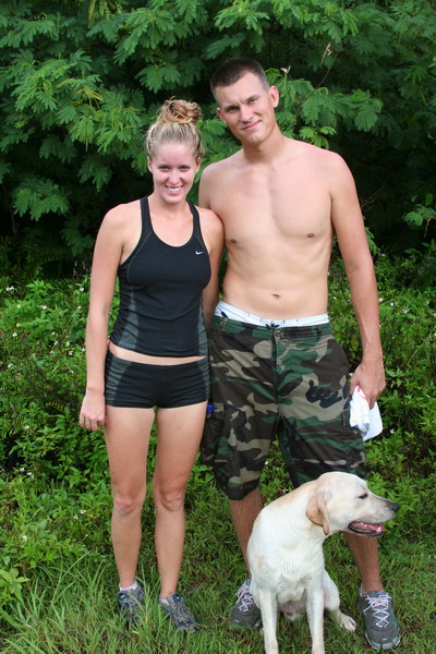
Then, we have the required post hiking pictures (perhaps to prove that we have survived another hike…)
Here are our friends Dennis and Amanda (and Jake), who we hope will go hiking with us another day. 🙂
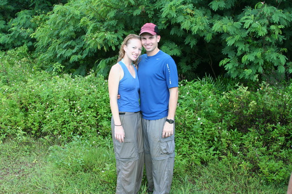
Amanda was kind enough to reciprocate the favor for Anna and me.
This is definitely one of our favorite hikes. It has a little of everything, jungle, cliffs, history, adventure and cool and refreshing cave pools. We highly recommend it.
So, until our next adventure…
–Jim
An afternoon in the water
This afternoon, was again spent playing in the water. We left on a boat out of the small harbor just a few hundred yards down from our house.
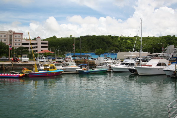
We headed north to again visit Double Reef. It’s about a half an hour to get there, so we had a little time to enjoy the scenery and sun on the way.
Double Reef is so named because there is a second, circular reef just offshore. Here is what it looks like.

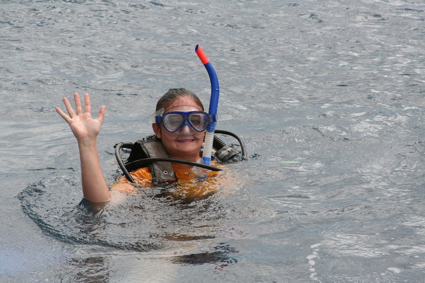
Once we were anchored, everyone geared up and dropped into the water.
This is Jessica (one of the USAFA cadets, who were also on the boat with us). Isn’t she cute in all the gear?? 🙂
Then we have Sergeant SCUBA … “Hi kids, one day you can grow up and SCUBA dive … it’s lots of fun!”

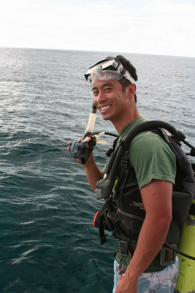
Even though we only snorkeled today, it was great to be in the water. Plus, we got to lie out in the sun, enjoy the day, the boat and the people with us.
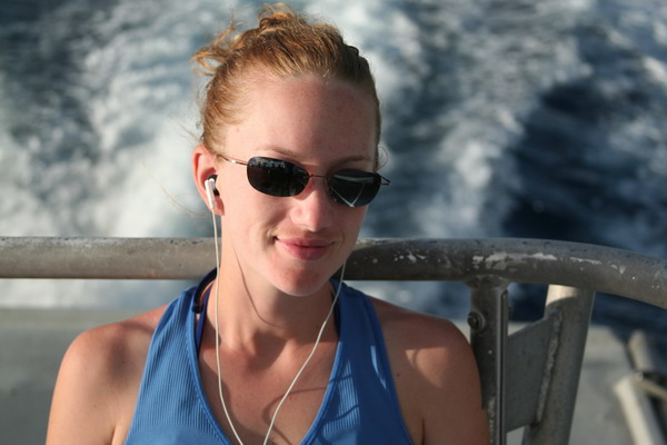
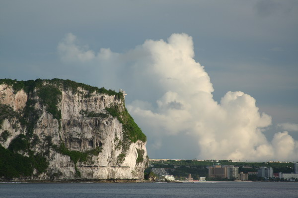
On the ride back home, I made this picture of someone who needs no introduction…
This is the venerable Two Lover’s Point where legend says two Chamorro lovers intertwined their hair when cornered by Spanish authorities to press them into a different arranged marriage. So, instead of face a fate without each other, they leapt off the several hundred foot cliff to their mutual (but joined together) demise.
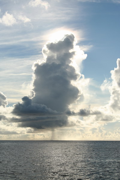
The clouds can be so hypnotic.
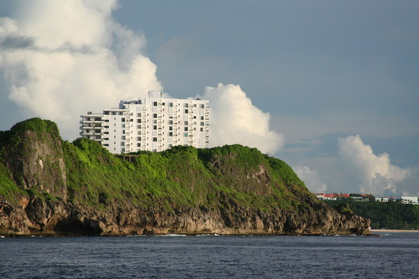
This picture is of Oka Tower (AKA where Sgt Hall lives). We’ve included it by special request. 🙂
These fisher people are at the mouth of the Agana Boat Basin (our starting and finishing point today).

It was a most enjoyable and relaxing day. This is such a beautiful island and the waters around it are immaculate (at least in most places).
Until the next adventure…
–Jim
Waterfall Valley and Black Sand Beach … jump right in!
Today, Anna and I hiked out to two different destinations. The first, we had visited earlier this year with my parents and the second was a brand new hike (for us at least).
The impetus for the hikes today is that there is another group of six cadets from the Air Force Academy. They’re again visiting Guam to get an idea of what the “real” Air Force is all about. My part in that was to show them what the “real” Guam is all about.
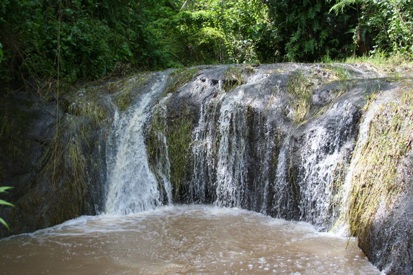
We started down south with a very pretty valley that contains 5 waterfalls very close to each other. However, we spent most of our time at the last two.
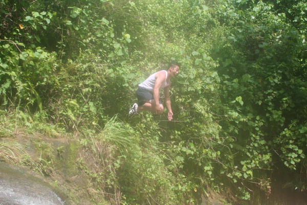
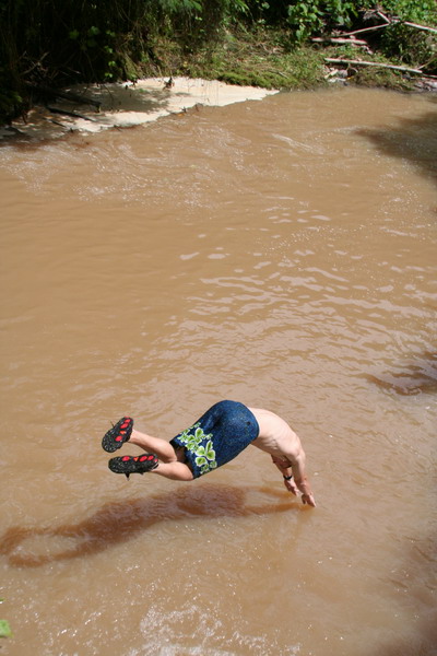
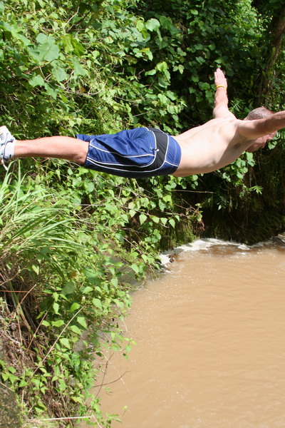
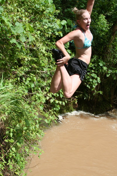
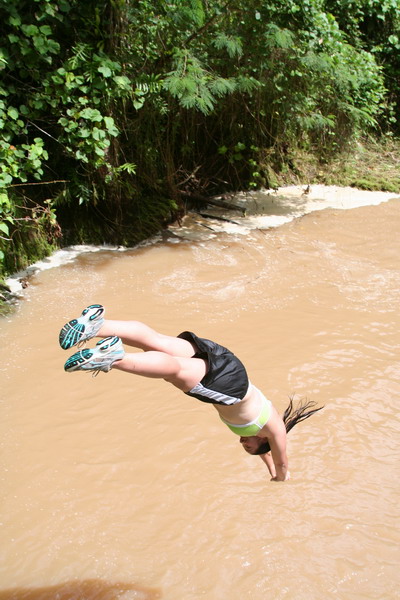
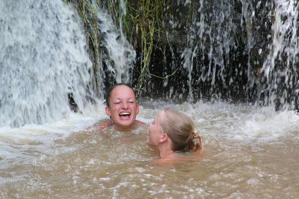
As you can see in these next few pictures, we decided to jump right in! Don’t worry, the water was plenty deep. Also, it’s brown because there has been so much rain lately.
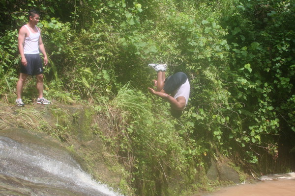
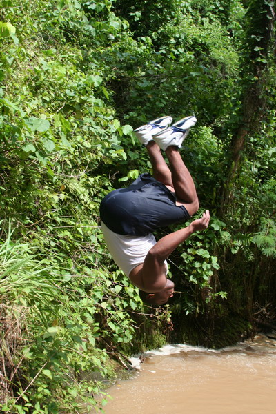
I know you can’t really tell from this picture, but here Jamie is just about to complete a one and a half flip. He almost made it all the way around. I give him a 7.0.
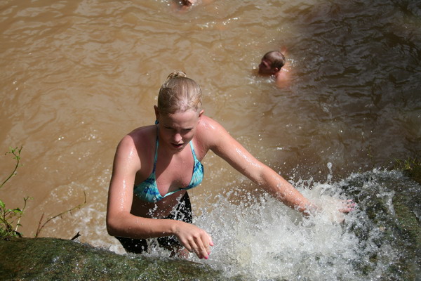
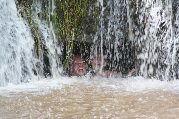
The only hard part about jumping in (although it was sorta fun), was that you had to climb back up the waterfall to get out.
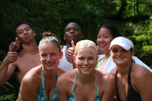
Here are four of the six cadets.
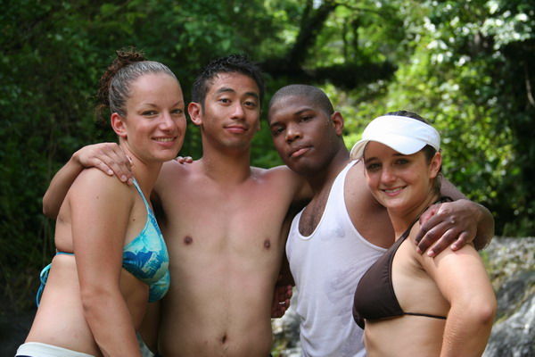
This is everyone who hiked with us (except Anna and me who were taking the pictures).
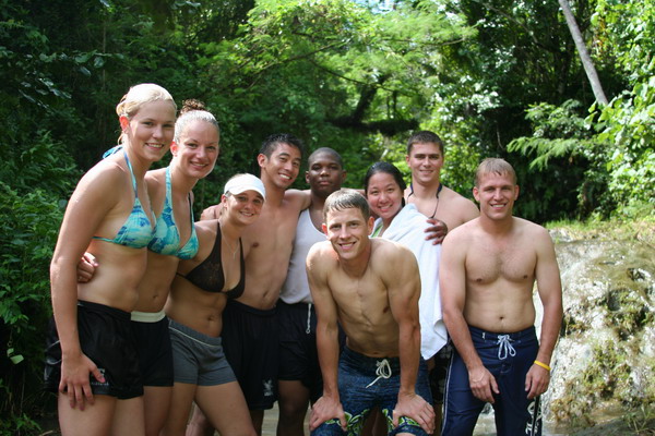
Just the cadets again.
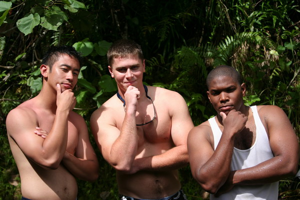
Here are some of the guys trying to look tough (or perhaps thoughtful … I’m not really sure which).
Here is the other waterfall we played in. It was a lot smaller, but fun to get behind the falls.
The girls were having lots of fun playing in the falls.
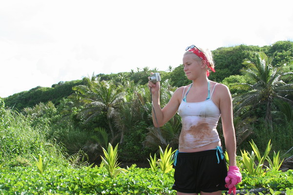
You can see in this picture of Lindsay of just how muddy the trail was.
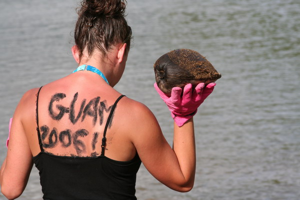
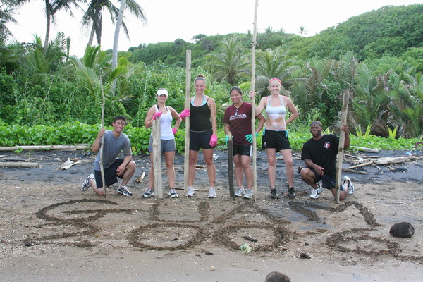
That concluded our hike to waterfall valley. After we (sort of) cleaned up, we jumped back in our car, drove 5 minutes north and parked at the Talafofo Bay trailhead. Although we didn’t really follow a trail, we went coast steering to reach the black sand beach of Guam. The beach is black due to the presence of the mineral magnetite (a form of iron oxide). A large quantity was carried to the beach by a nearby river, and kept there by wave and current action. Although, it was most likely deposited originally by the volcanic activity that formed the island. It’s interesting to note that magnetite is the most magnetic of all the minerals on Earth. If you hold a magnetic to the sand, it will pick up a number of the grains. Another random fact about this fascinating material is that crystals of it are found in numerous animals (including humans).
In fact, the black sand is also useful to write messages on your back.
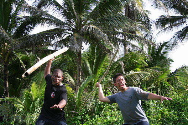
Another interesting use of magnetite sand is as war paint on your face. These guys were imagining what the ancient Chamorro warriors were like.
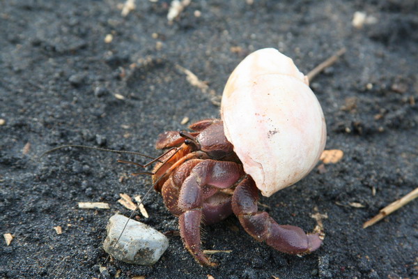
OK, so this little guy’s shell didn’t blend in too well with the black.
Here are the cadets again.
While the black sand was very pretty (and certainly unique), the beach itself had a LOT of trash on it. Perhaps it was just washed up from local fiestas, but it basically ruined an otherwise beautiful location on Guam. Unfortunately, it’s an all too common occurrence here to find a spot that could be simply stunning that is marred by an abundance of trash. So, if you ever visit or live here, please help clean some of it up, even if it’s one piece of trash at a time!
Overall though, it was a great day of hiking. We enjoyed hiking with the cadets and other CGOs from the base.
We can’t wait to go again. Our time here on Guam is drawing to a close (we have about a month left), so we’re trying to get everything in that we haven’t done yet. So much to do, so little time…
Until the next adventure.
–Jim
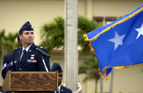
Military Retirement Ceremony
This post is for all those who have never had the opportunity to attend a military retreat or retirement ceremony.
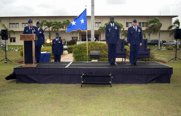
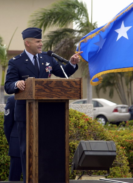
A few weeks ago, I had the opportunity to help with the planning and execution of a retirement ceremony for our vice wing commander, Col Stephen Wolborsky. He had served is country honorably in the United States Air Force for 26 years and the intent was to give him a fitting tribute.
I had the honor of being the narrator for the event.

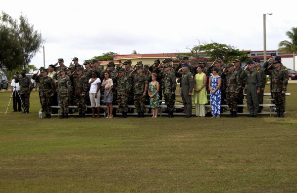
Here are some of those in attendance for the event.
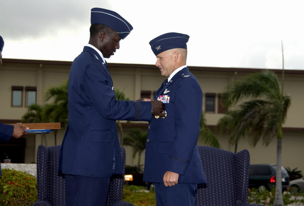
During the retirement ceremony, Col Wolborsky was presented with the Legion of Merit decoration, as well as a retirement certificate, a letter from the president and since the Air Force does think families are important, a letter to his wife, for her support of his career.
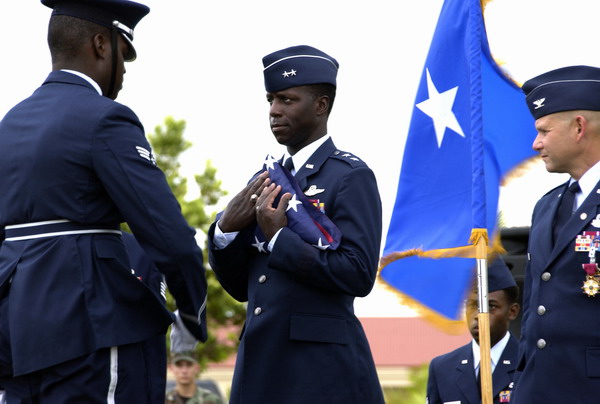
The ceremony was officiated by Major General Rice, who flew in from Hawaii and also presented Col Wolborsky with the medal and all of those certificates.
He also had a chance to tell some anecdotes from his long (and very distinguished) Air Force career. You can tell that he’s a very animated story teller.
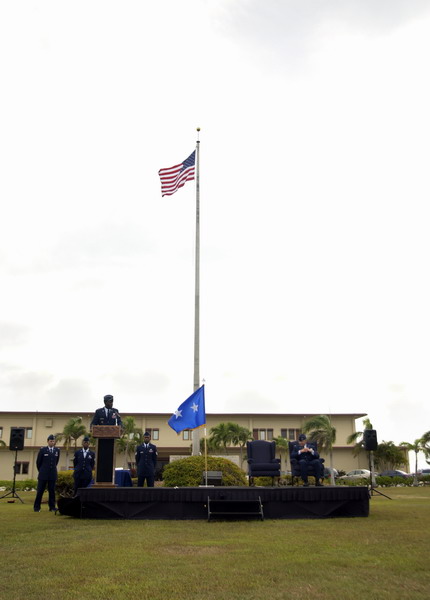
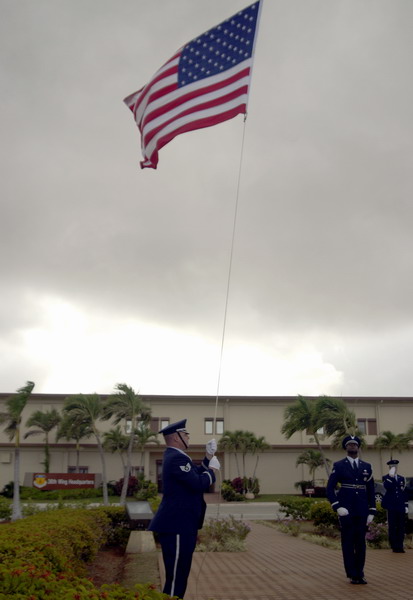
At the conclusion of the retirement ceremony, we had a retreat ceremony. The honor guard took the colors down, while the wing rendered the appropriate military custom.

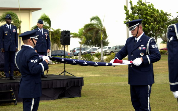
The honor guard also did a flag folding ceremony for him. The wing staff also gave Col Wolborsky the flag as a token of their appreciation.
The flag was retired and presented to Maj Gen Rice, who in turn, presented it to Col Wolborsky.
A the end of the ceremony, a jet flying in the local exercise that had just ended coincidentally flew over and gave a fitting impromptu aerial display.

It was a very fitting tribute to the man who had done so much for the base. It was an honor to have worked with and for him.
–Jim
Note: many thanks to the base photographers who made these pictures.
Guam Liberation Day 2006
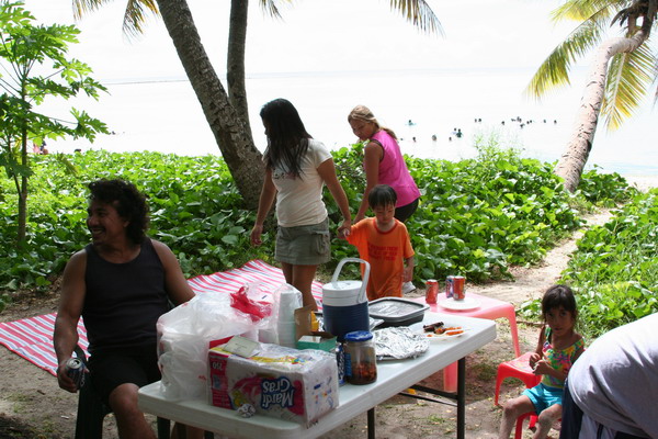
Yesterday was Guam’s 62nd Liberation Day. It commemorates July 21st as the day American military returned and defeated the occupying Japanese force during WWII. Each year, there is a huge celebration and parade to commemorate the event. While we didn’t go to the parade, we did celebrate with a BBQ with some friends.
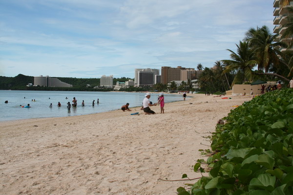
We went to the main tourist village and BBQ’d on the beach. It was a beautiful day for it because it was cloudy (but not rainy) in the morning and sunny in the afternoon, but a breeze kept the temperature cool. This is the view from our location.
You can see all the hotels along the beach in Tumon. This is where most of the 1.5 million Japanese tourists who come to Guam each year stay.
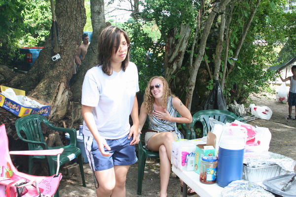
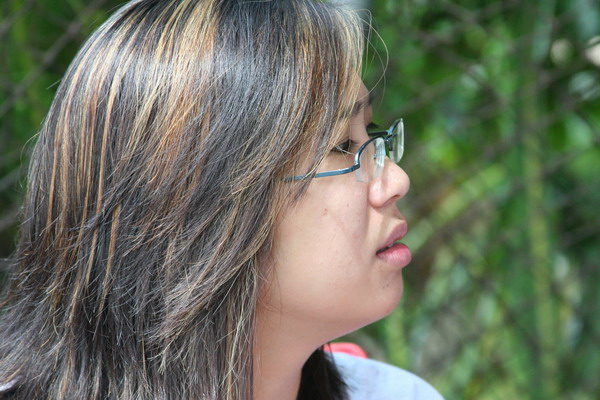
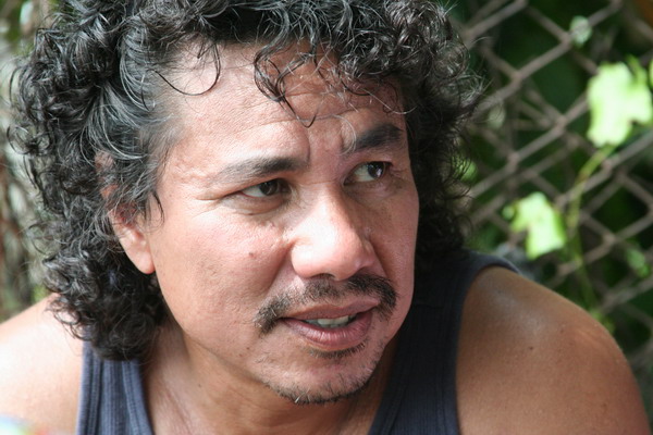
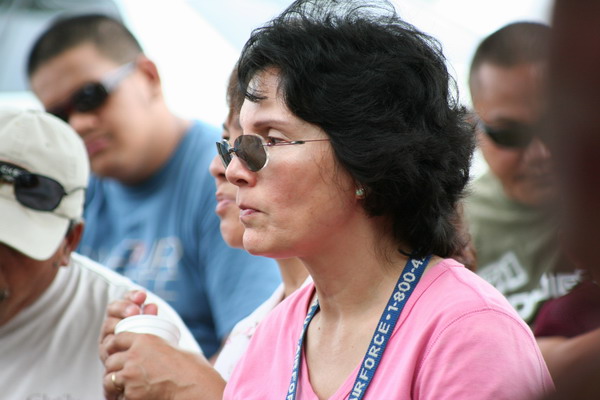
These are some of the people who work with Anna and were with us at the BBQ.
Tricia:

Liezl:
Ray:
These are a few other friends who joined us for lunch.
We had a good time sharing food and laughter with our friends. So, until the next adventure…
–Jim
Southern Guam Fiesta
A couple weeks ago we went to the southern end of Guam for a fiesta. For those of you who aren’t familiar with that tradition here on Guam, here’s my understanding of how it works.
Fiestas are the national pastime of the island. This is the only place (that I know of) that people take out a loan for up to $25,000 to pay for a party for hundreds of people (most of whom they are related to). Oh, there’s no wedding involved. It’s typically to celebrate a patron saint (98% of the island is Catholic), or celebrate some other event. Basically, any excuse will do, and on any weekend, you can find a fiesta that ranges from a large family gathering, to an entire village joining in a celebration.
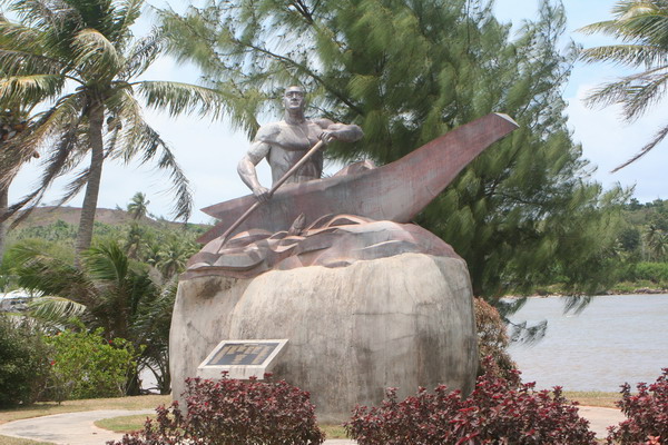
Our experience was down in the southern village of Malojloj. Here’s one of the monuments to an event by 2 ancient chiefs of Guam, Chiefs Gadao and Malaguana. Here’s the basic story:
Chief Malaguana from Tumon (in west central Guam), heard of the feats of Chief Gadao from Inarajan (in south central Guam). He decided to paddle down by canoe to challenge the great southern chief. As he got close, he met a stranger along the way who invited him to dinner. Chief Malaguana then shook a coconut off a nearby tree. The host (who was actually Chief Gadao) then crushed the coconut with his fingers. Chief Malaguana thought, “if an ordinary man can do this, how strong is the chief??” So, Chief Malaguana decided not to challenge Chief Gadao, but as the both got in the canoe, they were facing opposite directions. As they began to paddle, the canoe actually broke in half and Malaguana paddled so fast, he made it all the way back to Tumon without realizing that the canoe had broken.
Here’s a monument to those chiefs.
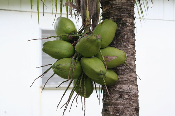
Here are some of those coconuts…
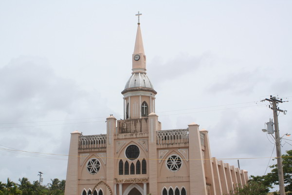
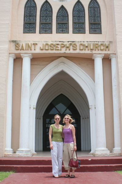
This church is one of the major landmarks on southern Guam.
Here is Anna and our friend and neighbor, Rachael.
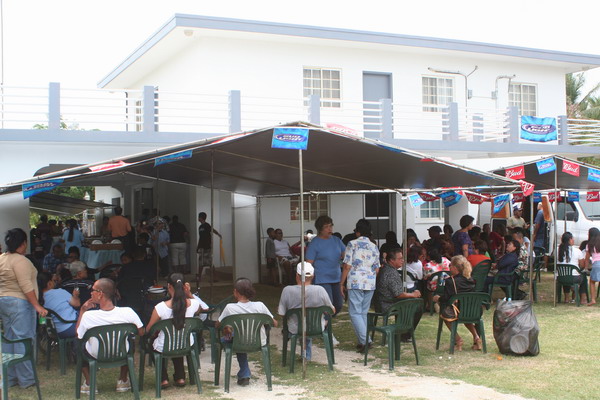
Here’s the fiesta we went to (there were many going on at the same time).
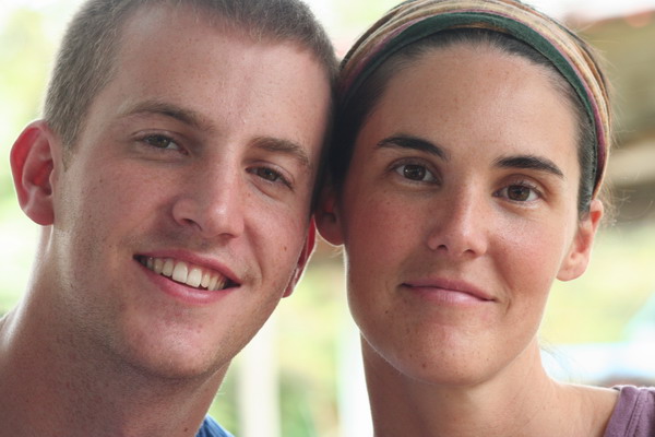
Here are our friends Jon and Libby.
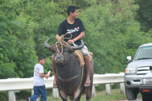
There are many carabao around the island. They are still used as a beast of burden, but can also be ridden for sport (as they are here). It’s interesting to note these are actually water buffalo.
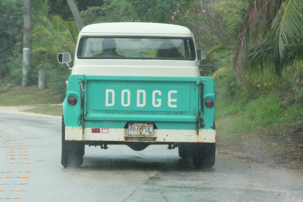
While there aren’t many cars like this on Guam anymore, it’s still fun to see a throw back to a time gone by.
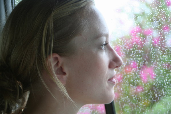
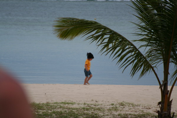
Here is my favorite photo subject.
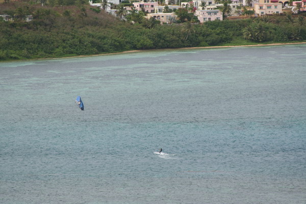
Another popular sport on Guam is kite boarding. Here’s one in Pago Bay.
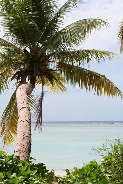
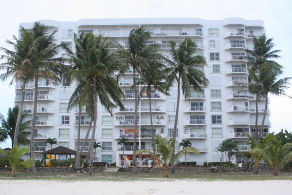
This is back on our beach, looking back up at our condo.
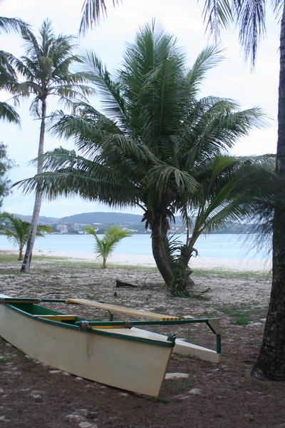
This is the outrigger canoe that Dan and I bought last year from our old neighbor who built it himself. Unfortunately, it’s no longer sea worthy, but it was fun to take it out snorkeling in search of manta rays (we’ve seen three thus far).
So, until the next adventure…
–Jim