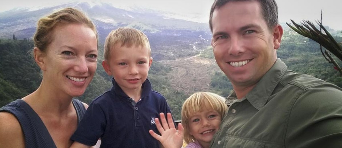
Ok, here is the second batch of my favorite pictures.
This next group of pictures is a SMALL sampling of pictures from my deployment to central and southwest Asia in 2003-04.
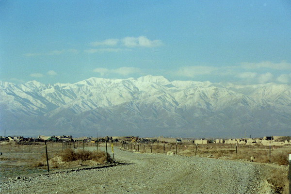
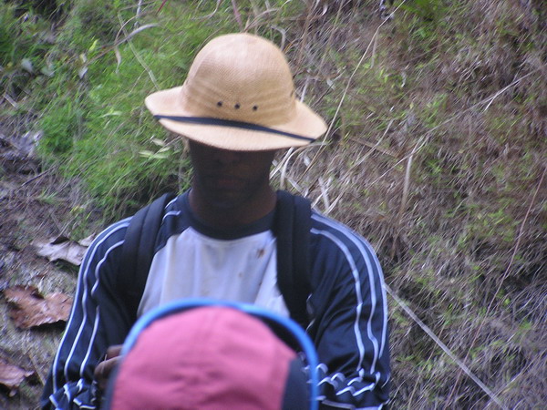
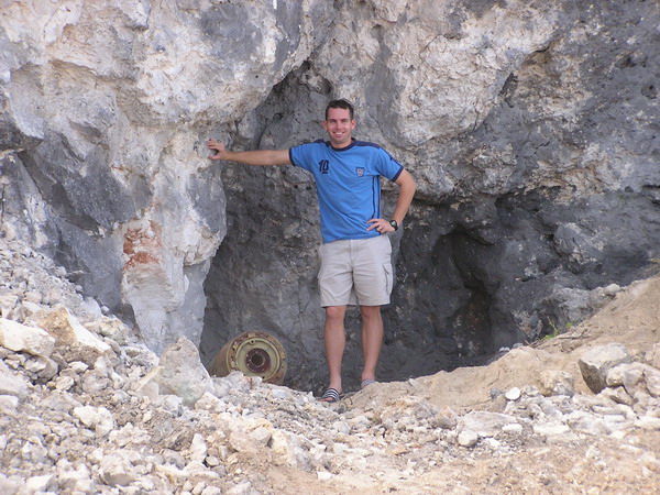
The first picture is the view from a road in Afghanistan, about 30 miles away from Kabul at Bagram Air Base. As you can see, the mountains were spectacular (20,000′ peaks near 360 degrees around). This particular location was a former Soviet base, which had been ravaged by over two decades of constant warfare. One of the reminders of that were the landmines. Afghanistan is the most heavily mined country in the world. Anytime you are on the other side of the wire (as seen in this picture), there is probably a mine very nearby.
I think that’s one of the reasons I like this picture so much. Stark natural beauty contrasted with the lethal realities of human warfare.
Ok, I’ll let the pictures speak for themselves.
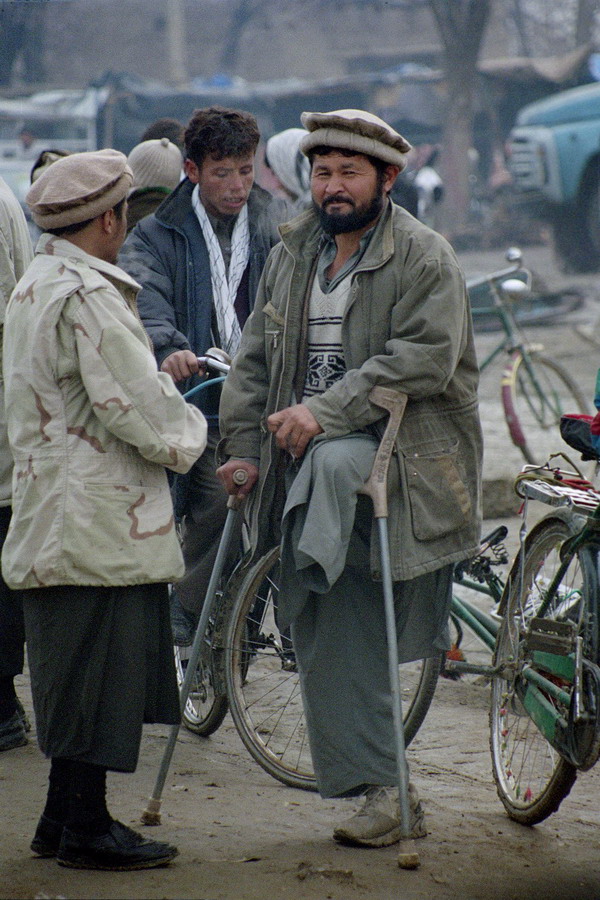
In fact, this picture really captures my experience in Afghanistan. If you’ll permit me to indulge, I’ll explain what I mean.
I see:
– A man bearing an all too common mark of the ubiquitous
landmines
– The American influence with the desert camouflage
– The traditional Afghan hats
– The common scarf
– The cold in the air
– Bicycles as a main source of transportation
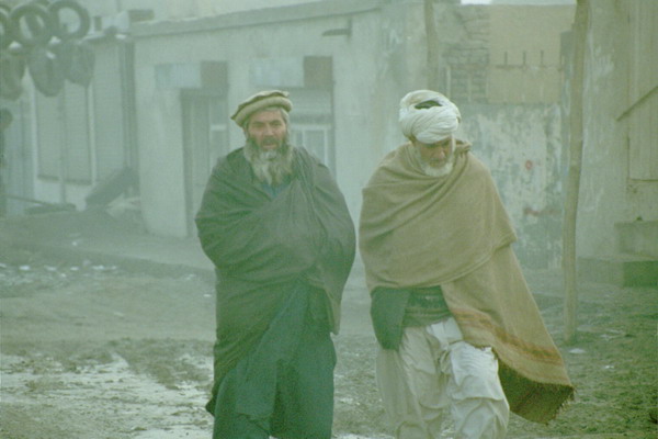
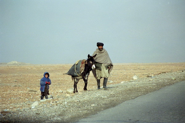
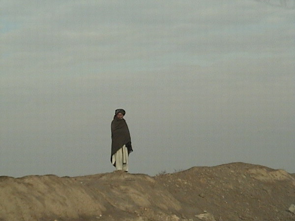
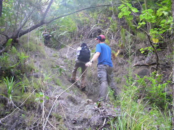
More images of Afghanistan:
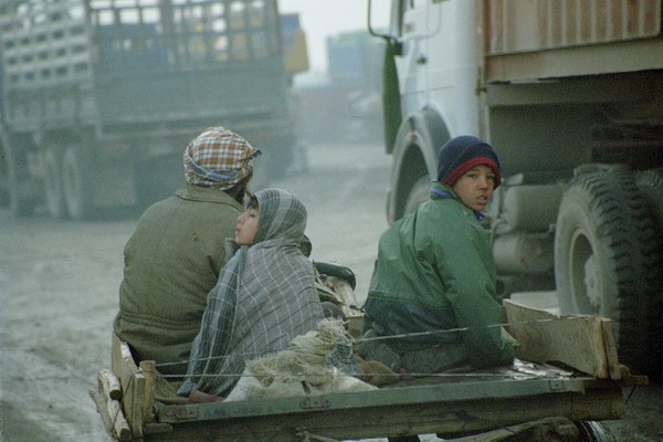
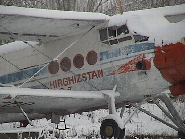
My team also went into 5 other countries. Two of the most unique were the former Soviet states of Kyrgyzstan and Uzbekistan. Here’s one of a old Soviet era plane.
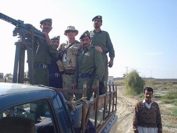
The other central Asian stop was in Pakistan. This is at a small base in central Pakistan. As you can see, we made friends with our Pakistani army escorts.
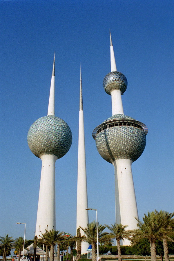
Our stops in southwest Asia included Qatar and Kuwait. Here’s the architectural icon of Kuwait City, the Kuwaiti Towers. It was designed in 1977 by a Swedish company. During the Iraq invasion of 1989, the Iraqis did their best to destroy it, but were unsuccessful and it survives today as a very nice landmark. The Tower on the right has a restaurant in the lower ball and the upper is an observation deck. The tower on the left is a water tower (nicest one I’ve seen!) and the small one in the center one lights up the other two at night.
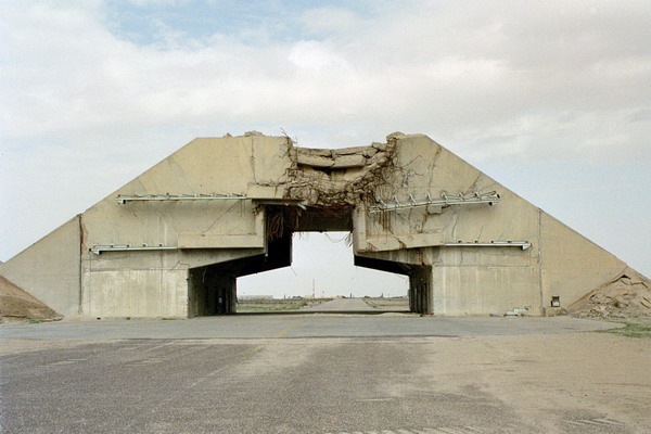
In one of the bases there, we found remnants of the US bombing in Operation Desert Storm. These are hardened aircraft shelters built for the Kuwaitis by the French. They were purported to be indestructible. However, as you can see, they didn’t hold up too well to the US bunker buster bombs. As an interesting side note, the Kuwaitis went back to the French company and requested that they rebuild or repay since it was obviously NOT indestructible. The response was, well, we can’t warranty against the Americans. Sorry.
Here’s what they looked like over a decade later.
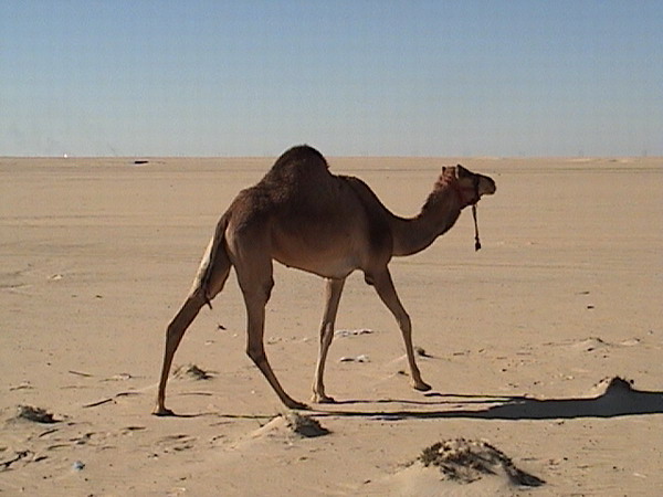
There were also plenty of camels just wandering around…
OK, I will stop this one here. The next entry will have Guam, Japan and Palau pictures.
–Jim
My Favorite Pictures — Part 1
This entry is a forum to post some of my pictures that I really like. It’s a collection of everything since about 2003.
There’s really no order here (other than I grouped like pictures roughly together). So, I’ll give a quick synopsis of the story for each picture, but I assume that most people just look at the pictures anyway. 🙂
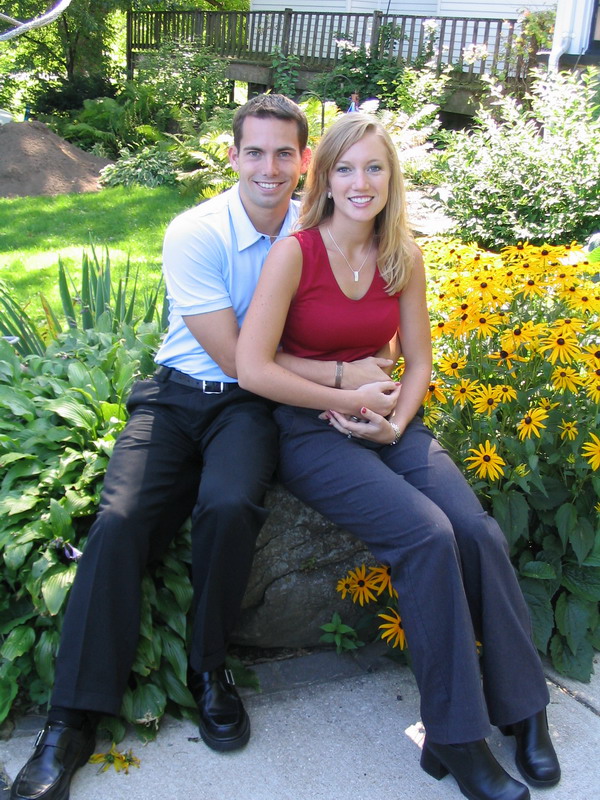
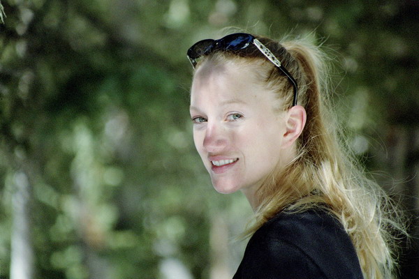
This first picture is one that I didn’t take. It’s a shot of Anna and I in front of her family’s house in Wisconsin, back in 2003 (taken by her Mom … thanks Mom).
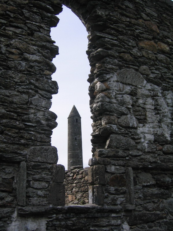
In the summer of 2004, my mom and sister took a trip to Ireland. Anna and her mom also joined the trip. I, however, had to stay back. I was in a 2-month long school in Ohio. Here’s a shot that we liked from her trip.
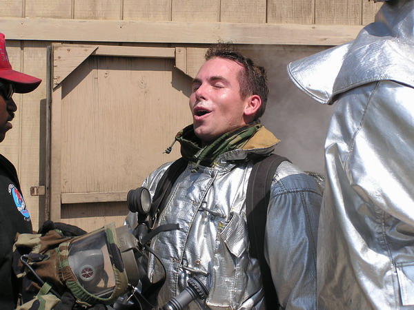
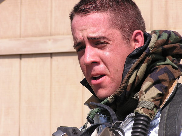
While the family was touring around Irish Isle, I was learning things like just how hot a firefighter’s suit can be. The first picture is me and the second, my friend Lucky (another Air Force officer currently stationed down in Florida).
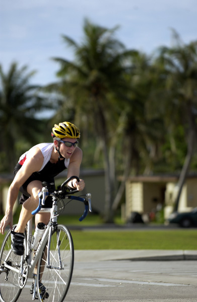
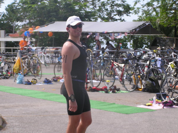
Here’s yet another picture that I didn’t take (this one was by one of the very talented base photographers). It was from one of the Andersen AFB’s triathlons last year (2005). I’m coming into transition 2 (as you can tell by the fact that I am taking my shoes off…)
These next two shots are from the beaches of Guam. The first is Anna and I at a beach commonly referred to as Lost Pond. This one was taken by another friend of ours, Kevin (who’s now stationed in Italy).
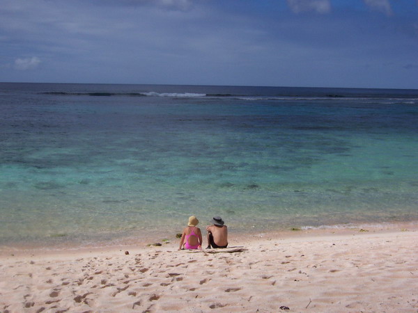
This is Anna inspecting the small creatures at the land bridge just north of Double Reef Beach.
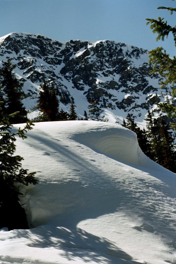
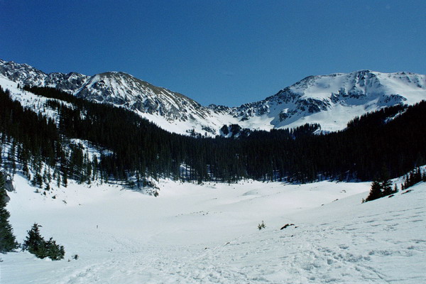
The next seven pictures are from our trip to New Mexico in 2004. We spent almost 2 weeks there visiting family in Albuquerque, hiking in Santa Fe, alpine skiing at Taos, snowshoeing in the mountains above Taos, and llama trekking in the Rio Grande river valley. Here are the representative shots.
In Taos, we stayed at a very cute bed and breakfast. This is a view from the outside. As an interesting side note, Julia Roberts owned the house right behind (we didn’t see Julia though).
This is my beautiful wife as we are snowshoeing our way up the mountain.
The mountains:
The highlight of the trip was probably the llama trek we took. It was only a couple days long, but a great experience. We highly recommend trekking with these affable animals. While they are in the camel family, they are not large enough to carry people, so they helped out and carried our gear. 🙂 Stuart (our guide) filled us in on all kinds of details on the surrounding flora and fauna.
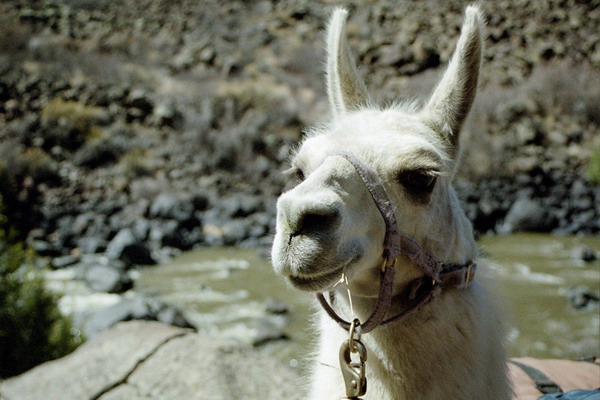
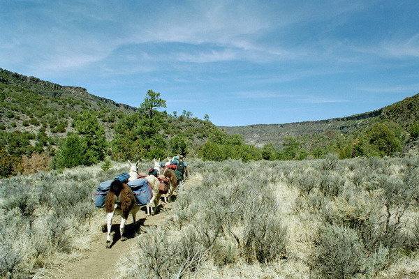
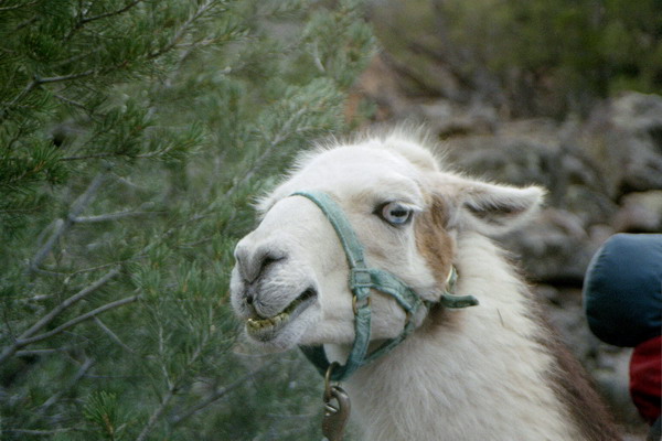
Llamas have a definite leader when they are in a group and this was our group’s leader, Azul.
Ok, I will end this entry here. I have picked out almost 100 pictures, so it will take a few parts to finish this one. 🙂
–Jim
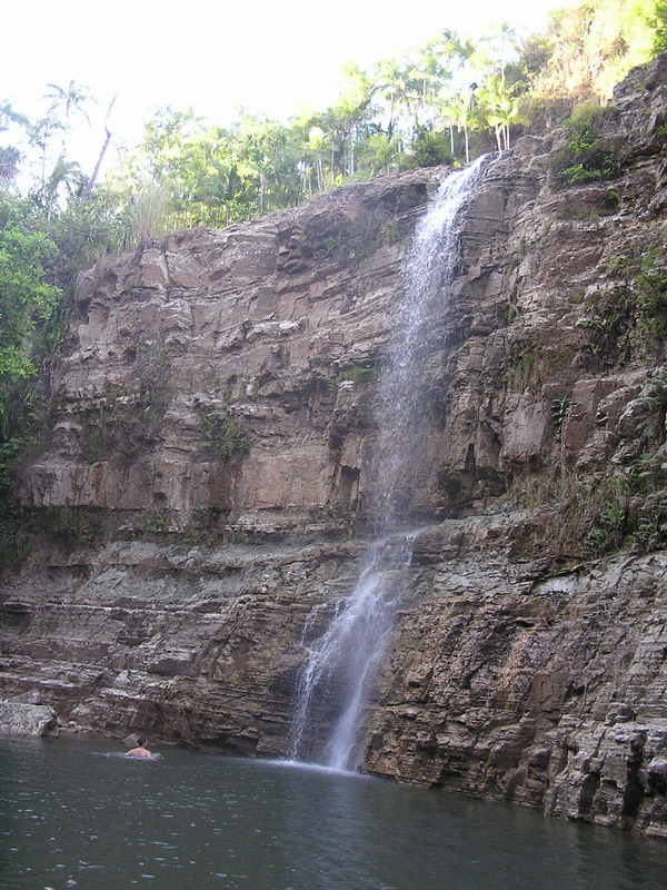
Lower Sigua Falls
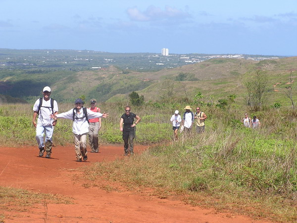
Hi, well this weekend, we braved the jungle of Guam again. We went again with a group of CGOs. This time there were 12 in our party.
I offered to take the group on another hike, this time in search of one of the pretty waterfalls around the interior of Guam. However, my caveat was that it would be a hard hike. Even so, I had a surprising number of people join us.
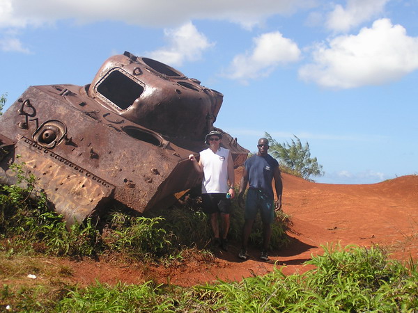
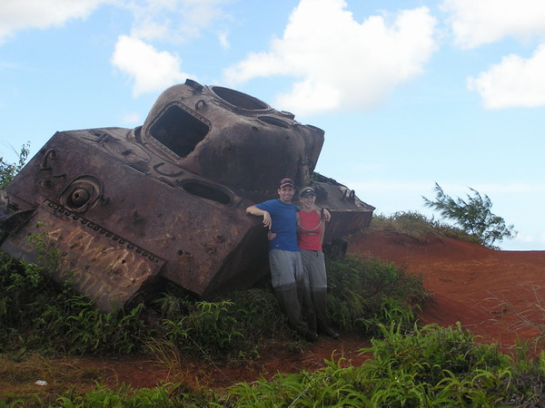
The trail began over very familiar territory on top of Mount Alutom. We took the same route as we did for several other hikes. However, this time we continued down the trail further. The landmark for our turn wasn’t a tree (as it was for Upper Sigua Falls), but a WWII Sherman tank.
You can see how happy we were to find it (there was only one small marsh to cross to get there…)
Here we all are posing in front of this tank that was brought here sometime after the war for target practice (no there wasn’t a battle fought there … although that would make for a better story).
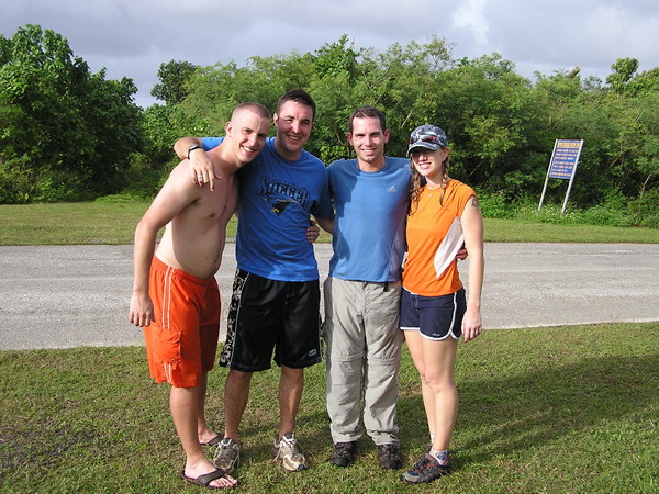
Lance and Mario:
All the pretty girls in the group:
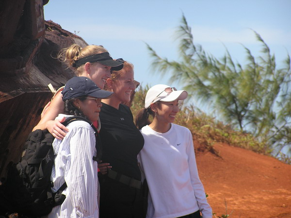
Here’s Anna and I:
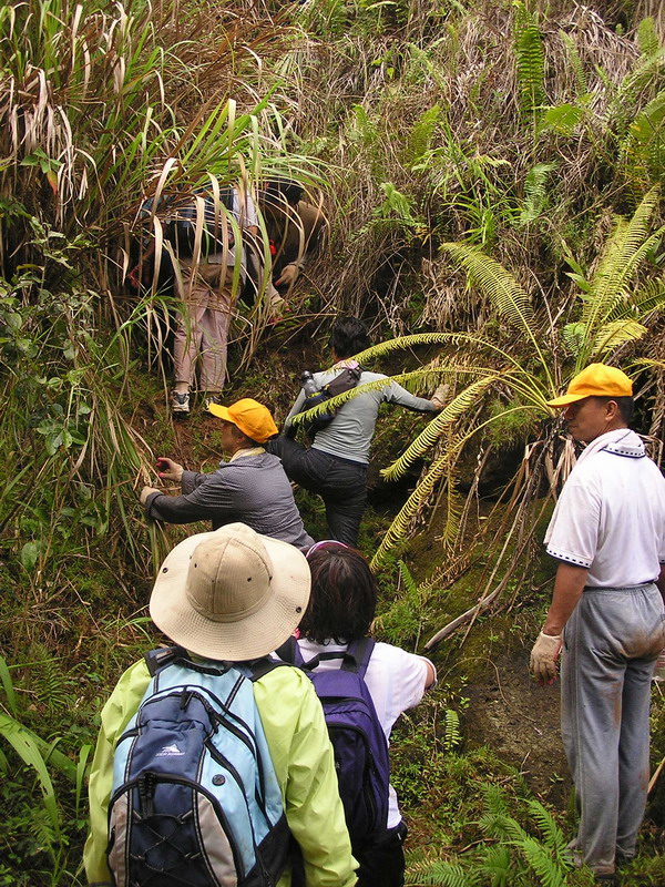
From the tank, we descended into the jungle. In fact, we dropped down to the river valley floor and followed the very narrow, very murky, very deep river to the first water falls, Sinisa Falls. When we arrived at the top of the falls, it was pretty, but there was no easy way to reach the bottom. So, we hiked up the other side of the river bank, bushwhacked through some tough savanna grass and back down into the jungle. I wish I had some pictures of the stuff we went through, but I was more concerned with getting us safely back down to the river to take pictures. Sorry.
However, we all made it safely down, although not without our fair share of falls along the way.
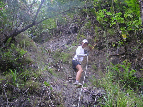
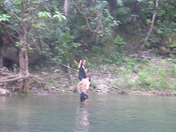
Here we are making our way down the last little section of the ravine to get to the falls.
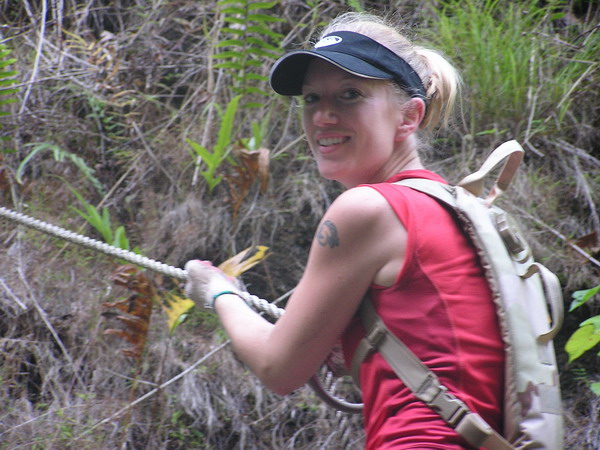
Anna coming down the rope, looking graceful as always:
This is me spotting “Mudslide” as he came down. 🙂
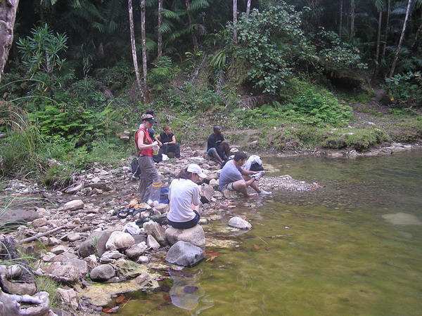
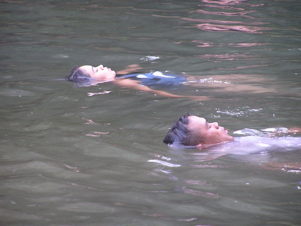
Once everyone got back down to the river, we decided it was time for a little relaxing in the water. Unfortunately, the pool wasn’t too large, nor was it very deep. It was refreshing nonetheless.
After we were cooled off, we continued down the river (which was the prettiest of all the rivers we’ve hiked though on Guam, thus far at least). Again, my camera was packed away in the dry bag because everything that wasn’t sealed or waterproof got utterly drenched on this trip.
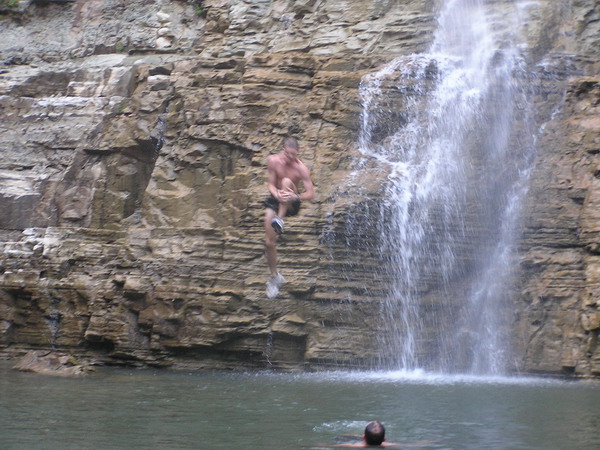
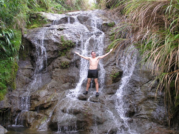
So, after our second leg of the trip. This is the waterfall we were rewarded with (Lower Sigua Falls).
This was a much larger and prettier falls (you can get an idea of scale from the person in the left side foreground).
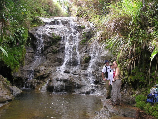
Here are some more pictures of us playing the water.
So, with nightfall fast approaching, we hustled up the bank. It was another steep trail, but this time it was well worn with a number of ropes along the way to assist us.
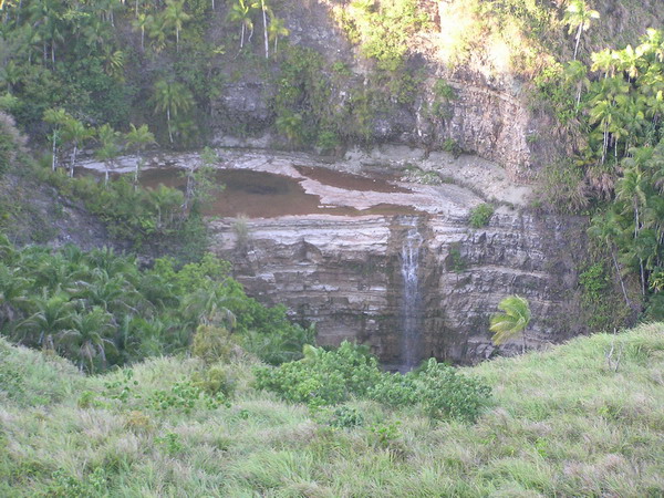
When we got back up to the top of the ridge, we were rewarded with this pretty aerial view of Lower Sigua Falls, where we had just been.
So, with that, we went back up the hill to our vehicles. We got back to complete a 7 mile round trip hike that went 1,200 feet down and back up again, and took just over 5 hours. It was not bad for an afternoon hike. I had a great time and hope that some of our friends from this hike will join us again soon!
Until the next adventure.
–Jim
Guam Isla Triathlon
I know it’s been a couple weeks since my last post. Sorry, just we’ve not done anything website worthy. 🙂
Last weekend, however, I decided to continue my masochistic habit of triathlons. If you’ve been following the site, you’ll notice that last year, I was very active, racing something like 12 times last year. This year, however, is a different story. Perhaps it’s that I’ve been working too much, but I haven’t been out training hardly at all, let alone racing.
This is our last year on the island, and I have heard stories of how great the X-Terra Offroad Triathlon in Saipan is. So, to determine if I would be able to survive it, I decided that I should try another one first. That’s where the Guam Isla comes in. My goal in this race was survival, not placement. 🙂
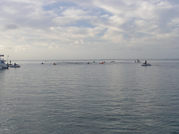
The Guam Isla was an Olympic distance race, which means we did a 1.5K (about 1 mile) swim, a 40K (about 26 miles) bike, and a 10K (about 6.5 miles) run. The site was down in Merizo on the far southern end of the island.
It was a floating start, so we all swam out to the starting buoy and did an out and back course. The water is very clear on Guam and this swim was quite pretty. I have to admit though … last year when I did the Cocos Crossing (a 2.5 mile swim from the small island back to the bigger island) a girl on the boat going to the start told me she saw a hammerhead shark in the channel from the helicopter she was flying just a few days before. I didn’t pay much attention then because we were only crossing the channel, not swimming in it. However, the swim course for this tri was entirely in the channel. Most of the time, I couldn’t see the sea floor (it was a pretty blue though) but the thought of the hammerheads in the water kept popping in my head and (here’s the admission) was a bit unnerving.
Anyway, here we are with the kayaker/jet ski support crews out in full force.
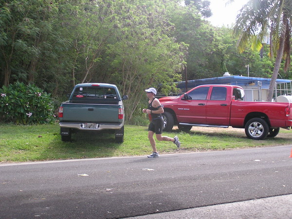
This is me on the left getting out of the water about a half an hour later.
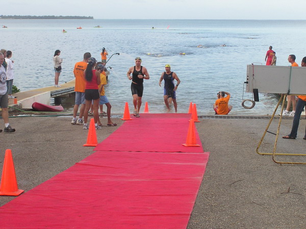
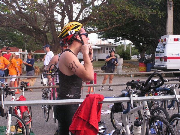
It was a little harder to get through the transitions this time, since I was a rather out of practice. (yes, I did fix my helmet before I started biking 🙂 ).
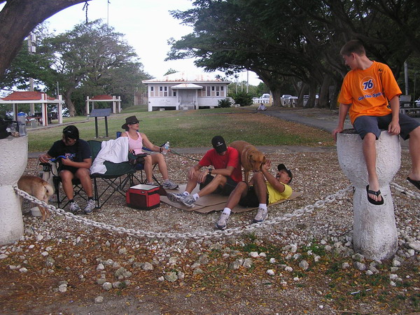
Once we left on our bikes, it was over an hour before we’d be back, so this is what everyone did to amuse themselves. As you can see, they had a good time.
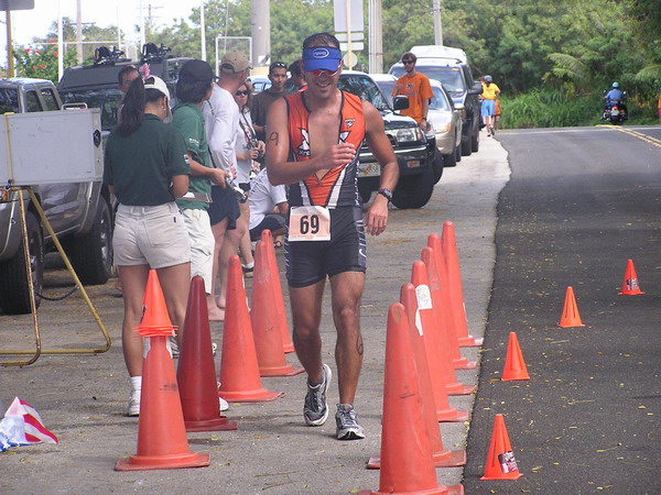
After a couple large hills, rough roads, and almost an hour and a half later, I came back in to transition to the run.
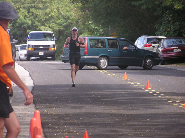
It was a long, hot, but fortunately flat run course. The only bad part was pyschcological … I got to the run turn around point and thought that the course was marked short (according to my GPS). So, I cruised in and pushed hard for what I thought was the last half mile or so. Unfortunately, when I got to the end (or so I thought), to my surprise they said, “keep going!”
Here I am right after I heard that … I don’t know if you can tell by my expression, but I was not pleased at the thought of running more. 🙂
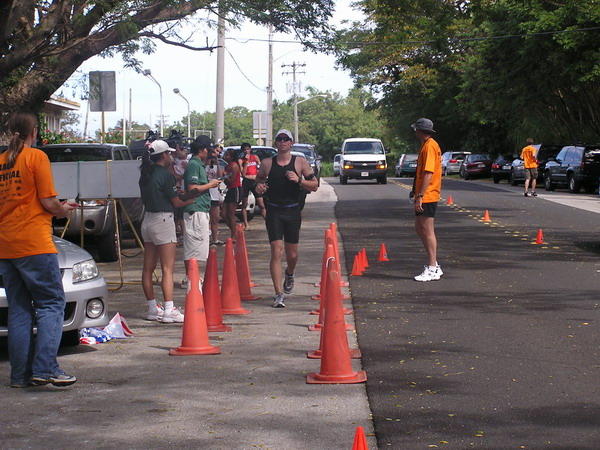
So, in reality it was another half mile out and back. That was a minor point they forgot to point out on the course map. Oh well, it was only a mile right?
Here’s our friend finishing up. Way to go Mark!
FINALLY, here I am finishing up after just about 3 hours.
Can you see the relief in my face I am done?? I know I have done these races before, but this was by far the most difficult because I did it with no training and the run was a bit tough mentally.
So, looks like I am all set for X-Terra. We’re scheduled to be there for the race on April 1st.
Sometime after, I will post how it goes. 🙂
–Jim
Da Bomb
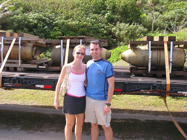
Anna and I were witness to history in the making (or rather destruction) this weekend. For those who don’t already know, there are a number of Vietnam era munitions (read: bombs) stored here at Andersen AFB. When these weapons reach the end of their service life, they are removed from our inventory and destroyed. This typically means putting them on a ship and sending them back to the mainland. However, since they are so old, there are some that are not stable enough to safely make the long voyage. So, that’s where we come in. Our expolsive ordinance disposal (EOD) flight was called in to destroy these munitions locally.
Anna and I were able to tag along and watch the process.
Here we are with da bomb.
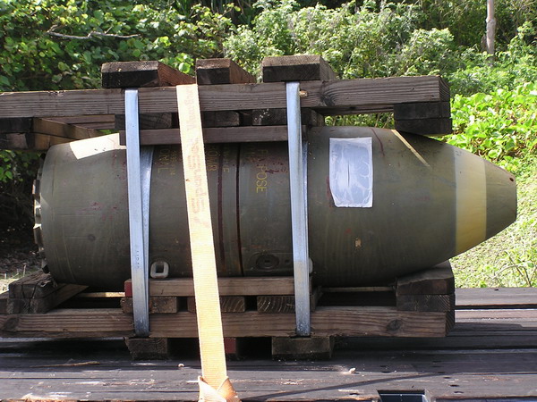
A close up of the 750 pound bomb.
Our EOD range is perhaps one of the prettiest anywhere. Not to worry though, there are PLENTY of environmental protections in place to make sure we don’t harm the environment. Having spent a year working as an environmental program manager, I can safely say that the Air Force is doing well in protecting our natural environment on Guam.
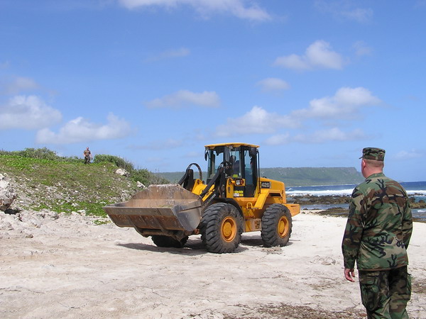
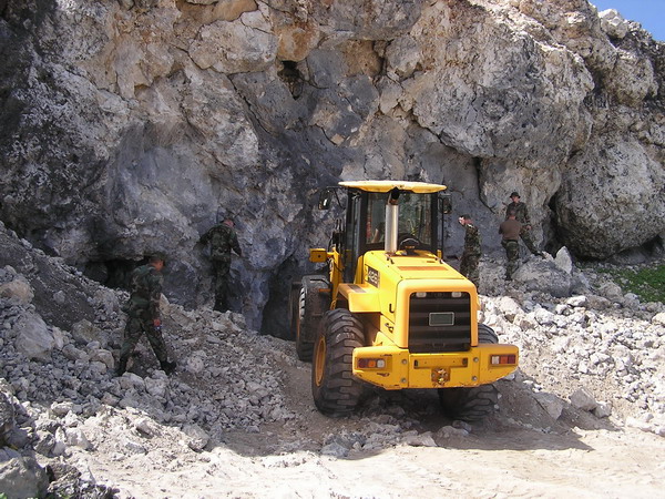
Here’s where the bombs are placed.
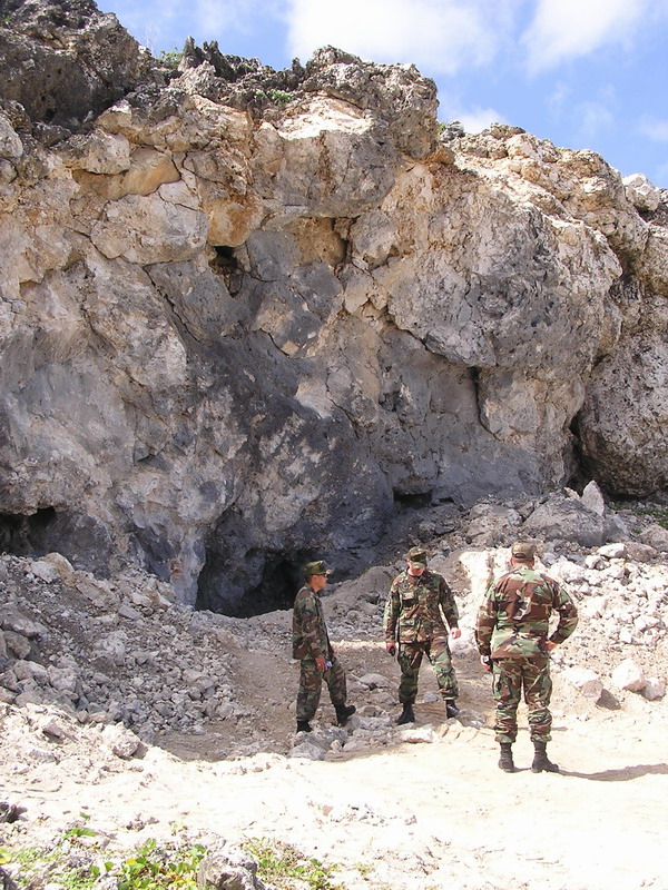
A front-end loader is used to carry the bomb from the trailer to deposit as close to the limestone cliff as possible.
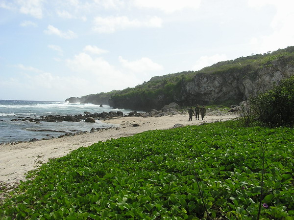
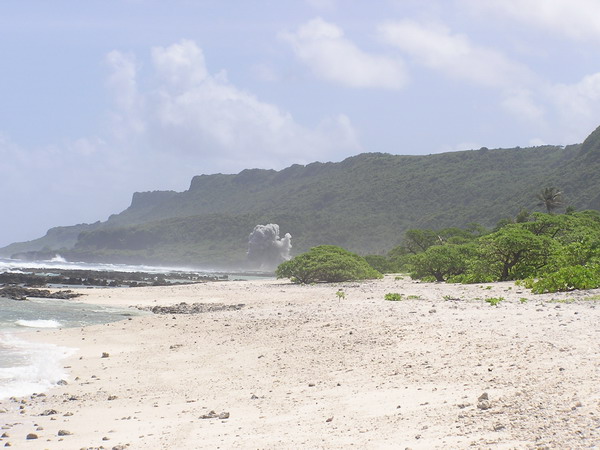
Here’s the view out from the beach to Pati Point.
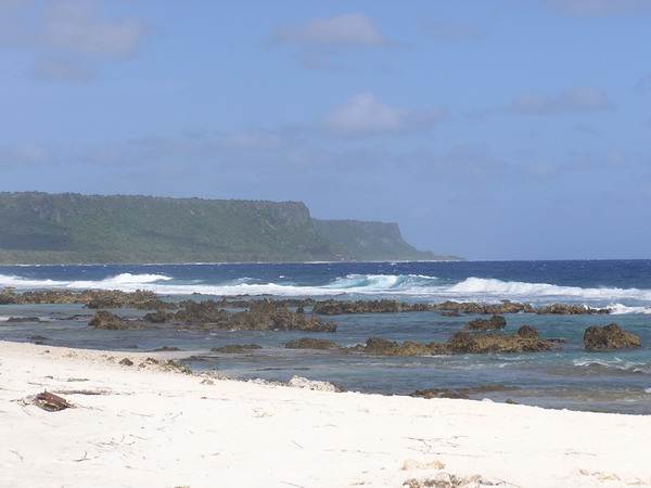
It looks so small and benign, doesn’t it??

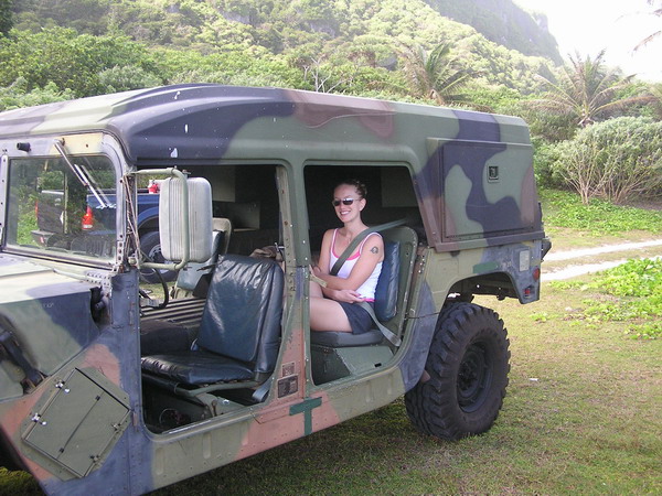
Anna even got to sit in the HMMWV (AKA Humvee) for a while. 🙂
Once we got 6,500 feet away, we found a good vantage point to watch the explosion from.
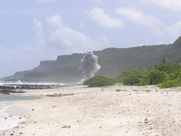
Finally, after two and a half hours of waiting, we got to see…
BOOM.
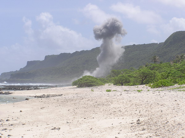
After the explosion, the plan was to repeat this process three more times that day. Unfortunately, when they got back to the site, so much of the cliff had come down, they had to wait until Monday to clear it out and repeat the process. It’s a long process to get everything set and make sure it’s completely safe. It’s the right thing to do, but makes for a rather anti-climactic finish.
It was a blast nonetheless. 🙂
–Jim
Hong Kong — Day 3, Animals and Victoria Peak
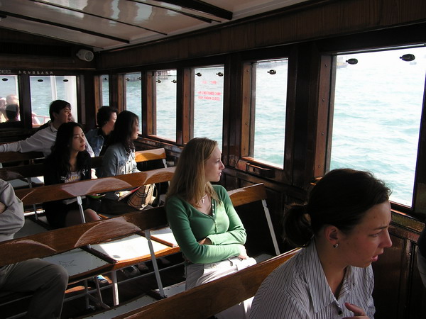
Our final day in Hong Kong was a race to see as much as we could. 🙂 We began early in the morning after we checked out of our hotel with another Star ferry ride back over to Hong Kong island. Which, by the way, cost $4.40 Hong Kong dollars for two of us to cross one way. That works out to just over a quarter ($0.25!!) each. What a deal for a romantic boat ride!
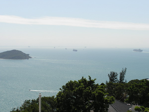
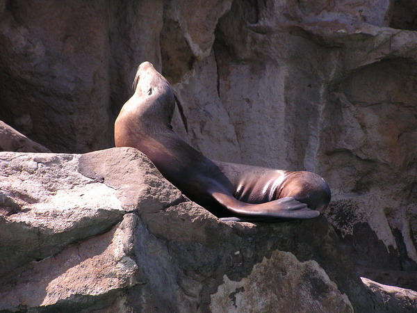
The first stop for the day was to the Ocean Park. This is a large combination amusement park and oceanarium.
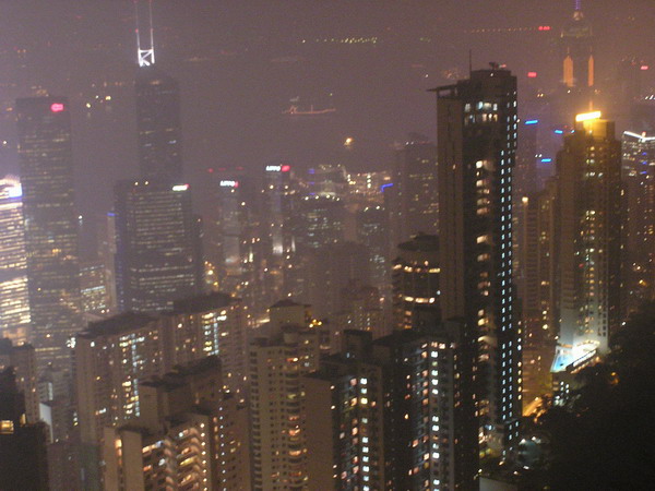
Here is the view from the gondola as we go from one half of the park to the other.
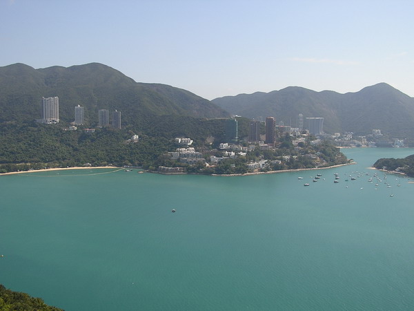
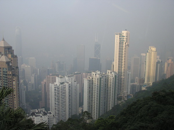
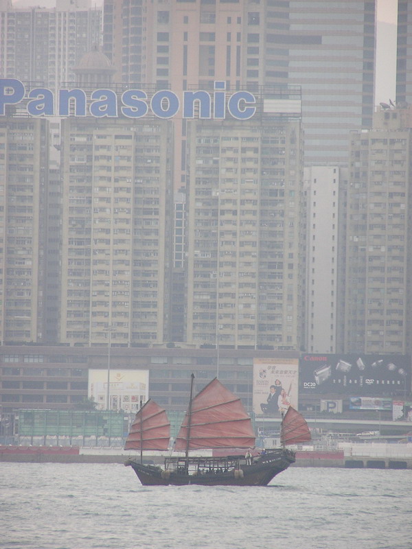
Once we arrived at the top, this is the view that greeted us. I was really struck by the sheer number of ships that were coming and going. It’s a great perspective on just how much commerce is conducted on and by Hong Kong.
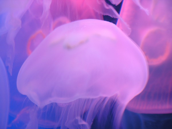
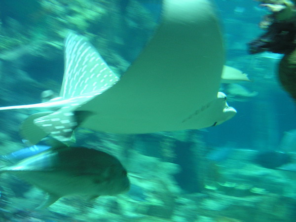
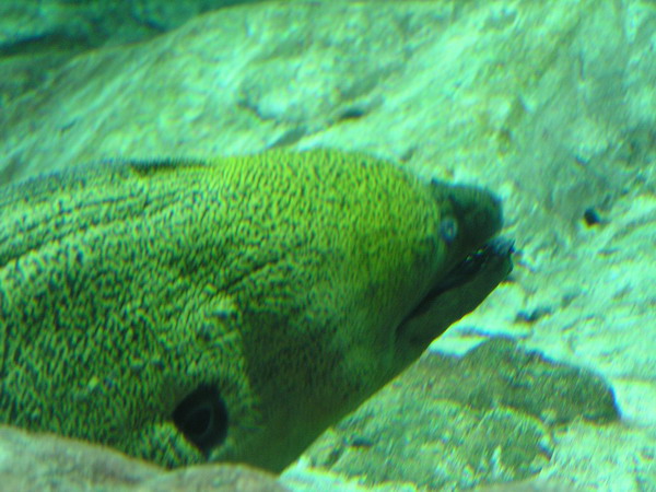
While we didn’t partake in any of the amusement/theme park rides (it just didn’t compare to any of the Six Flags parks), we did see some fascinating and well done displays.
Even in the pictures, these jellies just look surreal…
I am still a fan of watching rays swim through the water. Such grace and elegance.
This is perhaps Anna’s least favorite sea creature, the Moray eel.
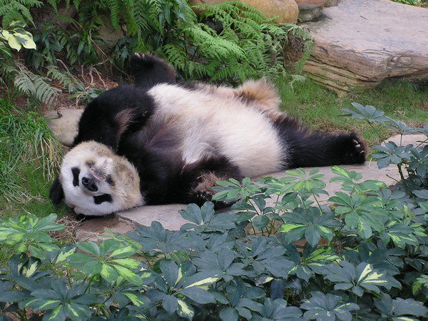
Of course, there were two Giant Pandas lounging. We learned that they spend 41% of their time resting, 55% eating and 4% doing other things. Apparently, we came during the 41%.
We next headed down to Stanley’s Market. Yes, I know we had already been shopping quite a bit, but hadn’t bought much. We mostly enjoyed wandering among the myriad of shops.
After we were totally shopped out (and now carrying a few bags of souvenirs :-)), we hopped a bus to the city.
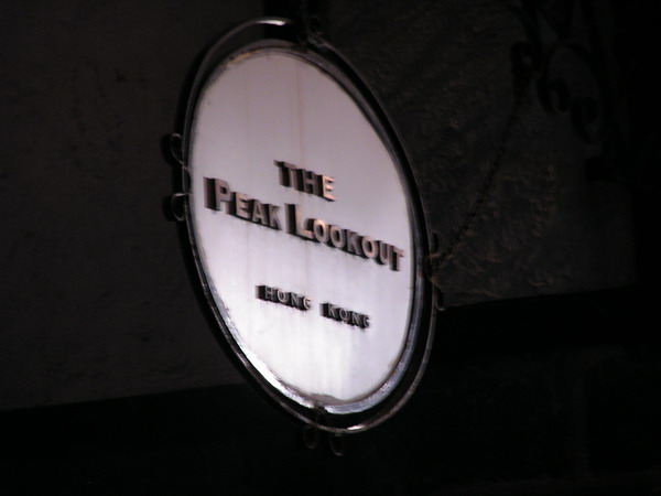
We were headed to the Victoria Peak Tram for the highly touted ride up to the peak. The tram has been in operation since 1888, so it’s been around for a while. Nevertheless, we made it safely to the “top.” When we arrived, we found a shopping mall, several restaurants and lots of people. Since we wanted to reach the actual peak, we still had 30 minutes more hiking.
This is a view from the ride up.
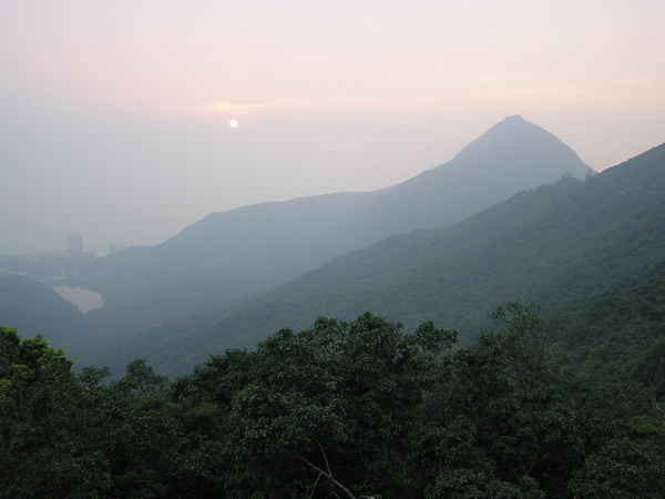
We heard the sunsets were very nice from the peak, and while a little hazy, this one did not disappoint us.
We had worked up a healthy appetite during the day. We found a very nice, romantic restaurant right on the peak as well.
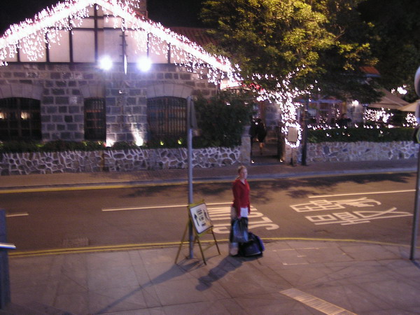
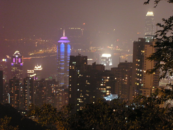
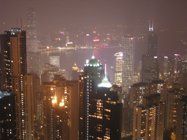
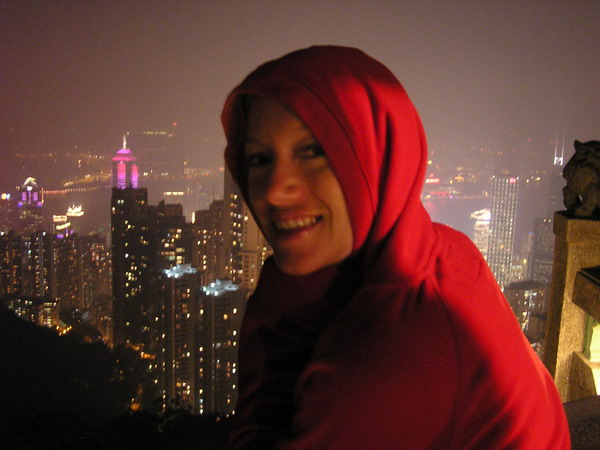
We ended our Hong Kong experience with another light show. This time, our vantage point was from the top of Victoria Peak (just over 1,800′ above sea level). With over 6 million tourists a year, this is the largest tourist attraction in Hong Kong.
The show was yet again, spectacular.
As you can see, it was a little cold for us thin-blooded people from Guam.
From there, it was back to the airport to await the 4 and a half hour flight back to Guam.
Hong Kong was a nice introduction to Chinese culture. It was a unique blend of the east and west. It helped that there was still a strong British influence and everything was in English and Cantonese (interestingly, not Mandarin as the rest of China is).
It was another great trip and one that we won’t forget anytime soon!
We can’t wait to experience more of the culture when we go to mainland China this spring.
–Jim
Hong Kong — Day 2, Light show and Big Buddha
Ok, unfortunately, I wasn’t able to finish my “real time” posting of our Hong Kong trip. However, thanks to everyone who let me know they appreciated the effort. 🙂
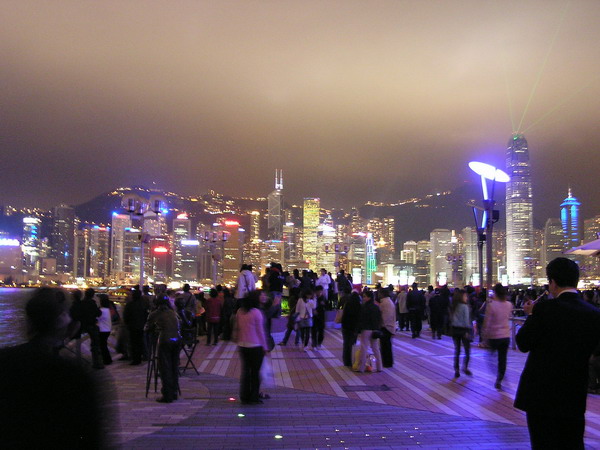
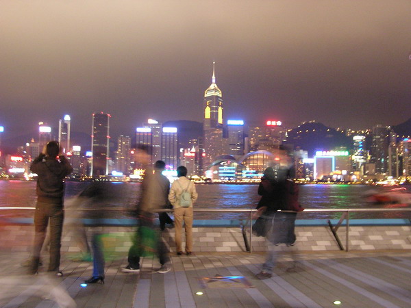
The Hong Kong skyline at promptly 8:00 PM every night is punctuated with a dramatic and beautiful light show. Many of the buildings participate and have a choreographed show that is accompanied by music (broadcast on the radio). We watched from the Avenue of Stars where the music came over a public stereo system and even though there was a bit of a crowd, made the display quite enjoyable (albeit chilly).
Here are a few shots from the show.
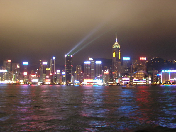
This is probably my favorite shot…
After the light show, we took the venerable Star Ferry across the channel to Hong Kong Island. We spent the rest of night exploring the plentiful night life on the island.
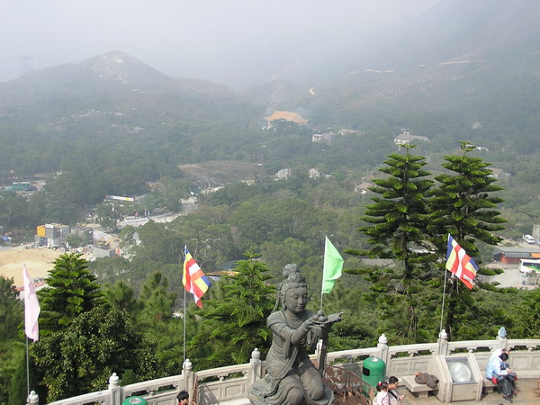
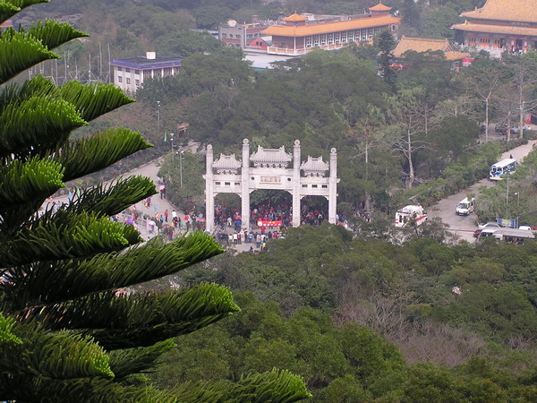
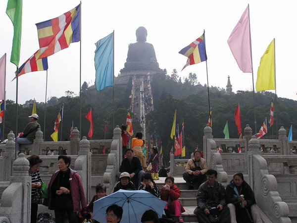
Early the next morning, we got up and took the MTR (Mass Transit Rail) to the neighboring island of Lantau. We were going to see the “Big Buddha” as the giant statue outside the Po Lin Buddhist Monastary is reffered to.
It sits over 80 feet high and rests serenely atop a large hill and commands an impressive view of the surrounding country.
If you wish to go up and examine the Buddha, there are 260 steps that lead the way…
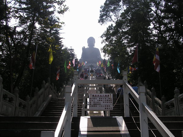
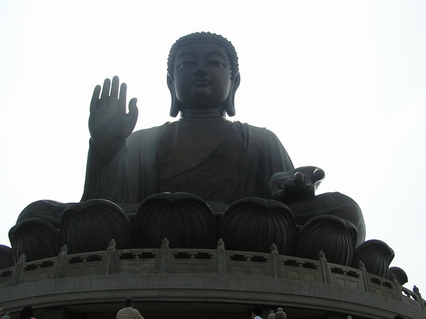
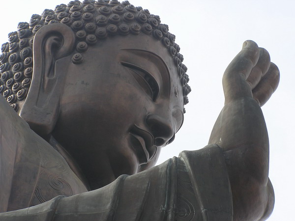
As we got to the top, we came face to face with a larger than life bronze Buddha. In fact, this is the world’s largest, outdoor, seated Buddha (of course, I don’t know where a larger indoor, standing Buddha is…)
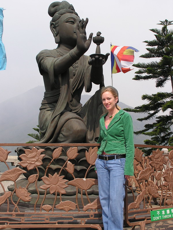
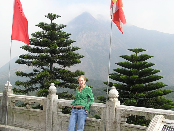
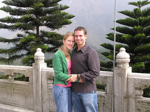
Here is an array of pictures from around the top. I hope you’ll forgive me for including more pictures than I normally do (and causing this page to load even slower than it normally does), but there were so many important perpsectives that I didn’t want you to lose.

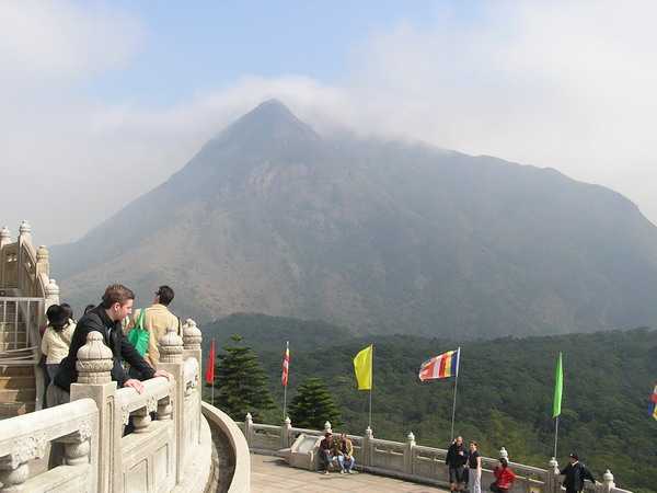
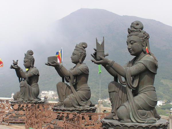
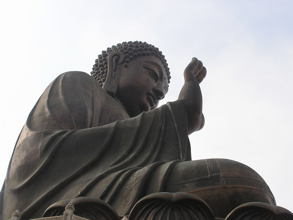

Here we are looking back up at the imposing “Enlightened One.”
After our time there, we went back to the hotel, then out to a very good Indian restaurant for dinner with some British friends we met in Hong Kong.
It was quite a lively discussion at the dinner table. 🙂
Then, back to the hotel for some well deserved rest.
The next day would have many more interesting sights and sounds to experience.
So, until then.
–Jim
Hong Kong — Day 1, Kowloon
This entry is a first. I am writing and posting pictures THE SAME DAY. 🙂 I know that’s how this site is supposed to work, but rarely do we take a break with enough time to sort the pictures, resize them, AND post the text. So, hopefully, this more timely approach will help alleviate a little of the time burden.
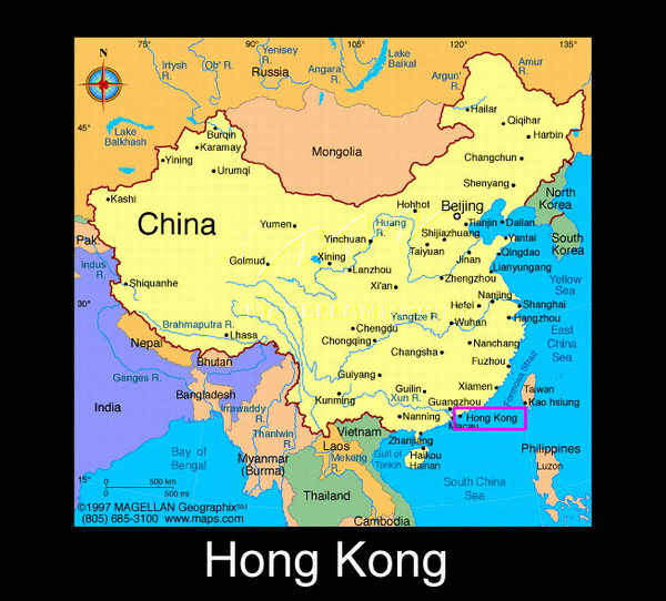
OK, so, here’s what our Hong Kong experience has been thus far. For those of you not familiar with the area, here’s a map of China.
We arrived late last night and checked into our hotel. We promptly fell asleep, despite intentions of wandering around the hotel to get our bearings. Oh well, it was a good night’s rest for today’s walking tour, at least.
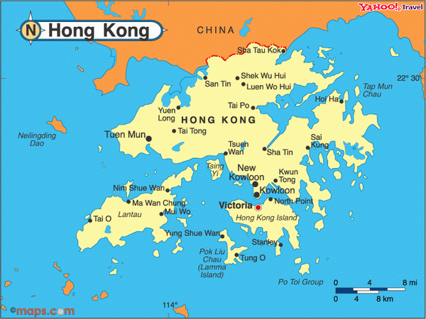
Our hotel is in Kowloon. Here’s a map of the Hong Kong area, so you can get a better idea of the area.
Hong Kong was turned back over to the People’s Republic of China back in 1997 (after 99 years leased by the British), but it certainly still retains many western (British) aspects (streets named Waterloo for example). So, while this may not be like “mainland” China, it is certainly a unique culture.
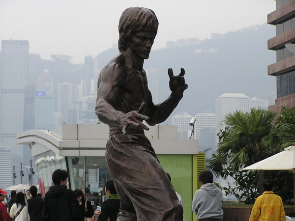
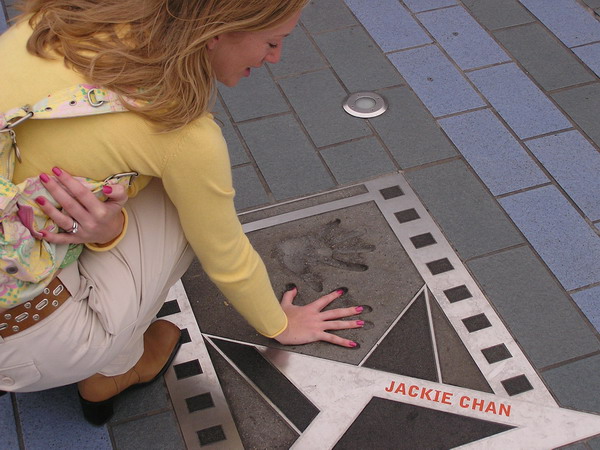
We began our day on the Avenue of Stars, Hong Kong’s homage to it’s film industry and stars. Here I am trying to be like the venerable Bruce Lee. Pretty good impression, huh?? 🙂
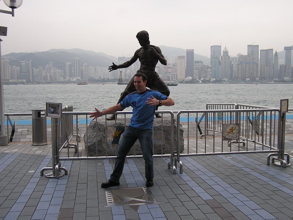
Ok, so the statue looks better without me making a fool of myself in front of it…
Anna’s hands are almost as big as Jackie’s.
The harbor afforded interesting juxtapositions of old and new:
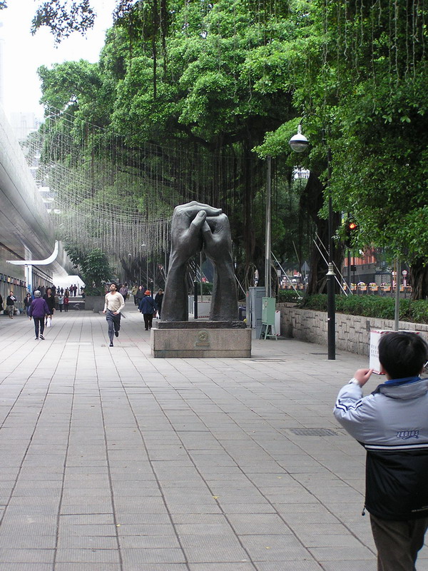
From there, we wandered along Nathan Street and came across this unique statue:
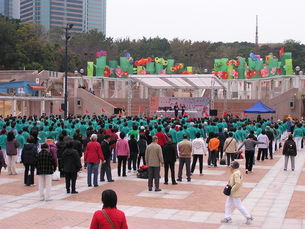
Then, over to Kowloon Park. Perhaps since it was a Saturday morning, there was a large group gathered to do what appeared to be Tai Chi. We stayed and watched for a while. Anna was really tempted to join in, but didn’t.
Another vestige of British rule.
Our big event for the day was shopping. We stopped by the Jade Market, the Ladies’ Market, and several other smaller ones. In fact, the whole area is absolutely packed with shops with just about everything imaginable for sale.
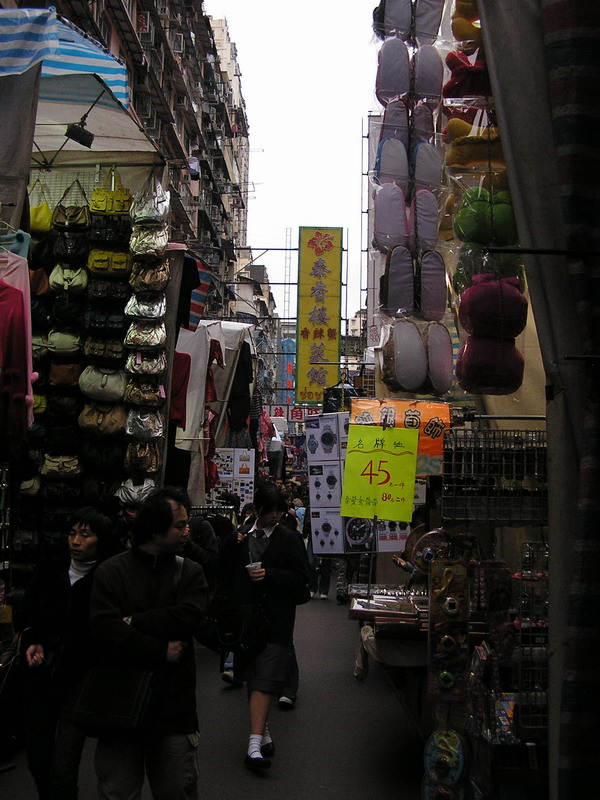
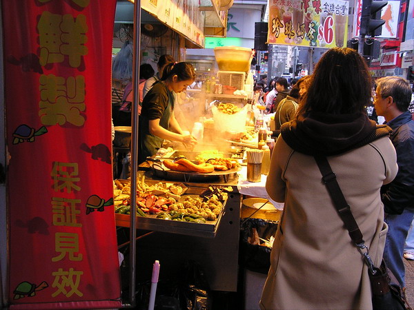
We also sampled some of the local food. It was a little scary at first (and sometimes hard to communicate what it is and what we wanted), but it was quite tasty in the end.
So, we are now in the hotel room resting up for tonight. We’re planning to watch the light show (many buildings on Hong Kong Island have lights on them and there’s a nightly show … supposedly, it’s the world’s largest regular light show). Then, over to Hong Kong island for dinner and perhaps see how the night life is over there. 🙂
Hopefully, tomorrow I will be able to update you with the story and pictures from that!
Until then.
–Jim
Double Reef — hike with CGOs
Well, we decided to go for another hike this past weekend. So, we offered to all the Company Grade Officers (CGOs … this is what the Air Force calls its junior officers in the ranks of lieutenant and captain) that we would take everyone down to the Double Reef Beach.
So, our weekend started out as it usually does here on Guam. We did a 5K race first thing on Saturday morning. Since it was the weekend before Valentine’s day, they had a couples race. It was a normal 5K, with the twist that each couple ran a relay 5K (meaning one ran a 5K, then came back and tagged their partner for the second 5K). It was a nice change and a lot of fun.
After our warm up in the morning, we met up with everyone. Although there are well over 100 CGOs on base, only 10 hardy people dared venture into the jungle with us. Perhaps our reputation of taking the long and hard way has preceded us. 🙂
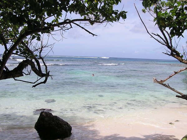
Well, regardless, we didn’t have much trouble getting down to the beach. It’s a very pretty and secluded beach. Since the only land access is through Navy property, it limits the number of visitors.
When we got to the beach, pretty much everyone was ready to jump in the water and cool off after the steamy hike through the jungle.
Here’s the view we found when we got to the beach:
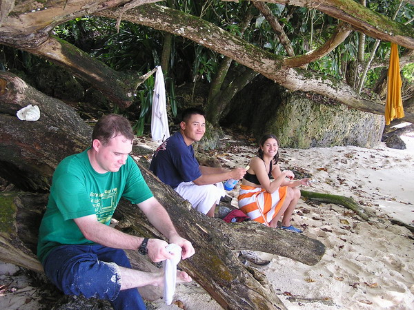
About half the group decided to go for a long distance snorkel. The other half explored the shoreline and ate a light lunch. Here we are enjoying a little food.
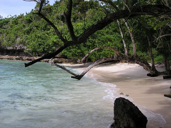
A couple more shots of the beach. As you can see, the trees have grown out over the sand. They were probably straight at one time, but the wind and weather have caused them to list slightly. It’s nice to be able to hide in their shade though.
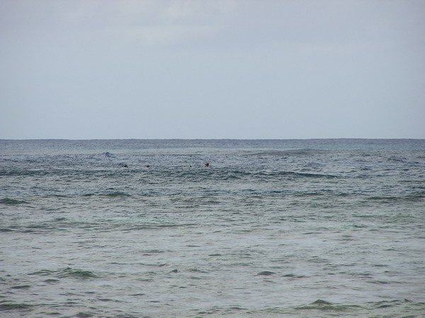
Here are the snorkelers … if you look close you can see someone with their head out of the water.
We stayed and played in the water for quite a while. In fact, so long that half of the group had to part ways and head back up the trail to attend an awards ceremony that was going on that night. Everyone else joined Anna and I for a continuation hike a little further down the coast. This time, we were hiking on the coral mantle. Since the tide was almost at high tide (and it was about a full moon), the water was quite high. As we traveled, we’d have to stop for the waves to come in and go back out so that we could pick our way through the coral, and not get swept out to sea. Not to worry though, the waves weren’t too strong, so there was little real danger. Just slow going.
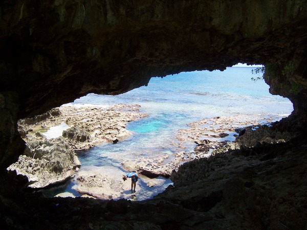
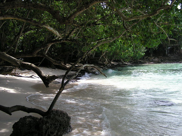
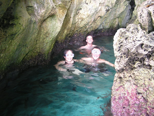
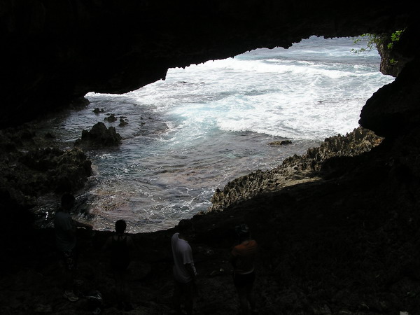
Eventually, we reach a small cave that looked very inviting. It was the same cave that we explored the last time we were at Double Reef beach. This time we came prepared with underwater flashlights though, so we could see what was around us.
Here’s what it looked like:
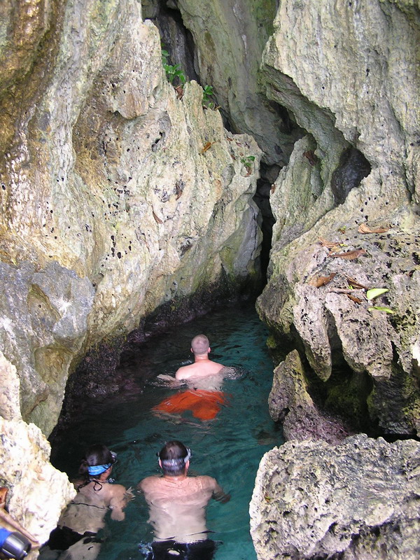
Our destination on this part of the hike was a natural arch. Here’s a picture from under the land bridge.
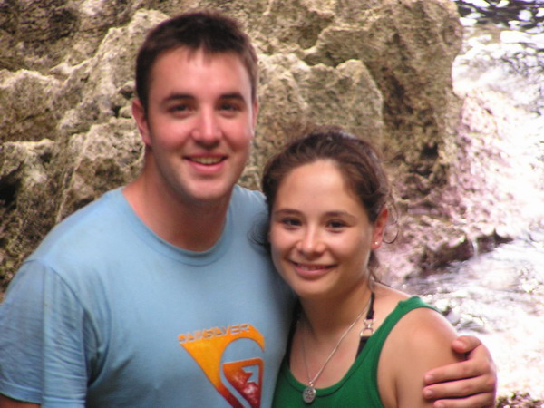
Our friends Andy and Jen:
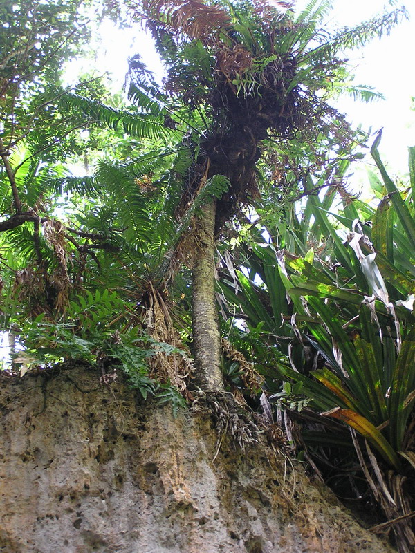
The plants even grow in precarious places…
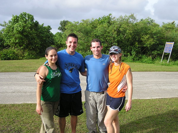
Here we all are after the hike.
Well, it was another fun hike through the jungles of Guam. Next up is a trip up the highest mountain in the world … Mt Lam Lam.
Ok, so it’s only the highest if you measure from the bottom of the Marianas Trench (35,798 feet below sea level). So, if you add to that the 1,332 ft ABOVE sea level that Mt Lam Lam soars, it’s much higher than the mere 29,035 feet that Mt Everest stands. That will be our next hiking destination.
We’ll keep you all posted on how it unfolds.
Until then.
–Jim
Lonfit Waterfall
This weekend has mostly been about spending time with each other (since Anna and I were apart for entirely too long). However, what weekend would be complete without a little adventure.
So, we talked our friends Mark and Samantha into going hiking with us.
We decided to go on a medium difficulty hike. Our choice was a 40 foot waterfall in the center of the island called Lonfit Waterfall.
This was very close to another waterfall (that also happened to be the first hike we went on here in Guam, called San Carlos Falls).
So, without a whole lot of difficulty, we made our way down into the valley where the waterfall was. It helped that there was a pretty well established trail though.
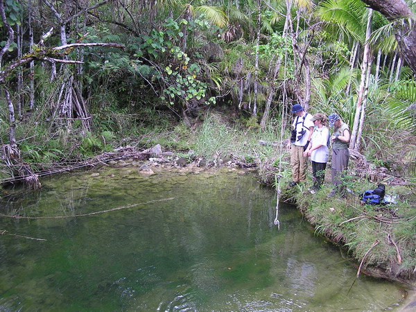
When we got close, we heard a lot of talking, so we knew there were already people there. Once we got down to the waterfall, we found a group of about 10 Japanese tourists who’d also hiked to the falls. They were very nice and were just about to head back as we arrived.
Here they are headed back up the hill.
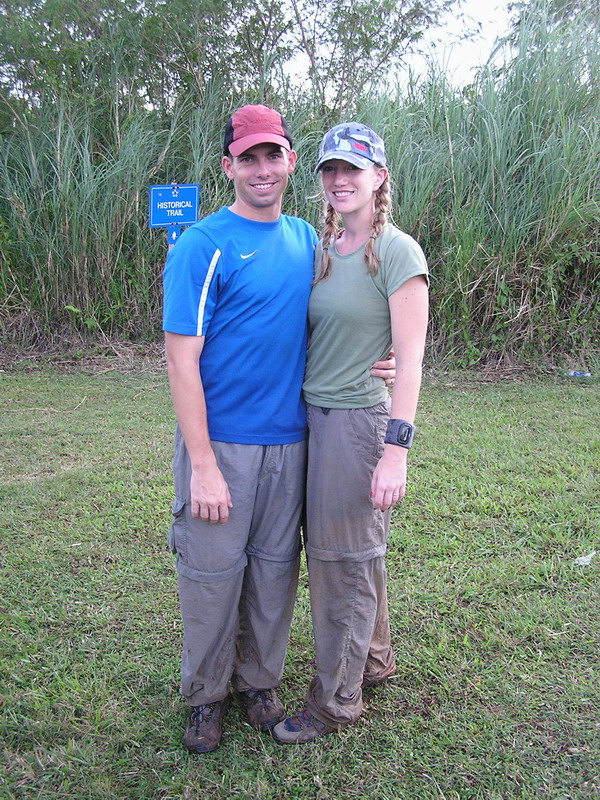
And here I am on the falls. 🙂
Here’s everyone else. As you can see, no one else wanted to play in the water.
Once we hit the river, that became our trail for the rest of the hike.
We also went in search of the swimming hole further up another branch of the river. The Japanese group also went looking for it, but told us they couldn’t find it. So, we headed down hoping that we would be able to find it.
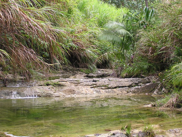
Eventually, after hiking through the river for while, we came upon the swimming hole (I think the Japanese group just didn’t go far enough up the river).
It looked very inviting (since we were hot and there was a rope swing). However, two things kept everyone out of the water.
1. The mosquitoes were voracious (I killed three simultaneously
within a square inch on my shoulder)
2. There was a 4 foot fresh water eel swimming around in the
pool. While I HIGHLY doubt he would have bothered us, he was
big enough and scary enough that no one wanted to get close
enough to check.
So, instead, we took a couple pictures and turned around and headed back the way we came. 🙂
Here is everyone by the water’s edge (the eel didn’t stay around long enough to get his picture taken).
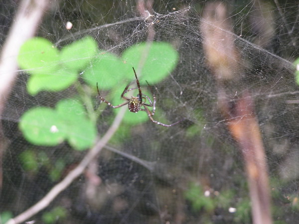
Here’s another local resident of the jungle (a Banana Spider).
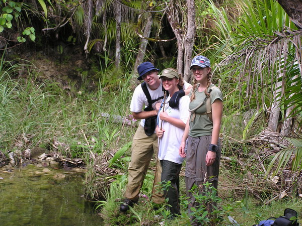
Here we are after the hike. As you can see, we got a little dirty, but that’s half the fun!
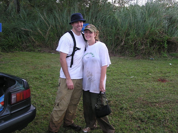
Another fun hike with great friends.
Until the next one…
–Jim