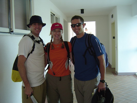
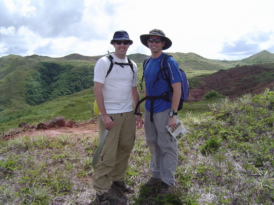
Well, this afternoon, we decided that it had been entirely too long since we last ventured into the jungles of Guam. So, Anna and I, along with our neighbor and good friend, Mark Koeppen, set off on another hike (also known as a Boonie Stomp here on Guam).
Here we are ready to leave the building…
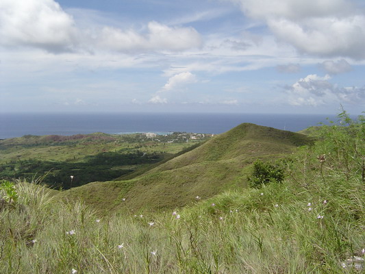
Our destination for the day was a river valley in central Guam called Sigua. This is also a popular destination for 4 wheel drive vehicles, so as usual for the US, there’s a constant struggle between protecting the native environment and allowing people to use their off road vehicles. Fortunately, there weren’t too many out today, so
we had relative tranquility.
Here’s the view from the beginning of the trail:
If you have ever hiked on Guam you know there are three things that can happen as you try to find your way:
1. There are so many trails (each with marking tape) that it’s very difficult to discern the true path.
2. The trail evaporates into nothing as plants go quickly to obscure the path.
3. The real trail and the map do not agree.
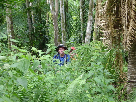
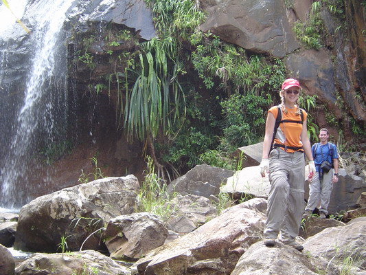
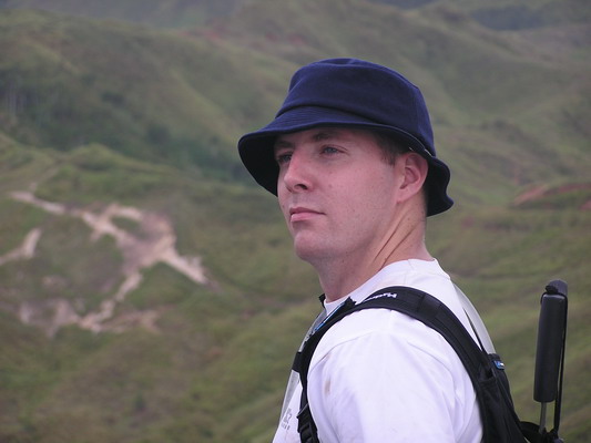
So, today, I was very careful to check and double check our route (it was Mark’s first time hiking with us and I wanted him to go with us again):
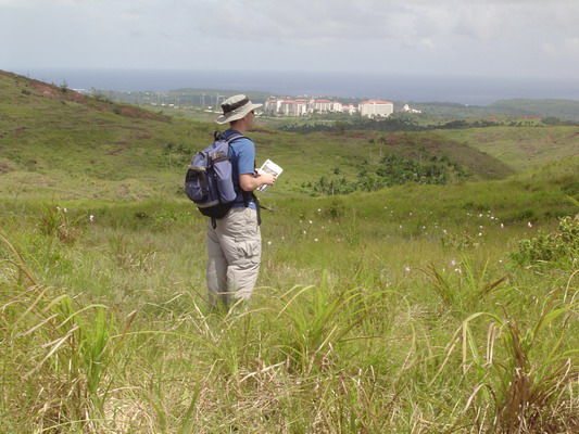
Mark and I along the trail.
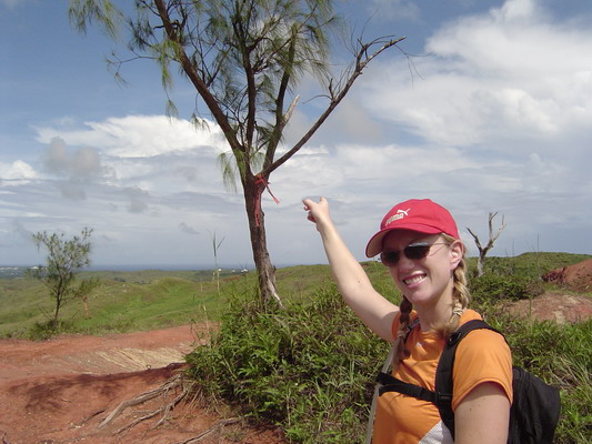
Our route was along a ridge to a particular tree…here is Anna pointing out that useful tree (yes the trail guide actually mentions this tree as the location where we turned):
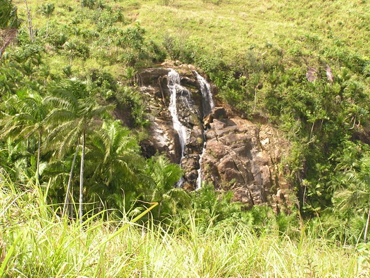
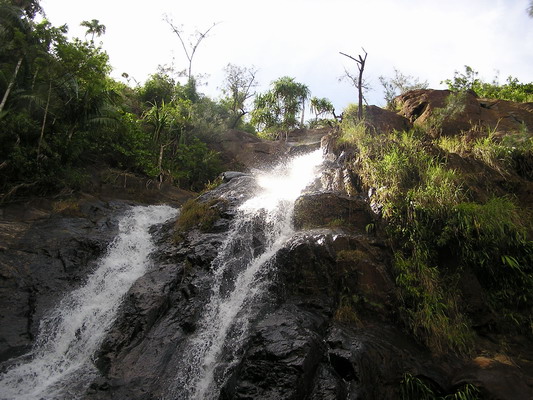
Here is our first view of our first destination, Upper Sigua Falls.
From here, the trail diverged from the grassy savannah, to a very steep, slippery jungle path. It was made more slippery by the near constant rain over the last 2 weeks. In places people who had gone before were nice enough to leave a rope to allow us easier passage down the slope. In fact, today without the rope, it would have been impossible to get down.
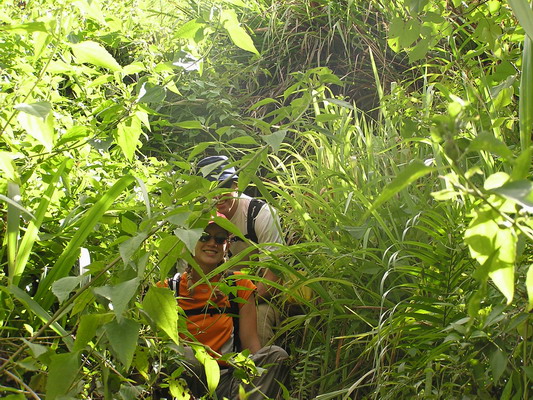
Here’s a shot of Anna and Mark coming out of the VERY dense bushes:
Here is Mark’s perspective looking down at me and Anna.
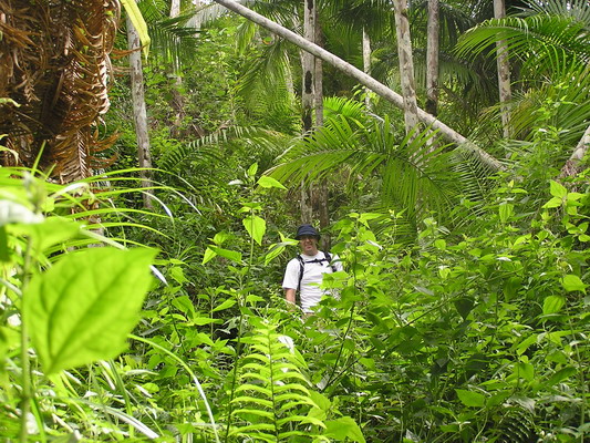
Here you can see a little more open part of the jungle.
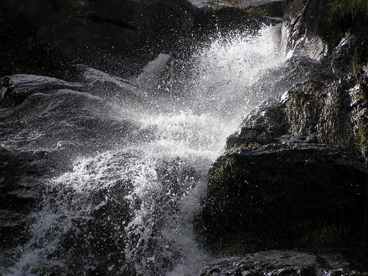
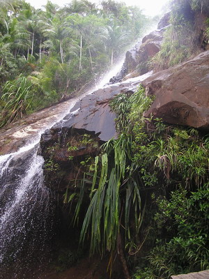
We finally made it down the slope, and arrived at a very majestic waterfall.
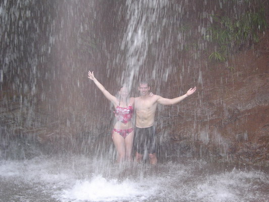
The pool beneath was cool, but shallow. However, we were able to make it around behind the falls:
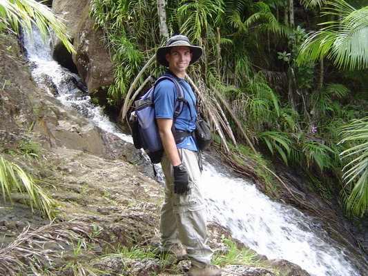
Mark hamming it up…
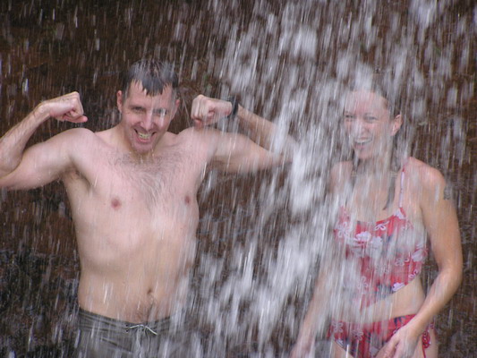
We each took turns seeing if we were tough enough to bear the brunt of the force of water as it came down…turns out we were.
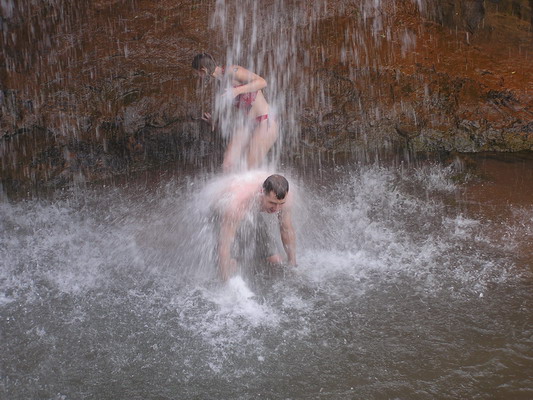
A final shot of Upper Sigua Falls in the afternoon sun.
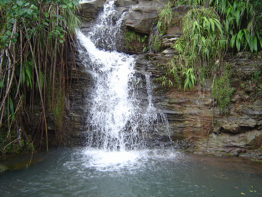
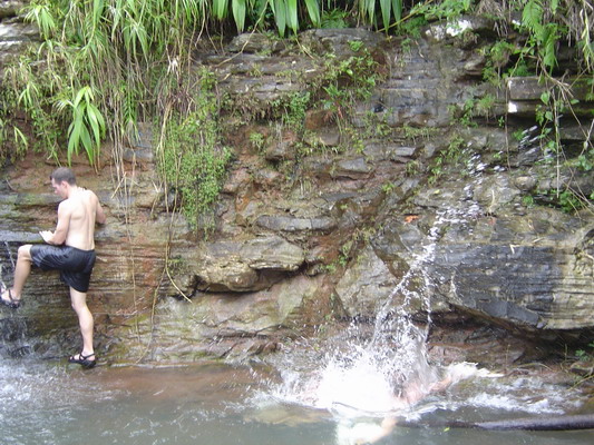
The next destination was a little way up the valley. So, we got our clothes back on (albeit wet clothes) and headed back up another steep and slippery part of the ravine. We wound our way back up to a place called Alutom Falls.
Here’s a shot of the small but very picturesque falls.
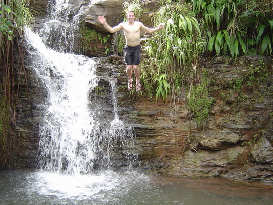
This time the pool beneath was a little deeper, so Mark and I decided to take a plunge.
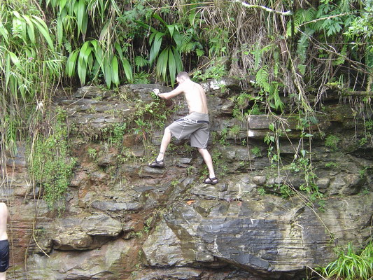
Here is Mark climbing up the rocks:
Here is Mark NOT climbing up the rocks…
Yes, the rocks were a little slippery. Don’t worry, he was fine, and after he saw that Anna had photographic evidence of his fall, thought it was quite funny.
Here I am in mid-leap.
Once we satiated our desire to jump off of things, we headed back up the other side of the valley, to complete a large loop.
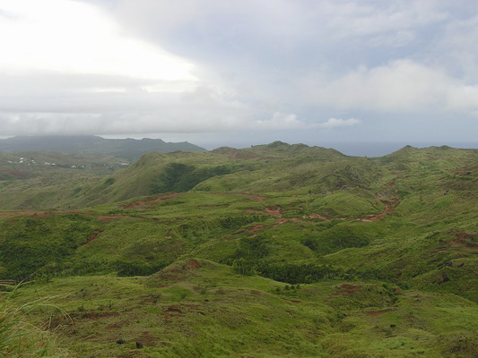
We hiked up to the top of Mt. Alutom.
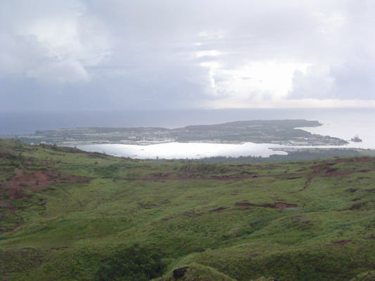
Here are a couple shots from the top:
This is the main commercial and military harbor of Guam, Apra Harbor.
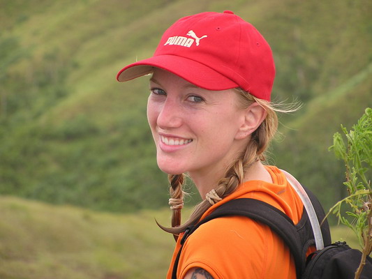
My beautiful wife:
After taking the pictures on the peak, we headed back to our car to complete a 2.75 mile hike that took just about 2 hours of hiking time (3 hours total).
It was a very enjoyable hike with some great views of our island home.
–Jim
3 thoughts on “2 waterfalls — 1 Hike”
Comments are closed.
Jimbo – **NICE** shots. I much prefer these shots than actually being out in the steam-room that is the jungles of Guam.
–dan
Incredible landscapes!
I got the site address from Karen.
Hola muchacho and muchacha.
I am envious of you two.
Best of luck!
Salude!
-Matt
I ran across your pictures researching my father’s AACS Radio/Radar Station on the top of Mt. Alutom.
Thier camp overlooked Apra Harbor.
Many of your photos look familiar to black and whites he took in 1945 and some colors a friens sent me in 2005.
Send me you e-mail address and I will e-mail you the black and whites.
Next time you hike up to the top of Mt. Alutom you might find were this camp and station was.
Before my father passed away he told me about the radar station. He said it was top secret and was only to be refered to as a radio ststion at that time. Oddly enough he took pictures of everything but the radar station in 1945.
He told me about Nimitz and Halsey hiking up to his ststion whenever thet were in port.
He also mentioned in his letters to my mother about a radio to Washington they left on all night waiting to see if the Japs had surrendered.
I would love to hike or drive up to the top of Mt. Alutom to see where he lived until the war was over. However the flight from Dallas,TX is a long and expensive one.
The road up to the top of Mt. Alutom was built by Navy Seabees in 1945 for the AACS Radio/Radar Station.
He also mentioned a slide the Seabees cut down the side of Mt Alutom to drag heavy equipment up the side of the mountain.
He also mentioned a plane that crashed into the side of the moutain that took hours to cut throughbthe grass to get to it.