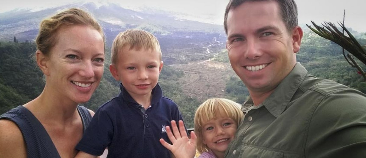
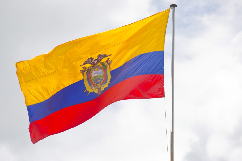
In May, Anna and I were able to hop a flight down for our first South American holiday… we began in the capital city, Quito. The capital is second highest capital city in the world at 2,850 meters (9,350 ft), after La Paz in Bolivia. Suffice it to say, walking around took a little getting used to after many years living at sea level. With a population of over 2.2 million people, it’s a large city. As you probably know, Ecuador was once a part of the Incan Empire, but there were several periods of development in Quito, from the end of the first millennium the Incas conquered the area in the 15th century. The Incas were subsequently defeated by the Spanish in 1534 which began nearly 300 years of colonial rule. Eventually in 1822, Antonio José de Sucre and Simon Bolivar’s troops won independence for Quito and the surrounding area. This was the region of modern-day Columbia, Ecuador and Venezuela and became “Gran Columbia” as part of Simon Bolivar’s vision to unite the former Spanish Colonies in Central and South America. Unfortunately, due to civil unrest and a war in 1828-29 against Peru, the vision failed to become reality. Adding further defeat, in 1830, Gran Columbia broke into the modern states of Columbia, Ecuador and Venezuela (and to a lesser extent parts of several other countries). At which time, Quito became the capital of Ecuador. The modern vestige of this brief unification is the similarity in flags in the former Gran Columbia (Columbia, Ecuador and Venezuela). To start things off in images, here is the Ecuadorian flag with it’s double band of yellow to represent the crops and fertile soil, the blue for the ocean and clear skies, the red for the blood for the the Ecuadorian who died in creating the country and finally the Ecuador coat of arms in the center.
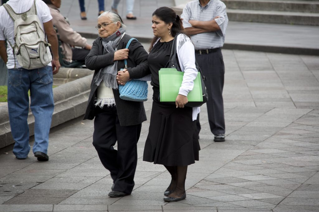
Although there has been a great deal of turmoil in Ecuador, we found it to be a wonderful country. Her people and landscape were welcoming and diverse. 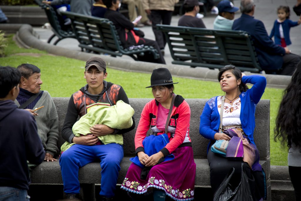
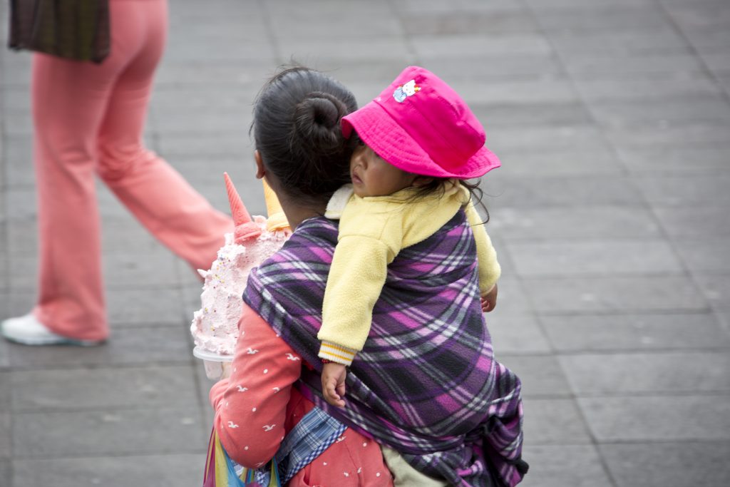
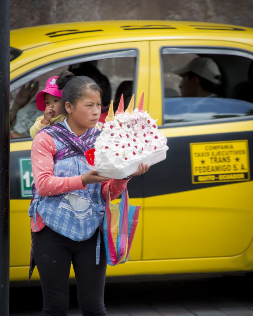
Although this looks suspiciously like ice cream on a hot street, it’s actually Espumillas, a meringue cream made with fruit pulp, egg white and sugar.
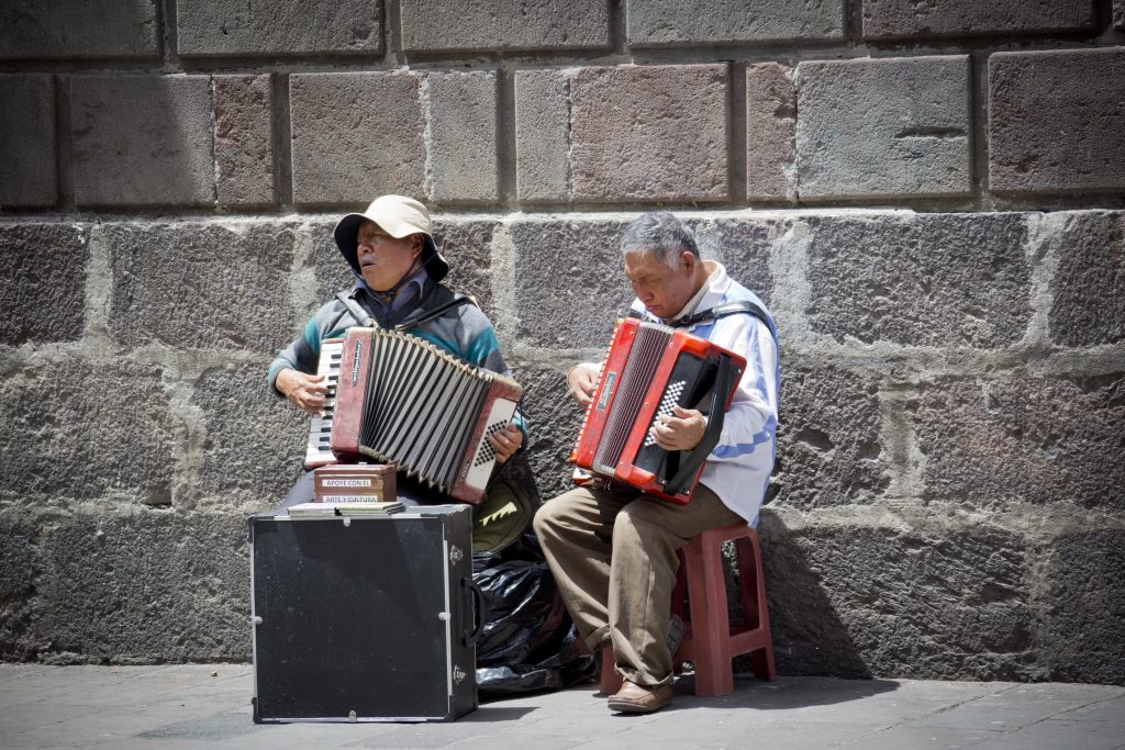
The street music was very entertaining as well.
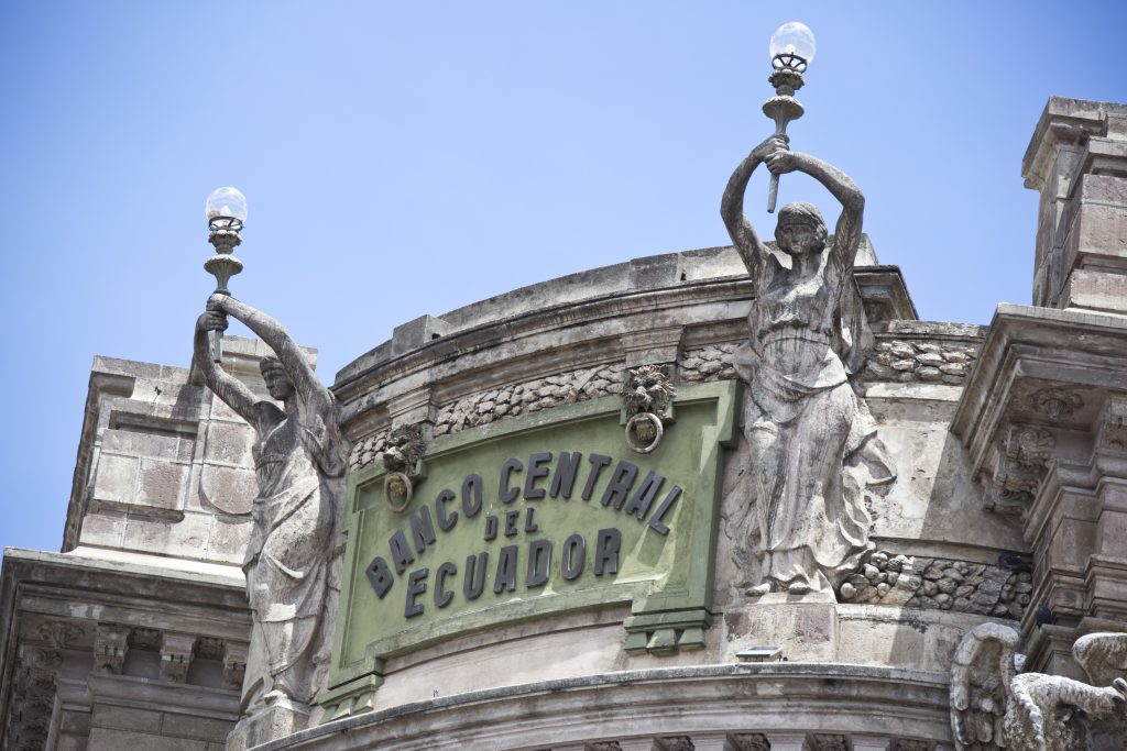
The banking situation in Ecuador is unusual. I have to admit, until I began doing research for our trip, I was ignorant that Ecuador uses the US Dollar as its currency. The reason for this stems from the effects of a strong El Nino weather pattern in 1998, combined with a poor oil market and a disease that devastated the shrimp export market. The confluence of these difficulties led to a 60% inflation rate in 1999, the highest in Latin America. The unsustainable inflation led the president to pursue dollarization, which has been used successfully elsewhere. However, the people of Ecuador responded with civil unrest and forced the president to resign. His vice president took over (after a brief interlude by a ruling triumvirate) and went ahead with the dollarization in September 2000. Along with austerity measures, the government of Ecuador obtained $2B in aid from the International Monetary Fund. Unfortunately for the people, the exchange rate was set at the inflated price of 2000, not the pre-crisis rate, thereby causing significant individual loss. Today, every dollar Ecuador uses from the United States comes with a small tariff. In practice, the dollar bills are usable in both countries, but coins less than one dollar are not transferable. Therefore, an Ecuadorian quarter is not legal tender in the US … but a cool souvenir.
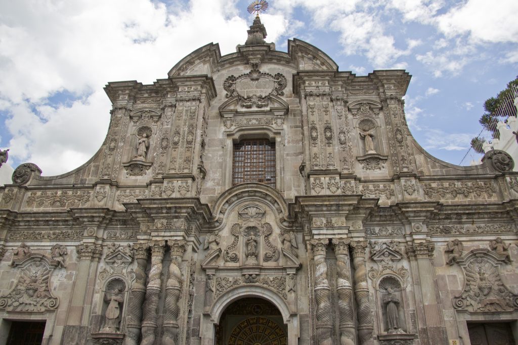
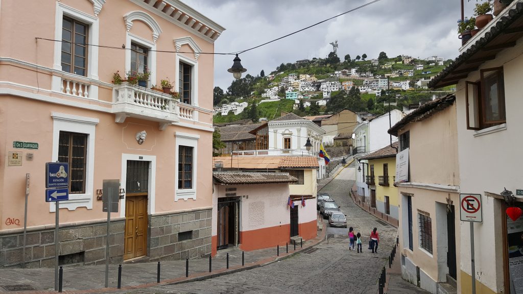
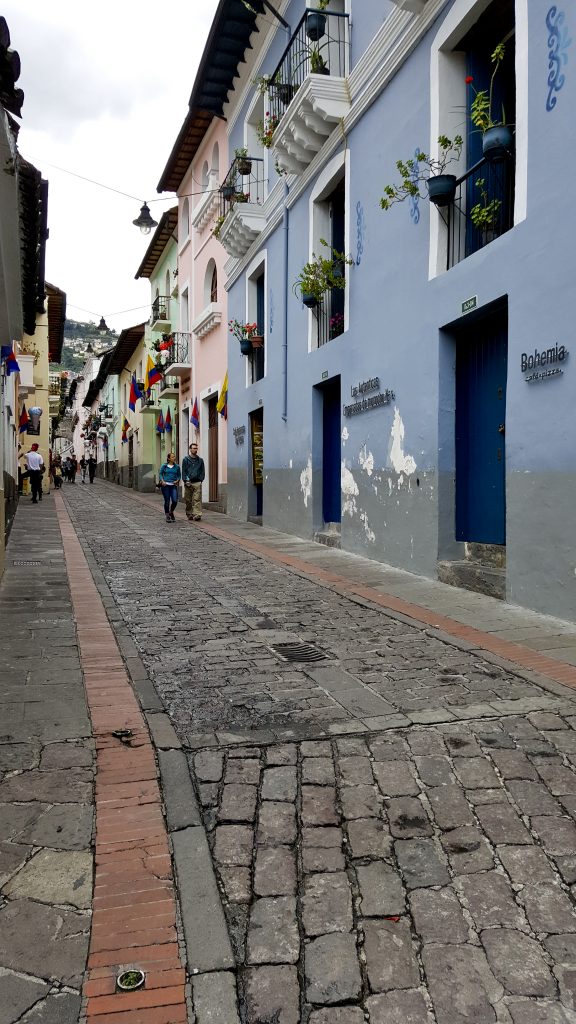
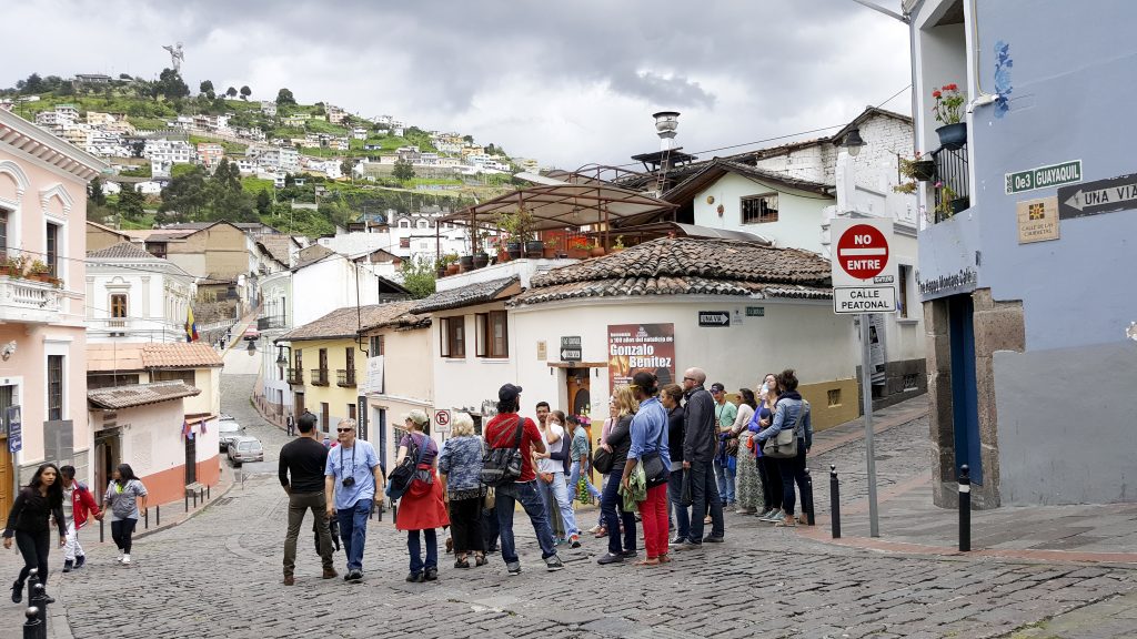
The colonial architecture (including that of the Catholic church) is impressive in Quito. It is so impressive that in 1978 UNESCO declared the city center a World Heritage Site.
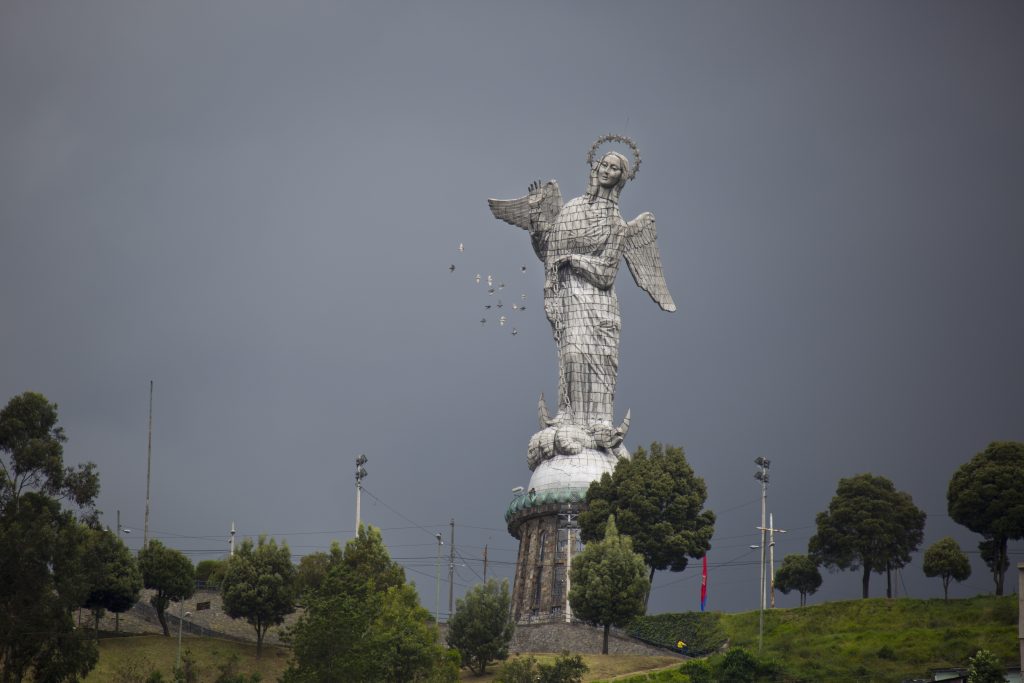
The Virgin of Quito tops a nearby hill built in 1975 and is apparently, the only (large) Madonna depicted with wings.
We joined a very informative free walking tour and highly recommend it, if you’re in Quito. http://freewalkingtourecuador.com/
In fact, the tour was so good, we continued with a second tour to see the “Middle of the World,” AKA the Equator (or Ecuador). http://freewalkingtourecuador.com/middle-world/
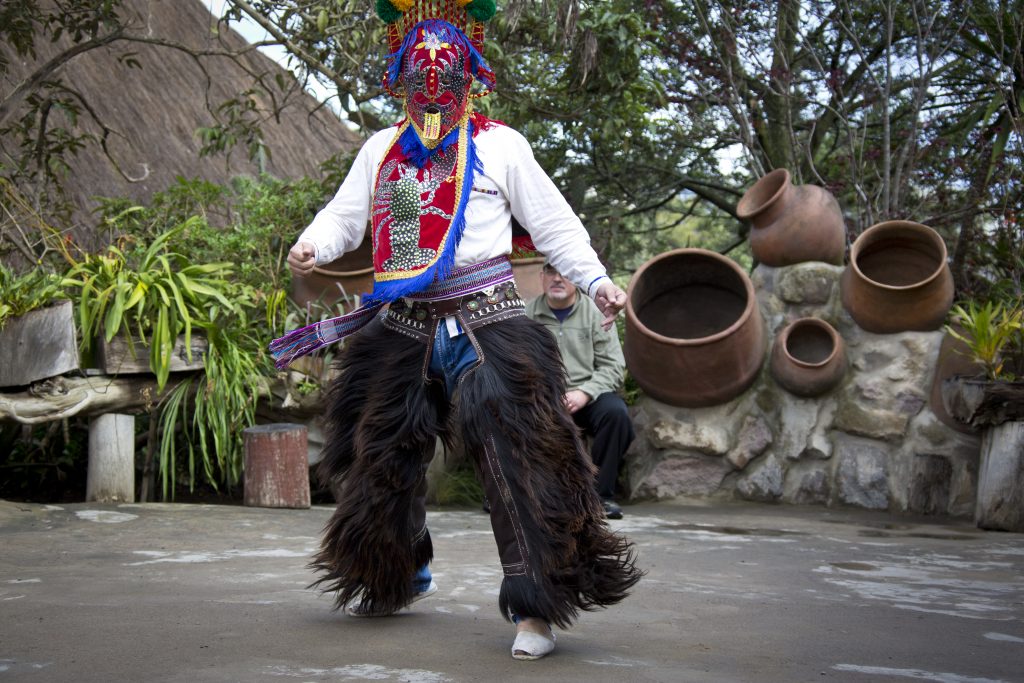
Our guide was kind enough to explain the particularities and peculiarities of being directly on the equator.
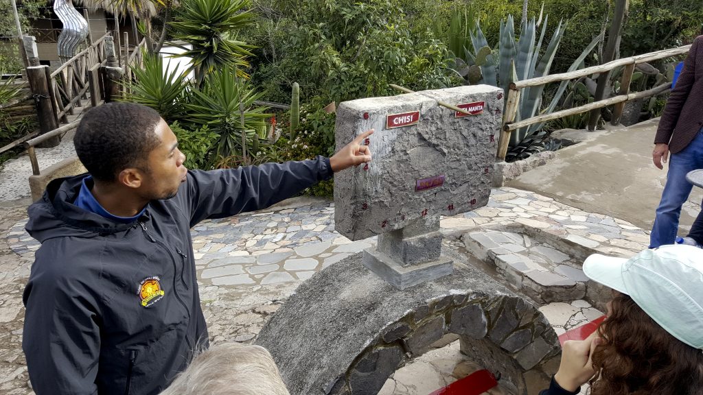
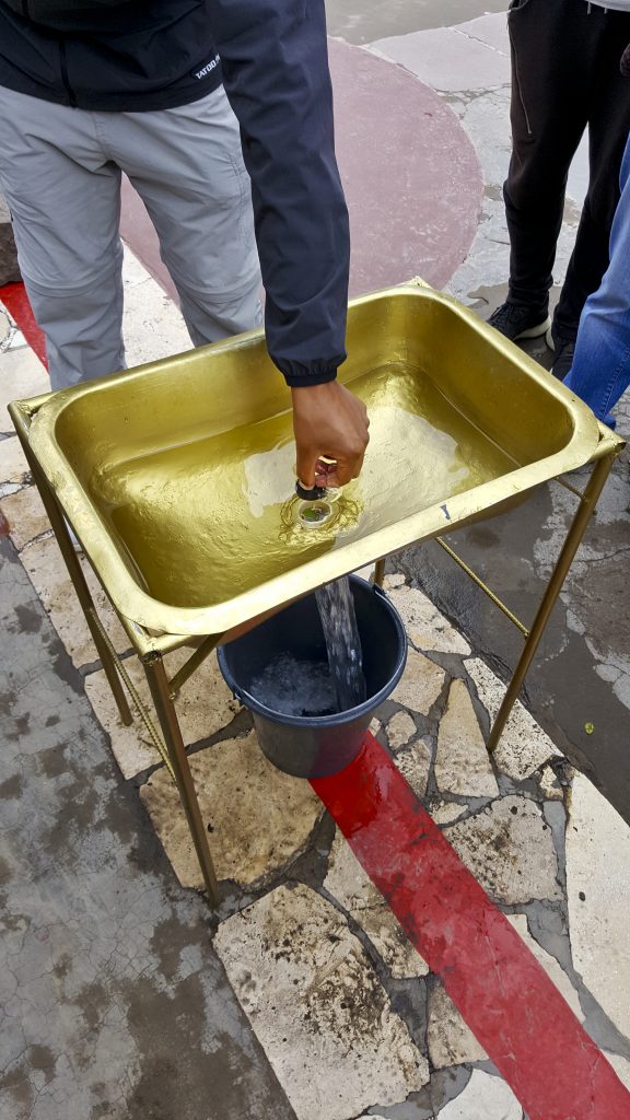
A demonstration was included to physically show us the Coriolis Effect on a water drain. I’m not sure how accurate this experience was, but it was fun to watch in any case. Supposedly, in this drain, the water drains straight with no spin, because it’s directly on the equator.
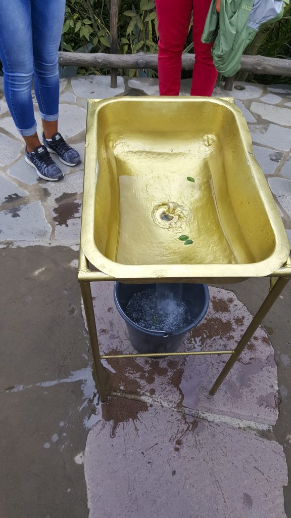
And this drain spins one direction, south of the equator … a similar tub spins the opposite direction on the other side of the line. Unfortunately, the science behind this isn’t there, but again, makes for a good story.
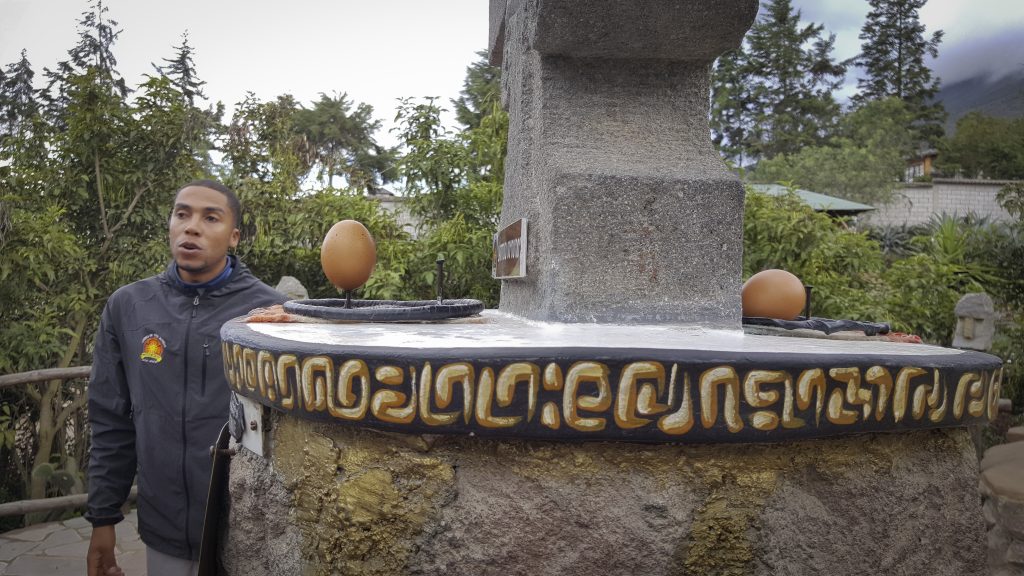
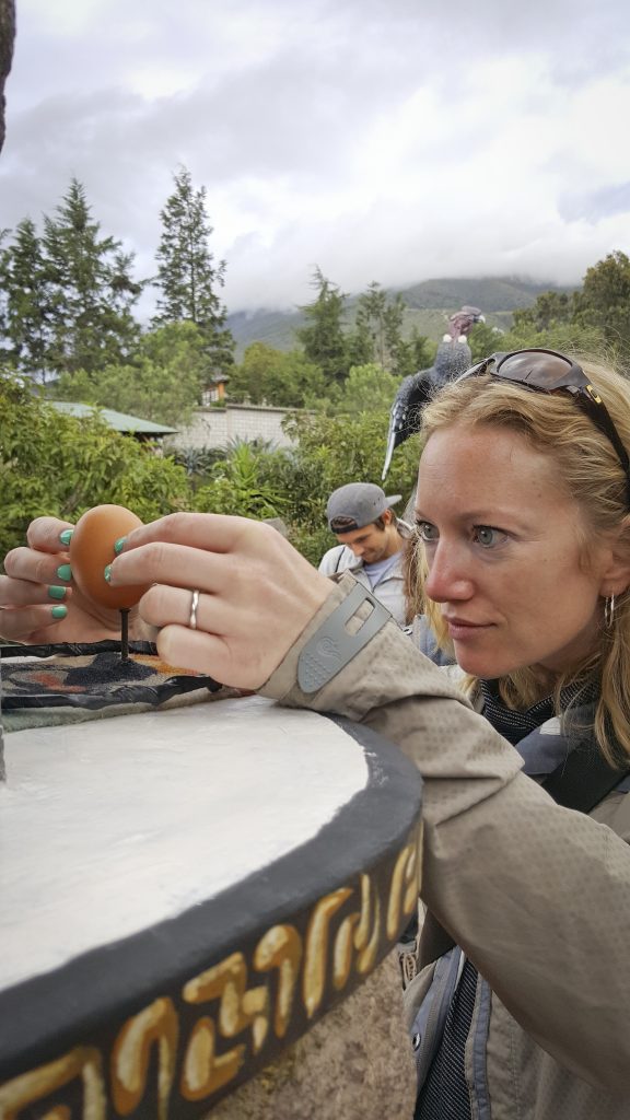
Another superstition exemplified for us was an “eternal” equinox. You’ve probably done or heard of standing an egg on its end, which is only possible during equinox when the world is “vertical.” The idea here was that since we’re on the equator, we would be “vertical” all the time and the only place where you can stand an egg on its end all the time. While this was a fun exercise, it’s not scientifically accurate and it’s possible anytime, anywhere.
Nevertheless, we had fun trying. Anna was one of the few to succeed in balancing the egg.
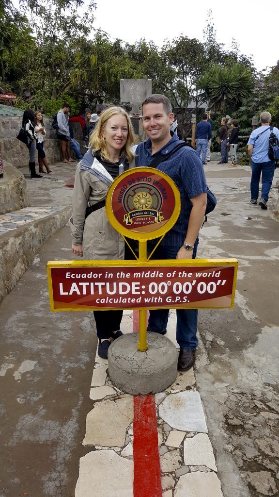
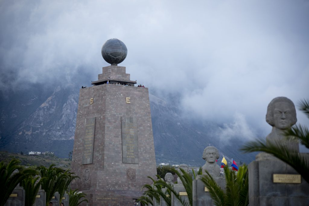
Here is the official monument to the equator, however, the argument is that it was incorrectly surveyed and consequently several hundred meters off the actual equator (where the previous images were made).
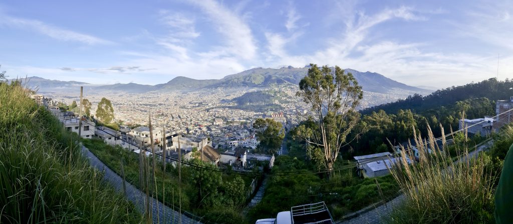
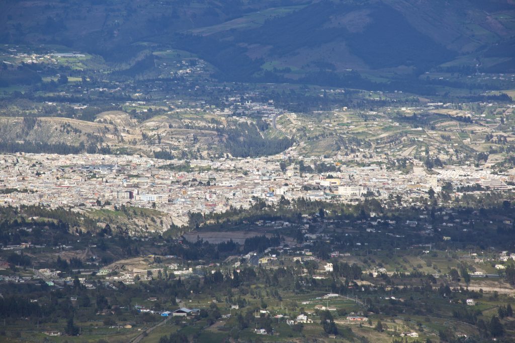
A panorama of Quito, ringed by mountains.
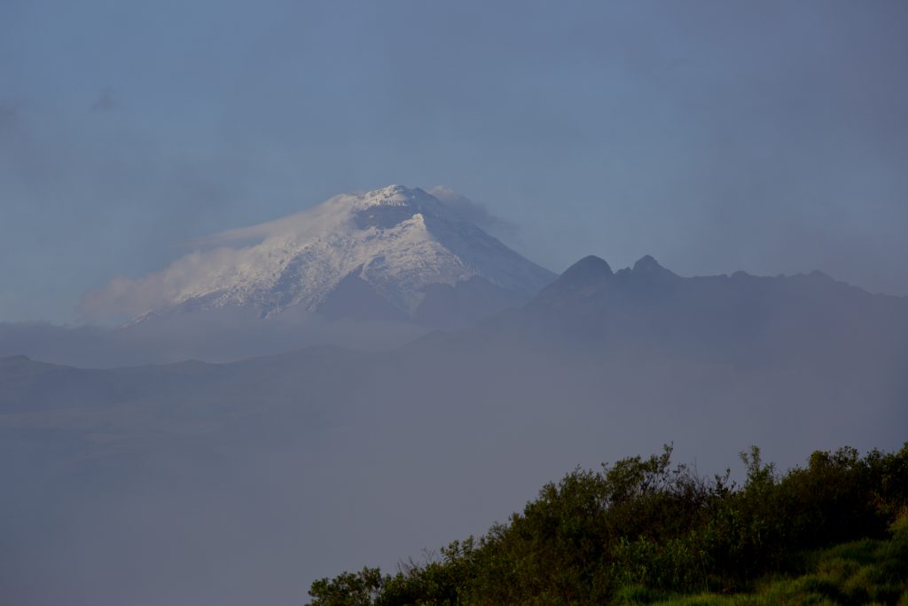
Cotopaxi is an active stratovolcano, the second highest summit in Ecuador reaching a height of 5,897 m (19,347 ft) and one of the highest volcanoes in the world. Although we didn’t have the opportunity to climb it, it was very majestic.
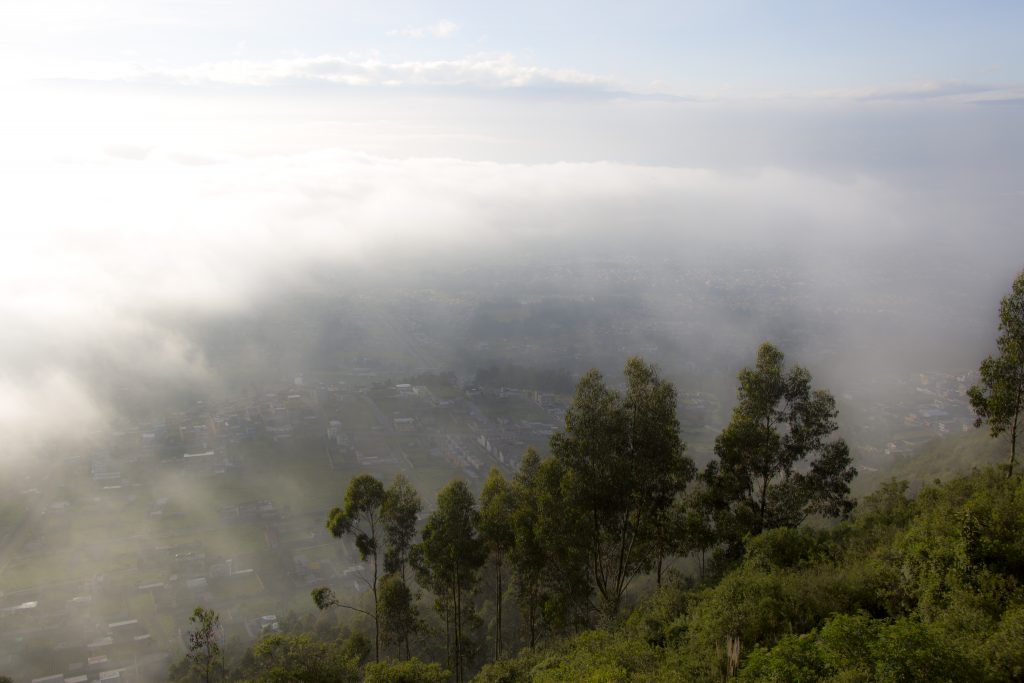
The sun burning off the morning mist over Quito.
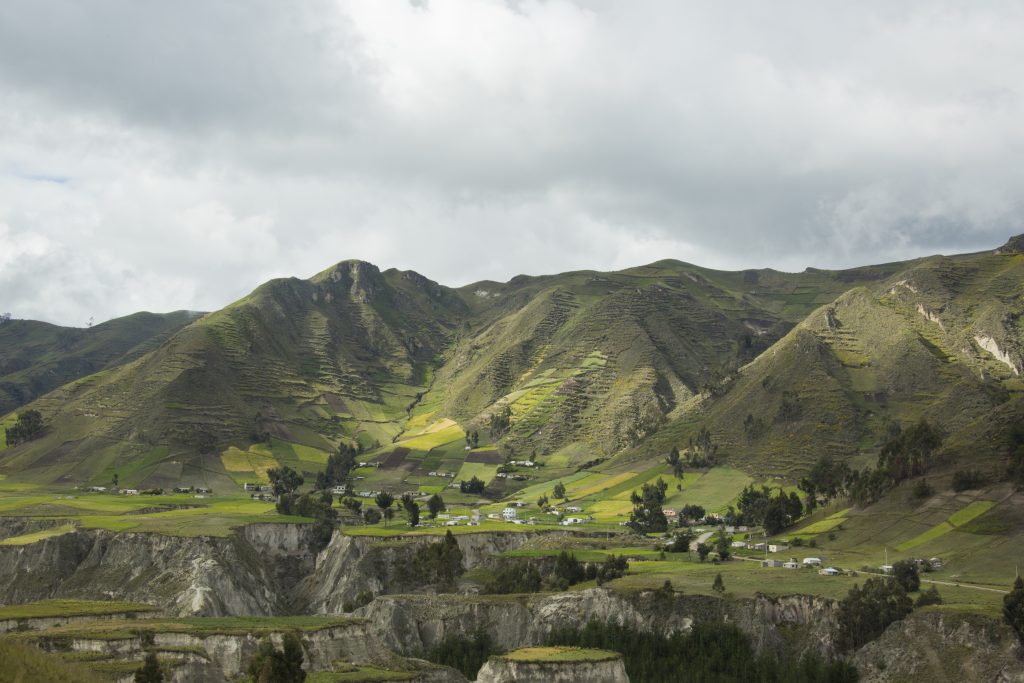
We decided to use another company for our next tour … heading out to Quilotoa. This company was also very good and we highly recommend them as well. http://www.carpedm.ca/quilotoa-1- day/
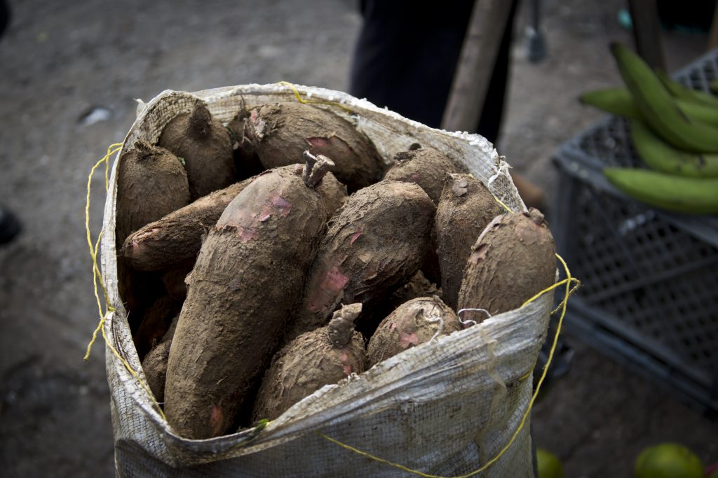
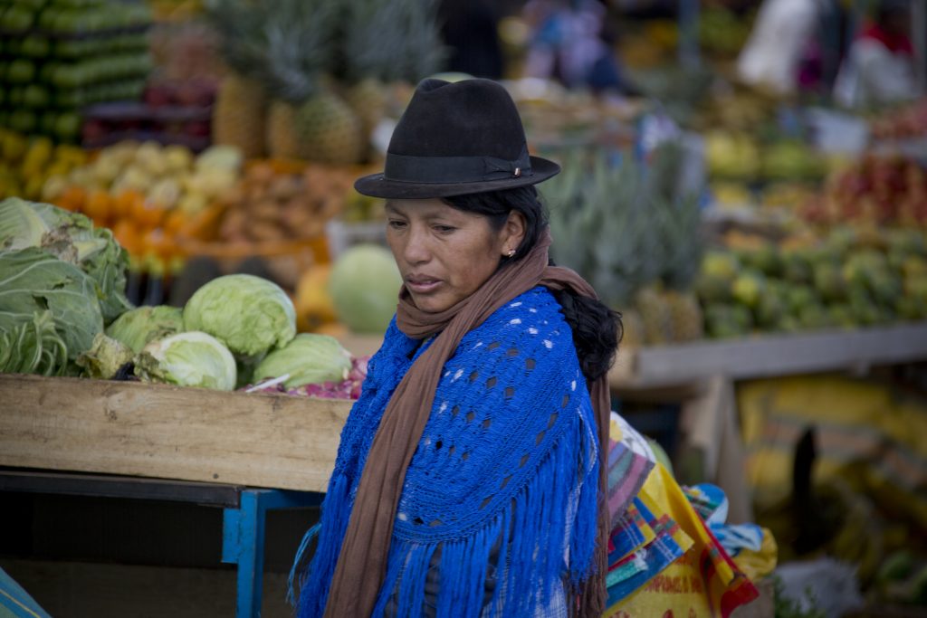
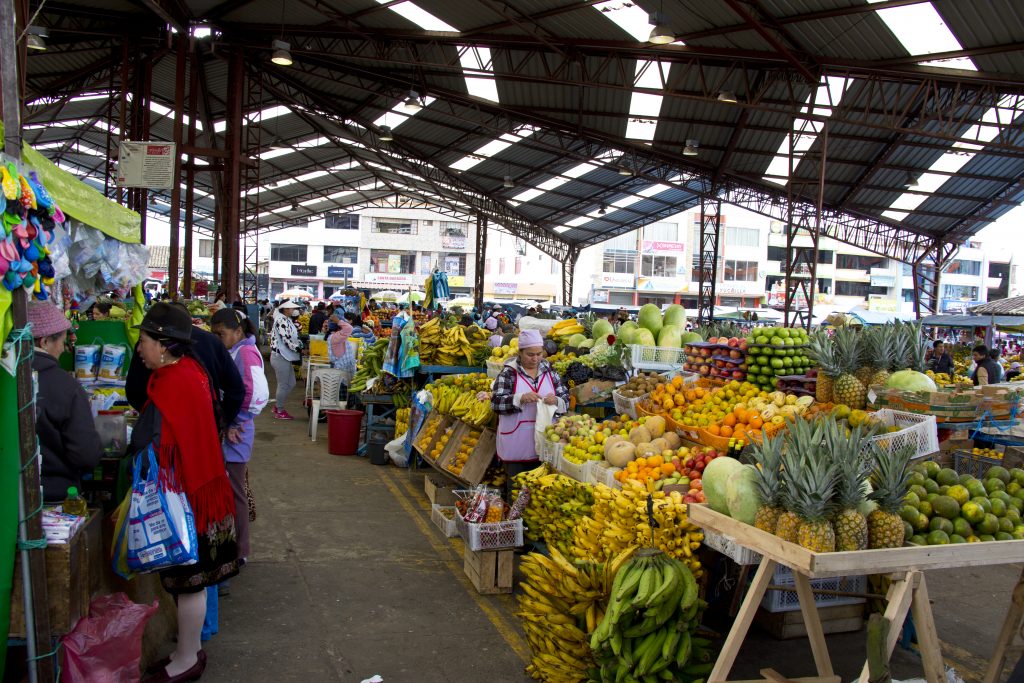
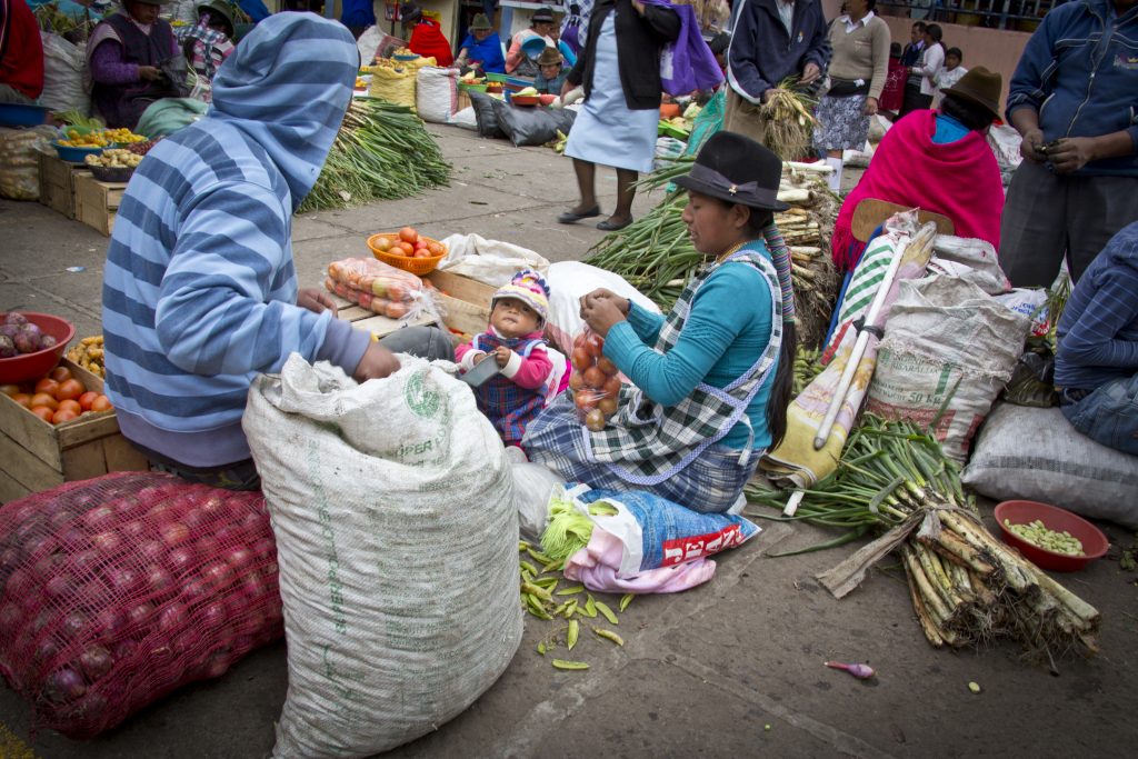
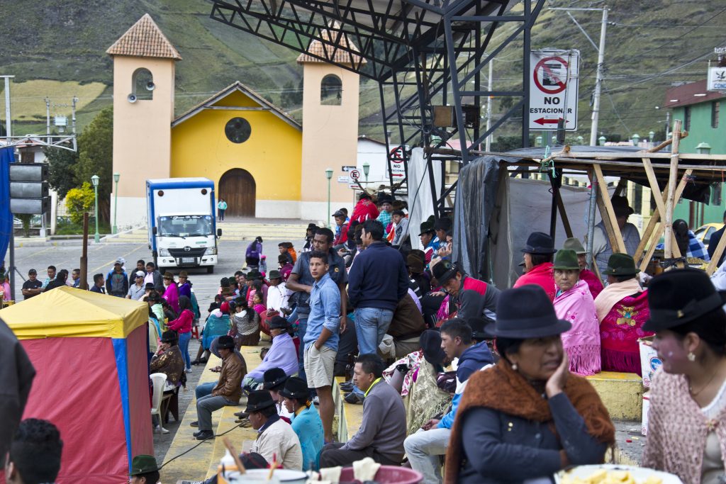
As we went on a Sunday, the market in Pujili was in full force.
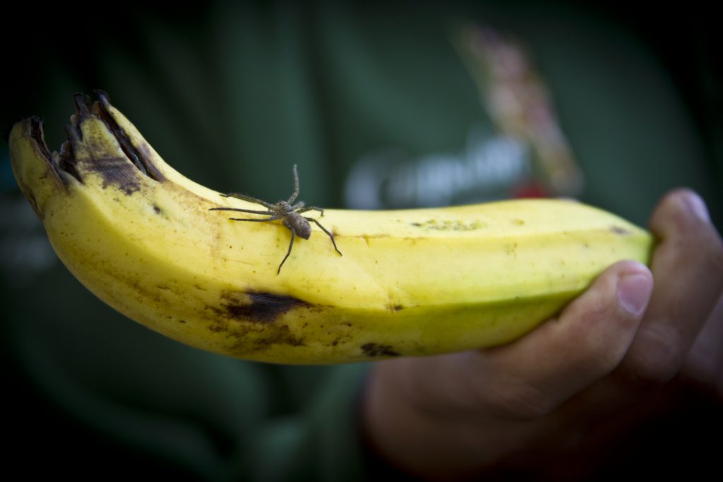
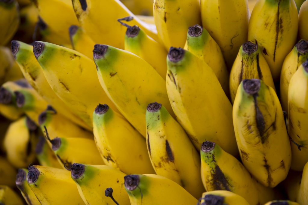
Bananas come with a free rider.
The market was very typical and fortunately for us, very few tourists. We had fun exploring.
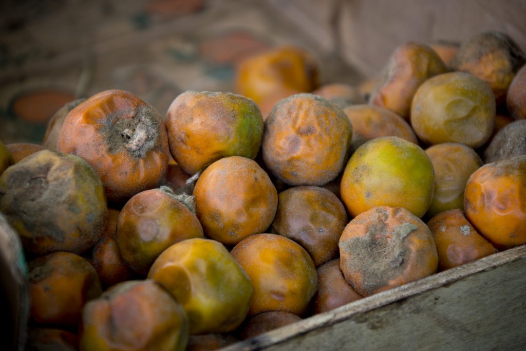
Not the prettiest, but very tasty.
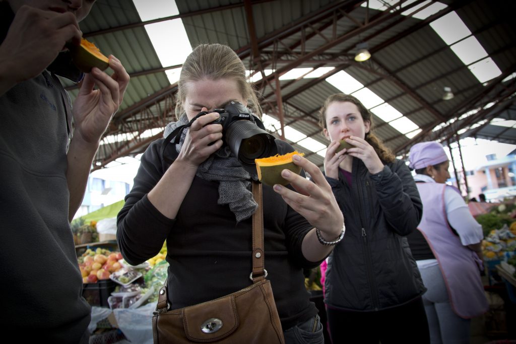
Some of our traveling partners … including a macro of the fruit.
My macro.
Yum.
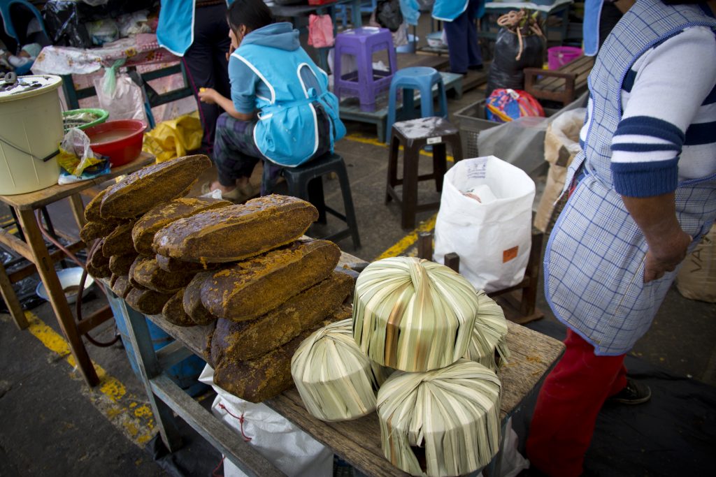
Although it looks more like a bread, it’s actually a sugar/molasses-based hard candy that is wrapped in grass (on the right). I’m afraid I’ve forgotten its real name. I bought several (much smaller) packets and they were a tasty burst of energy while hiking later. Plus, it’s about as green as you can get for packaging.
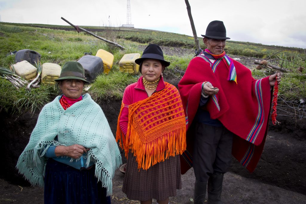
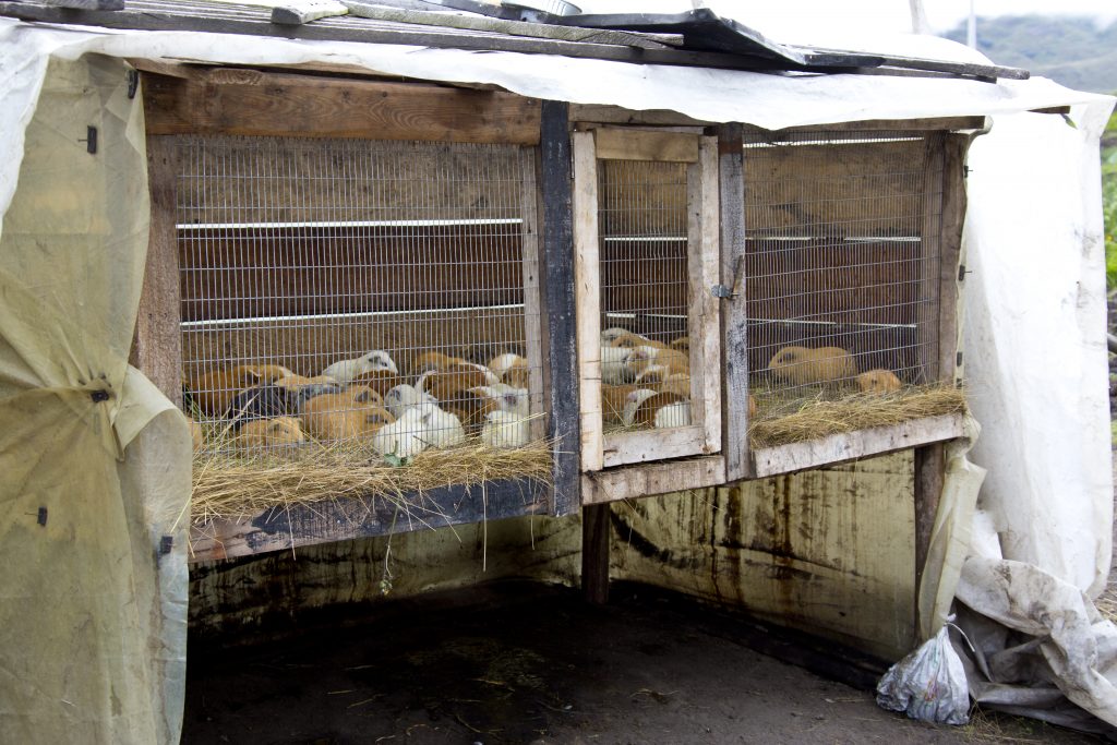
Our little group also stopped at this family’s house/farm. The grandparents have lived here for over 25 years and the rest of the family has come to visit on Sunday.
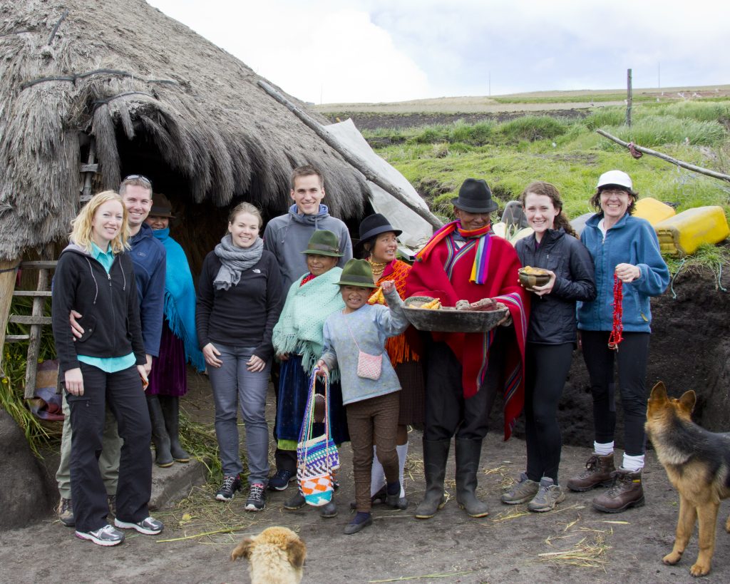
In addition to farming a few crops (and of course hosting tourists), the family makes money raising Guinea Pigs for their meat. This family had over 200 running around and in the cage. In addition to being cute, the animals are also quite tasty. I tried them a couple times while in Ecuador. Anna was slightly less enthused.
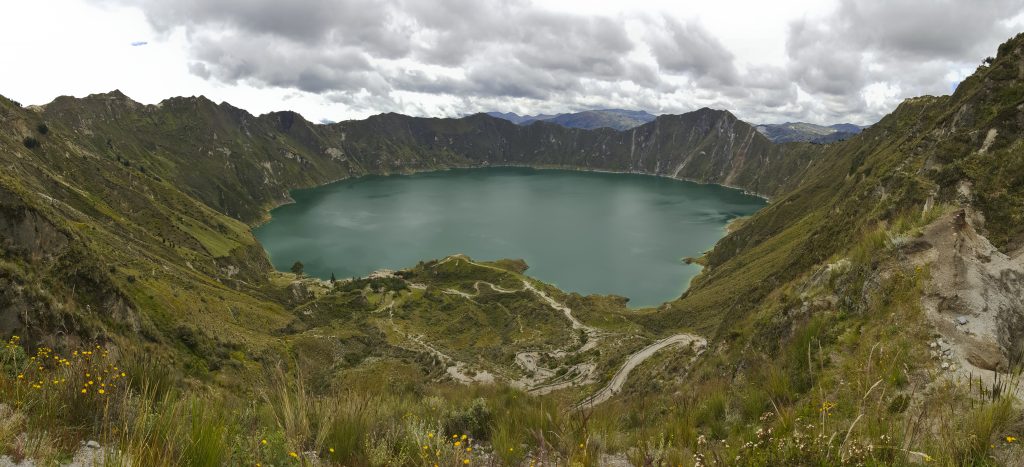
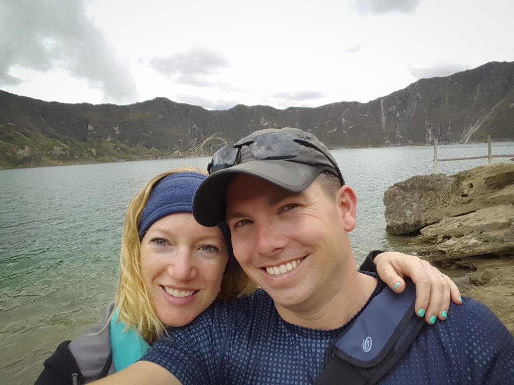
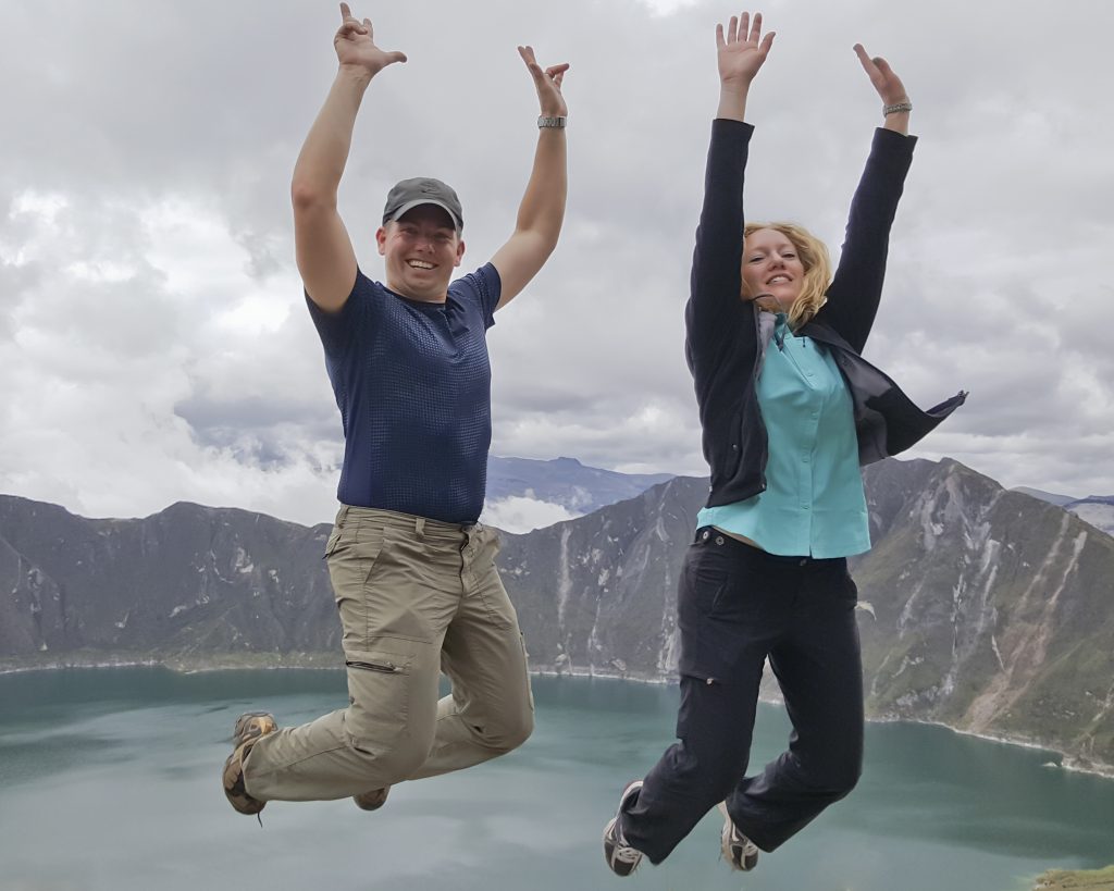
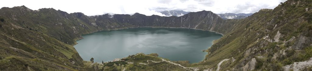
After what seemed like forever, we finally made it to Quilotoa. It’s up at 3,800 meters (12,500 ft), so it was a bit brisk, but gorgeous emerald caldera that is about 3 km across (~2 mi).
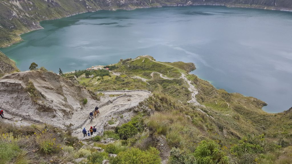
There was also an option to ride to/from the lake on a donkey. We choose human power.
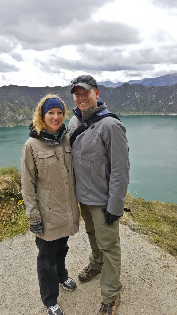
Finally made it to the lake, but were told if we went swimming not to dive deep as the water is acidic/poison not too far below the surface.
After an exhilarating hike and tasty lunch, we hopped back in the van for a return journey to Quito.
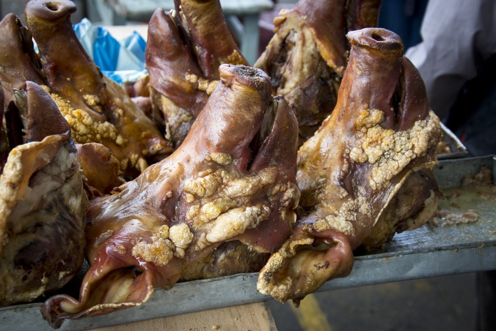
This is physically a meat market … intended to allow people to shop for potential spouses.
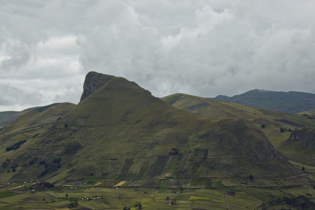
The “Gorilla Mountain.” Can you see it?
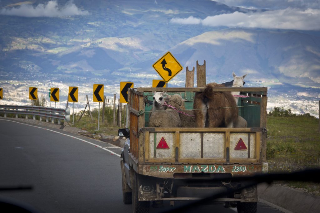
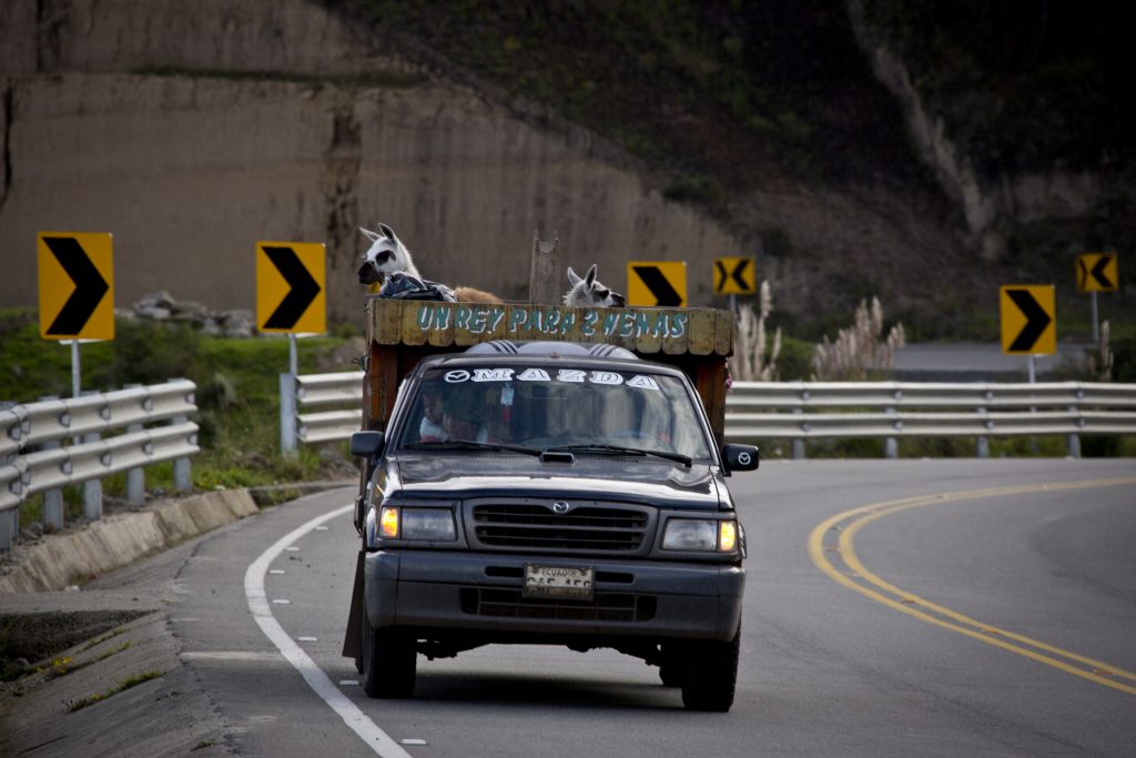
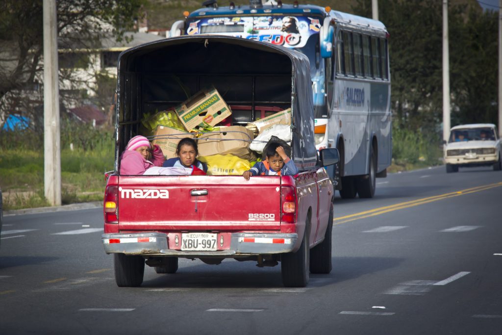
The journey wasn’t quite as comfortable for these guys.
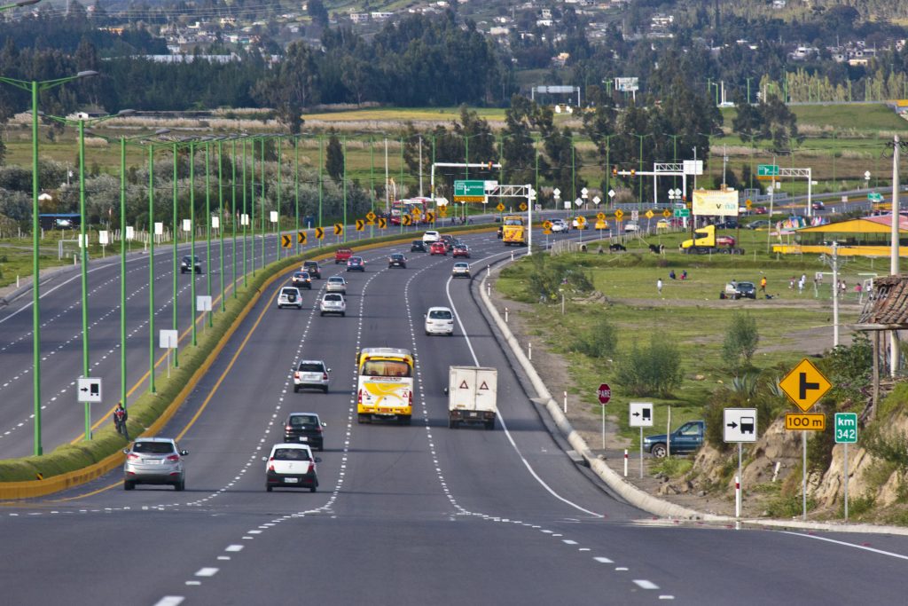
This is the Pan-American Highway that totals 30,000 km (~19,000 miles) and as the name indicates, runs the length of North and South America. As you can see, this stretch in Ecuador is in very good condition.
Well, that covers the beginning of our adventure in Ecuador. Next up, we fly out to the Galapagos Islands for an 8-day cruise around the islands and some AMAZING wildlife.
Until then…
–Jim