As you can tell from this post, I have come home from Iraq. It was a great (albeit challenging) experience. If you’re interested, the previous three posts have a few details.
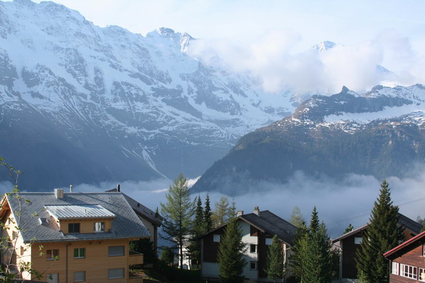
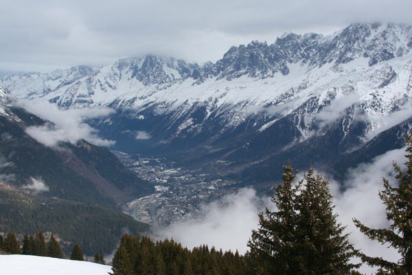
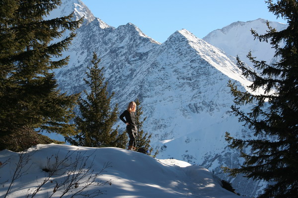
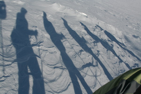
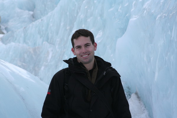
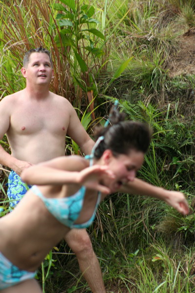
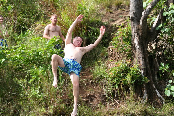
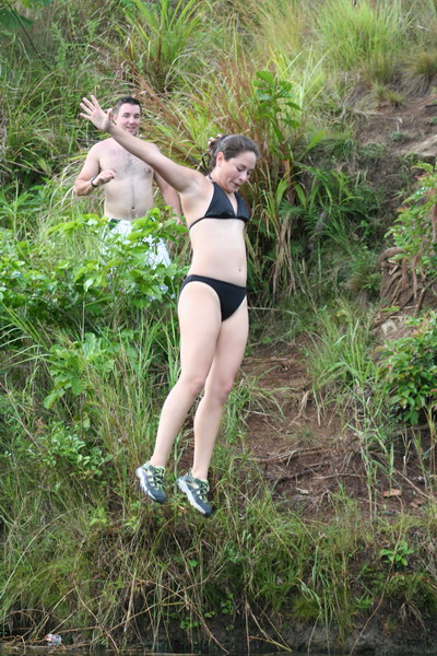
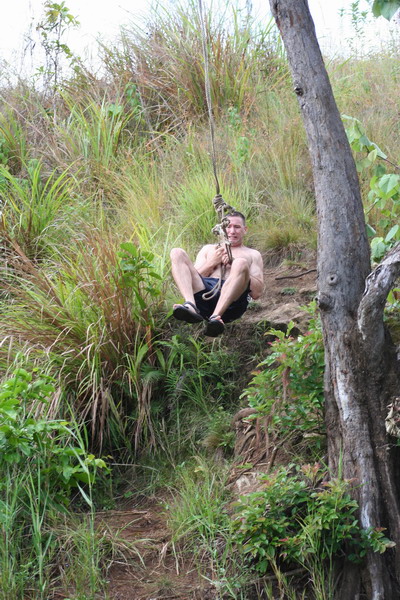
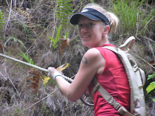
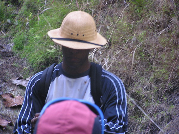
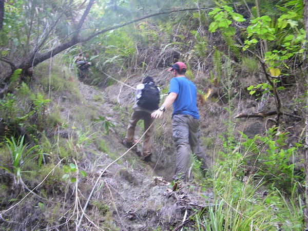
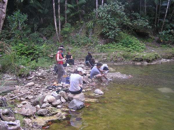
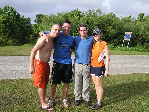
However, one of the first orders of business was to go out into the incredibly green forest (especially to color deprived eyes). The first day was on this hike from Trier across the border into Luxembourg, and the second was an almost 60 mile (100km) bike ride. But, since I only have a few pictures of the hike, this will be a short one. We ventured out into the wilds of Germany with our good friend Ken (who you may recall from our Budapest trip earlier this year).
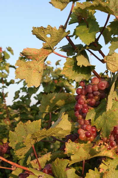
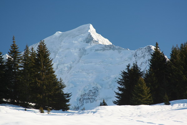
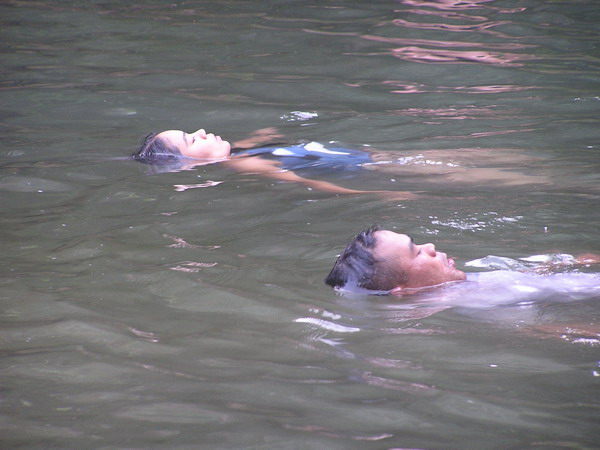
Now on to the hike: since we hiked along side of (or at least in sight of) the Mosel River for a long way, there were plenty of late season grapes (very sweet).
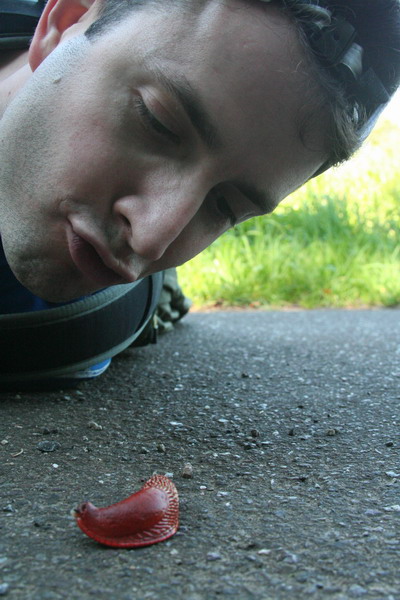
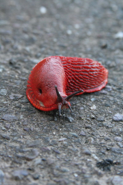
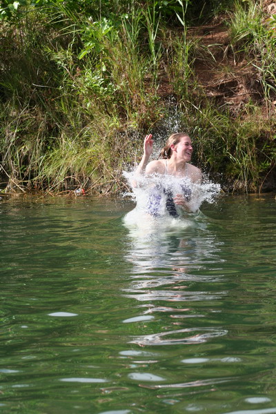
We also happened across this interesting fellow (I mean the slug, not Ken…).
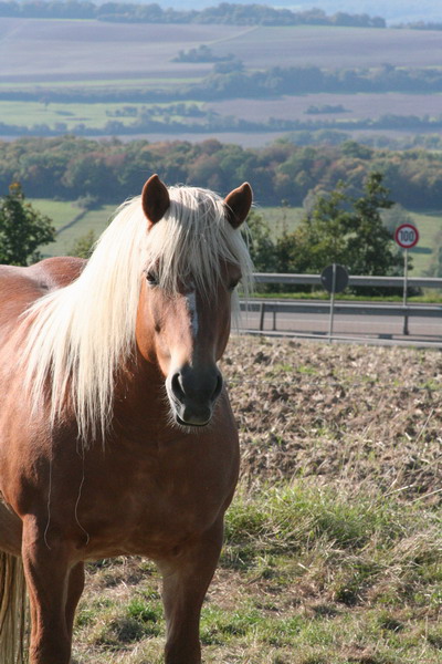
Conveniently, Ken had brought some carrots which made a perfect snack for our new friends.
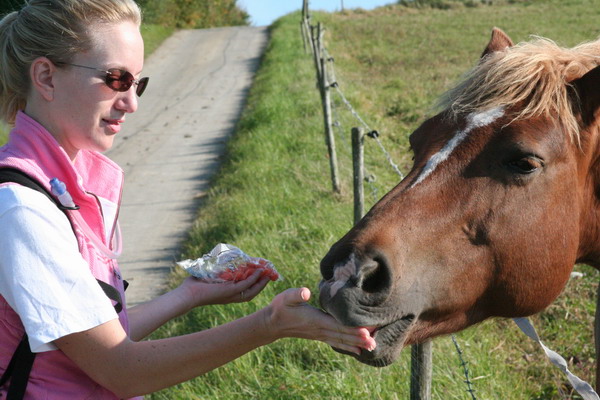
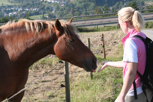
In fact, they were even posing for Ken’s pictures. She really liked the wind.
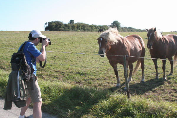
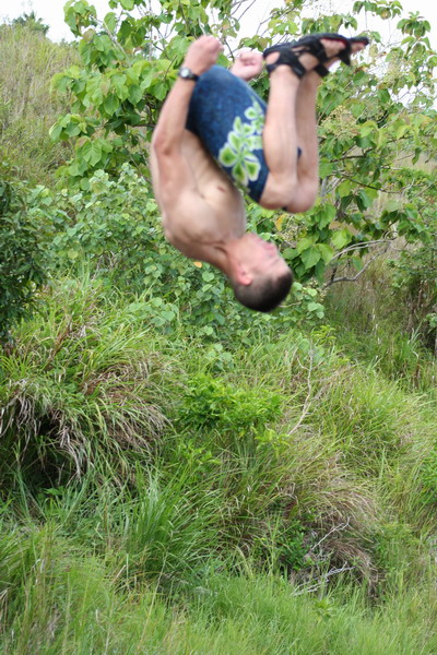
Ken got very creative with his images and posted a montage on One True Media. If you’d like to see the slideshow, make sure your speakers are turned on and follow this link:
international hike
So, that concludes our hike across the border. The next post will detail our first “real” trip together again. We just visited the stunningly romantic city of Venice. So, until then.
–Jim
Category: Hikes
Switzerland Part 2 — Mürren
After our adventures in the Interlaken Valley, we moved our base camp further up the mountain to the village of Mürren.
This magnificent little village is only accessible by hiking trail and train. Since we had a bit of luggage (including the computer I’m typing on), we opted for the easier, but still picturesque train.
The period after Easter until mid-May is in between the winter and summer seasons. So, most shops (and people) are closed/gone on holiday. Fortunately, in early May, some places are opened back up. Such was the case for the B&B where we stayed. The owner of this lovely place, Denise, opened a day early. It was the perfect location and if you decide to trek to Mürren, we highly recommend the Chalet Fontana.
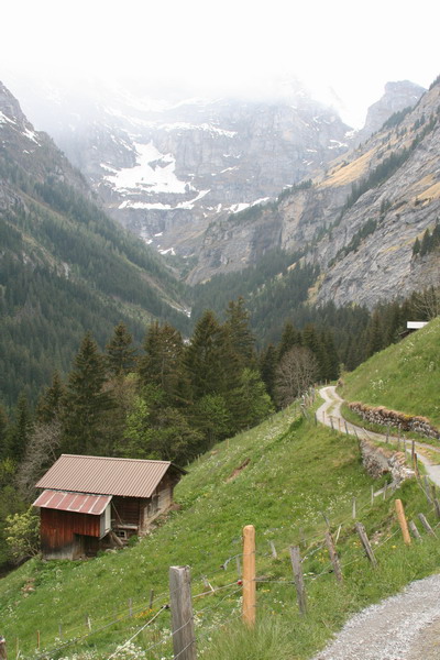
Since there are no cars in the town (except a couple work trucks that seemed to be everywhere at once!), hiking was the plan for our time there.
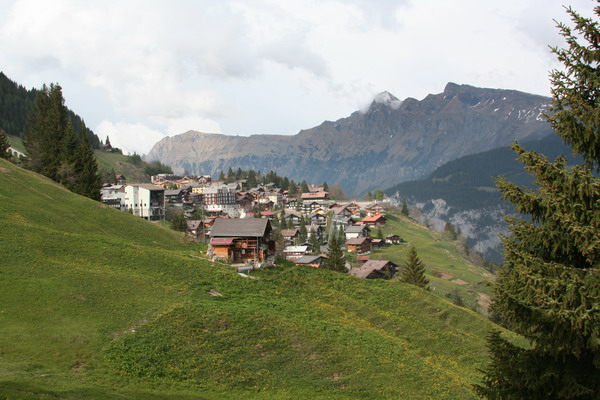
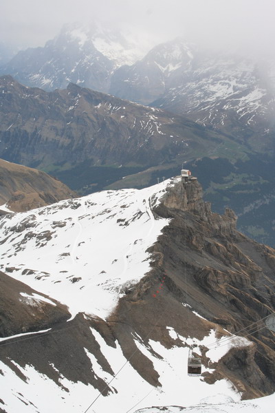
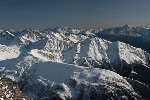
Mürren is on the east side of the Lauterbrunnen Valley and offers a great view of the Eiger, Mönch and Jungfrau mountains on the other side of the valley. Although this is a resort town, we virtually had the place to ourselves. The hiking trails were very easy to navigate and gave views that are second to none. As you can see here, at 1,650 meters (or 5,400 feet), it is often already above the clouds.
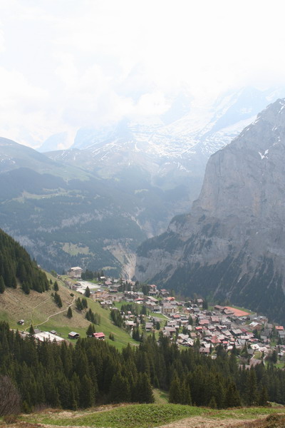
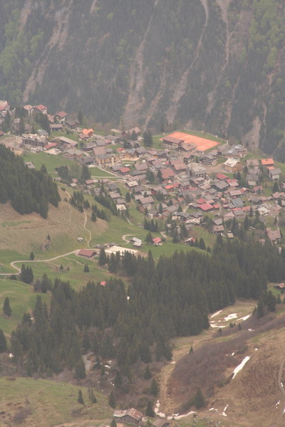
Here’s a perspective of Mürren as we emerged from the trees.
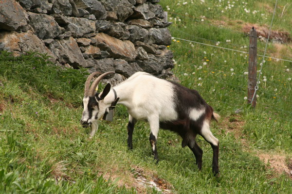
Unfortunately, there wasn’t an abundance of wild fauna, but there were quite a few domestic and relatively tame ones for our viewing pleasure.
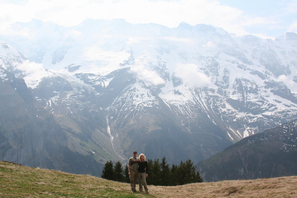
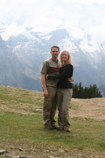
Here we are on another hike. This is one of those times I wished I brought a tri-pod with (or that there were other people on the trail). So, I used a small pile of rocks instead. Anna makes a nice blond pine tree, don’t you think?
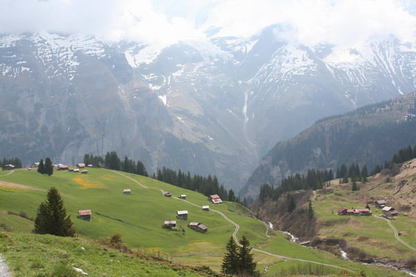
Here’s the view back down to Mürren.
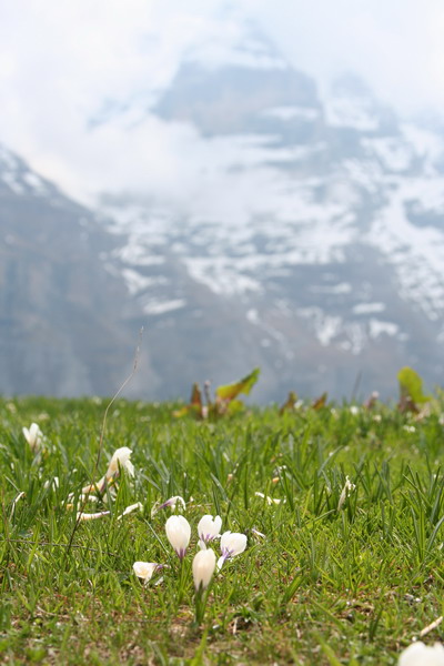
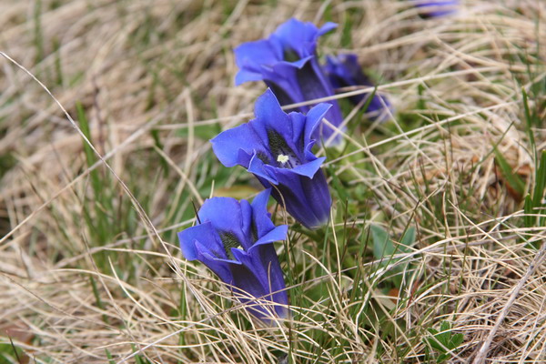
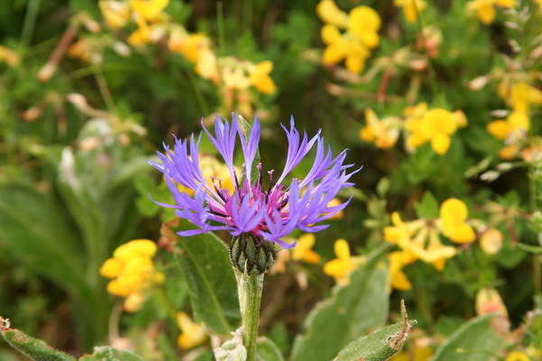
The mountain wild flowers were very pretty too.
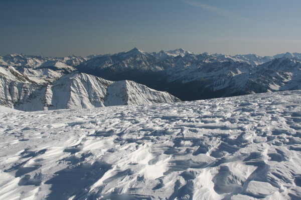
The plan for this hike was to go all the way up to the gondola station, Birg (2,677 meters or 8,800 feet), then ride that up to the peak of the Schilthorn (2,970 meters or 9,750 feet).
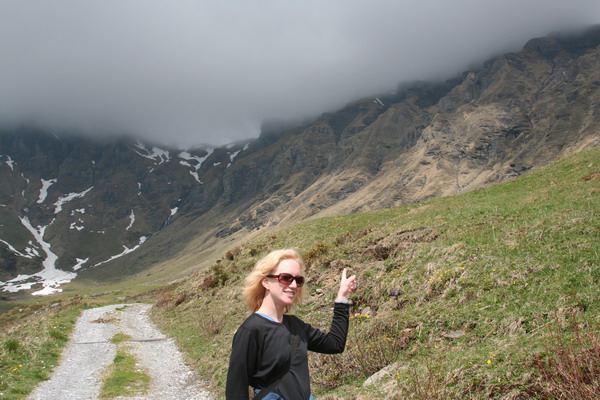
However, for those who have accompanied us on hikes in other locations you know that I can be a little zealous in my hiking goals… This time though, Anna talked some sense into me. The clouds covered Birg and she said she saw lightning. While I didn’t see the lightning myself, I trusted her judgment and reluctantly acquiesced, so we headed back down the mountain.
Anna wanted this picture as proof that it was indeed bad weather…
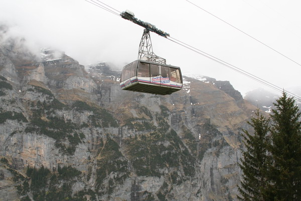
The next day, it had cleared up sufficiently to actually see Birg and the Schilthorn Peak. Instead of retracing our hike to re-attempt the peak, we opted for the easier gondola. Again, since it was early season, the ticket prices were reduced (although still expensive).
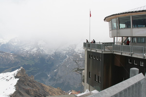
On the peak there is a revolving restaurant called the Piz Gloria. It was completed in 1968 and it’s claim to fame is that before it opened to the public, it was used in the James Bond film, “On Her Majesty’s Secret Service” in 1969. For those who have actually seen the film (neither Anna nor I have), it was the one where George Lazenby played 007 (after Sean Connery and before Roger Moore). The view, although partly obscured by the haze and clouds was still beautiful.
Here is the view looking back down at Birg. You can see there was a bit of snow on the trail. As it has been in Germany, this spring has been exceptionally warm. Denise told us she skied down from here just two weeks before. Now, there’s hardly any snow left. Perhaps next time we come back, we’ll come to ski (and hike).
Yet another view of Mürren. I couldn’t help myself, it was just too cute.
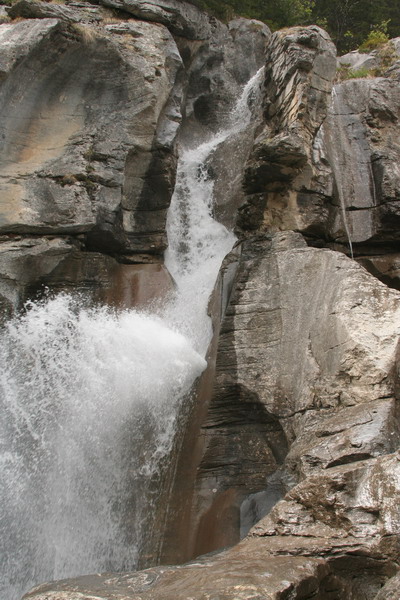
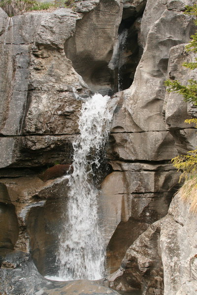
Here are a few images from yet another hike. This time down past the smaller (even more remote) village of Gimmelwald. It has been saved from further development by its designation as inside an avalanche zone.
There were pretty wild flowers here too.
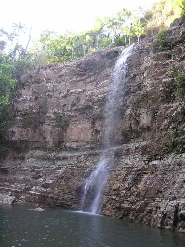
This waterfall was Anna’s favorite.
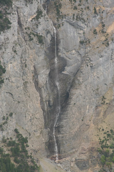
Trümmelbach Falls was my favorite, but this one was my second favorite.
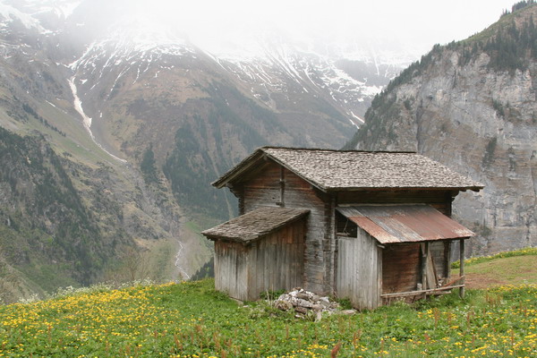
Swiss architecture all over the country was beautiful, but in the mountains, the combination of synthetic and natural was amazing.
The next morning, we packed up our bags and headed back down on the train. We really enjoyed our time back in the mountains. It was hard to leave, but we are excited that the Alps are only a (relatively) short car-ride away.
Up next is a bit of relaxation in the bath town of Baden-Baden on the edge of the German Black Forest.
–Jim
Chamonix Mont Blanc — Top of Europe
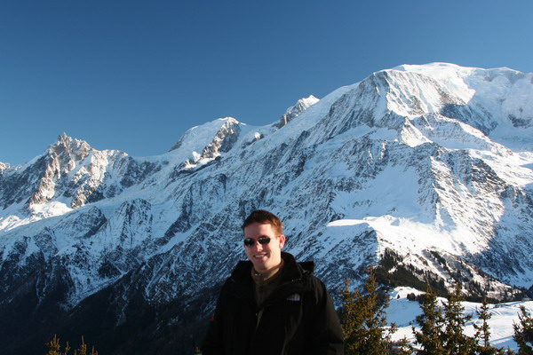
Well, we just got back from one of the best trips we’ve taken. The French Alps are truly spectacular. We went to Chamonix Mont Blanc to spend the weekend skiing and playing in the snow.
We went skiing the first day. Unfortunately the weather across Europe has been very warm, so the snow wasn’t the best. Nonetheless, it was great to be back on the slopes.
The next day, the sun came out and it was a beautiful (and warm) day.
We loved snowshoeing on the mid mountain (around 1800m)…
The sun lit up the mountains real nice…
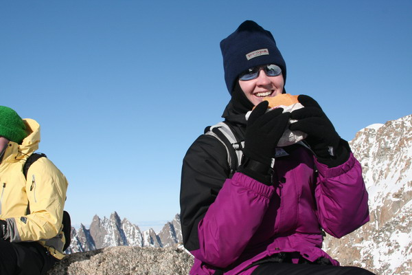
That night, we wandered around the town of Chamonix. Yes, that is hot iron she is using.
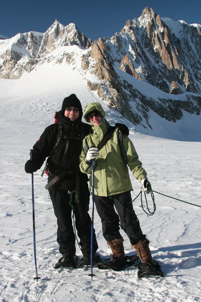
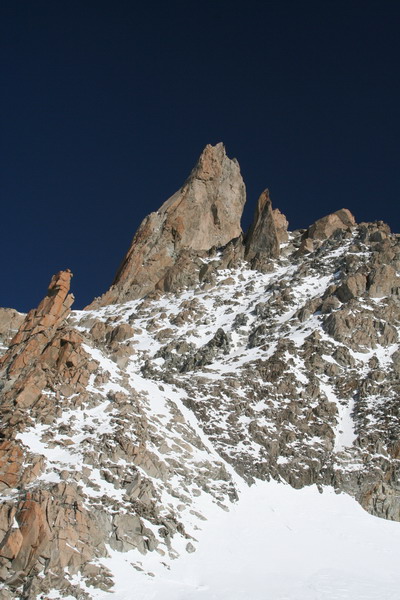
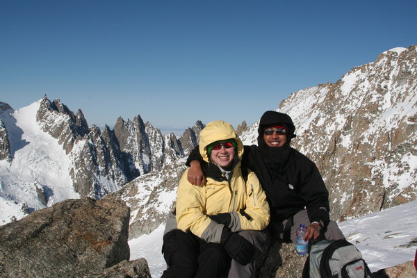
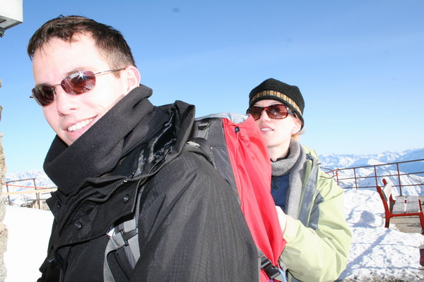
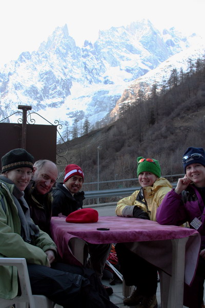
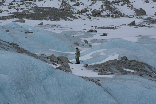
Next day, we decided that snow shoeing was so much fun that we hired a guide to lead us across one of the high mountain glaciers. To get there though, we had to pass underneath the mountain and into Italy. Along with 3 of our friends and our guide we hopped on a gondola and took the easy way up the mountain to about 3,500 meters (11,500 ft).
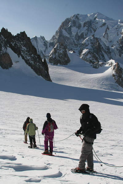
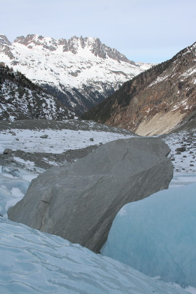
Here are a few of the views from our trip across the glacier.
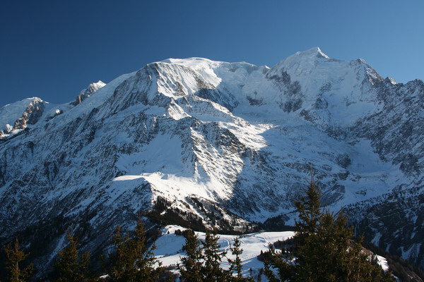
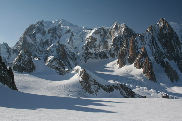
This is my favorite view of Mont Blanc.
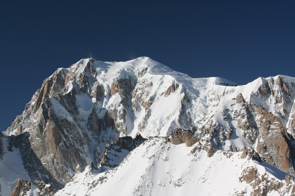
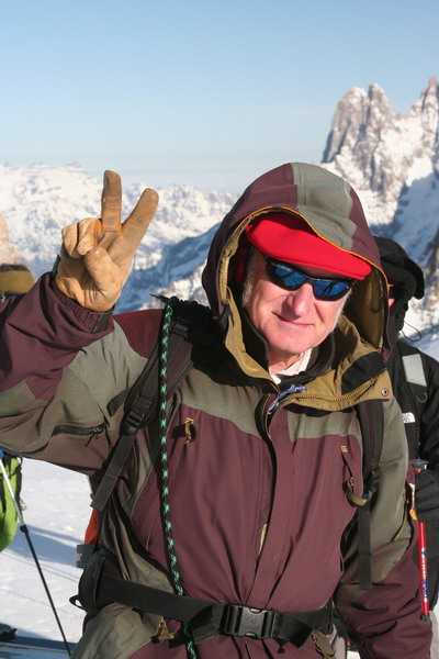
This is our fearless guide, Patrice. He has been guiding people on Mont Blanc for 36 years. Although he prefers rock climbing, he has made the ascent to the Mont Blanc massif more than 25 times. This is the mountain that began the modern age of mountaineering.
Here are three random facts about Mont Blanc thanks to Wikipedia:
– It was first ascended in 1786 by Jacques Balmat and Dr. Michel
Paccard
– Nearly 20,000 people ascend to the summit each year, even though
it is a technical ascent and requires a fair about of skill to
successfully reach the peak.
– Future President Theodore Roosevelt led an expedition and
reached the peak on his honeymoon in 1886.
Although it was fairly safe to cross the glacier, we were crossing the valley on top of nearly 200 meters of ice and 2-3 meters of snow.
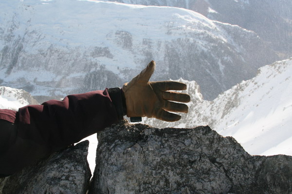
The far ridge of the mountain is the border between France and Italy. So, Patrice’s hand is in both countries.
We stopped at the base of this peak for lunch.
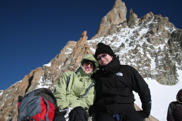
Here is Melissa enjoying her lunch.
Ravi and Katie made a very cute mountain couple.
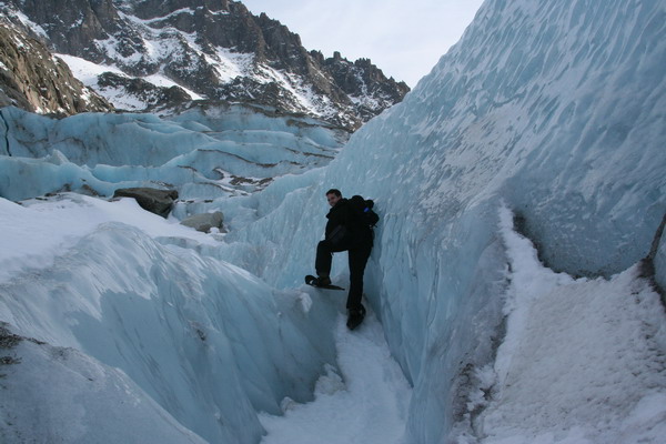
Here we are trekking back across the glacier.
This is the “after” picture as we packed the gear up to head back down.
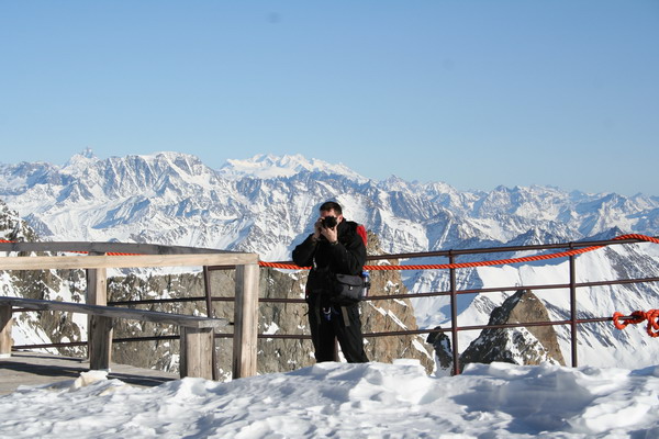
Katie caught me doing my thing… 🙂
Back down at the bottom, we felt compelled to pop into the Italian diner. Some of us had espresso, but for us non-coffee drinkers, it was incredibly thick hot chocolate. Actually, it is the only hot chocolate that I’ve added a packet of sugar to. Perhaps that’s because it was only semi-sweet chocolate or maybe it was just because I love sugar, who knows…
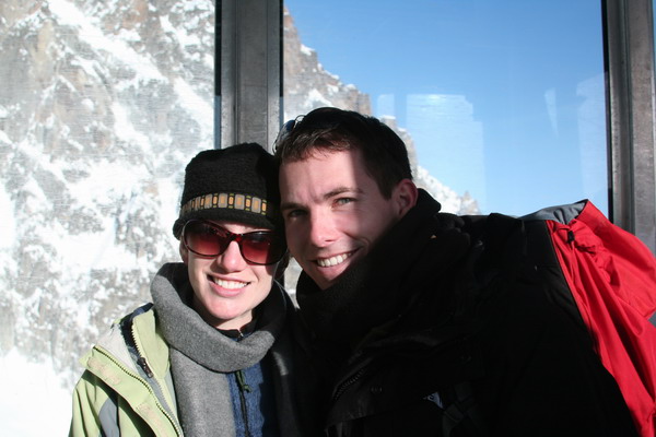
Anna and I really enjoyed climbing with all of them. It was a great way to get a taste of the high mountain. We plan to come back in the summer of 2008 to climb all the way to the top. Perhaps they will want to join us then.
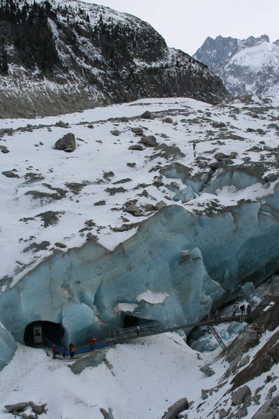
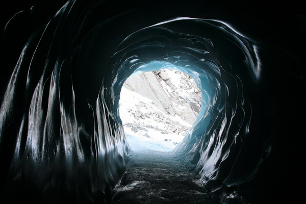
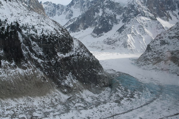
Our last day in Chamonix was spent on yet another glacier, Le Mer de Glace (or Sea of Ice). This time, there was only a little snow on the ice, so we could actually explore the ice. At the top of a cog railway (again at about 1,800 meters). Unfortunately, it was a bit touristy, but interesting nonetheless.
Here is the ice a little closer.
We explored the Ice Grotto. The ice is clear and absorbs all the red light which creates a brilliant blue hue.
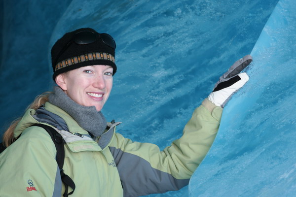
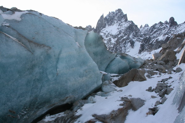
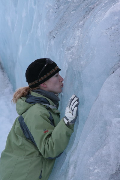
After we had our fill of the unique (albeit a little manufactured) ice grotto we headed out onto the ice. After what seemed like a long time, we reached another ice fall. Anna liked it so much, she gave it some love.
If you look closely, you can see little Anna hiking back over the glacier.
You can see how Le Mer de Glace slowly flows down from the heights of Mont Blanc into the Chamonix valley.
It was an amazing 4 days. We loved being back in the mountains and all the spectacular activities that are available. We can’t wait to go back to explore more of the Alps.
–Jim
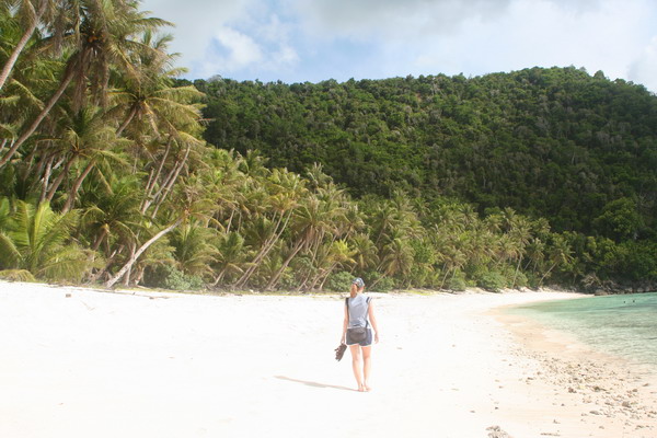
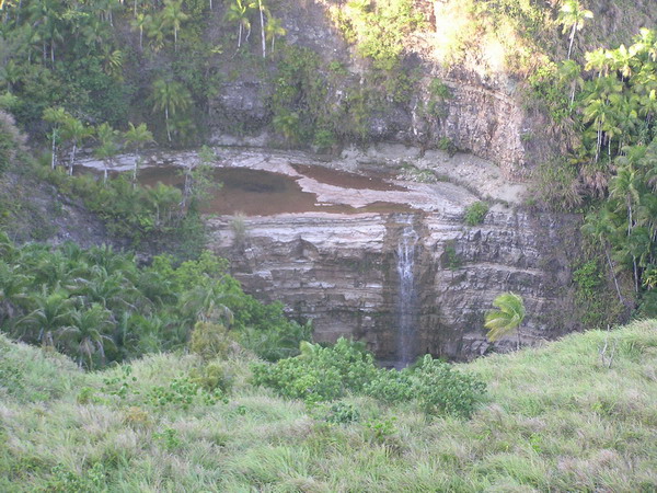
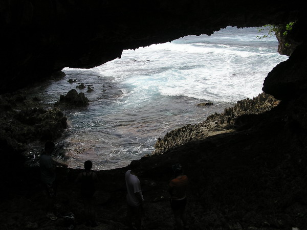
Pagat Cave and Cliff
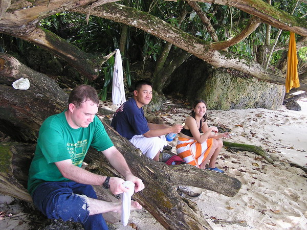
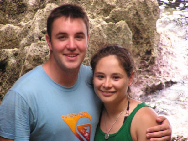
This afternoon, we had the pleasure of joining Dennis and Amanda for her first “real” hike on Guam. Amanda said she wanted to go on a hard hike. So … we decided on Pagat Cave and Cliff (which you may recall from a post last year).
In fact here she is now (she did really well, considering this was her first true foray into the jungles of Guam).
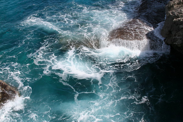
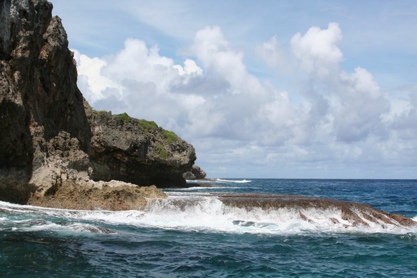
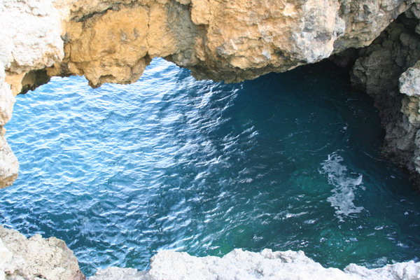
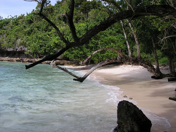
The hike meanders through the jungle for a while, past the cave and out to the ocean. We then headed north and made our way to the natural bridge. Once we arrived, the water had a little surge, but nothing too dangerous. Here’s what the area looks like.
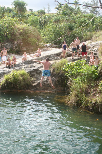
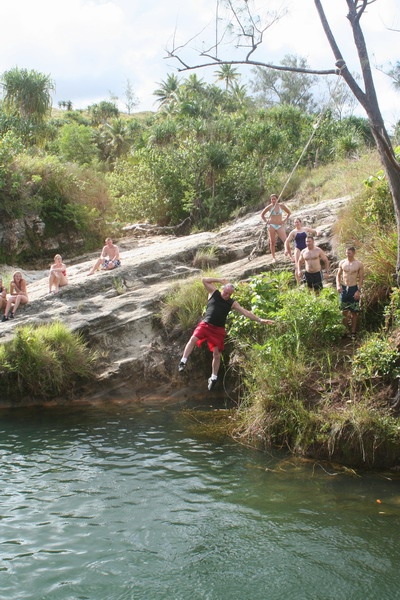
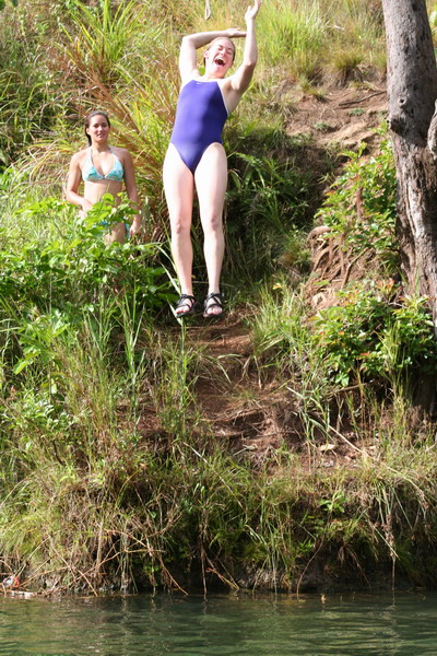
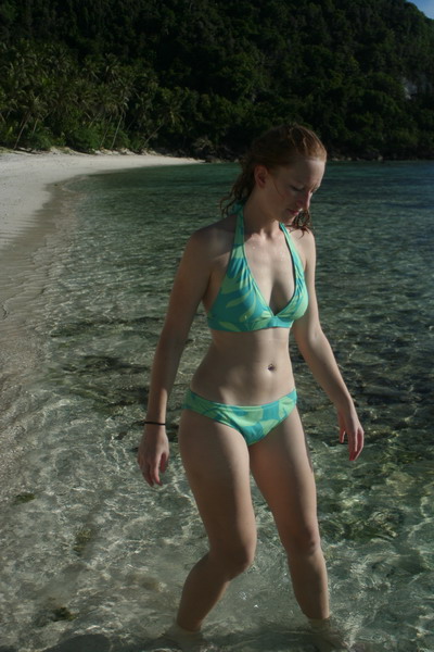
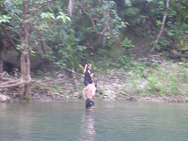
So, we decided to get in the water … off the cliff. 🙂 Don’t worry; there was a pretty easy (and safe) way to get out of the water. Just swim over to one of the ledges and wait for the water to raise you up, and then just step out. In fact, here’s Dennis doing just that.
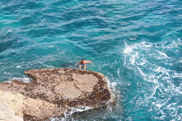
Last time, I took all my pictures from above looking down. This time, I decided to get down on that ledge and take some pictures. This is what the perspective is from down there.
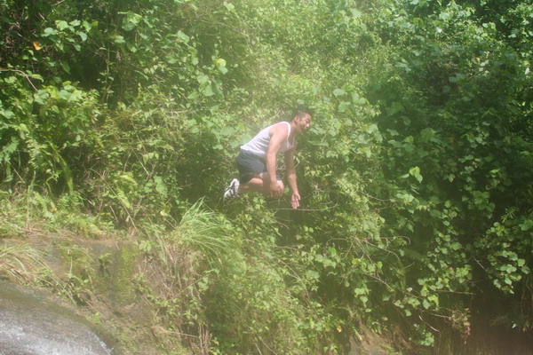
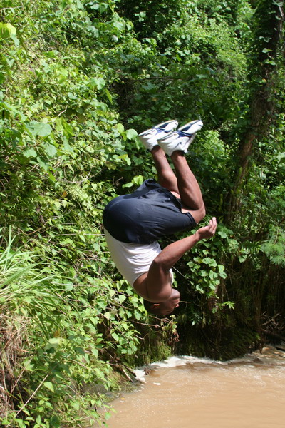
I caught Dennis in mid-leap, literally flying down toward the water.
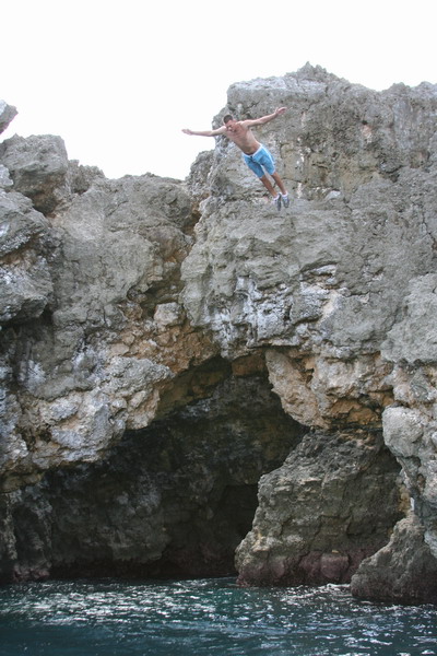
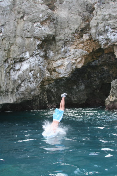
All four of us (including Anna, who hadn’t jumped off a cliff since a bad landing in Palau last year) felt the thrill of freefall. I always love the feeling of flying through the air. It’s just the landing that sometimes hurts. Fortunately, the water is very forgiving (to a point).
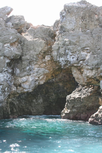
Here’s the other side of the bridge.
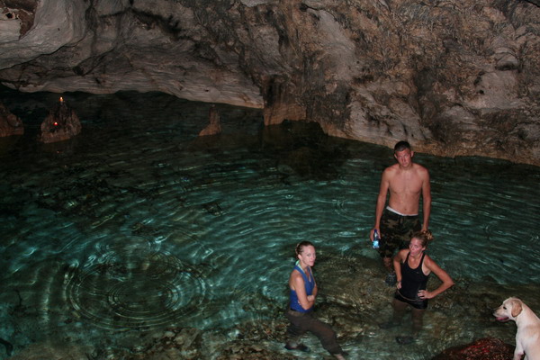
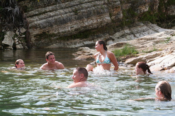
After the ocean, we needed some fresh water to rinse off in, so we went back up to the cave. When we got there, we found a couple candles burning, so we thought someone was already in the cave (and our entrance would be disturbing them), but the cave was empty. So, we light a bunch of candles ourselves so we could see without flashlights and cooled off the in very refreshing water of Pagat Cave. As you may recall, it was used as a water source for the ancient Chamorro village that is nearby. The water is a bit brackish (salty), but not too bad (don’t worry, I didn’t drink a lot).
This picture was the third one I had taken (after our eyes had adjusted to the light), so you can imagine how much the other three appreciated the flash (but the first two pictures didn’t turn out…). Sorry guys.
Although the flash ruins the lighting, you can still see how pretty the water is there.
Then, we have the required post hiking pictures (perhaps to prove that we have survived another hike…)
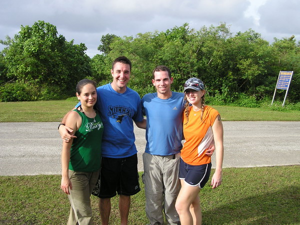
Here are our friends Dennis and Amanda (and Jake), who we hope will go hiking with us another day. 🙂
Amanda was kind enough to reciprocate the favor for Anna and me.
This is definitely one of our favorite hikes. It has a little of everything, jungle, cliffs, history, adventure and cool and refreshing cave pools. We highly recommend it.
So, until our next adventure…
–Jim
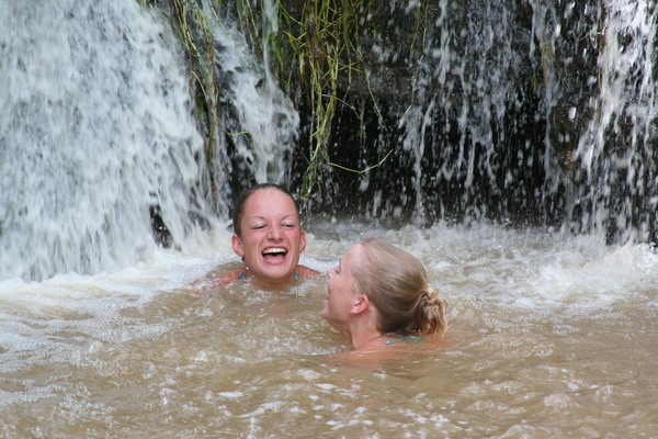
Waterfall Valley and Black Sand Beach … jump right in!
Today, Anna and I hiked out to two different destinations. The first, we had visited earlier this year with my parents and the second was a brand new hike (for us at least).
The impetus for the hikes today is that there is another group of six cadets from the Air Force Academy. They’re again visiting Guam to get an idea of what the “real” Air Force is all about. My part in that was to show them what the “real” Guam is all about.
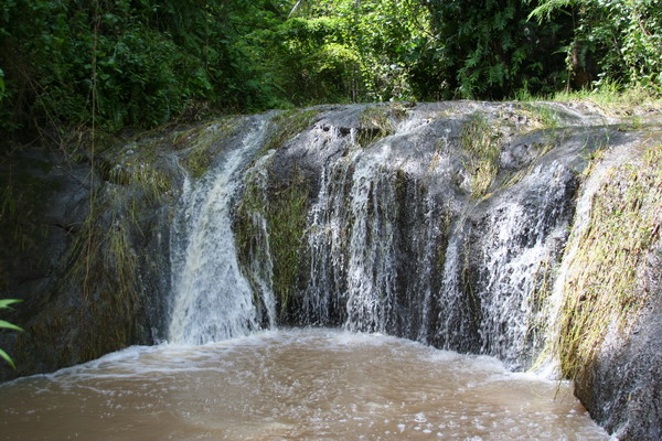
We started down south with a very pretty valley that contains 5 waterfalls very close to each other. However, we spent most of our time at the last two.
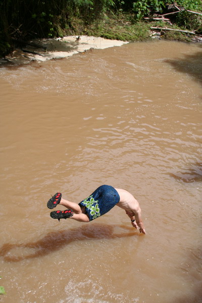
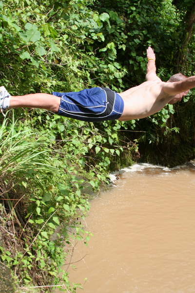
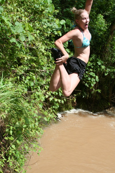
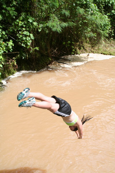
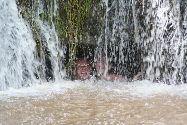
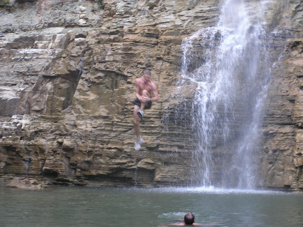
As you can see in these next few pictures, we decided to jump right in! Don’t worry, the water was plenty deep. Also, it’s brown because there has been so much rain lately.
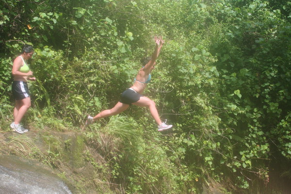
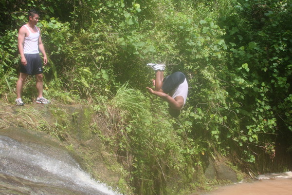
I know you can’t really tell from this picture, but here Jamie is just about to complete a one and a half flip. He almost made it all the way around. I give him a 7.0.
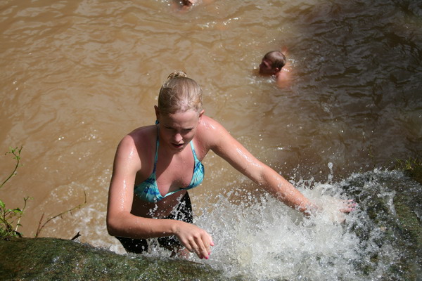
The only hard part about jumping in (although it was sorta fun), was that you had to climb back up the waterfall to get out.
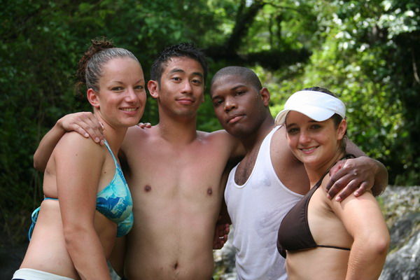
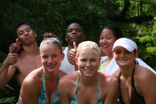
Here are four of the six cadets.
This is everyone who hiked with us (except Anna and me who were taking the pictures).
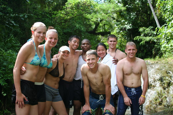
Just the cadets again.
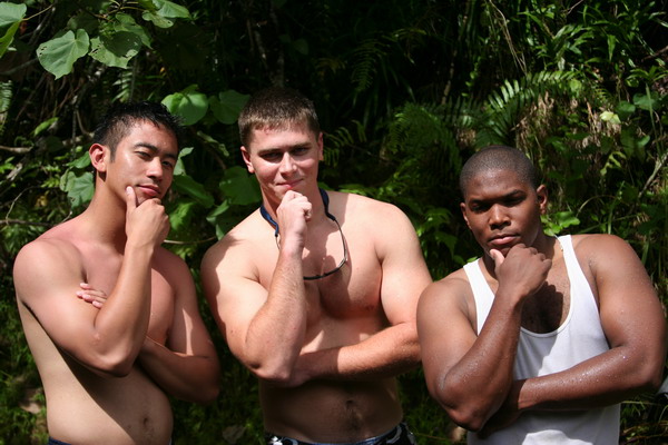
Here are some of the guys trying to look tough (or perhaps thoughtful … I’m not really sure which).
Here is the other waterfall we played in. It was a lot smaller, but fun to get behind the falls.
The girls were having lots of fun playing in the falls.
You can see in this picture of Lindsay of just how muddy the trail was.
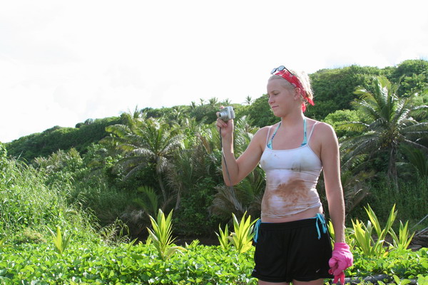
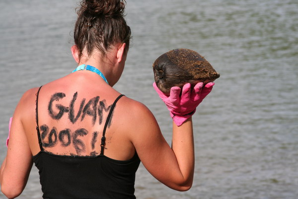
That concluded our hike to waterfall valley. After we (sort of) cleaned up, we jumped back in our car, drove 5 minutes north and parked at the Talafofo Bay trailhead. Although we didn’t really follow a trail, we went coast steering to reach the black sand beach of Guam. The beach is black due to the presence of the mineral magnetite (a form of iron oxide). A large quantity was carried to the beach by a nearby river, and kept there by wave and current action. Although, it was most likely deposited originally by the volcanic activity that formed the island. It’s interesting to note that magnetite is the most magnetic of all the minerals on Earth. If you hold a magnetic to the sand, it will pick up a number of the grains. Another random fact about this fascinating material is that crystals of it are found in numerous animals (including humans).
In fact, the black sand is also useful to write messages on your back.
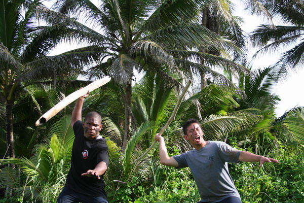
Another interesting use of magnetite sand is as war paint on your face. These guys were imagining what the ancient Chamorro warriors were like.
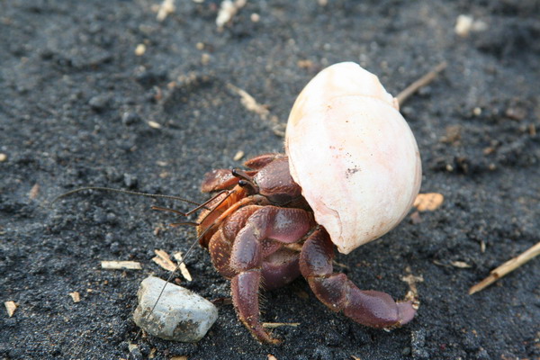
OK, so this little guy’s shell didn’t blend in too well with the black.
Here are the cadets again.
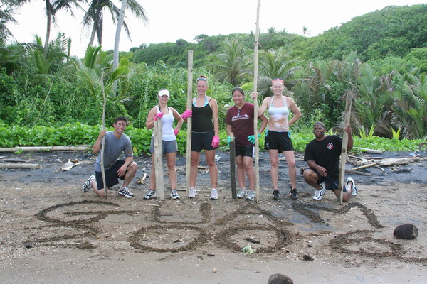
While the black sand was very pretty (and certainly unique), the beach itself had a LOT of trash on it. Perhaps it was just washed up from local fiestas, but it basically ruined an otherwise beautiful location on Guam. Unfortunately, it’s an all too common occurrence here to find a spot that could be simply stunning that is marred by an abundance of trash. So, if you ever visit or live here, please help clean some of it up, even if it’s one piece of trash at a time!
Overall though, it was a great day of hiking. We enjoyed hiking with the cadets and other CGOs from the base.
We can’t wait to go again. Our time here on Guam is drawing to a close (we have about a month left), so we’re trying to get everything in that we haven’t done yet. So much to do, so little time…
Until the next adventure.
–Jim
Tarzan Swim Hole
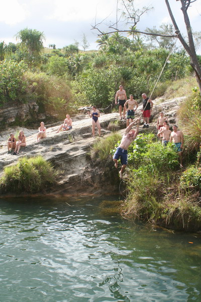
Today, we took our largest group on the hiking trails of Guam. There were 23 people who came with us to Tarzan Swim Hole. We wanted to go somewhere easy to get to and had water to cool off in.
Here’s the group by the water. As you can see, the main attraction was the rope swing.
Unfortunately, this year’s wet season has been fairly dry (thus far at least) and the water level was about 3 feet lower than last time we were there.
This is our friend Gordon going into the water. As you can see, he made sure to point his fingers and toes before he hit the water…
This is Andy’s father (his mother and sister were also hiking with us) who had no fear going off the rope swing.
There are six Air Force Academy cadets who are on Andersen for a few weeks to learn about the Air Force. Here is a picture of most of them (all except Rodney in the middle are cadets).
Here’s Lindsey enjoying the ride on the swing.
Still smiling as she hits the water.
Gordon is apparently more interested in watching the rope than the girl about to face plant in the water. 🙂
Here’s Gordon, still pointing those fingers and toes…
Jen makes sure she can see where she’s going, while Andy watches attentively from the shore.
Rodney concentrates soo hard holding on to the rope, he grimaces…
Jamie had without a doubt the most athletic water entry. He did a flip off the rocks into the water.
Once everyone enjoyed the water enough, we packed up and headed back up the hill and off to dinner for Guam’s best cheeseburgers at Jeff’s Pirates Cove.
Until the next adventure.
–Jim
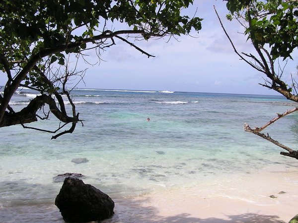
A day at Haputo beach
Yesterday, we went back to one of our favorite beaches on Guam, Haputo Beach. It’s on one of the Navy bases on the island, so that limits who has access. That also means that there’s often little or no crowd. Yesterday, we were fortunate and had it to ourselves most of the time.
It’s a short hike to get from where one parks down to the beach. Since we like to hike, that was a bonus for us. 🙂
This is the view of Haputo Bay from where we started. It looks like it’s a long way, but only take about 10-15 minutes to get there.
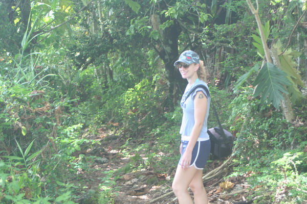
It’s a well defined trail (there are even some old stairs to take you down the steep hill). Here’s Anna on the trail.
You can see the massive crowds we had to fight when we got down to the beach.
First thing we decided to do was lay out and soak up the sun. The wind was blowing, so it kept things *somewhat* cool.
Here is the view that we had from the sand.
After a while, we decided to get in the water.
Since the camera is not waterproof, we took it back up the beach, then back to the water for a little open water swim. This time of year, the waves are very calm, so we could swim through a cut in the barrier reef to get to the far side of the reef. There, the water is deep, crystal clear and teeming with life. We swam the length of the bay, got out and hiked back. A good workout, with a great view.

Then, we packed our gear up and headed back up the hill. We had a dinner to go to that night.
So, until the next adventure…
–Jim
Highest Mountain in the World
Well, this afternoon, in a matter of three hours, Anna and I conquered the tallest mountain in the world at a staggering height of just over 37,000 feet. Do you know what its name is?? No, it’s not Mt Everest, nor Mt Kilimanjaro. It’s called Mt Lam Lam.
🙂 OK, so only 1,331 feet are above sea level. The rest is underwater and goes down to the Marianas Trench (the deepest known place in the world). However, it’s the highest point in Guam.
It’s a deceptively challenging hike. Many people who try to summit Mt Lam Lam, get diverted the much easier (but only about 50′ lower) Mt Jumullong.
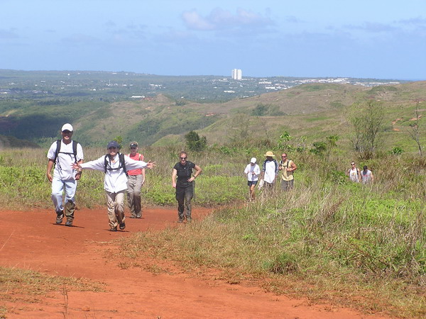
However, we made our way through the jungle and vast morass of spider webs…
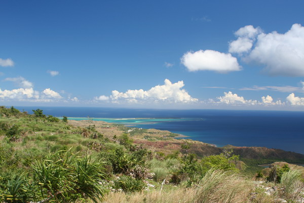
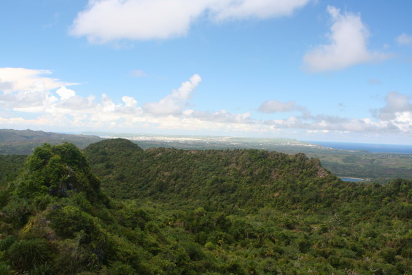
When we go up to the top, there were some beautiful vistas of the island that greeted us. Here’s the view of Cocos Island to the south.
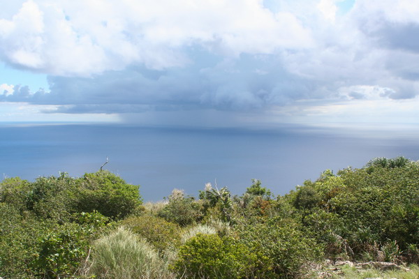
Here’s a small tropical shower out over the Pacific.
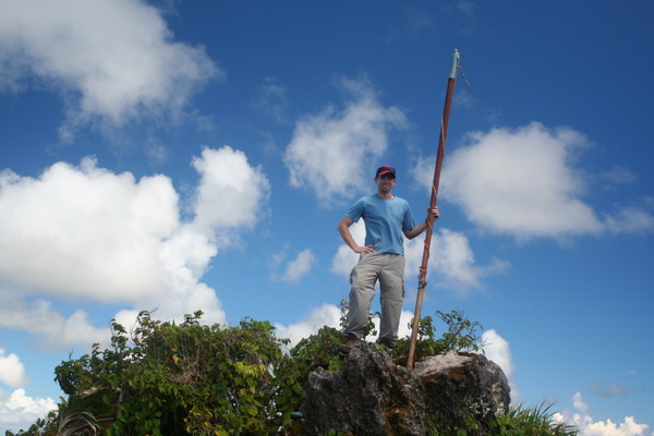
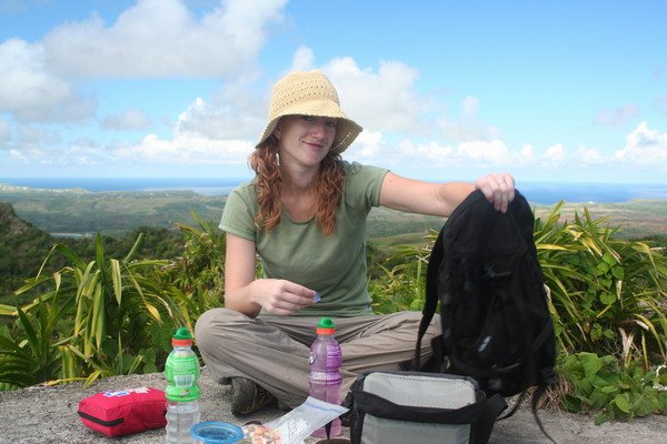
Here I am (almost) on top of the world!
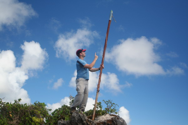
If only I could go up just a little more…
Of course as is our tradition, while we were up on top, we had to have a little picnic.
Another interesting perspective is to look north from Mt Lam Lam. If you look closely in this picture, you can see both sides of the island. It’s a unique location to get a feeling of just how small (or large) Guam really is. Although there is plenty of space and it certainly doesn’t feel small, it’s easy from this vantage point to get a feel for the layout of the island. For your reference, Guam is 212 square miles (or about three times larger than Washington D.C., or about a third the size of the Hawaiian island Oahu), and at the smallest only 3-4 miles wide (as this picture shows).
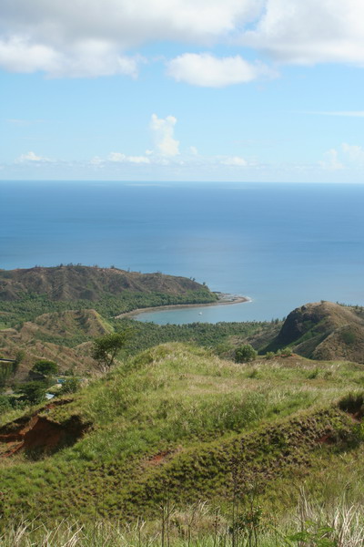
On the way down, we found this very nice perspective of Cetti Bay.
So, that concluded our hike up the towering Mt Lam Lam. A fun little hike, but be warned. It’s tougher than it looks! 🙂
Until the next adventure…
–Jim
Lower Sigua Falls
Hi, well this weekend, we braved the jungle of Guam again. We went again with a group of CGOs. This time there were 12 in our party.
I offered to take the group on another hike, this time in search of one of the pretty waterfalls around the interior of Guam. However, my caveat was that it would be a hard hike. Even so, I had a surprising number of people join us.
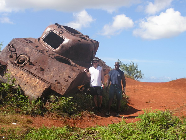
The trail began over very familiar territory on top of Mount Alutom. We took the same route as we did for several other hikes. However, this time we continued down the trail further. The landmark for our turn wasn’t a tree (as it was for Upper Sigua Falls), but a WWII Sherman tank.
You can see how happy we were to find it (there was only one small marsh to cross to get there…)
Here we all are posing in front of this tank that was brought here sometime after the war for target practice (no there wasn’t a battle fought there … although that would make for a better story).
Lance and Mario:
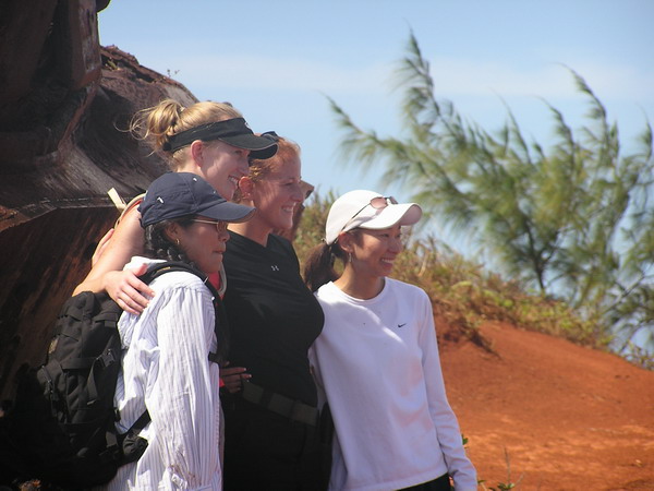
All the pretty girls in the group:
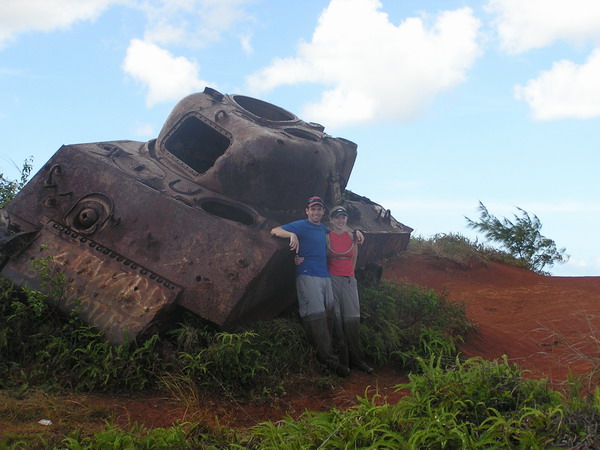
Here’s Anna and I:
From the tank, we descended into the jungle. In fact, we dropped down to the river valley floor and followed the very narrow, very murky, very deep river to the first water falls, Sinisa Falls. When we arrived at the top of the falls, it was pretty, but there was no easy way to reach the bottom. So, we hiked up the other side of the river bank, bushwhacked through some tough savanna grass and back down into the jungle. I wish I had some pictures of the stuff we went through, but I was more concerned with getting us safely back down to the river to take pictures. Sorry.
However, we all made it safely down, although not without our fair share of falls along the way.
Here we are making our way down the last little section of the ravine to get to the falls.
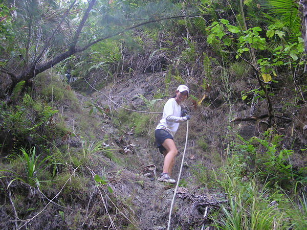
Anna coming down the rope, looking graceful as always:
This is me spotting “Mudslide” as he came down. 🙂
Once everyone got back down to the river, we decided it was time for a little relaxing in the water. Unfortunately, the pool wasn’t too large, nor was it very deep. It was refreshing nonetheless.
After we were cooled off, we continued down the river (which was the prettiest of all the rivers we’ve hiked though on Guam, thus far at least). Again, my camera was packed away in the dry bag because everything that wasn’t sealed or waterproof got utterly drenched on this trip.
So, after our second leg of the trip. This is the waterfall we were rewarded with (Lower Sigua Falls).
This was a much larger and prettier falls (you can get an idea of scale from the person in the left side foreground).
Here are some more pictures of us playing the water.
So, with nightfall fast approaching, we hustled up the bank. It was another steep trail, but this time it was well worn with a number of ropes along the way to assist us.
When we got back up to the top of the ridge, we were rewarded with this pretty aerial view of Lower Sigua Falls, where we had just been.
So, with that, we went back up the hill to our vehicles. We got back to complete a 7 mile round trip hike that went 1,200 feet down and back up again, and took just over 5 hours. It was not bad for an afternoon hike. I had a great time and hope that some of our friends from this hike will join us again soon!
Until the next adventure.
–Jim
Double Reef — hike with CGOs
Well, we decided to go for another hike this past weekend. So, we offered to all the Company Grade Officers (CGOs … this is what the Air Force calls its junior officers in the ranks of lieutenant and captain) that we would take everyone down to the Double Reef Beach.
So, our weekend started out as it usually does here on Guam. We did a 5K race first thing on Saturday morning. Since it was the weekend before Valentine’s day, they had a couples race. It was a normal 5K, with the twist that each couple ran a relay 5K (meaning one ran a 5K, then came back and tagged their partner for the second 5K). It was a nice change and a lot of fun.
After our warm up in the morning, we met up with everyone. Although there are well over 100 CGOs on base, only 10 hardy people dared venture into the jungle with us. Perhaps our reputation of taking the long and hard way has preceded us. 🙂
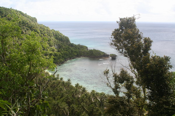
Well, regardless, we didn’t have much trouble getting down to the beach. It’s a very pretty and secluded beach. Since the only land access is through Navy property, it limits the number of visitors.
When we got to the beach, pretty much everyone was ready to jump in the water and cool off after the steamy hike through the jungle.
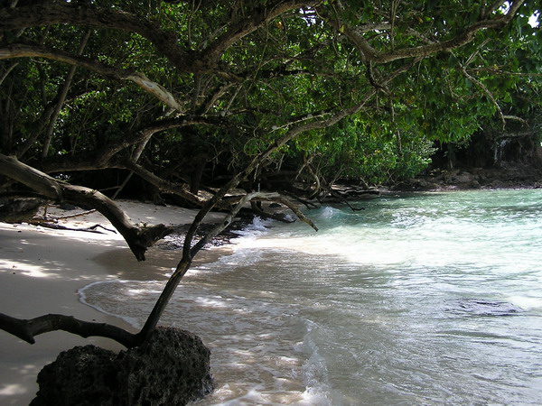
Here’s the view we found when we got to the beach:
About half the group decided to go for a long distance snorkel. The other half explored the shoreline and ate a light lunch. Here we are enjoying a little food.
A couple more shots of the beach. As you can see, the trees have grown out over the sand. They were probably straight at one time, but the wind and weather have caused them to list slightly. It’s nice to be able to hide in their shade though.
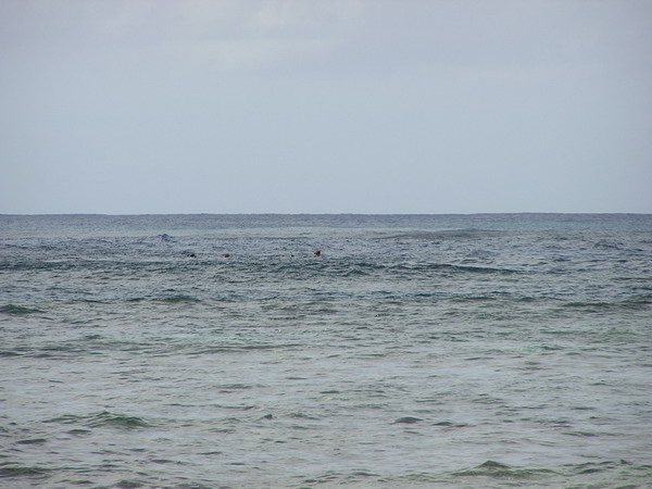
Here are the snorkelers … if you look close you can see someone with their head out of the water.
We stayed and played in the water for quite a while. In fact, so long that half of the group had to part ways and head back up the trail to attend an awards ceremony that was going on that night. Everyone else joined Anna and I for a continuation hike a little further down the coast. This time, we were hiking on the coral mantle. Since the tide was almost at high tide (and it was about a full moon), the water was quite high. As we traveled, we’d have to stop for the waves to come in and go back out so that we could pick our way through the coral, and not get swept out to sea. Not to worry though, the waves weren’t too strong, so there was little real danger. Just slow going.
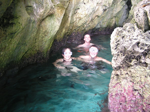
Eventually, we reach a small cave that looked very inviting. It was the same cave that we explored the last time we were at Double Reef beach. This time we came prepared with underwater flashlights though, so we could see what was around us.
Here’s what it looked like:
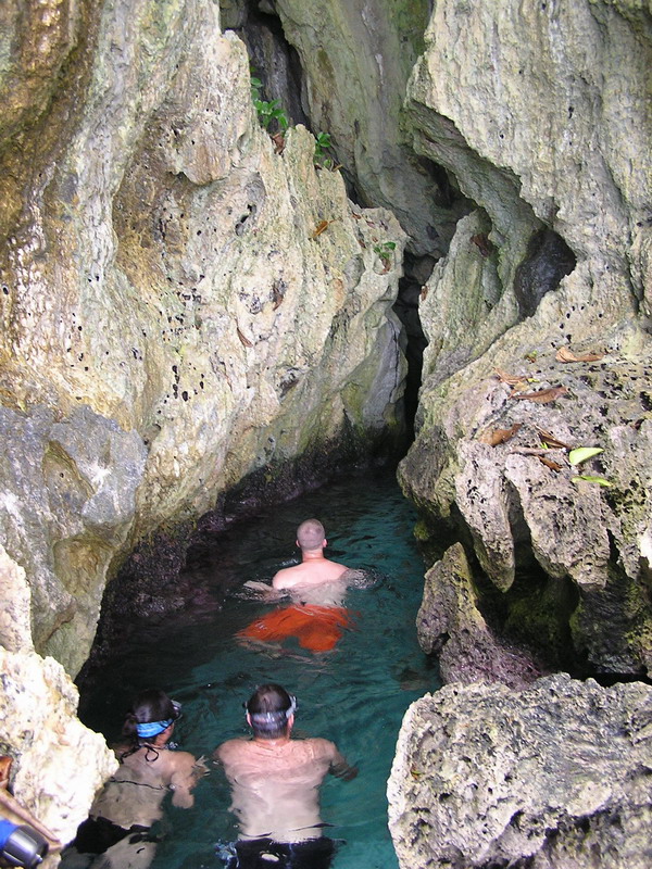
Our destination on this part of the hike was a natural arch. Here’s a picture from under the land bridge.
Our friends Andy and Jen:
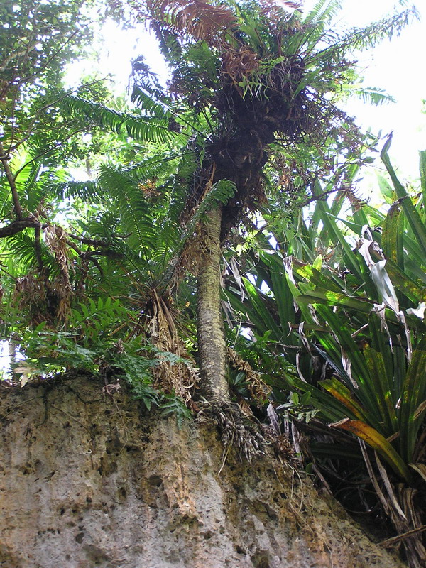
The plants even grow in precarious places…
Here we all are after the hike.
Well, it was another fun hike through the jungles of Guam. Next up is a trip up the highest mountain in the world … Mt Lam Lam.
Ok, so it’s only the highest if you measure from the bottom of the Marianas Trench (35,798 feet below sea level). So, if you add to that the 1,332 ft ABOVE sea level that Mt Lam Lam soars, it’s much higher than the mere 29,035 feet that Mt Everest stands. That will be our next hiking destination.
We’ll keep you all posted on how it unfolds.
Until then.
–Jim